Khadzhibey Estuary
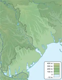
Khadzhibey Estuary, or Khadzhibeyskyi Liman (Ukrainian: Хаджибейський лиман, Turkish: Haci Bey liman), is an estuary of the north-western part of the Black Sea, located on the north-west from the City of Odessa. It is named after the former Khadzhibey fortress.
| Khadzhibey Estuary | |
|---|---|
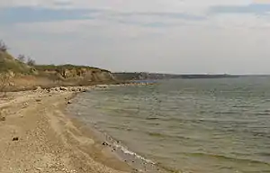 The coast of the Khadzhibey Estuary | |
 Khadzhibey Estuary | |
| Location | Ukraine |
| Coordinates | 46°37′N 30°36′E |
| Type | estuary |
| Primary inflows | Malyi Kuyalnyk |
| Basin countries | Ukraine |
| Max. length | 33 km (21 mi) |
| Max. width | 3.5 km (2.2 mi) |
| Surface area | 112 km2 (43 sq mi) |
| Average depth | 5 m (16 ft) |
| Max. depth | 18.3 m (60 ft) |
| Water volume | 560×106 m3 (20×109 cu ft) |
| Salinity | 3-6 percent |
| Settlements | Odessa |
The estuary is separated from the sea by the sandbar, which has about 5 km length. The length of the estuary is 31 km, width 0.5–2.5 km, square 70 km2, depth up to 2.5 m. The bottom of the estuary is covered by the flakes of black mud, which have healthy properties. The river Malyi Kuyalnyk flows to the estuary. The fauna of the estuary consists of crabs Rhithropanopeus harrisii, shrimps Palaemon elegans, round goby Neogobius melanostomus and monkey goby Neogobius fluviatilis, etc.
References
- Starushenko L.I., Bushuyev S.G. (2001) Prichernomorskiye limany Odeschiny i ih rybohoziaystvennoye znacheniye. Astroprint, Odessa, 151 pp. (in Russian)
- North-western Black Sea: biology and ecology, Eds.: Y.P. Zaitsev, B.G. Aleksandrov, G.G. Minicheva, Naukova Dumka, Kiev, 2006, 701 pp.
This article is issued from Wikipedia. The text is licensed under Creative Commons - Attribution - Sharealike. Additional terms may apply for the media files.