Khera Khurd
Khera Khurd is a census town in North West district in the Indian state of Delhi. This place is dominated by MAAN gotra of Jat community. It is also known as Chota Khera. Narela is the nearest town and Rohini is the nearest urbanised area.Khurd and Kalan Persian language word which means small and Big respectively when two villages have same name then it is distinguished as Kalan means Big and Khurd means Small with Village Name.
Khera Khurd
Chota khera | |
|---|---|
city | |
 Khera Khurd Location in India | |
| Coordinates: 28.77806°N 77.09882°E | |
| Country | |
| State | Delhi |
| District | North West |
| Population (2001) | |
| • Total | 8,813 |
| Languages | |
| • Official | Hindi, English Haryanvi |
| Time zone | UTC+5:30 (IST) |
| Website | www.dmrceu.org |
Demographics

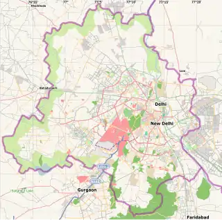
Map of Delhi showing location of Khera Khurd
As of 2001 India census,[1] Khera Khurd had a population of 8813. Males constitute 56% of the population and females 44%. In Khera Khurd, 13% of the population is under 6 years of age. Hindi is the local language.
Politics
INC, BJP, BSP, AAP are the major political parties.
References
- "Census of India 2001: Data from the 2001 Census, including cities, villages and towns (Provisional)". Census Commission of India. Archived from the original on 16 June 2004. Retrieved 1 November 2008.
This article is issued from Wikipedia. The text is licensed under Creative Commons - Attribution - Sharealike. Additional terms may apply for the media files.