Khrystoforivka
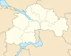
Khrystoforivka (Ukrainian: Христофорівка; Russian: Христофоровка) is an urban-type settlement in Kryvyi Rih Raion of Dnipropetrovsk Oblast in Ukraine. It is located on the left bank of the Bokovenka in the drainage basin of the Dnieper. Population: 1,369 (2020 est.)[1]
Khrystoforivka
Христофорівка | |
|---|---|
Urban-type settlement | |
 Khrystoforivka | |
| Coordinates: 47°58′49″N 33°05′34″E | |
| Country | Ukraine |
| Oblast | Dnipropetrovsk Oblast |
| Raion | Kryvyi Rih Raion |
| Population (2020) | |
| • Total | 1,369[1] |
| Time zone | UTC+2 (EET) |
| • Summer (DST) | UTC+3 (EEST) |
Economy
Transportation
The closest railway station is in Haikivka, about 5 kilometres (3.1 mi) southwest of Khrystoforivka, on the railway line connecting Kryvyi Rih and Dolinska, with further connections to Cherkasy and Odessa.
Khrystoforivka has access to Highway H11 connects Kryvyi Rih with Mykolaiv and Highway H23 connecting Kryvyi Rih with Kropyvnytskyi.
References
- "Чисельність наявного населення України (Actual population of Ukraine)" (PDF) (in Ukrainian). State Statistics Service of Ukraine. Retrieved 30 September 2020.
This article is issued from Wikipedia. The text is licensed under Creative Commons - Attribution - Sharealike. Additional terms may apply for the media files.