Kilkenny West (civil parish)
Kilkenny West is a civil parish in County Westmeath, Ireland. It is located about 33.81 kilometres (21 mi) west of Mullingar.
Kilkenny West | |
|---|---|
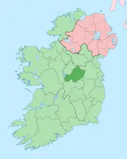
 Kilkenny West Location of Kilkenny West within County Westmeath in the Republic of Ireland | |
| Coordinates: 53°29′15″N 7°51′6″W | |
| Country | |
| Province | Leinster |
| County | County Westmeath |
| Irish grid reference | N098485 |
Kilkenny West is one of 4 civil parishes in the barony of Kilkenny West in the Province of Leinster. The civil parish covers 10,030.3 acres (40.591 km2).
Kilkenny West civil parish comprises the village of Glassan and 45 townlands: Annagh, Auburn, Ballaghkeeran Big, Ballaghkeeran Little, Ballyboy Lowpark, Ballynacliffy, Ballynakill, Ballynakill Upper, Bethlehem, Bleanphuttoge, Boardsland, Brittas, Caplahard, Carrickfin, Cartronkeel, Corr, Creevenmanagh, Deerpark, Farrannamoreen, Fortyacres, Glassan, Kilfaughny, Kilkenny Abbey, Kilkenny Lanesborough, Kilkenny West, Lackan, Lisdachon, Lisnascreen, Lissatunny, Lissoy, Littletown, Lowpark Ballyboy, Lurgan, Magheracuirknagh, Pearsonsbrook, Portaneena, Rath, Temple's Island, Toberclare, Tobernagauhoge, Tonagh, Tullaghan, Tullyhogan, Tullyhumphrys, Tullylanesborough and Waterstown
The neighbouring civil parishes are: Shrule (County Longford) to the north, Noughaval to the north–east, Drumraney to the east, Ballyloughloe and St. Mary's to the south, Bunown to the west and Noughaval to the north–west.[1][2][3]
References
- Kilkenny West civil parish, Co. Westmeath townlands.ie Retrieved on 27 July 2015.
- Kilkenny West civil parish, Co. Westmeath The IreAtlas Townland Data Base. Retrieved on 27 July 2015.
- Kilkenny West civil parish, Co. Westmeath The Placenames Database of Ireland. Retrieved on 27 July 2015.
External links
- Kilkenny West civil parish at the IreAtlas Townland Data Base
- Kilkenny West civil parish at townlands.ie
- Kilkenny West civil parish at The Placenames Database of Ireland