Kościeliska Valley
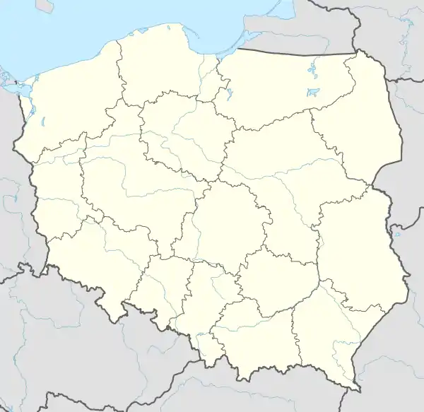
The Kościeliska is a valley in Poland, in Tatra Mountains, Western Tatras, Poland. It stretches from the village of Kiry, about 9 km, right up to the main ridge of the Tatras. Half way up is the Ornak mountain refuge, built in 1948.[1] Is reached by road from Zakopane - 7 km.
| Kościeliska | |
|---|---|
 | |
 Kościeliska | |
| Length | 9 kilometres (5.6 mi) |
| Geography | |
| Coordinates | 49°15′14″N 19°51′1″E |
| Mountain range | Tatra |
Geography
Near the exit the valley is narrow but farther up it fans out into several lateral branches, above which rise the rounded summits of the Western Tatras, the highest of which is Mt. Bystrá, on the Slovakia side of the frontier.
The upper part of the valley (the Hala Tomanowa and Hala Pyszna) have been constituted strict nature reserve, thus forming a sanctuary for the flora and fauna peculiar to them.
The whole valley is pervaded with the aura of old legends about hidden treasure.[2] There are ancient mining traditions going as far back on the 15th century.
In the 19th century Kościeliska valley was one of the strongest and biggest metallurgical centres in the area, in the neighbouring mountains various metals were found, mainly silver, later on also iron ore.[3]
This valley owes its exceptional charm not only to its beauty spots, but also to its numerous forms of characteristic of limestone country: caves, wells, shaped rocks and crags. There are about 70 larger and smaller caves here, the longest of which are Jaskinia Zimna[4] (6 km) or Jaskinia Wysoka – Za Siedmiu Progami [5] (11,5 km), and the deepest Jaskinia Miętusia (200 m) or Bańdzioch Kominiarski (570 m).[6]
Among the most interesting tourist spots in the valley are:[7]
- Lodowe Źródło (Icy Spring)
- Jaskinia Mroźna (Frosty Cave), Jaskinia Mylna (False Cave), Jaskinia Raptawicka (Raptawicka Cave)[8]
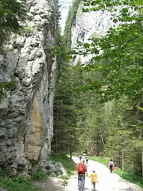
- Wąwóz Kraków i Smocza Jama (Kraków Gorge with Dragon’s Den) - one of the most picturesque part of the valley.
- Hala Pisana (Pisana Alp)
- Staw Smerczyński (Smreczyński Pond)
Trails
In the lover part of the Dolina Kościeliska the red trail branches off Polana Upłaz, and takes one to the summit of Ciemniak (2,090 metres AMSL), a mountain in the Czerwone Wierchy (Red Mountains) group of peaks. The blue trail leads to the Polana na Stołach. The black path "Ścieżka nad Reglami" leading to Chochołowska Valley.
From the middle section of the valley the green trail leads from the Ornak refuge along the Dolina Tomanowa (Tomanowa Valley) to the Czerwone Wierchy. Yellow trail leads up to the pass Iwaniacka Przełęcz and thence to the summit Ornak (1,854 metres). Green trail leads to the pass Raczkowa Przełęcz. About 35 minutes walk along the black trail from the Refuge leads to the mountain pond Smerczyńki - one of the very few in this part of Tatra Mountains.[9]
Gallery
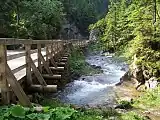 Valley
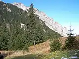 Raptawickie Turnie
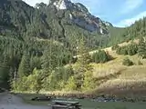 Valley
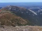 View from Bystra
 Ornak refuge
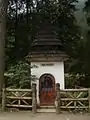
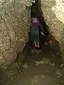 False Cave
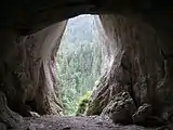 Pawlikowski's Window
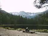 Smerczynski Lake
References
External links
- Dolina Kościeliska (pl.)
- Przez Dolinę Kościeliską (pl.)