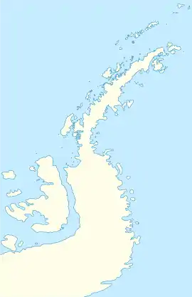
Kopaitic Island
Kopaitic Island is an island lying 0.6 kilometres (0.3 nmi) west of Cape Legoupil in the Duroch Islands, Antarctica. It was named by the Chilean Antarctic Expedition of 1947 for Lieutenant Boris Kopaitic O'Neill, the leader of the Chilean party at Greenwich Island in 1947.[1]
 Kopaitic Island  Kopaitic Island | |
| Geography | |
|---|---|
| Location | Antarctica |
| Coordinates | 63°19′S 57°55′W |
| Archipelago | Duroch Islands |
| Administration | |
| Administered under the Antarctic Treaty System | |
| Demographics | |
| Population | Uninhabited |
González Anchorage is an anchorage on the west side of Kopaitic Island, first charted by the Chilean Antarctic Expedition of 1948, which named it after Capitan Ernesto González Navarrete, the commander of the expedition.[2] There are several rocks in the anchorage, of which Saavedra Rock, named for Lieutenant Colonel Eduardo Saavedra, is the largest.[3] Romero Rock, named for Chilean Army astronomer Guillermo Romero Gonzalez, lies 0.1 nmi (0.19 km) west of Saavedra Rock. It was originally called "Islote Astronomo Romero". Around 1951 the name was shortened to "Islote Romero", and the present name, Romero Rock, has been in use since 1962.[4]
Gutiérrez Reef is a reef with 2 fathoms (4 m) of water over it, located 0.2 nautical miles (0.4 km) north-northeast of the north end of Kopaitic Island. It was named by the second Chilean Antarctic Expedition in 1948 after a boatswain by the name Gutiérrez.[5] Gándara Island is immediately southwest of Kopaitic Island.[6]
See also
- List of Antarctic and sub-Antarctic islands
References
- "Kopaitic Island". Geographic Names Information System. United States Geological Survey. Retrieved 2020-06-30.
- "González Anchorage". Geographic Names Information System. United States Geological Survey. Retrieved 2020-06-30.
- "Saavedra Rock". Geographic Names Information System. United States Geological Survey. Retrieved 2020-06-30.
- "Romero Rock". Geographic Names Information System. United States Geological Survey. Retrieved 2020-06-30.
- "Gutiérrez Reef". Geographic Names Information System. United States Geological Survey. Retrieved 2020-06-30.
- "Gándara Island". Geographic Names Information System. United States Geological Survey. Retrieved 2020-06-30.
![]() This article incorporates public domain material from websites or documents of the United States Geological Survey.
This article incorporates public domain material from websites or documents of the United States Geological Survey.