Kotputli
Kotputli is a municipality in Rajasthan, India, located between Jaipur and Delhi. Kotputli was formed from the main town of Kot and the nearby village of Putli. Initially, both villages belonged to the Marwari business family before they were merged into a single district. Kotputli has many historic temples and schools. It was historically a part of the Khatri Riyasat (now Alwar) kingdom, whose capital was at the nearby village of Bairath during the Mahabharata period.[1]
Kotputli | |
|---|---|
City | |
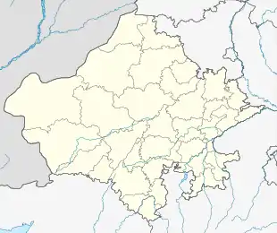 Kotputli Location in Rajasthan, India | |
| Coordinates: 27.705479°N 76.190969°E | |
| Country | |
| State | Rajasthan |
| District | Jaipur |
| Tehsil | Kotputli |
| Population (2011) | |
| • Total | 49,202 |
| Languages | |
| • Official | Hindi |
| • Regional | Rajasthani, Ahirwati |
| Time zone | UTC+5:30 (IST) |
| PIN | 303108 |
| Telephone code | 01421 |
| Vehicle registration | RJ 32 |
Kotpuli's economy has blossomed in recent years due to large infrastructure projects. For example, Sardar School and Sardar Zanana Hospital were made by local Gurjar bodies in conjunction with the Tijoriwala family. Since then, numerous schools and hospitals have been built in Kotputli.[2][3]
Organizations
Kotputli is home to many government and non-government higher education institutions, including NIMT Mahila B.Ed College (Offering B.Ed), NIMT Technical and Professional Colleges (Offering BA, BSc, BCom, LLB, BALLB), NIMT Institute of Management (Offering PGDM), Lal Bahadur Shastri Government PG College, Shri Krishna PG Law College, Tagore PG Law College, and Hans Law College.[4]
Population
Kotputli had a population of 69,420 as of the 2011 Census of India, with 26,051 males and 23,151 females.[5]
Demographics
The population of Kotputli was 52.7% male and 47.3% female as of the 2011 census.[5] When asked about religious preference, 97.6% of the region identified as Hindu and 2.0% as Muslim, with Christians, Sikhs, and Jains making up the remaining population. Kotputli has an average literacy rate of 60.6%, slightly higher than the national average of 59.5%; male literacy is 71.5%, and female literacy is 48.6%.[5] 88.1% of the population lives in the city, while 11.9% live in rural areas. 15.5% of the population is under six years of age.[5]
Geography and climate
Kotputli has an average elevation of 439 meters (1,440 ft).
| Climate data for Kotputli | |||||||||||||
|---|---|---|---|---|---|---|---|---|---|---|---|---|---|
| Month | Jan | Feb | Mar | Apr | May | Jun | Jul | Aug | Sep | Oct | Nov | Dec | Year |
| Average high °C (°F) | 25 (77) |
28 (82) |
34 (93) |
38 (100) |
41 (106) |
40 (104) |
36 (97) |
34 (93) |
36 (97) |
36 (97) |
31 (88) |
27 (81) |
34 (93) |
| Average low °C (°F) | 8 (46) |
12 (54) |
18 (64) |
23 (73) |
27 (81) |
29 (84) |
27 (81) |
26 (79) |
25 (77) |
20 (68) |
15 (59) |
9 (48) |
20 (68) |
| Average precipitation cm (inches) | 0.35 (0.14) |
0.27 (0.11) |
0.32 (0.13) |
0.35 (0.14) |
0.6 (0.2) |
3.26 (1.28) |
8.89 (3.50) |
6.44 (2.54) |
3.42 (1.35) |
0.45 (0.18) |
0.07 (0.03) |
0.06 (0.02) |
24.48 (9.62) |
| Source: Foreca | |||||||||||||
See also
References
- "Indian Princely States before 1947 A-J". www.worldstatesmen.org. Retrieved 21 April 2020.
- "Excellence – No Finish Line". abg.com. Retrieved 21 April 2020.
- "Birla Corporation". www.birlacorporation.com. Retrieved 21 April 2020.
- "List of schools in Kotputli, Jaipur block | OruSchool.In". oruschool.in. Retrieved 21 April 2020.
- "Kotputli Tehsil Population Jaipur, Rajasthan, List of Villages & Towns in Kotputli Tehsil". Censusindia2011.com. Retrieved 21 April 2020.