Kudafari
Kudafari (Dhivehi: ނ.ކުޑަފަރި) is one of the inhabited islands of Noonu Atoll.
Kudafari | |
|---|---|
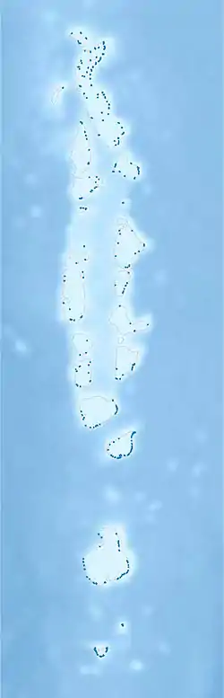 Kudafari Location in Maldives | |
| Coordinates: 05°52′47″N 73°23′58″E | |
| Country | Maldives |
| Geographic atoll | Miladhummadulhu Atoll |
| Administrative atoll | Southern Miladhunmadulu |
| Distance to Malé | 188.87 km (117.36 mi) |
| Dimensions | |
| • Length | 0.680 km (0.423 mi) |
| • Width | 0.430 km (0.267 mi) |
| Population (2014)[1] | |
| • Total | 453 (including foreigners) |
| Time zone | UTC+05:00 (MST) |
History
It is said that the first inhabitants of Kudafari were Black African slaves that were brought to the Maldives. They were freed in Malé and subsequently settled in this Island. According to late historian Lutfi writing in Faiythoora, he says the Africans in Feridhoo were an offshoot of the slaves sent to Kudafari from Malé after Sultan Hadhi Hassan got angry at them. This was in the 15th century. The islanders living today are descendants of these people. So that makes Kudafari one of the Afro-South Asian communities in Maldives along with similar communities in India and Sri Lanka with Siddi and Kaffir people respectively.
Geography
The island is 188.87 km (117 mi; 102 nmi) north of the country's capital, Malé.[2] Kudafari's land is flat.[lower-alpha 1] The highest point on the island is 15 metres (49 ft) above sea level. 0.5 km (0.31 mi) from north to south and 0.7 km (0.43 mi) from east to west.[lower-alpha 1]
The average temperature 25 °C (77 °F). The hottest month is April, at 27 °C (81 °F), and the coldest January, at 26 °C (79 °F).[4] The average rainfall 1,944 millimeters per year. The wettest month is August, with 322 mm (12.7 in) of rain, and the wettest February, with 40 mm (1.6 in).[5]
Ecology
"The 'Integrated Multi-Tropical Aquaculture Project' was envisaged to initiate a community-led cause to revive coral reefs. Being from a small island such as Kudafari, we see the effects of climate change every day. But despite the odds, the project made me believe in a future that we all can achieve."[6]
Demography
| Year | Pop. | ±% |
|---|---|---|
| 2006 | 373 | — |
| 2014 | 415 | +11.3% |
| 2006-2014: Census populations Source: [7] | ||
Education
Kudafaree has a school.[10]
Smart School Programme
As part of the government's programme to improve the standard of education in the country, President Mohamed Nasheed launched the smart school programme.[11] Kudafari School was inaugurated as the first Smart School under the programme.
Smart schools make use of information and communication technology and multimedia resources in the classrooms, in order to cater to the needs of all the students of different academic levels.
Notes
References
- "Table PP5: Resident Population by sex, nationality and locality (administrative islands), 2014" (PDF). Population and Households Census 2014. National Bureau of Statistics. p. 33. Retrieved 10 August 2018.
- "Coordinate Distance Calculator". Boulter.com. Retrieved 10 August 2018.
- UNDP. "Make My Island" (PDF): 23. Cite journal requires
|journal=(help) - "Table 3.3: Total Maldivian Population by Islands" (PDF). National Bureau of Statistics. Retrieved 10 August 2018.
- "Maldives population". maldivesfinest.com. Retrieved 19 July 2017.
- Ellis, Royston (2008). Maldives. Bradt Travel Guides. ISBN 9781841622668.
- "Slots Allocation Sheet" (PDF). Department of Higher Education. July 2018. Retrieved 10 August 2018.
- "The President's Office - President Nasheed Launches Smart School Programme in Kudafari School". www.presidencymaldives.gov.mv. Retrieved 18 July 2017.