Kuma, Kumamoto
Kuma (球磨村, Kuma-mura) is a village located in Kuma District, Kumamoto Prefecture, Japan.
Kuma
球磨村 | |||||||||||||
|---|---|---|---|---|---|---|---|---|---|---|---|---|---|
Village | |||||||||||||
 Flag  Emblem | |||||||||||||
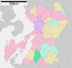 Location of Kuma in Kumamoto Prefecture | |||||||||||||
 Kuma Location in Japan | |||||||||||||
| Coordinates: 32°15′N 130°39′E | |||||||||||||
| Country | Japan | ||||||||||||
| Region | Kyushu | ||||||||||||
| Prefecture | Kumamoto Prefecture | ||||||||||||
| District | Kuma | ||||||||||||
| Area | |||||||||||||
| • Total | 207.73 km2 (80.21 sq mi) | ||||||||||||
| Population (April 1, 2017) | |||||||||||||
| • Total | 3,863 | ||||||||||||
| • Density | 19/km2 (48/sq mi) | ||||||||||||
| Time zone | UTC+09:00 (JST) | ||||||||||||
| City hall address | 1730 Ōaza Watarihei, Kuma-mura, Kuma-gun, Kumamoto-ken 869-6401 | ||||||||||||
| Website | www | ||||||||||||
| |||||||||||||
As of April 1, 2017 the village had an estimated population of 3,863[1] and a population density of 19 persons per km2. The total area is 207.73 km2.
Located in the southern portion of Kumamoto Prefecture, the Kuma River flows through the center. 90% of the village is covered by forests.
One of Japan's largest limestone caves, Kyūsen-dō, is located in Kuma. There are two large mountains located near Kuma village. In addition, there are several mountains measuring under 700 meters whose tributaries feed into the Kuma river. The average rain fall in Kuma Mura is roughly 2,300 millimeters.
Kuma village has a variety of symbols including the Japanese cedar tree, the mountain cherry blossoms, the kingfisher, and the sweet fish.
The main industries of Kuma Village are forestry and agriculture.
Kuma village can be accessed by rail via the JR Kyushu Hisatsu Line. There are three train stations located in the Kuma district: Watari Station, Naraguchi Station and Isshōchi Station.
See also
References
- "Official website of Kuma Village" (in Japanese). Japan: Kuma Village. Retrieved 1 May 2017.
External links
 Media related to Kuma, Kumamoto at Wikimedia Commons
- Kuma official website (in Japanese)
| Authority control |
|---|