Kuparuk River
The Kuparuk River is a river in Alaska's North Slope that enters a bay on the Beaufort Sea between Beechey Point and Prudhoe Bay.[5] The north-flowing river is about 200 miles (320 km) long,[3] and its delta is about 3 miles (5 km) wide.[3] Its Eskimo name appeared on a map drawn in 1901 by a prospector who spelled it Koopowra, which he translated as Big River (possibly Kugauraq).[3]
| Kuparuk River | |
|---|---|
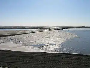 Spring ice breakup in 2011 | |
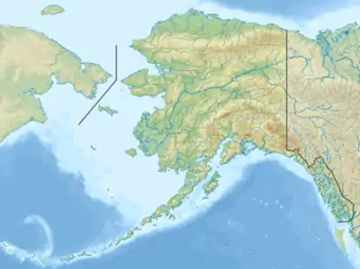 Location of the mouth of the Kuparuk River in Alaska | |
| Location | |
| Country | United States |
| State | Alaska |
| Borough | North Slope |
| Physical characteristics | |
| Source | |
| • location | Brooks Range |
| • coordinates | 68°32′15″N 149°14′46″W[1] |
| • elevation | 2,900 ft (880 m)[2] |
| Mouth | Gwydyr Bay, Beaufort Sea |
• location | 8 miles (13 km) southeast of Beechey Point[1] |
• coordinates | 70°25′28″N 148°52′15″W[1] |
• elevation | 0 ft (0 m)[1] |
| Length | 200 mi (320 km)[3] |
| Basin size | 3,130 sq mi (8,100 km2)[4] |
| Discharge | |
| • average | 1,400 cu ft/s (40 m3/s)[4] |
Kuparuk Mound, a 30-foot (9.1 m) pingo about 12 miles (19 km) southeast of Beechey Point, is named after the river. Arctic explorer Ernest de Koven Leffingwell named the mound, which he used as a triangulation station in 1911.[3]
The Kuparuk River oil field, the second largest oil field in North America, is centered about 40 miles (64 km) west of Prudhoe Bay.[6] Discovered in 1969, it covers about 500 square miles (1,300 km2).[7]
See also
References
- "Kuparuk River". Geographic Names Information System. United States Geological Survey. January 1, 2000. Retrieved September 3, 2013.
- Source elevation derived from Google Earth search using GNIS source coordinates.
- Orth, Donald J.; United States Geological Survey (1971) [1967]. Dictionary of Alaska Place Names: Geological Survey Professional Paper 567 (PDF). University of Alaska Fairbanks. United States Government Printing Office. p. 553. Archived from the original (PDF) on October 17, 2013. Retrieved September 4, 2013.
- Benke, Arthur C.; Cushing, Colbert E., eds. (2005). Rivers of North America. Burlington, Massachusetts: Elsevier Academic Press. p. 933. ISBN 0-12-088253-1.
- Alaska Atlas & Gazetteer (7th ed.). Yarmouth, Maine: DeLorme. 2010. pp. 135–36. ISBN 978-0-89933-289-5.
- "Kuparuk River Field" (PDF). ConocoPhillips Alaska. June 2013. Archived from the original (PDF) on April 18, 2013. Retrieved September 4, 2013.
- "AOGCC Pool Statistics: Kuparuk River Unit, Kuparuk River Oil Pool". Alaska Oil and Gas Commission. 2011. Retrieved September 4, 2013.
| Authority control |
|
|---|