Kyun-Tas
Kyun-Tas (Russian: Кюн-Тас; Yakut: Күн Таас) is a mountain range in the Sakha Republic, Far Eastern Federal District, Russia.[2]
| Kyun-Tas | |
|---|---|
| Кюн-Тас/ Күн Таас | |
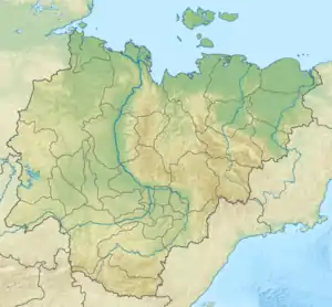 Location in Sakha, Russia | |
| Highest point | |
| Elevation | 1,083 m (3,553 ft) |
| Dimensions | |
| Length | 100 km (62 mi) NW / SE |
| Width | 50 km (31 mi) NE / SW |
| Geography | |
| Country | Russia |
| Federal subject | Sakha Republic |
| Range coordinates | 69°48′N 140°2′E [1] |
| Parent range | Momsko-Chersk Region, East Siberian System |
| Geology | |
| Age of rock | Cretaceous |
| Type of rock | Sandstone, mudstone |
| Climbing | |
| Easiest route | From Deputatsky |
The Kyun-Tas is one of the mountain areas of Yakutia where there are kigilyakh rock formations.[3][4][5]
Geography
The Kyun-Tas is located 55 kilometres (34 mi) northeast of Deputatsky,[6] between the Selennyakh Range and the western end of the Polousny Range. It rises at the southern limit of the Yana-Indigirka Lowland, northwest of the Aby Lowland.[7] It is a broad massif with mountains of middle height and smooth slopes. The 170 kilometres (110 mi) long Baky River, one of the rivers that forms the Uyandina tributary of the Indigirka, has its source in Lake Baky. The lake is located at the junction of the Kyun-Tas and the western end of the Polousny Range.[8]
The main ridge stretches in a roughly southeast/northwest direction west of the eastern slopes of the Selennyakh Range for about 100 kilometers (62 mi).[7] Although the range is smaller, the highest summits of the Kyun-Tas are higher than those of the neighboring Polousny Range. The highest peak, located in the northern part, is 1,083 metres (3,553 ft) high; there is another high peak at the southeastern end that is 1,031 metres (3,383 ft).[8]
See also
References
- Map of Khrebet Kyuntas in Sakha (Yakutiya), Russia
- Natural regions of the U.S.S.R - Internet Archive
- Murzin Yuri Andreyevich, Kigilyakhi of Yakutia
- Types of weathering
- Vladimir Gorbatovsky, Сакральные места России (Sacred places of Russia) p. 179
- mindat.org Deputatsky, Ust’-Yanskiy Rayon, Respublika Sakha (Yakutiya), Russia
- Google Earth
- Map - ист карты R-54-XXI,XXII Омчикандя. Масштаб: 1 : 200 000. Указать дату выпуска/состояния местности.