La Chapelle-en-Juger
La Chapelle-en-Juger is a former commune in the Manche department in Normandy in north-western France. On 1 January 2016, it was merged into the new commune of Thèreval.[2]
La Chapelle-en-Juger | |
|---|---|
Part of Thèreval | |
.jpg.webp) The church of Saint-Pierre | |
Location of La Chapelle-en-Juger 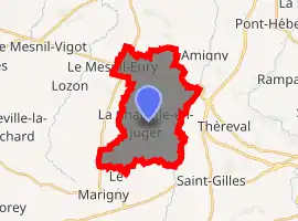
| |
 La Chapelle-en-Juger  La Chapelle-en-Juger | |
| Coordinates: 49°07′41″N 1°12′56″W | |
| Country | France |
| Region | Normandy |
| Department | Manche |
| Arrondissement | Saint-Lô |
| Canton | Saint-Lô-1 |
| Commune | Thèreval |
| Area 1 | 15.00 km2 (5.79 sq mi) |
| Population (2017)[1] | 662 |
| • Density | 44/km2 (110/sq mi) |
| Time zone | UTC+01:00 (CET) |
| • Summer (DST) | UTC+02:00 (CEST) |
| Postal code | 50570 |
| Elevation | 17–112 m (56–367 ft) (avg. 97 m or 318 ft) |
| 1 French Land Register data, which excludes lakes, ponds, glaciers > 1 km2 (0.386 sq mi or 247 acres) and river estuaries. | |
World War II
After the liberation of the area by Allied Forces in early June 1944, engineers of the Ninth Air Force IX Engineering Command began construction of a combat Advanced Landing Ground to the south of the town. Declared operational on 5 July, the airfield was designated as "A-5", it was used by the 404th Fighter Group which flew P-47 Thunderbolts until the end of August when the unit moved into Central France. Afterward, the airfield was closed.[3][4] This can't be correct as the village and the surrounding area wasn't liberated until 26 July, following Operation COBRA.
See also
References
- Téléchargement du fichier d'ensemble des populations légales en 2017, INSEE
- Arrêté préfectoral 2 December 2015 (in French)
- Johnson, David C. (1988), U.S. Army Air Forces Continental Airfields (ETO), D-Day to V-E Day; Research Division, USAF Historical Research Center, Maxwell AFB, Alabama.
- Maurer, Maurer. Air Force Combat Units of World War II. Maxwell AFB, Alabama: Office of Air Force History, 1983. ISBN 0-89201-092-4.
| Wikimedia Commons has media related to La Chapelle-en-Juger. |
| Authority control |
|
|---|
This article is issued from Wikipedia. The text is licensed under Creative Commons - Attribution - Sharealike. Additional terms may apply for the media files.