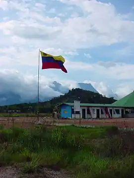
La Esmeralda, Venezuela
La Esmeralda is a small settlement in and the capital of Alto Orinoco Municipality in Venezuela’s Amazonas State. The name means “the emerald”. It is located on the shore of the Orinoco river, only 9 miles from the Casiquiare canal bifurcation that links it to the Amazon River.
La Esmeralda | |
|---|---|
.svg.png.webp) La Esmeralda | |
| Coordinates: 3°10′26″N 65°32′48″W | |
| Country | |
| State | Amazonas State |
| Municipality | Alto Orinoco Municipality |
| Founded | 1758 |
| Elevation | 225 m (738 ft) |
| Population (2013) | |
| • Total | 20 030 |
| Time zone | VST |
| Climate | Af |

Orinoco river crossing La Esmeralda
The settlement contains about a hundred homes, a school, an airfield and a military outpost.
Climate
La Esmeralda has a tropical rainforest climate (Af) with heavy to very heavy rainfall year-round.
| Climate data for La Esmeralda | |||||||||||||
|---|---|---|---|---|---|---|---|---|---|---|---|---|---|
| Month | Jan | Feb | Mar | Apr | May | Jun | Jul | Aug | Sep | Oct | Nov | Dec | Year |
| Average high °C (°F) | 32.0 (89.6) |
32.4 (90.3) |
32.4 (90.3) |
31.4 (88.5) |
30.4 (86.7) |
29.9 (85.8) |
30.0 (86.0) |
30.7 (87.3) |
31.6 (88.9) |
31.6 (88.9) |
32.0 (89.6) |
31.8 (89.2) |
31.4 (88.4) |
| Daily mean °C (°F) | 27.1 (80.8) |
27.3 (81.1) |
27.5 (81.5) |
27.1 (80.8) |
26.5 (79.7) |
26.2 (79.2) |
26.1 (79.0) |
26.5 (79.7) |
27.0 (80.6) |
27.0 (80.6) |
27.4 (81.3) |
27.1 (80.8) |
26.9 (80.4) |
| Average low °C (°F) | 22.3 (72.1) |
22.3 (72.1) |
22.6 (72.7) |
22.8 (73.0) |
22.7 (72.9) |
22.6 (72.7) |
22.2 (72.0) |
22.3 (72.1) |
22.4 (72.3) |
22.5 (72.5) |
22.8 (73.0) |
22.4 (72.3) |
22.5 (72.5) |
| Average rainfall mm (inches) | 109 (4.3) |
120 (4.7) |
163 (6.4) |
296 (11.7) |
356 (14.0) |
379 (14.9) |
351 (13.8) |
298 (11.7) |
194 (7.6) |
205 (8.1) |
173 (6.8) |
125 (4.9) |
2,769 (108.9) |
References
External links
La Esmeralda Mercal
This article is issued from Wikipedia. The text is licensed under Creative Commons - Attribution - Sharealike. Additional terms may apply for the media files.