Lake Dai
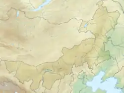
Lake Dai, also known by its Chinese name Daihai, is a lake in Liangcheng County, Ulanqab Prefecture, Inner Mongolia, China.
| Lake Dai 岱海 | |
|---|---|
 Lake Dai 岱海 | |
| Location | Liangcheng County, Ulanqab Prefecture, Inner Mongolia, China |
| Coordinates | 40°34′05″N 112°41′22″E |
| Basin countries | China |
| Max. length | 25 km (16 mi) |
| Max. width | 20 km (12 mi) |
| Surface area | 160 km2 (62 sq mi) |
| Average depth | 9 m (30 ft) |
| Max. depth | 15–18 m (49–59 ft) |
| Lake Dai | |||||||||
|---|---|---|---|---|---|---|---|---|---|
| Chinese | 岱海 | ||||||||
| |||||||||
Geography
Lake Dai is a round lake with an area of about 160 km2 (62 sq mi), measuring about 25 kilometers (16 mi) from east to west and about 20 kilometers (12 mi) from north to south. It has an average depth of about 9 meters (30 ft) and a maximal depth of 15–18 meters (49–59 ft).
History
Under the Qin, Huangqi and Dai lakes formed the northern boundaries of Yanmen Commandery, marking part of the northern frontier of the Chinese empire.[1]
References
Citations
- Hua & al. (2017), s.v. "Yanmen".
Bibliography
- Li Shizhen (2017), Hua Linfu; et al. (eds.), Ben Cao Gang Mu Dictionary, Vol. II: Geographical and Administrative Designations, Berkeley: University of California Press, ISBN 9780520291966.
External links
| Five Great Lakes | ||
|---|---|---|
| Notable freshwater lakes |
| |
| Notable salt lakes | ||
| National Parks |
| |
| Protected wetlands | ||
| Nature Reserves | ||
| Major urban lakes | ||
| Reservoirs | ||
This article is issued from Wikipedia. The text is licensed under Creative Commons - Attribution - Sharealike. Additional terms may apply for the media files.