Lake Fork Gunnison River
Lake Fork Gunnison River or Lake Fork is a 64.7-mile-long (104.1 km)[2] tributary of the Gunnison River in Colorado. The river's source is Sloan Lake near Handies Peak in the San Juan Mountains of Hinsdale County. Lake Fork flows through Lake San Cristobal and Lake City before a confluence with the Gunnison River in Blue Mesa Reservoir.
| Lake Fork Gunnison River[1] | |
|---|---|
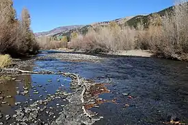 The river in Lake City. | |
| Physical characteristics | |
| Source | |
| • location | Sloan Lake |
| • coordinates | 37°54′16″N 107°30′49″W |
| • elevation | 12,910 ft (3,930 m) |
| Mouth | |
• location | Confluence with Gunnison River |
• coordinates | 38°27′38″N 107°19′19″W |
• elevation | 7,523 ft (2,293 m) |
| Basin features | |
| Progression | Gunnison—Colorado |
References
- "Lake Fork". Geographic Names Information System. United States Geological Survey. Retrieved 2011-02-04.
- U.S. Geological Survey. National Hydrography Dataset high-resolution flowline data. The National Map Archived 2012-04-05 at WebCite, accessed March 18, 2011
This article is issued from Wikipedia. The text is licensed under Creative Commons - Attribution - Sharealike. Additional terms may apply for the media files.