Lam Thamenchai District
Lam Thamenchai (Thai: ลำทะเมนชัย, pronounced [lām tʰā.mēːn.t͡ɕʰāj]) is a district (amphoe) of Nakhon Ratchasima Province, northeastern Thailand.
Lam Thamenchai
ลำทะเมนชัย | |
|---|---|
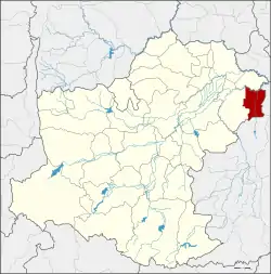 District location in Nakhon Ratchasima Province | |
| Coordinates: 15°21′12″N 102°55′6″E | |
| Country | Thailand |
| Province | Nakhon Ratchasima |
| Seat | Khui |
| Area | |
| • Total | 308.5 km2 (119.1 sq mi) |
| Population (2013) | |
| • Total | 32,527 |
| • Density | 104.4/km2 (270/sq mi) |
| Time zone | UTC+7 (ICT) |
| Postal code | 30270 |
| Geocode | 3029 |
History
The area of Lam Thamenchai was separated from Chum Phuang District and made a minor district (king amphoe) on 15 July 1996. [1]
On 15 May 2007, all 81 minor districts were upgraded to full districts.[2] On 24 August the upgrade became official.[3]
Geography
Neighboring districts are (from the east clockwise): Khu Mueang and Lam Plai Mat of Buriram Province; Chum Phuang and Mueang Yang of Nakhon Ratchasima Province.
The district is named after the Thamenchai River, the main river of the district.
Administration
The district is divided into four subdistricts (tambons). The township (thesaban tambon) of Nong Bua Wong covers parts of the tambons Kui and Phlai.
| 1. | Khui | ขุย | |
| 2. | Ban Yang | บ้านยาง | |
| 3. | Chong Maeo | ช่องแมว | |
| 4. | Phlai | ไพล |
References
- ประกาศกระทรวงมหาดไทย เรื่อง แบ่งเขตท้องที่อำเภอชุมพวง จังหวัดนครราชสีมา ตั้งเป็นกิ่งอำเภอลำทะเมนชัย (PDF). Royal Gazette (in Thai). 113 (Special 18 ง): 23. June 26, 1996.
- แถลงผลการประชุม ครม. ประจำวันที่ 15 พ.ค. 2550 (in Thai). Manager Online.
- พระราชกฤษฎีกาตั้งอำเภอฆ้องชัย...และอำเภอเหล่าเสือโก้ก พ.ศ. ๒๕๕๐ (PDF). Royal Gazette (in Thai). 124 (46 ก): 14–21. August 24, 2007.