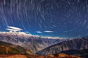
Langtang
Langtang is a region in the north-central Himalayas of the Bagmati province of Nepal. Situated 51 kilometres north of the Kathmandu Valley, the region is renowned for hosting the Langtang national park which eventually constitutes the border with the Tibet autonomous region of China. About 4,500 people reside inside the park (with Tamang as majority), and many more depend on it for timber and firewood.

The park contains a wide variety of climatic zones, from subtropical to alpine.[1] Approximately 25% of the park is forested. Trees include the deciduous oak and maple, evergreens like pine, and various types of rhododendron. Animal life includes the Himalayan black bear, the goat-like Himalayan tahr, Assam macaque and red pandas.[2] There are also stories of Yeti sightings.
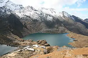
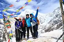
The park contains the Gosainkunda lakes, sacred to Hindus. Pilgrimages are made there in August. Another spiritual site is the Buddhist monastery Kyanjin Gompa. Popular activities for tourists in the park include trekking, climbing, and white-water rafting.
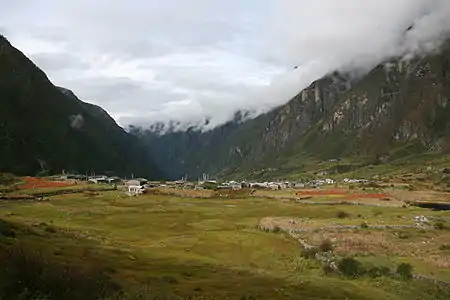
The village of Langtang was completely destroyed by a massive avalanche followed by the earthquake in April 2015.[3] The village suffered an estimated 310 deaths, including 176 Langtang residents, 80 foreigners, and 10 army personnel. More than 100 bodies were never recovered.
Langtang Himal
Langtang Himal is a mountain range in the Himalayas comprising the following peaks:[4]
| Peak | elevation |
|---|---|
| Langtang Lirung | 7,234 m (23,734 ft) |
| Langtang Ri | 7,205 m (23,638 ft) |
| Dorje Lakpa | 6,966 m (22,854 ft) |
| Loenpo Gang | 6,979 m (22,897 ft) |
| Changbu | 6,781 m (22,247 ft) |
| Yansa Tsenji | 6,690 m (21,950 ft) |
| Kyunga Ri | 6,601 m (21,657 ft) |
| Dogpache | 6,562 m (21,529 ft) |
| Langshisha Ri | 6,427 m (21,086 ft) |
| Gangchenpo | 6,387 m (20,955 ft) |
| Morimoto | 6,150 m (20,180 ft) |
| Tsogaka | 5,846 m (19,180 ft) |
| Yala Peak | 5,520 m (18,110 ft) |
.JPG.webp)
See also
References
- "Flora and Fauna in Langtang national park". Ministry of Forest and Environment, Government of Nepal.
- "Faunal Diversity". www.langtangnationalpark.gov.np. Retrieved 2019-12-23.
- Cadwalladr, Carole (May 16, 2015). "Nepal earthquake: the village wiped off the map in a few terrifying seconds". The Guardian. Retrieved 29 January 2016.
- Carter, H. A. (1985). "Classification of the Himalaya" (PDF). American Alpine Journal. 27 (59): 109–141.