Lexington Avenue/51st Street station
Lexington Avenue/51st Street is a New York City Subway station complex on the IRT Lexington Avenue Line and IND Queens Boulevard Line. The station is located on Lexington Avenue and stretches from 51st Street to 53rd Street in Midtown Manhattan. It is served by the 6 and E trains at all times, and by M trains during weekdays. In addition, <6> trains stop here during weekdays in the peak direction, and 4 trains stop here during late nights.
Lexington Avenue/51 Street | |||||||||||||
|---|---|---|---|---|---|---|---|---|---|---|---|---|---|
 Lexington Avenue and 53rd Street plaza entrance | |||||||||||||
| Station statistics | |||||||||||||
| Address | East 53rd Street & Lexington Avenue New York, NY 10022[1] | ||||||||||||
| Borough | Manhattan | ||||||||||||
| Locale | Midtown Manhattan | ||||||||||||
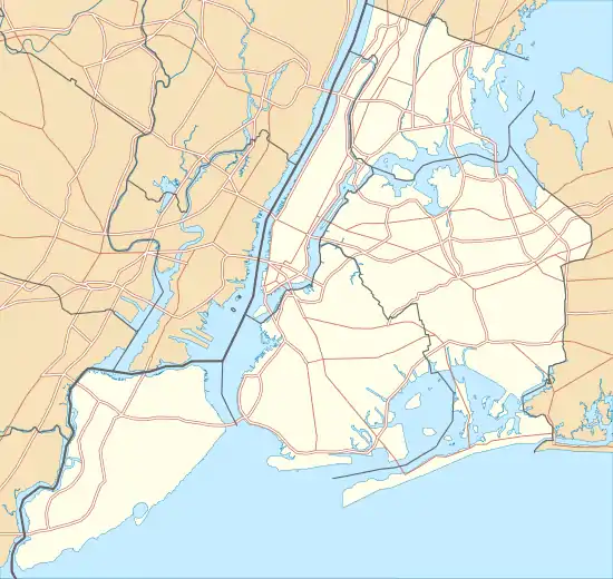
| Coordinates | 40.757075°N 73.971977°W | ||||||||||||
| Division | A (IRT), B (IND) | ||||||||||||
| Line | IRT Lexington Avenue Line IND Queens Boulevard Line | ||||||||||||
| Services | 4 6 E M | ||||||||||||
| Transit | |||||||||||||
| Structure | Underground | ||||||||||||
| Levels | 2 | ||||||||||||
| Other information | |||||||||||||
| Opened | December 11, 1988[3] | ||||||||||||
| Station code | 612[4] | ||||||||||||
| Accessible | |||||||||||||
| Traffic | |||||||||||||
| 2019 | 18,957,465[5] | ||||||||||||
| Rank | 10 out of 424[5] | ||||||||||||
| |||||||||||||
| |||||||||||||
| |||||||||||||


The complex comprises two stations: 51st Street on the Lexington Avenue Line and Lexington Avenue–53rd Street (originally Lexington—Third Avenues) on the Queens Boulevard Line. Originally two separate stations, these were connected in 1988 via a transfer passage, which was opened with the construction of 599 Lexington Avenue. Approximately 50,000 riders transfer between the Lexington Avenue and Queens Boulevard Lines each weekday.[6]
In 2019, the station complex had an annual ridership of 18,957,465, making it the tenth-busiest in the system.[5]
History
IRT Lexington Avenue Line
Following the completion of the original subway, there were plans to construct a line along Manhattan's east side north of 42nd Street. The original plan for what became the extension north of 42nd Street was to continue it south through Irving Place and into what is now the BMT Broadway Line at Ninth Street and Broadway. In July 1911, the IRT had withdrawn from the talks, and the Brooklyn Rapid Transit Company (BRT) was to operate on Lexington Avenue. The IRT submitted an offer for what became its portion of the Dual Contracts on February 27, 1912.[7][8]
In 1913, as part of the Dual Contracts, which were signed on March 19, 1913,[9] the Public Service Commission planned to split the original Interborough Rapid Transit Company (IRT) system from looking like a "Z" system (as seen on a map) to an "H"-shaped system. The original system would be split into three segments: two north–south lines, carrying through trains over the Lexington Avenue and Broadway–Seventh Avenue Lines, and a west–east shuttle under 42nd Street. This would form a roughly "H"-shaped system.[10][11] It was predicted that the subway extension would lead to the growth of the Upper East Side and the Bronx.[12][13]
51st Street station opened on July 17, 1918, with service initially running between Grand Central–42nd Street station and 167th Street via the line's local tracks.[14] On August 1, the "H system" was put into place, with through service beginning on the new east and west side trunk lines, and the institution of the 42nd Street Shuttle along the old connection between the sides.[15] The cost of the extension from Grand Central was $58 million.[16]
IND Queens Boulevard Line
This station opened on August 19, 1933 with the opening of the IND Queens Boulevard Line to Roosevelt Avenue in Queens. Service was initially provided by E trains running via the IND Eighth Avenue Line.[17] On December 15, 1940, the IND Sixth Avenue Line opened between West Fourth Street–Washington Square and 59th Street–Columbus Circle. On this date, F trains began using this station, diverging west of the station onto the Sixth Avenue Line.[18][19]
Station renovations
In 1966, an agreement was reached with the developers of 345 Park Avenue to remove the entrance at the corner of 51st Street and Lexington Avenue and replace it with a new entrance at the same corner adjacent to the building.[20]
In July 1968, the New York City Transit Authority (NYCTA) completed plans to construct a 320-foot (98 m)-long free transfer passageway between the north end of the 51st Street station and the Lexington Avenue mezzanine of the Lexington Avenue station. Construction on the project was supposed to start in early 1969.[21] On December 12, 1969, the NYCTA put the estimated $2.5 million contract up for bid.[22][23]
The IRT platforms' elevators were installed in June 1989, making the station one of the earliest to comply with the Americans with Disabilities Act of 1990. The elevator to the IND platform was installed later.
In 2003, as part of efforts to ease crowding in the station, a mezzanine was added to connect the passageway to the Third Avenue end of the IND station.[24]
Station layout
| G | Street Level | Exit/entrance |
| B1 | Side platform | |
| Northbound local | ← ← | |
| Southbound local | | |
| Side platform | ||
| B2 | Northbound express | ← |
| Southbound express | | |
| B3 | Southbound | ← ← |
| Island platform | ||
| Northbound | | |
The two stations are linked by a passageway between the northbound IRT platform and the upper mezzanine of the IND platform. From the extreme north end of both IRT platforms, a staircase, an elevator, and an escalator lead to an underpass connecting the southbound and northbound IRT platforms, linking to a corridor extending north from the northbound platform. The corridor, opened in 1989, extends to the staircases and escalators going down to the IND platform and contains a turnstile bank in the center. The corridor is divided into two sections: a shopping arcade outside fare control and a transfer hallway inside fare control. The section outside fare control leads to a staircase and elevator inside the south side of 132 East 53rd Street, which go up to the northeast corner of East 52nd Street and Lexington Avenue. A glass-enclosed staircase outside the same building leads to the southeast corner of 53rd Street and Lexington Avenue. Outside fare control under the Citigroup Center, at the northeast corner of the same intersection, there are two stairs and an elevator.[25]
The southbound Lexington Avenue Line platform has a part-time fare control area near the south end. A seven-step staircase goes up to a turnstile bank. Outside fare control, there is a customer assistance booth and one staircase going up to the front entrance of the Doubletree Metropolitan Hotel on the southwest corner of Lexington Avenue and East 50th Street.[26][25] The New York Public Library's Terence Cardinal Cooke-Cathedral Branch is within this exit, just outside of fare control. The 2,100-square-foot (200 m2) branch, the second smallest in the NYPL system, became part of the New York Public Library in 1992. Before that, it was a library for the Roman Catholic Archdiocese of New York.[27]
At Lexington Avenue and 51st Street, eight stairs go up to all four corners of that intersection (two to each corner). The eastern stairs serve the northbound platform, and the western stairs serve the southbound platform.[25] At one point, there was also an entrance from the southbound platform to the basement of the General Electric Building at 51st Street, which opened in 1931 and was sealed,[28] being replaced by a new street entrance in 1965.[29] The connecting passageway was made of marble with aluminum storefronts.[30] The entrance in the General Electric Building's basement replaced the original sidewalk staircases at the southwestern corner of Lexington Avenue and 51st Street.[31]
The Queens Boulevard Line platform has an unstaffed entrance/exit at the east (railroad north) end. One escalator and one elevator from the platform goes up to a turnstile bank, where two staircases go up to either western corner of Third Avenue and 53rd Street. A larger staircase goes up to the entrance plaza of 205 East 53rd Street at the northeast corner, and there is also an entrance/exit from under the southeast-corner building. The original name, Lexington–3rd Avenues, came from this exit.[25] The fare control area contains access to both the primary mezzanine, which contains the IRT transfer, as well as a set of staircases and escalators leading directly to the east end of the IND platform.
IRT Lexington Avenue Line platforms
51 Street | ||||||||||||||||||||||||||||||||||||||||||||||||||||||||||||||||||||
|---|---|---|---|---|---|---|---|---|---|---|---|---|---|---|---|---|---|---|---|---|---|---|---|---|---|---|---|---|---|---|---|---|---|---|---|---|---|---|---|---|---|---|---|---|---|---|---|---|---|---|---|---|---|---|---|---|---|---|---|---|---|---|---|---|---|---|---|---|
 Downtown local platform | ||||||||||||||||||||||||||||||||||||||||||||||||||||||||||||||||||||
| Station statistics | ||||||||||||||||||||||||||||||||||||||||||||||||||||||||||||||||||||
| Address | East 51st Street & Lexington Avenue New York, NY 10022 40.757075°N 73.971977°W | |||||||||||||||||||||||||||||||||||||||||||||||||||||||||||||||||||
| Division | A (IRT) | |||||||||||||||||||||||||||||||||||||||||||||||||||||||||||||||||||
| Line | IRT Lexington Avenue Line | |||||||||||||||||||||||||||||||||||||||||||||||||||||||||||||||||||
| Services | 4 6 | |||||||||||||||||||||||||||||||||||||||||||||||||||||||||||||||||||
| Platforms | 2 side platforms | |||||||||||||||||||||||||||||||||||||||||||||||||||||||||||||||||||
| Tracks | 2 | |||||||||||||||||||||||||||||||||||||||||||||||||||||||||||||||||||
| Other information | ||||||||||||||||||||||||||||||||||||||||||||||||||||||||||||||||||||
| Opened | July 17, 1918[14] | |||||||||||||||||||||||||||||||||||||||||||||||||||||||||||||||||||
| Station code | 401[4] | |||||||||||||||||||||||||||||||||||||||||||||||||||||||||||||||||||
| Accessible | ||||||||||||||||||||||||||||||||||||||||||||||||||||||||||||||||||||
| Opposite- direction transfer | Yes | |||||||||||||||||||||||||||||||||||||||||||||||||||||||||||||||||||
| Station succession | ||||||||||||||||||||||||||||||||||||||||||||||||||||||||||||||||||||
| Next north | 59th Street: 4 | |||||||||||||||||||||||||||||||||||||||||||||||||||||||||||||||||||
| Next south | Grand Central–42nd Street: 4 | |||||||||||||||||||||||||||||||||||||||||||||||||||||||||||||||||||
| ||||||||||||||||||||||||||||||||||||||||||||||||||||||||||||||||||||
| ||||||||||||||||||||||||||||||||||||||||||||||||||||||||||||||||||||
51st Street on the IRT Lexington Avenue Line is a local station with two local tracks and two side platforms. The two express tracks, used by the 4 and 5 trains during daytime hours, pass through a lower level and are not visible from the platforms.[32] Both platforms have emergency exits from the lower level express tracks.
The station features modern beige bricks over the original tiles, but the standard IRT-style mosaics remain intact. There is a crossunder at the extreme north end of the platforms with an elevator, a staircase, and an up-only escalator on each side. This crossunder features stairs, elevators and up-only escalators. A ceramic artwork called Tunnel Vision by Nina Yankowitz was installed here in 1989, but was removed after a 2016 retiling.
The platforms are approximately 25 feet (7.6 m) below street level and the station's full-time fare control areas are at the center of each. A staircase of seven steps goes up to a turnstile bank, with a token booth and two exits to each corner on each side outside fare control.
This station is the southernmost station on the Lexington Avenue Line to be directly under Lexington Avenue itself. South of here, the line shifts slightly westward to Park Avenue.
Image gallery
 51st Street tiles
 51st Street entrance to the southbound platform
 50th Street entrance to the southbound platform
IND Queens Boulevard Line platform
Lexington Avenue–53 Street | |||||||||||||||||||||||||||||||||||||||||||||||||||||||||||||||||||||||||||||||||||||||||
|---|---|---|---|---|---|---|---|---|---|---|---|---|---|---|---|---|---|---|---|---|---|---|---|---|---|---|---|---|---|---|---|---|---|---|---|---|---|---|---|---|---|---|---|---|---|---|---|---|---|---|---|---|---|---|---|---|---|---|---|---|---|---|---|---|---|---|---|---|---|---|---|---|---|---|---|---|---|---|---|---|---|---|---|---|---|---|---|---|---|
 Looking south on the platform leading to the transfer | |||||||||||||||||||||||||||||||||||||||||||||||||||||||||||||||||||||||||||||||||||||||||
| Station statistics | |||||||||||||||||||||||||||||||||||||||||||||||||||||||||||||||||||||||||||||||||||||||||
| Address | Lexington Avenue & East 53rd Street New York, NY 10022 40.758343°N 73.971033°W | ||||||||||||||||||||||||||||||||||||||||||||||||||||||||||||||||||||||||||||||||||||||||
| Division | B (IND) | ||||||||||||||||||||||||||||||||||||||||||||||||||||||||||||||||||||||||||||||||||||||||
| Line | IND Queens Boulevard Line | ||||||||||||||||||||||||||||||||||||||||||||||||||||||||||||||||||||||||||||||||||||||||
| Services | E M | ||||||||||||||||||||||||||||||||||||||||||||||||||||||||||||||||||||||||||||||||||||||||
| Platforms | 1 island platform | ||||||||||||||||||||||||||||||||||||||||||||||||||||||||||||||||||||||||||||||||||||||||
| Tracks | 2 | ||||||||||||||||||||||||||||||||||||||||||||||||||||||||||||||||||||||||||||||||||||||||
| Other information | |||||||||||||||||||||||||||||||||||||||||||||||||||||||||||||||||||||||||||||||||||||||||
| Opened | August 19, 1933[33][34] | ||||||||||||||||||||||||||||||||||||||||||||||||||||||||||||||||||||||||||||||||||||||||
| Station code | 275[4] | ||||||||||||||||||||||||||||||||||||||||||||||||||||||||||||||||||||||||||||||||||||||||
| Accessible | |||||||||||||||||||||||||||||||||||||||||||||||||||||||||||||||||||||||||||||||||||||||||
| Opposite- direction transfer | Yes | ||||||||||||||||||||||||||||||||||||||||||||||||||||||||||||||||||||||||||||||||||||||||
| Former/other names | Lexington–3rd Avenues | ||||||||||||||||||||||||||||||||||||||||||||||||||||||||||||||||||||||||||||||||||||||||
| Station succession | |||||||||||||||||||||||||||||||||||||||||||||||||||||||||||||||||||||||||||||||||||||||||
| Next east | Court Square–23rd Street: E | ||||||||||||||||||||||||||||||||||||||||||||||||||||||||||||||||||||||||||||||||||||||||
| Next west | Fifth Avenue/53rd Street: E | ||||||||||||||||||||||||||||||||||||||||||||||||||||||||||||||||||||||||||||||||||||||||
| |||||||||||||||||||||||||||||||||||||||||||||||||||||||||||||||||||||||||||||||||||||||||
| |||||||||||||||||||||||||||||||||||||||||||||||||||||||||||||||||||||||||||||||||||||||||
Lexington Avenue–53rd Street on the IND Queens Boulevard Line opened on August 19, 1933[33][34] and has two tracks and one island platform.[32] It was built 70 feet (21 m) below street level, as the line had to pass beneath all of the north–south subway lines that were built before it. As a result, long escalators and staircases are required to reach the mezzanine from the platform.[33][34] At the extreme west end of the Queens Boulevard Line platform, a single staircase and a bank of two escalators (which were once the longest in the world), a single escalator, and one ADA-accessible elevator go up to the full-time mezzanine.[25]
There are no tiles, trim line, or mosaics on the track walls. East of this station (railroad north), the line goes under the East River to Long Island City, Queens.
Artwork
In 1976, with funding from the Exxon Corporation, this station, as well as three others citywide, received new "artfully humorous graffiti" murals and artwork.[35] Local designer Sperling Elman Inc. received $5,000 to place a new coat of paint on the entrances. The paint was placed "in a variety of colors and in broad stripes."[35]
The 2004 artwork here is called Passing Through by Al Held. It features glass mosaic on the mezzanine walls.
Image gallery
 Stair at the foot of 599 Lexington Avenue
 Older signage, since removed from the station
 As seen from the front of an arriving train
Proposed Second Avenue Subway station
As part of the construction of the Second Avenue Subway, the Metropolitan Transportation Authority has considered including a transfer between this station complex and the proposed 55th Street station on the Second Avenue Line, which would be located under Second Avenue between 52nd Street and 56th Street.[36] This would provide a transfer to the proposed T train, which would serve the Second Avenue Line upon completion of Phase 3, although that phase is currently not funded or scheduled. Currently, the transfer is under evaluation.[37][38] The proposed transfer passage would run under 53rd Street between the eastern end of the Queens Boulevard Line platform and Second Avenue, connecting to the southern end of 55th Street station.[39] The MTA projects that providing a transfer between the Queens Boulevard and Second Avenue lines would reduce crowding in the existing transfer passage between the Queens Boulevard and Lexington Avenue lines at the western end of the Queens Boulevard Line platform.[36]
References
- "Borough of Manhattan, New York City". Government of New York City. Retrieved December 28, 2020.
- "Manhattan Bus Map" (PDF). Metropolitan Transportation Authority. July 2019. Retrieved December 1, 2020.
- Guide Archived July 22, 2018, at the Wayback Machine to December 11, 1988, version of the New York City Subway map
- "Station Developers' Information". Metropolitan Transportation Authority. Retrieved June 13, 2017.
- "Facts and Figures: Annual Subway Ridership 2014–2019". Metropolitan Transportation Authority. 2020. Retrieved May 26, 2020.
- "Potential East Midtown Transit Improvements" (PDF). www.cb5.org. Metropolitan Transportation Authority. October 2012. p. 28. Archived from the original (PDF) on January 6, 2017. Retrieved February 8, 2018.
- Walker, James Blaine (1918). Fifty Years of Rapid Transit — 1864 to 1917. New York, N.Y.: Law Printing. pp. 230–233. Retrieved November 6, 2016.
- "Petition for Subway in Lexington Ave". The New York Times. May 22, 1912. ISSN 0362-4331. Retrieved February 16, 2009.
A petition is being circulated among the residents and property owners of the section just south of the Grand Central Station, in Park and Lexington Avenues, protesting against the proposed abandonment of the construction of the Subway in Lexington Avenue, between Forty-third and Thirty-second Streets.
- "Subway Contracts Solemnly Signed; Cheers at the Ceremonial Function When McCall Gets Willcox to Attest" (PDF). The New York Times. March 20, 1913. ISSN 0362-4331. Retrieved January 11, 2018.
- "Money Set Aside For New Subways; Board of Estimate Approves City Contracts to be Signed To-day with Interboro and B.R.T." (PDF). The New York Times. March 19, 1913. ISSN 0362-4331. Retrieved November 10, 2017.
- Engineering News-record. McGraw-Hill Publishing Company. 1916. p. 846.
- Whitney, Travis H. (March 10, 1918). "The Seventh and Lexington Avenue Subways Will Revive Dormant Sections — Change in Operation That Will Transform Original Four-Tracked Subway Into Two Four-Tracked Systems and Double Present Capacity of the Interborough". The New York Times. p. 12. Retrieved August 26, 2016.
- "Public Service Commission Fixes July 15 For Opening of The New Seventh and Lexington Avenue Subway Lines — Will Afford Better Service and Less Crowding — Shuttle Service for Forty-Second Street — How the Various Lines of the Dual System Are Grouped for Operation and List of Stations on All Lines". The New York Times. May 19, 1918. p. 32. Retrieved November 6, 2016.
- "Lexington Av. Line to be Opened Today" (PDF). The New York Times. July 17, 1918. p. 13. ISSN 0362-4331. Retrieved April 21, 2020.
- "Open New Subway Lines to Traffic; Called a Triumph — Great H System Put in Operation Marks an Era in Railroad Construction — No Hitch in the Plans — But Public Gropes Blindly to Find the Way in Maze of New Stations — Thousands Go Astray — Leaders in City's Life Hail Accomplishment of Great Task at Meeting at the Astor". The New York Times. August 2, 1918. p. 1. Retrieved November 6, 2016.
- "Finish a New Link of the Dual Subway; Lexington Avenue Line North of Forty-second Street to Begin Local Service Wednesday. Branch Extends to Bronx Through service, with Times SquareGrand Central Shuttle Connections, to Open Soon. Changes in the Bronx". The New York Times. July 11, 1918. p. 20. ISSN 0362-4331. Retrieved January 8, 2017.
-
- "Two Subway Units Open At Midnight; Links in City-Owned System in Queens and Brooklyn to Have 15 Stations" (PDF). The New York Times. August 18, 1933. ISSN 0362-4331. Retrieved November 7, 2015.
- "New Queens Subway Service Will Be Launched Tonight; Tunnel From Manhattan Open to Jackson Heights; Service Will Eventually Be Extended Through To Jamaica" (PDF). Long Island Daily Press. August 18, 1933. p. 20. Retrieved July 27, 2016.
- "New Queens Tube To Open Saturday: Brooklyn-Long Island City Link of City Line Also to Be Put in Operation" (PDF). New York Evening Post. August 17, 1933. p. 18. Retrieved July 27, 2016.
- Sparberg, Andrew J. (October 1, 2014). From a Nickel to a Token: The Journey from Board of Transportation to MTA. Fordham University Press. ISBN 978-0-8232-6190-1.
-
- Linder, Bernard (December 2008). "Sixth Avenue Subway Service Changes". New York Division Bulletin. Electric Railroaders' Association. 51 (12): 2–4. Retrieved August 6, 2016.
- "New 6th Ave. Tube Will Be Boon to Queens Residents". The Brooklyn Daily Eagle. December 8, 1940. p. 10. Retrieved October 4, 2015.
- Minutes and Proceedings of the New York City Transit Authority. New York City Transit Authority. 1968. p. 20.
- Transportation Progress: An Interim Report. Metropolitan Transportation Authority. 1968. p. 8.
- Engineering News-record. McGraw-Hill. 1969. p. 142.
- Authority, New York City Transit (1969). Proceedings of the New York City Transit Authority Relating to Matters Other Than Operation. The Authority. p. 324.
- Feldman, Jason. "Contractors Construct 200-ft.-long Mezzanine Under 53rd St". New York Construction. Retrieved November 29, 2012.
- "Lexington Avenue—53rd Street Neighborhood Map". mta.info. Metropolitan Transportation Authority. April 2018. Retrieved December 28, 2020.
- Station Reporter — 51st Street/Lexington Avenue Complex Archived July 26, 2009, at the Wayback Machine
- Kilgannon, Corey (October 24, 2010). "A New York Public Library Branch That's a Commuter's Secret". The New York Times. Retrieved January 26, 2018.
- "General Electric Building" (PDF). National Register of Historic Places, National Park Service. December 19, 2003. p. 11. Retrieved October 13, 2020.
- Minutes and Proceedings of the New York City Transit Authority. New York City Transit Authority. 1965. pp. 31, 80.
- "Underground Arcade of RCA Building Will Be of Marble". New York Herald Tribune. March 1, 1931. p. E1. Retrieved October 13, 2020 – via ProQuest.
- "Subway Entrance in Radio Building; Easements Given for Approach in New Edifice at Lexington Av". The New York Times. February 24, 1931. ISSN 0362-4331. Retrieved October 13, 2020.
- Dougherty, Peter (2006) [2002]. Tracks of the New York City Subway 2006 (3rd ed.). Dougherty. OCLC 49777633 – via Google Books.
- "New Queens Subway Service Will Be Launched Tonight; Tunnel From Manhattan Open to Jackson Heights; Service Will Eventually Be Extended Through To Jamaica". Long Island Daily Press. Fultonhistory.com. August 18, 1933. p. 20. Retrieved July 27, 2016.
- "New Queens Tube To Open Saturday: Brooklyn-Long Island City Link of City Line Also to Be Put in Operation". New York Evening Post. Fultonhistory.com. August 17, 1933. p. 18. Retrieved July 27, 2016.
- Burks, Edward C. (November 18, 1976). "A Subway Elongatomus? Why, It's Preposterous!". The New York Times. Retrieved September 21, 2016.
- "Second Avenue Subway Final Environmental Impact Statement (FEIS): Chapter 5b: Transportation—Subway and Commuter Rail" (PDF). mta.info. Metropolitan Transportation Authority. May 2004. Retrieved October 17, 2018.
- "Second Avenue Subway Final Environmental Impact Statement (FEIS): Figure 2-1: New York City Subway Service with Second Avenue Subway Line" (PDF). mta.info. Metropolitan Transportation Authority. May 2004. Retrieved October 17, 2018.
- "Second Avenue Subway Final Environmental Impact Statement (FEIS): Chapter 2: Project Alternatives" (PDF). mta.info. Metropolitan Transportation Authority. May 2004. Retrieved October 17, 2018.
- "Second Avenue Subway Final Environmental Impact Statement (FEIS): Chapter 3: Description of Construction Methods and Activities" (PDF). mta.info. Metropolitan Transportation Authority. May 2004. Retrieved October 17, 2018.
External links
| Wikimedia Commons has media related to Lexington Avenue / 51st – 53rd Streets (New York City Subway). |
- nycsubway.org – IRT East Side Line: 51st Street
- nycsubway.org — Tunnel Vision Artwork by Nina Yankowitz (1989)
- nycsubway.org — Passing Through Artwork by Al Held (2004)
- nycsubway.org – IND Queens Boulevard Line: Lexington Avenue/53rd Street
- Station Reporter — 51st Street/Lexington Avenue Complex
MTA: Arts for Transit:
Google Maps Street View: