List of World Heritage Sites in Africa
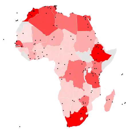
The United Nations Educational, Scientific and Cultural Organization (UNESCO) has designated 145 World Heritage Sites in Africa.[lower-alpha 1] These sites are located in 35 countries (also called "state parties").
no sites
1–2 sites
3–4 sites
5–6 sites
7–8 sites
9 sites
Selection of World Heritage Sites
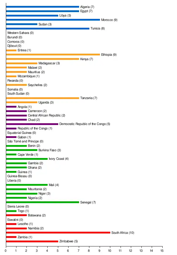
South Africa has the lead with ten sites; followed by Ethiopia and Morocco being home to nine sites; then Tunisia with eight sites; and Algeria, Egypt, Kenya, Senegal, and Tanzania at seven. Ten countries have only a single site each. Four sites are shared between two countries: Maloti-Drakensberg Park (Lesotho and South Africa), the Mount Nimba Strict Nature Reserve (Côte d'Ivoire and Guinea), the Stone Circles of Senegambia (the Gambia and Senegal), and the Mosi-oa-Tunya / Victoria Falls (Zambia and Zimbabwe). Three sites are in whole held by Uganda, Sudan and Madagascar. Two sites are shared among three countries, Sangha Trinational (Central African Republic, Cameroon, and Congo) and W-Arly-Penjari Complex (Benin, Burkina Faso, and Niger).[1]
The first sites from the continent were inscribed in 1978, when the Island of Gorée of Senegal and the Rock-Hewn Churches of Ethiopia were chosen during the list's conception.[2][3]
As of September 2017, Somalia has no official World Heritage Sites since the Somali government is not party to the 1972 World Heritage Convention. However, there are around a dozen archaeological sites in the country that are believed to be potential future candidates for World Heritage status.[4]
Each year, UNESCO's World Heritage Committee may inscribe new sites on the list, or delist sites that no longer meet the criteria. Selection is based on ten criteria: six for cultural heritage (i–vi) and four for natural heritage (vii–x).[5] Some sites, designated "mixed sites," represent both cultural and natural heritage. In Africa, there are 55 cultural, 44 natural, and 5 mixed sites.[1]
Several efforts have been devoted to increasing the number of sites and preserving the heritage of existing sites on the continent; for example, on 5 May 2006, the African World Heritage Fund was launched by UNESCO to target the region of Sub-Saharan Africa. It planned to protect the sites by hiring personnel for state parties to maintain national inventories of existing sites, as well as to "prepare nomination dossiers for inscription onto the World Heritage List." Grants were also destined to help the "[conservation] and management of heritage properties in general" and to rehabilitate properties in danger.[6]
The drive was initially funded by South Africa with US$3.5 million,[6] and, as of March 2011, has amassed $4.7 million from various countries, with an additional $4.1 million in pending pledges.[7] UNESCO has also attempted to increase awareness of African human origin sites in Ethiopia, with a goal of conserving and protecting the areas from further deterioration.[8]
The World Heritage Committee may also specify that a site is endangered, citing "conditions which threaten the very characteristics for which a property was inscribed on the World Heritage List."[9] Along with other World Heritage Sites, sites in danger are subject to re-evaluation by the committee every year at their "ordinary sessions".[10][11] Africa has 17 sites on the danger list, accounting for 13% of all African sites and 35% of the 48 endangered sites worldwide. The Democratic Republic of Congo and Libya both have 5 sites on the danger list, the second highest of any country in the world and two of the three countries to have more than three sites inscribed.[lower-alpha 2][12]
Sites in Africa have been marked as such for a variety of reasons, such as deforestation and hunting,[13][14] civil war,[15] threats to and hostage taking of reserve staff,[16] oil and gas projects and mining,[17] declines in biodiversity,[18] and structural damage to buildings.[19] Three sites were formerly declared as being in danger, but have since lost the status: the Ngorongoro Conservation Area (1984–1989),[20] the Rwenzori Mountains National Park (1999–2004),[21] and Tipasa (2002–2006).[22] The Garamba National Park and Timbuktu have also lost their statuses in 1992 and 2005, respectively, but later regained it in 1996 and 2012.[23][24] Despite its large number of endangered sites and the circumstances surrounding them, African World Heritage Sites have never been stripped of their title, something that has only occurred twice.[25]
Legend
The list below ignores UNESCO's geopolitical definition of Africa and includes what it describes as sites in the "Arab States".[26] Egypt is included as part of North Africa. The list also comprises a number of sites for which the state party is outside the continent, but the site itself is located in Africa; three such sites are located on the Canary Islands (belonging to Spain), one on Madeira (belonging to Portugal), one on Réunion (belonging to France), and one on the Tristan da Cunha archipelago (belonging to the United Kingdom).
- Site – named after the World Heritage Committee's official designation[1]
- Location – sorted by country, followed by the region at the regional or provincial level. In the case of multinational or multi-regional sites, the names are sorted alphabetically.
- Criteria – as defined by the World Heritage Committee[5]
- Area – in hectares and acres, excluding any buffer zones. A value of zero implies that no data has been published by UNESCO
- Year – during which the site was inscribed to the World Heritage List
- Description – brief information about the site, including reasons for qualifying as an endangered site, if applicable
Sites
| Site | Image | Location | Criteria | Area ha (acre) |
Year | Description |
|---|---|---|---|---|---|---|
| Aapravasi Ghat | 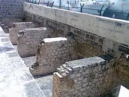 | Port Louis District, 20°09′31″S 57°30′11″E | Cultural: (vi) | 0.16 (0.40) | 2006 | Aapravasi Ghat was the first site chosen by the British government to take part in the "Great Experiment", where indentured laborers were used instead of slaves. Between 1834 and 1920, almost half a million contracted workers passed through Port Louis from India, either to work in Mauritius or to transfer to other British colonies.[27] |
| Abu Mena |
 | Abusir, 30°50′28″N 29°39′47″E | Cultural: (iv) | 182 (450) | 1979 | The ruins of the former Christian holy city contain a church, a baptistery, basilicas, public buildings, streets, monasteries, houses, and workshops, and were built over the tomb of Menas of Alexandria.[28] The World Heritage Committee designated Abu Mena as an endangered site in 2001, due to cave-ins in the area caused by the clay at the surface, which becomes semi-liquid when met with "excess water".[29] |
| Air and Ténéré Natural Reserves |
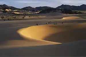 | Arlit Department, 18°N 9°E | Natural: (vii), (ix), (x) | 7,736,000 (19,120,000) | 1991 | Africa's largest protected area, located in the Saharan desert of Ténéré, consists of the volcanic rock mass of Aïr and a small isolated Sahelian pocket with unique flora and fauna.[30] The natural reserve was placed on UNESCO's List of World Heritage in Danger in 1992, due to the increase in military conflicts and the hostage-taking of six reserve staff in February. Removal from this list was considered in 1999, but as of 2011, its position remains unchanged.[31][32] |
| Aksum | 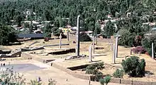 | Tigray Region, 14°07′49″N 38°43′07″E | Cultural: (i), (iv) | — | 1980 | The ruins of the city of Aksum, dating from the 1st to the 13th century, mark the heart of ancient Ethiopia and what was the "most powerful state between the Eastern Roman Empire and Persia". It includes monolithic obelisks, giant stelae, royal tombs, and ruins of former castles.[33] |
| Al Qal'a of Beni Hammad | 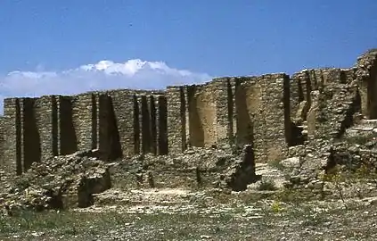 | Maadid, 35°49′06″N 4°47′13″E | Cultural: (iii) | 150 (370) | 1980 | The fortified first capital of the Hammadid emirs was originally built in 1007 and demolished in 1152. It features an 8-bay, 13-aisle mosque, which is one of the largest in Algeria.[34] |
| Aldabra Atoll | 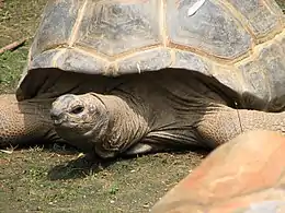 | Aldabra Group, 9°25′00″S 46°25′00″E | Natural: (vii), (ix), (x) | 35,000 (86,000) | 1982 | The Aldabra Atoll consists of four large coral islands and a lagoon, surrounded by a coral reef. The islands are home to the world's largest population of giant tortoises.[35] |
| Amphitheatre of El Jem | 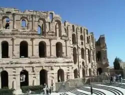 | El Djem, 35°17′47″N 10°42′25″E | Cultural: (iv), (vi) | — | 1979 | The Amphitheatre of El Jem, built during the 3rd century, is North Africa's largest amphitheatre, and the largest one built outside of Italy, with a capacity of 35,000 spectators, and "illustrates the grandeur and extent of Imperial Rome."[36] |
| Ancient Ferrous Metallurgy Sites of Burkina Faso | Douroula, Tiwêga, Yamané, Kindibo, Békuy, 12°35′16″N 3°19′44″W | Cultural: (iii), (iv), (vi) | 122.3 (302) | 2019 | [37] | |
| Ancient Ksour of Ouadane, Chinguetti, Tichitt and Oualata | 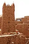 | Chinguetti, Ouadane, Oualata, and Tichitt, 20°55′44″N 11°37′25″W | Cultural: (iii), (iv), (v) | — | 1996 | "Founded in the 11th and 12th centuries to serve the caravans crossing the Sahara, these trading and religious centres became focal points of Islamic culture. [...] Typically, houses with patios crowd along narrow streets around a mosque with a square minaret. They illustrate a traditional way of life centred on the nomadic culture of the people of the western Sahara."[38] |
| Ancient Thebes with its Necropolis | 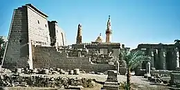 | Qena, 25°44′00″N 32°36′00″E | Cultural: (i), (iii), (vi) | 7,390 (18,300) | 1979 | The former capital of Egypt and city of the Egyptian god Amun contains relics from the height of Ancient Egypt. The temples, palaces and the necropolises of the Valley of the Kings and the Valley of the Queens bear "a striking testimony to Egyptian civilization."[39] |
| Archaeological Site of Carthage | 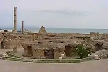 | Tunis, 36°51′10″N 10°19′24″E | Cultural: (ii), (iii), (vi) | — | 1979 | Founded in the 9th century BCE, Carthage was developed into a trading empire spanning the Mediterranean, and was, according to UNESCO, "home to a brilliant civilization." The city was destroyed in 146 BCE in the Punic Wars at the hands of the Romans, but was later rebuilt by these.[40] |
| Archaeological Site of Cyrene |
 | Jebel Akhdar, 32°49′30″N 21°51′30″E | Cultural: (ii), (iii), (vi) | — | 1982 | The formerly Greek colony was Romanized and transformed into a capital, until it was destroyed by the 365 Crete earthquake. The thousand-year-old ruins have remained renowned since the 18th century.[41] |
| Archaeological Site of Leptis Magna |
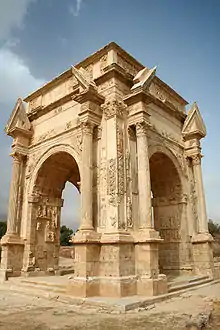 | Khoms, 32°38′18″N 14°17′35″E | Cultural: (i), (ii), (iii) | — | 1982 | The Roman city of Leptis Magna was enlarged by Emperor Septimius Severus, who was born there. Public monuments, a harbour, a marketplace, storehouses, shops, and homes were among the reasons for its induction into the list.[42] |
| Archaeological Site of Sabratha |
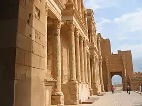 | Sabratha, 32°48′19″N 12°29′06″E | Cultural: (iii) | — | 1982 | "A Phoenician trading-post that served as an outlet for the products of the African hinterland, Sabratha was part of the short-lived Numidian Kingdom of Massinissa before being Romanized and rebuilt in the 2nd and 3rd centuries."[43] |
| Archaeological Site of Volubilis | 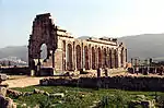 | Meknes, 34°04′26″N 5°33′25″W | Cultural: (ii), (iii), (iv), (vi) | 42 (100) | 1997 | The important Roman outpost of Volubilis was founded in the 3rd century BCE to become the capital of Mauretania. It contained many buildings, the remains of which have survived extensively to this day.[44] |
| Archaeological Sites of the Island of Meroe | 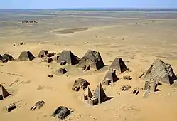 | Meroë, 16°56′00″N 33°43′00″E | Cultural: (ii), (iii), (iv), (v) | 2,357 (5,820) | 2011 | The site was the centre of the Kingdom of Kush, a major force active from the 8th century BCE to the 4th century CE. It is home to pyramids, temples, and domestic buildings, among other vestiges.[45] |
| Asante Traditional Buildings |  | Kumasi, 6°24′04″N 1°37′33″W | Cultural: (v) | — | 1980 | The site, north-east of Kumasi, hosts the final intact remains of the Ashanti Empire, which peaked in the 18th century. The dwellings, which are made of earth, wood, and straw, are susceptible to the damages caused by the "onslaught of time and weather."[46] |
| Asmara |  | Maekel, 15°20′07″N 38°56′09″E | Cultural: (ii)(iv) | 481 (1,190) | 2017 | Located at over 2000 metres above sea level, the capital of Eritrea developed from the 1890s onwards as a military outpost for the Italian colonial power. After 1935, Asmara underwent a large scale programme of construction applying the Italian rationalist idiom of the time to governmental edifices, residential and commercial buildings, churches, mosques, synagogues, cinemas, hotels, etc.[47] |
| Barberton Makhonjwa Mountains | Mpumalanga, 25°47′06″S 31°03′07″E | Natural: (viii) | 113,137 (279,570) | 2018 | The mountains contain the world's oldest geological structures and are known to have preserved volcanic and sedimentary rocks estimated to be between 3.6 and 3.25 billion years old.[48] | |
| Banc d'Arguin National Park |  | Azefal and Nouadhibou, 20°14′05″N 16°06′32″W | Natural: (ix), (x) | 1,200,000 (3,000,000) | 1989 | The park consists of sand dunes, coastal swamps, small islands, and shallow bodies of water; all bordering the coast of the Atlantic Ocean. Birds are often found to migrate in the area, accompanied by various species of sea turtles and dolphins, whose presence fishermen often use to attract fish.[49] |
| Bassari Country: Bassari, Fula and Bedik Cultural Landscapes |  | 12°35′36″N 12°50′45″W | Cultural: (iii), (v), (vi) | 50,309 (124,320) | 2012 | [50] |
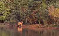
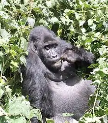
| Bwindi Impenetrable National Park | 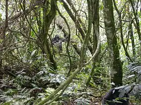 | Kabale District, Kisoro District, and Rukungiri District, 1°04′50″S 29°39′41″E | Natural: (vii), (x) | 32,092 (79,300) | 1994 | Located on the border of plain and mountain forests, the park in south-western Uganda is home to over 160 species of trees, over a hundred species of ferns, and various species of birds and butterflies. Many endangered species are within its boundaries as well, including the mountain gorilla.[51] |
| Cape Floral Region Protected Areas | 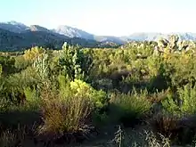 | Eastern Cape and Western Cape, 34°21′40″S 18°28′30″E | Natural: (ix), (x) | 553,000 (1,370,000) | 2004 | The site consists of eight protected areas that are among the richest in plant life worldwide, containing nearly 20% of Africa's total flora. Its scientific value is demonstrated by the presence of fire and radiation adaptivity in plants and seed dispersal by insects.[52] |
| Chongoni Rock-Art Area | 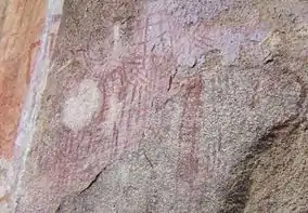 | Dedza District, 14°17′36″S 34°16′45″E | Cultural: (iii), (vi) | 12,640 (31,200) | 2006 | The 127-site area contains the richest concentration of rock art in Central Africa, ranging from Stone Age paintings to contemporary work from farmers. The symbols depicted in the rock art are strongly centred around women, and retain a cultural significance for the Chewa.[53] |
| Cidade Velha, Historic Centre of Ribeira Grande | 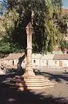 | Ribeira Grande, 14°54′55″N 23°36′19″W | Cultural: (ii), (iii), (vi) | 209 (520) | 2009 | The town, in the south of the island of Santiago, was the first European colonial outpost in the tropics, with remains dating back to the 16th century. Two churches, a royal fortress, and Pillary Square help comprise the tropical town's original street layout.[54] |
| Cliff of Bandiagara (Land of the Dogons) | 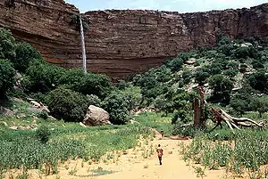 | Bandiagara Cercle, 14°20′00″N 3°25′00″W | Mixed: (v), (vii) | 327,390 (809,000) | 1989 | The sandy plateau and cliffs of Bandiagara outline the site, featuring houses, granaries, altars, sanctuaries, and Togu-Na meeting-places. Age-old social traditions such as masks, feasts, rituals, and ancestral worship also add to its cultural significance.[55] |
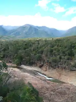
| Comoé National Park |
 | Zanzan, 9°N 4°E | Natural: (ix), (x) | 1,150,000 (2,800,000) | 1983 | Among the largest protected sites of West Africa, the park features the Comoé River and the unique flora which accompanies it.[56] The site was placed on UNESCO's List of World Heritage in Danger in 2003, due to unrest in Côte d'Ivoire, and various other factors such as poaching, wildfires, lack of proper management of the site, and overgrazing.[57] |
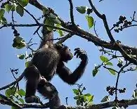
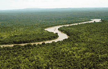
| Dja Faunal Reserve | 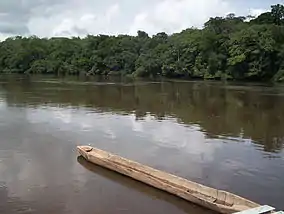 | Dja-et-Lobo and Haut-Nyong, 3°N 13°E | Natural: (ix), (x) | 526,000 (1,300,000) | 1987 | Among Africa's largest and best protected rain forests, the Cameroonian reserve is almost completely surrounded by the Dja River and contains 107 mammal species, of which five are threatened.[58] |
| Djémila | 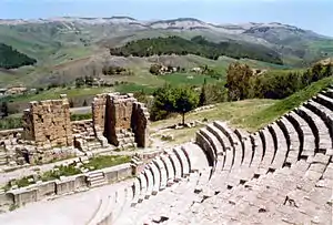 | Sétif, 36°19′14″N 5°44′12″E | Cultural: (iii), (iv) | 30 (74) | 1982 | The ruins of a Roman town in a mountainous location, including a forum, temples, basilicas, triumphal arches and houses, each adapted to a location 900 m (3,000 ft) above sea level.[59] |
| Djoudj National Bird Sanctuary | 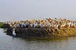 | Saint-Louis Region, 16°30′00″N 16°10′00″W | Natural: (vii), (x) | 16,000 (40,000) | 1981 | The Senegal River delta wetland area consists of streams, lakes, ponds and backwaters. It is the home to 1.5 million birds, including the great white pelican, the purple heron, the African spoonbill, the great egret, and cormorants. The sanctuary also features crocodiles, African manatees, and other typical Sahelian species.[60] |
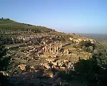
| Dougga / Thugga | 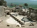 | Béja Governorate, 36°25′25″N 9°13′13″E | Cultural: (ii), (iii) | 70 (170) | 1997 | The site features the ruins of Dougga, a former capital of a Libyan–Punic state, which flourished under Ancient Rome and the Byzantine Empire, but declined in the Islamic period.[61] |
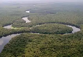
| Ecosystem and Relict Cultural Landscape of Lopé-Okanda |  | Ogooué-Ivindo and Ogooué-Lolo, 0°30′N 11°30′E | Mixed: (iii), (iv), (ix), (x) | 491,291 (1,214,010) | 2007 | The park features well-preserved tropical rain forests and savanna, resulting in a diverse ecosystem consisting of endangered, large mammals.[62] |
| Ennedi Massif: Natural and Cultural Landscape |  | 17°02′30″N 21°51′46″E | Mixed: (iii), (vii), (ix) | 2,441,200 (6,032,000) | 2016 | [63] |
| Fasil Ghebbi, Gondar Region | 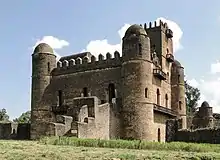 | Amhara Region, 12°36′25″N 37°27′58″E | Cultural: (ii), (iii) | — | 1979 | The fortress was the residence of the Ethiopian emperors during the 16th and 17th century. The city remains, which feature buildings with Hindu and Arab influences, were later remodelled with Baroque-style architecture by Jesuit missionaries.[64] |
| Fort Jesus, Mombasa | 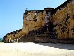 | Mombasa, 4°03′46″S 39°40′46″E | Cultural: (i), (iv) | 161,485 (399,040) | 2011 | Fort Jesus is a Portuguese fort built from 1593 to 1596 on Mombasa Island to guard the old port of Mombasa, Kenya. The site's layout follows the Renaissance ideal that the human body is perfectly proportionate.[65] |
| Forts and Castles, Volta, Greater Accra, Central and Western Regions | 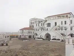 | Central Region, Greater Accra, Volta Region, and Western Region, 5°14′51″N 0°47′07″W | Cultural: (vi) | — | 1979 | The site features the remains of fortified trading posts, built along the Ghanaian coast between 1482 and 1786.[66] |
| Fossil Hominid Sites of South Africa[lower-alpha 3] |  | Gauteng, Limpopo, and North West, 24°09′31″S 29°10′37″E | Cultural: (iii), (vi) | — | 1999 | The various fossil sites contain traces of human occupation and evolution dating 3.3 million years.[67] |
| French Austral Lands and Seas | 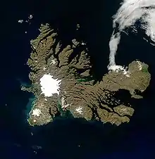 | Crozet Islands, Kerguelen Islands, Île Saint-Paul, ,Île Amsterdam 49°22′49″S 69°21′10″E | Natural: (vii), (ix), (x) | 67,296,900 (166,294,000) | 2019 | [68] |
| Garajonay National Park | 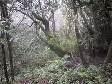 | La Gomera, 28°07′34″N 17°14′14″W | Natural: (vii), (ix) | 3,984 (9,840) | 1986 | Most of the park, in the middle of the island of La Gomera of the Canary Islands, is covered with a lush laurel forest.[69] |
| Garamba National Park |
 | Orientale, 4°00′N 29°15′E | Natural: (vii), (x) | 500,000 (1,200,000) | 1980 | The park has vast savannas, grasslands and woodland, featuring elephants, giraffes, hippopotamuses and the white rhinoceros.[70] Garamba was deemed to be endangered following the diminution of the white rhinoceros population in the area,[71] but it was removed from the list in 1991.[72] However, it later regained the status in 1996, when three rangers were killed and the population of white rhinoceros fell once again.[73][74] |
| Gebel Barkal and the Sites of the Napatan Region | 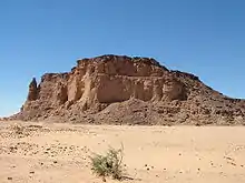 | Meroë, 18°32′00″N 31°49′00″E | Cultural: (i), (ii), (iii), (iv), (vi) | 183 (450) | 2003 | The five sites in the Nile Valley feature temples that are testimonial to the Napatan and Meroitic cultures.[75] |
| Gough and Inaccessible Islands | 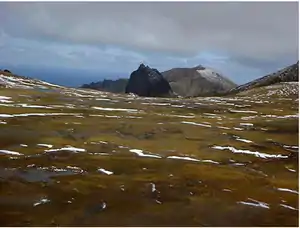 | Saint Helena, 40°19′29″S 9°55′43″W | Natural: (vii), (x) | 7,900 (20,000) | 1995 | The site represents one of the least-disrupted islands and marine ecosystems in the North Temperate Zone. The cliffs are free of introduced mammals and feature one of the world's largest colonies of seabirds.[76] |
| Great Zimbabwe National Monument | 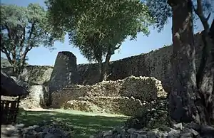 | Masvingo Province, 20°17′00″S 30°56′00″E | Cultural: (i), (iii), (vi) | 722 (1,780) | 1986 | The city, now in ruins, was an important trading center between the 11th and 15th centuries, and was capital of the Bantu civilization.[77] |
| Harar Jugol, the Fortified Historic Town | 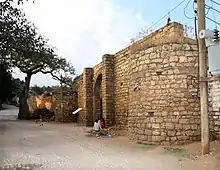 | Harari Region, 9°18′32″N 42°08′16″E | Cultural: (ii), (iii), (iv), (v) | 48 (120) | 2006 | The city is on a plateau and surrounded by gorges and savanna. It contains 82 mosques, 102 shrines, and unique interior design in the townhouses. It is said to be the fourth-holiest city of Islam.[78] |
| Historic Cairo | 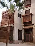 | Cairo, 30°03′00″N 31°15′40″E | Cultural: (i), (v), (vi) | 524 (1,290) | 1979 | One of the world's oldest Islamic cities and in the middle of urban Cairo, the site dates from the 10th century and reached its golden age in the 14th century. It contains mosques, madrasah, hammams and fountains.[79] |
| Historic Centre of Agadez | 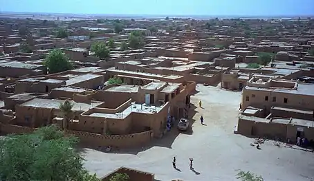 | Tchirozerine Department, 16°58′25″N 7°59′29″E | Cultural: (ii), (iii) | 78 (190) | 2013 | [80] |
| Historic City of Meknes | 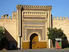 | Meknes, 33°53′00″N 5°33′30″W | Cultural: (iv) | — | 1996 | The former capital was founded in the 11th century and turned into a city with Spanish-Moorish influence during the 17th and 18th centuries.[81] |
| Historic Town of Grand-Bassam | 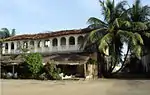 | Sud-Comoé, 5°11′45″N 3°44′11″W | Cultural: (iii), (iv) | 110 (270) | 2012 | A colonial town built during the 19th and 20th centuries, Grand-Bassam was the first Ivorian capital following French rule in the region. Its quarters, which specialised in commerce, administration and general housing, helped the city become the economic and judicial hub of the country, in addition to being its most important port.[82] |
| Ichkeul National Park | 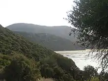 | Bizerte, 37°09′49″N 9°40′29″E | Natural: (x) | 12,600 (31,000) | 1980 | Ichkeul Lake and the surrounding wetlands is a destination for hundreds of thousands of migrating birds, including ducks, geese, storks and pink flamingos. It was once part of a chain that extended across North Africa.[83] |
| iSimangaliso Wetland Park | 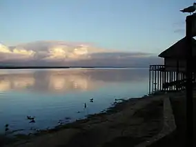 | KwaZulu-Natal, 27°50′20″S 32°33′00″E | Natural: (vii), (ix), (x) | 239,566 (591,980) | 1999 | The park features a variety of landforms, including coral reefs, long sandy beaches, coastal dunes, lake systems, and papyrus wetland, caused by fluvial, marine and aeolian processes.[84] |
| Island of Gorée | 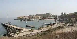 | Dakar Region, 14°40′02″N 17°24′03″W | Cultural: (vi) | — | 1978 | The island was the largest slave-trading center on the African coast from the 15th to the 19th century.[85] |
| Island of Mozambique | 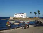 | Nampula, 15°02′03″S 40°44′09″E | Cultural: (iv), (vi) | — | 1991 | The fortified former Portuguese trading post has used the same architectural techniques, style, and materials since the 16th century.[86] |
| Island of Saint-Louis | 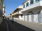 | Saint-Louis Region, 16°01′40″N 16°30′16″W | Cultural: (ii), (iv) | — | 2000 | The French colonial settlement from the 17th century is on an island in the mouth of the Sénégal River. It played an important role in the culture and economy of West Africa.[87] |
| Kahuzi-Biega National Park |
 | Maniema and South Kivu, 2°30′N 28°45′E | Natural: (x) | 600,000 (1,500,000) | 1980 | The park is dominated by two extinct volcanoes, Kahuzi and Biega. It also has abundant fauna, including the graueria gorillas.[88] The park was deemed to be endangered in 1997 when deforestation and hunting became a major problem. Militia groups and illegal settlers were also settling in the park, while fire and poaching helped justify the World Heritage Committee's decision.[89] |
| Kairouan | 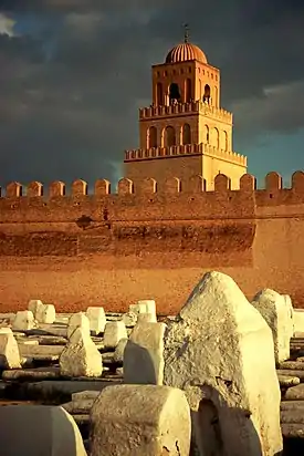 | Kairouan Governorate, 35°40′54″N 10°06′14″E | Cultural: (i), (ii), (iii), (v), (vi) | — | 1988 | The former capital was founded in 670 and flourished in the 9th century. Its heritage includes the Mosque of Uqba and the Mosque of the Three Gates.[90] |
| Kasbah of Algiers |  | Algiers, 36°47′00″N 3°03′37″E | Cultural: (ii), (v) | 60 (150) | 1992 | A unique Islamic city on the Mediterranean coast, the former site overlooks the Carthaginian trading posts of the 4th century BCE. It contains remains of a citadel, old mosques, and Ottoman-style palaces.[91] |
| Kenya Lake System in the Great Rift Valley | 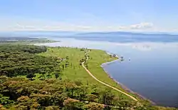 | Rift Valley Province, 0°26′33″N 36°14′24″E | Natural: (viii), (x) | 161,485 (399,040) | 2011 | Located in the Great Rift Valley, Kenya, the site features three lakes: Lake Bogoria, Lake Nakuru and Lake Elementaita. A highly diverse population of birds, including thirteen threatened species, frequent the area.[92][93] |
| Khami Ruins National Monument | 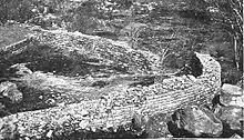 | Matabeleland, 20°09′30″S 28°22′36″E | Cultural: (iii), (iv) | — | 1986 | The city was built after the mid-16th century and was an important trading center.[94] |
| ǂKhomani Cultural Landscape | Northern Cape, 25°41′15″S 20°22′29″E | Cultural: (iii), (iv), (v), (vi) | 959,100 (2,370,000) | 2017 | The ǂKhomani Cultural Landscape is located at the border with Botswana and Namibia in the northern part of the country, coinciding with the Kalahari Gemsbok National Park (KGNP). The large expanse of sand contains evidence of human occupation from the Stone Age to the present and is associated with the culture of the formerly nomadic ǂKhomani San people and the strategies that allowed them to adapt to harsh desert conditions.[95] | |
| Kilimanjaro National Park | 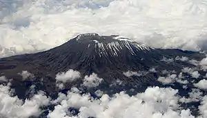 | Kilimanjaro Region, 3°04′00″S 37°22′00″E | Natural: (vii) | 75,575 (186,750) | 1987 | The volcanic massif Mount Kilimanjaro is Africa's highest point at 5,895 metres (19,341 ft), and is surrounded by a park with savanna and forest featuring numerous mammals.[96] |
| Kondoa Irangi Rock Paintings | 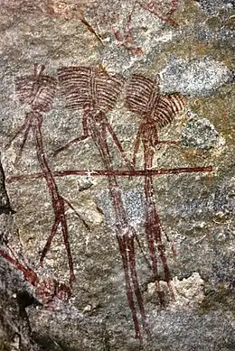 | Kondoa district, 4°43′28″S 35°50′02″E | Cultural: (iii), (vi) | 233,600 (577,000) | 2006 | Two millennia of rock carving, many of high artistic value, have been found at 150 shelters in the site. They tell the tale of socio-economic development from hunter-gatherer to agro-pastoralism.[97] |
| Konso Cultural Landscape | 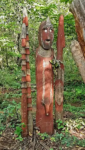 | Southern Nations, Nationalities, and People's Region, 5°18′N 37°24′E | Cultural: (iii), (v) | 14,000 (35,000) | 2011 | The site features 55 kilometres (34 mi) of stonewalled terraces and fortified settlements in the Konso highlands of Ethiopia.[98] |
| Koutammakou, the Land of the Batammariba | 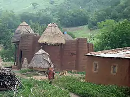 | Kara Region, 10°04′00″N 1°08′00″E | Cultural: (v), (vi) | 50,000 (120,000) | 2004 | The Batammariba's mud tower houses have become a symbol of Togo. They range up to two stories and feature spherical granaries.[99] |
| Ksar of Ait-Ben-Haddou | 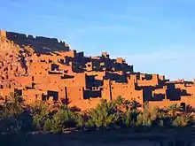 | Aït Benhaddou, 31°02′50″N 7°07′44″W | Cultural: (iv), (v) | 3 (7.4) | 1987 | The ksar is an example of a traditional pre-Saharan habitat, surrounded by high walls and reinforced with corner towers.[100] |
| Kunta Kinteh Island and Related Sites[lower-alpha 4] | 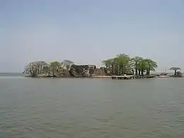 | Banjul, Lower Niumi, and Upper Niumi, 13°18′58″N 16°21′26″W | Cultural: (iii), (vi) | 8 (20) | 2003 | The site is a testimony to the encounters between Africa and Europe from pre-colonial times to independence along the Gambia River.[101] |
| Lake Malawi National Park |  | Central Region and Southern Region, 14°02′00″S 34°53′00″E | Natural: (vii), (ix), (x) | 9,400 (23,000) | 1984 | Lake Malawi contains hundreds of fish species, mostly endemic.[102] |
| Lakes of Ounianga | Ennedi Region, 19°03′18″N 20°30′20″E | Natural: (vii) | 62,808 (155,200) | 2012 | The Lakes of Ounianga are a series of 18 lakes located in the Sahara desert, in North-Eastern Chad. They exhibit a variety of sizes, depths, chemical compositions and colorations, and some of them are home to aquatic fauna.[103] | |
| Lake Turkana National Parks |
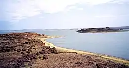 | Lake Turkana, 3°03′05″N 36°30′13″E | Natural: (viii), (x) | 161,485 (399,040) | 1997 | Turkana, as Africa's largest saline lake, is an important area for the study of fauna and flora. It is a breeding ground for the Nile crocodile, hippopotamus and several venomous snakes.[104] The site was placed the List of World Heritage in Danger in 2018, primarily due to the potential impact of Ethiopia's Gilgel Gibe III Dam.[105] |
| Lamu Old Town | 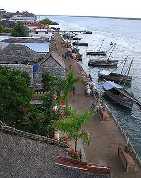 | Lamu, 2°16′05″S 40°54′07″E | Cultural: (ii), (iv), (vi) | 16 (40) | 2001 | The town is the oldest Swahili settlement, and is built in coral stone and mangrove timber. It features inner courtyards, verandas, and elaborate wooden doors.[106] |
| Laurisilva of Madeira | 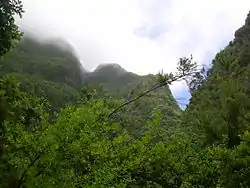 | Madeira, 32°46′00″N 17°00′00″W | Natural: (ix), (x) | 15,000 (37,000) | 1999 | The site is the largest surviving area of laurel forest. It consists of approximately 90% old-growth forest and is home to endemic species such as the Madeiran long-toed pigeon.[107] |
| Le Morne Cultural Landscape | 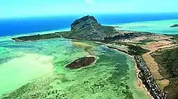 | Rivière Noire District, 20°27′07″S 57°19′42″E | Cultural: (iii), (vi) | 349 (860) | 2008 | The rugged mountain that juts into the ocean was used as a shelter by runaway slaves through the 18th and early 19th centuries. They formed small settlements in the caves and on its summit.[108] |
| Lower Valley of the Awash | 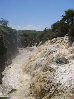 | Afar Region, 11°06′00″N 40°34′46″E | Cultural: (ii), (iii), (iv) | — | 1980 | Palaentological findings from at least four million years ago, such as Lucy, give evidence of human evolution.[109] |
| Lower Valley of the Omo | 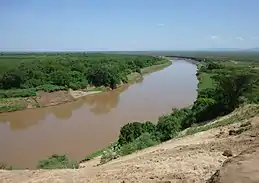 | Southern Nations, Nationalities, and People's Region, 4°48′00″N 35°58′00″E | Cultural: (iii), (iv) | — | 1980 | The prehistoric site near Lake Turkana is the location of many fossil findings, such as Homo gracilis.[110] |
| M'Zab Valley | 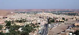 | Ghardaïa, 32°29′00″N 3°41′00″E | Cultural: (ii), (iii), (v) | 4,000 (9,900) | 1982 | The intact, traditional human habitat was built around five ksour in the 10th century by the Ibadites.[111] |
| Maloti-Drakensberg Park | 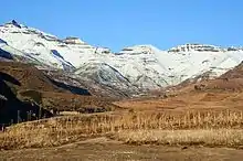 | Qacha's Nek District, KwaZulu-Natal, 29°45′55″S 29°07′23″E | Mixed: (i), (iii), (vii), (x) | 249,313 (616,070) | 2000 | The park features incisive dramatic cutbacks, golden sandstone ramparts, and the largest concentration of cave art in Sub-Saharan Africa.[112] |
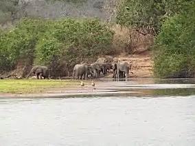
| Mana Pools National Park, Sapi and Chewore Safari Areas | 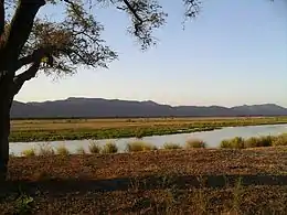 | Mashonaland West, 15°49′10″S 29°24′29″E | Natural: (vii), (ix), (x) | 676,600 (1,672,000) | 1984 | The park, located on the banks of the Zambezi River, features a variety of wild animals, such as buffalo, leopards, cheetahs and Nile crocodiles.[113] |
| Manovo-Gounda St. Floris National Park |
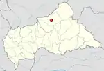 | Bamingui-Bangoran, 9°00′N 21°30′E | Natural: (ix), (x) | 1,740,000 (4,300,000) | 1988 | The park features vast savannas with a wealth of flora and fauna, such as black rhinoceros, elephants, cheetahs, leopards, wild dogs, red-fronted gazelles and buffalo.[114] The site was placed on the List of World Heritage in Danger in 1997 due to grazing and poaching that is thought to have claimed 80% of the wildlife in the park. Also cited was the shooting of four park staff and "a general state of deteriorating security".[14] |
| Mapungubwe Cultural Landscape | 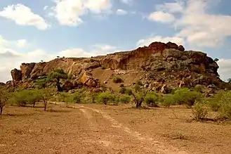 | Limpopo, 22°11′33″S 29°14′20″E | Cultural: (ii), (iii), (iv), (v) | 28,168 (69,600) | 2003 | The open savanna landscape lies at the confluence of the Limpopo and Shashe Rivers. It was the heart of the Mapungubwe Kingdom until the 14th century, when the area was abandoned, leaving untouched remains of palaces and settlements.[115] |
| Matobo Hills | 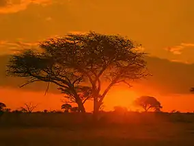 | Matabeleland South, 20°30′S 28°30′E | Cultural: (iii), (v), (vi) | 205,000 (510,000) | 2003 | The large boulders have been used as natural shelters since the early Stone Age and feature a collection of rock paintings.[116] |
| Mbanza-Kongo | 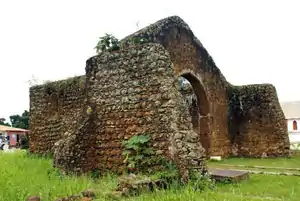 | Zaire Province, 6°16′04″S 14°14′53″E | Cultural: (iii), (iv), (vi) | 89.29 (220.6) | 2017 | The town of Mbanza Kongo, located on a plateau at an altitude of 570 metres, was the political and spiritual capital of the Kingdom of Kongo, one of the largest constituted states in Southern Africa from the 14th to 19th centuries.[117] |
| Medina of Essaouira (formerly Mogador) | 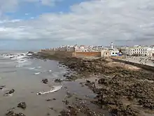 | Essaouira, 31°31′00″N 9°46′10″W | Cultural: (ii), (iv) | 30 (74) | 2001 | The fortified seaport built during the late 18th century has a mix of North African and European architecture, and was a major trading hub between the Sahara and Europe.[118] |
| Medina of Fez | 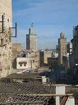 | Fez, 34°03′40″N 4°58′40″W | Cultural: (ii), (v) | 280 (690) | 1981 | The former capital was founded in the 9th century and features the world's oldest university. The urban fabric and main monuments date from the 13th and 14th centuries.[119] |
| Medina of Marrakesh | 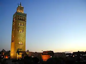 | Marrakesh, 31°37′53″N 7°59′12″W | Cultural: (i), (ii), (iv), (v) | 1,107 (2,740) | 1985 | The town was founded in the 1070s and remained a political, economic, and cultural centre for a long time. Monuments from that period include the Koutoubia Mosque, the kasbah, and the battlements. The city also holds newer features, including palaces.[120] |
| Medina of Sousse | 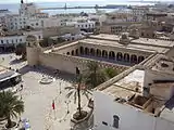 | Sousse Governorate, 35°49′40″N 10°38′19″E | Cultural: (iii), (iv), (v) | 32 (79) | 1988 | A prime example of a town from the early Islamic period, the city was an important port during the 9th century.[121] |
| Medina of Tétouan (formerly known as Titawin) | 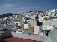 | Tétouan, 35°34′15″N 5°22′00″W | Cultural: (ii), (iv), (v) | 7 (17) | 1997 | Morocco's most complete medina served as the main point of contact between Morocco and Andalusia during the 8th century. The town was rebuilt by Andalusian refugees following the reconquista.[122] |
| Medina of Tunis | 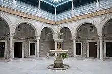 | Tunis, 36°49′00″N 10°10′00″E | Cultural: (ii), (iii), (v) | — | 1979 | The medina holds 700 monuments, including palaces, mosques, mausoleums, madrasah and fourtains, testifying to Tunis' golden age from the 12th to the 16th century.[123] |
| Memphis and its Necropolis – the Pyramid Fields from Giza to Dahshur | 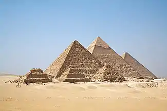 | Giza, 29°58′34″N 31°07′49″E | Cultural: (i), (iii), (vi) | 16,358 (40,420) | 1979 | The former capital features funerary monuments, like rock tombs, mastabas, temples, and pyramids. It is one of the Seven Wonders of the Ancient World.[124] |
| Mosi-oa-Tunya / Victoria Falls | 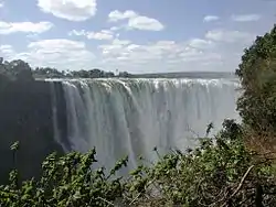 | Livingstone District and Matabeleland North, 17°55′28″S 25°51′19″E | Natural: (vii), (viii) | 8,780 (21,700) | 1989 | The falls of the Zambezi River, which is more than 2 km (1.2 mi) wide, plunge down various basalt gorges resulting in a colorful mist.[125] |
| Mount Kenya National Park/Natural Forest | 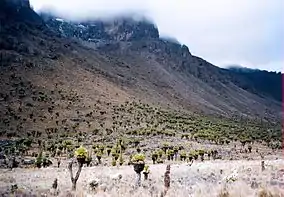 | Central Province and Eastern Province, 0°09′18″N 37°18′56″E | Natural: (vii), (ix) | 142,020 (350,900) | 1997 | The park surrounds the 5,199 m (17,057 ft) Mount Kenya and features twelve glaciers.[126] |
| Mount Nimba Strict Nature Reserve |
 | Lola Prefecture, 7°36′11″N 8°23′27″W | Natural: (ix), (x) | 18,000 (44,000) | 1981 | The reserve features Mount Nimba, its slopes covered in dense forest and grassy mountain pastures.[127] In 1992, the park was inscribed on the World Heritage Committee's danger list, citing a proposed iron and ore mining concession inside the park's boundaries and the apparition of refugees. The state party later stated that there was an error with the proposed mining site's boundaries, and that it was not in the reserve.[128] However, as of 2011, the site remains on the list due to poor security on the Ivorian side.[129] |
| Namib Sand Sea |  | 24°53′07″S 15°24′28″E | Natural: (vii), (viii), (ix), (x) | 3,077,700 (7,605,000) | 2013 | [130] |
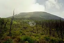
| Ngorongoro Conservation Area | 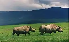 | Arusha Region, 3°11′14″S 35°32′27″E | Mixed: (iv), (vii), (viii), (ix), (x) | 809,440 (2,000,200) | 1979 | The site features a concentration of wild animals in a crater beside the active volcano Oldonyo Lengai.[131] |
| Niokolo-Koba National Park |
 | Kédougou Region and Tambacounda Region, 13°04′00″N 12°43′00″W | Natural: (x) | 913,000 (2,260,000) | 1981 | The forests and savannas bordering the Gambia River have a diverse fauna, including Derby eland, chimpanzees, lions, birds, reptiles, and amphibians.[132] The park was listed as being endangered for low mammal populations, the construction of a dam, and management problems.[133] |
| Nubian Monuments from Abu Simbel to Philae | 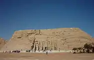 | Aswan, 22°20′11″N 31°37′34″E | Cultural: (i), (iii), (vi) | 374 (920) | 1979 | Located along the Nile, the site contains monuments such as the Temple of Ramesses II and the Sanctuary of Isis.[134] |
| Okapi Wildlife Reserve |
 | Orientale, 2°00′N 28°30′E | Natural: (x) | 1,372,625 (3,391,830) | 1996 | Covering a fifth of the Ituri Rainforest in the Congo River basin, the reserve contains many threatened species of primates and birds. It is inhabited by the nomadic pygmy Mbuti and Efé tribes.[135] In 1997, looting, the killing of elephants, and the departure of reserve staff led the World Heritage Committee to place the reserve on its List of World Heritage in Danger, only a year following its inscription as a natural heritage site.[136] |
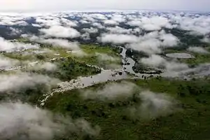
| Okavango Delta | 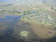 | Orientale, 19°17′00″S 22°54′00″E | Natural: (x) | 2,023,590 (5,000,400) | 2014 | [137] |
| Old Towns of Djenné |
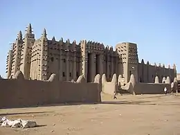 | Djenné, 13°54′23″N 4°33′18″W | Cultural: (iii), (iv) | — | 1988 | Inhabited since 250 BCE, the city was an important link in the trans-Saharan gold trade. It contains 2,000 traditional houses.[138] |
| Old Town of Ghadamès |
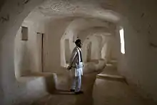 | Ghadames, 30°08′00″N 9°30′00″E | Cultural: (v) | — | 1986 | Located in an oasis, Ghadames is one of the oldest pre-Saharan cities and represents a traditional architecture with vertical division of functions.[139] |
| Osun-Osogbo Sacred Grove | 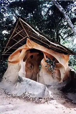 | Osogbo, 7°45′20″N 4°33′08″E | Cultural: (ii), (iii), (vi) | 75 (190) | 2005 | The dense forests are one of the final remnants of high forests in southern Nigeria. It is the last sacred grove of the Yoruba culture.[140] |
| Pitons, Cirques and Remparts of Reunion Island | 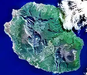 | La Réunion, 21°05′58″S 55°28′48″E | Natural: (vii), (x) | 105,838 (261,530) | 2010 | Outstanding terrain and biodiversity, as part of La Réunion National Park.[141] |
| Portuguese City of Mazagan (El Jadida) | 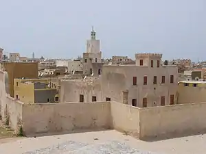 | El Jadida, 33°15′24″N 8°30′07″W | Cultural: (ii), (iv) | 8 (20) | 2004 | The fortification, akin to Renaissance military design from the early 16th century, was taken over by Morocco in 1769. Surviving buildings include the cistern and a Gothic church.[142] |
| Punic Town of Kerkuane and its Necropolis | 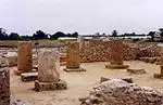 | Nabeul Governorate, 36°56′47″N 11°05′57″E | Cultural: (iii) | — | 1985 | The city was abandoned in 250 BCE during the First Punic War, and is the only surviving example of a Phoenicio–Punic settlement.[143] |
| Rabat, Modern Capital and Historic City: a Shared Heritage | 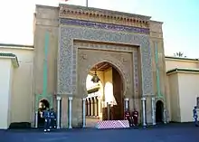 | Rabat-Salé-Zemmour-Zaer, 34°01′27″N 6°49′22″W | Cultural: (ii), (iv) | 349 (860) | 2012 | Rebuilt under the direction of the French from 1912 to the 1930s, the city blends historic and modern features, such as botanical gardens, the Hassan Mosque, and the remnants of Moorish and Andalusian settlements from the 17th century.[144] |
| Rainforests of the Atsinanana |
 | Eastern Madagascar, 14°27′35″S 49°42′09″E | Natural: (ix), (x) | 479,660 (1,185,300) | 2007 | The site consists of six national parks, and protects the island's unique biodiversity, which has evolved in isolation for 60 million years.[145] The park was deemed to be in danger in 2010, when logging and hunting activities continued to escalate, despite a ban by Madagascar on exporting illegal timber.[146] |
| Richtersveld Cultural and Botanical Landscape | 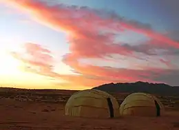 | Northern Cape, 28°36′00″S 17°12′14″E | Cultural: (iv), (v) | 160,000 (400,000) | 2007 | The mountainous desert sustains the semi-nomadic livelihood of the Nama, which includes seasonal migrations that have gone unchanged for two millennia.[147] |
| Risco Caído and the Sacred Mountains of Gran Canaria Cultural Landscape | 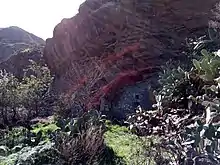 | Risco Caído, 28°02′40″N 15°39′40″W | Cultural: (iii), (v) | 9,425 (23,290) | 2019 | [148] |
| Robben Island | 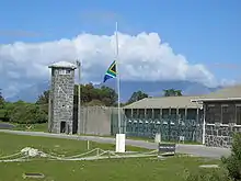 | Western Cape, 33°48′00″S 18°22′00″E | Cultural: (iii), (vi) | 475 (1,170) | 1999 | Between the 17th and 20th century, the island was used as a prison, including for political prisoners, a hospital for socially unacceptable groups, and a military base.[149] |
| Rock-Art Sites of Tadrart Acacus |
 | Fezzan, 24°50′00″N 10°20′00″E | Cultural: (iii) | — | 1985 | Thousands of cave paintings are visible in different styles, dating from 12,000 BCE to 100 CE.[150] |
| Rock-Hewn Churches, Lalibela | 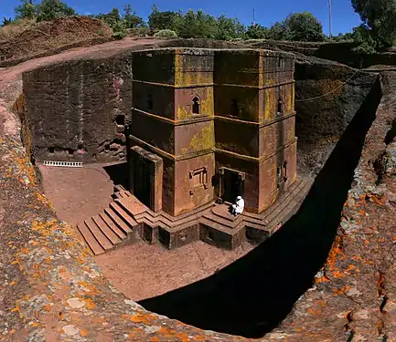 | Amhara Region, 12°01′46″N 39°02′26″E | Cultural: (i), (ii), (iii) | — | 1978 | The site contains eleven medieval cave churches from the 13th century.[151] |
| Royal Hill of Ambohimanga |  | Antananarivo, 18°45′33″S 47°33′46″E | Cultural: (iii), (iv), (vi) | 59 (150) | 2001 | The royal city and burial site is a spiritual and sacred site which has created strong feelings of national identity for several centuries.[152] |
| Royal Palaces of Abomey |  | Zou Department, 7°11′00″N 1°59′00″E | Cultural: (iii), (iv) | 48 (120) | 1985 | The city held the seat of twelve kings who ruled the Kingdom of Dahomey between 1625 and 1900. All but one king built their palace within the area.[153] |
| Ruins of Kilwa Kisiwani and Ruins of Songo Mnara | 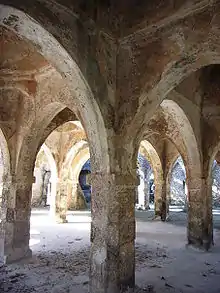 | Kilwa District, 8°57′28″S 39°31′22″E | Cultural: (iii) | — | 1981 | The site features the remains of two ports used extensively for trade across the Indian Ocean from the 13th and 16th century.[154] It was placed onto the list of List of World Heritage in Danger by the World Heritage Committee in 2004, citing "the continuing deterioration and the serious threats affecting the property of the Ruins of Kilwa Kisiwani and Songo Mnara".[155] Conditions subsequently improved and the site was removed from the World Heritage in Danger list in 2014.[156] |
| Ruins of Loropéni | %252CBF_sun15may2016-1106h.jpg.webp) | Loropéni, 10°15′00″N 3°35′00″W | Cultural: (iii) | 1.1 (2.7) | 2009 | More than a thousand years old, Loropéni is the best-preserved of ten fortresses in Lobi, which were part of about a hundred stone enclosures built during the trans-Saharan gold trade.[157] |
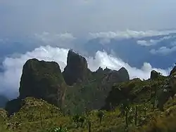
| Rwenzori Mountains National Park |  | Bundibugyo District, Kabarole District, and Kasese District, 0°13′25″N 29°55′27″E | Natural: (vii), (x) | 99,600 (246,000) | 1994 | Covering most of the Rwenzori Mountains, including Mount Margherita, Africa's third-highest peak, the park features glaciers, waterfalls and lakes in an Alpine landscape. It also features various endangered species and unusual flora.[158] |
| Sacred Mijikenda Kaya Forests | 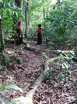 | Coast Province, 3°55′55″S 39°35′46″E | Cultural: (iii), (v), (vi) | 1,538 (3,800) | 2008 | The site comprises eleven forests spread 200 km (120 mi) along the coast of Kenya. They hold the remains of villages built during the 16th century by the Mijikenda, and are now considered sacred sites.[159] |
| Saint Catherine Area | 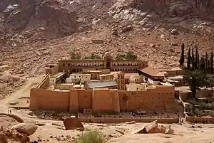 | South Sinai Governorate, 28°33′22″N 33°58′32″E | Cultural: (i), (iii), (iv), (vi) | 60,100 (149,000) | 2002 | The orthodox monastery from the 6th century is positioned near Mount Horeb where, according to the Old Testament, Moses received the Tablets of the Law. The region is sacred for Christians, Muslims and Jews.[160] |
| Salonga National Park |
 | Maniema and South Kivu, 2°S 21°E | Natural: (vii), (ix) | 3,600,000 (8,900,000) | 1984 | Africa's largest tropical rain forest reserve is situated at the heart of the Congo River basin and only accessible by water. It is the habitat of endangered species such as the bonobo, the Congo peafowl, the forest elephant, and the slender-snouted crocodile.[161] The site was deemed to be in danger in 1999, due to increased poaching activities and encroachments.[162] |
| Saloum Delta | 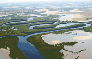 | 13°50′07″N 16°29′55″W | Cultural: (iii), (iv), (v) | 145,811 (360,310) | 2011 | The area has sustained human life thanks to fishing and shellfish gathering, for which there are 218 shellfish mounds across the site.[163] |
| Sanganeb Marine National Park and Dungonab Bay – Mukkawar Island Marine National Park | 19°44′10″N 37°26′35″E | Natural: (vii), (ix), (x) | 199,524 (493,030) | 2016 | Situated in the central Red Sea, Sanganeb, Dungonab Bay and Mukkawar Island feature a diverse system of coral reefs, mangroves, seagrass beds, beaches and islets, and host populations of seabirds, marine mammals, fish, sharks, turtles, manta rays and dugongs.[164] | |
| San Cristóbal de la Laguna |  | Province of Santa Cruz de Tenerife, 28°28′40″N 16°18′42″W | Cultural: (ii), (iv) | 60 (150) | 1999 | The city contains two centres: the unplanned Upper Town, and the planned Lower Town, laid out according to philosophical principals. Many of the buildings date from the 16th to the 18th centuries.[165] |
| Sangha Trinational | 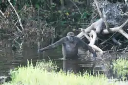 | 2°36′34″N 16°33′15″E | Natural: (ix), (x) | 746,309 (1,844,170) | 2012 | [166] |
| Selous Game Reserve |
 | Lindi Region, Morogoro Region, Mtwara Region, Pwani Region, and Ruvuma Region, 9°00′S 37°24′E | Natural: (ix), (x) | 5,000,000 (12,000,000) | 1982 | The park's vegetation varies from dense thickets to open wooded grasslands, and features large numbers of elephants, black rhinoceros, cheetahs, giraffes, hippos and crocodiles.[167] It was placed onto the list of List of World Heritage in Danger by the World Heritage Committee in 2014 due to widespread poaching, especially of elephants and rhinoceros.[168] |
| Serengeti National Park | 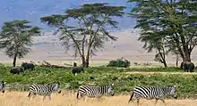 | Arusha Region, Mara Region, and Shinyanga Region, 2°20′00″S 34°34′00″E | Natural: (vii), (x) | 1,476,300 (3,648,000) | 1981 | The vast savanna is known for the annual migration for herds of wildebeest, gazelle, zebras, and their predators.[169] |
| Simien National Park |
 | Amhara Region, 13°11′00″N 38°04′00″E | Natural: (vii), (x) | 22,000 (54,000) | 1978 | The eroded Ethiopian plateau comprises jagged mountain peaks, deep valleys, and sharp precipices dropping about 1,500 m (4,900 ft).[170] The decrease of the walia ibex, bushbuck, and bushpig populations, as well as an increase of the human population in the park prompted the World Heritage Committee to place it on their List of World Heritage in Danger in 1996.[171] |
| Stone Circles of Senegambia | 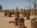 | Central River Division and Kaolack Region, 13°41′28″N 15°31′21″W | Cultural: (i), (iii) | 10 (25) | 2006 | The groups of stone circles are among over 1,000 different monuments along the Gambia River. Used as burial grounds, they were erected between the 3rd century BCE and the 16th century CE.[172] |
| Stone Town of Zanzibar | 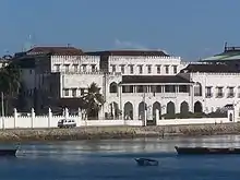 | Zanzibar, 6°09′47″S 39°11′21″E | Cultural: (ii), (iii), (vi) | 96 (240) | 2000 | A prime example of an East African coastal trading town, its urban fabric and townscape remains intact.[173] |
| Sukur Cultural Landscape | 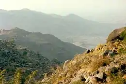 | Madagali, 10°44′26″N 13°34′19″E | Cultural: (iii), (v), (vi) | — | 1999 | The site features the Palace of the Hidi, terraced fields, and the remains of a former iron industry.[174] |
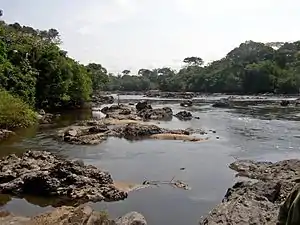
| Taï National Park | .jpg.webp) | Guiglo and Sassandra, 5°45′00″N 7°07′00″W | Natural: (vii), (x) | 330,000 (820,000) | 1982 | One of few remaining sections of the West African tropical forest, the park features a rich flora, including eleven species of monkeys.[175] |
| Tassili n'Ajjer | 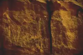 | Illizi and Tamanrasset, 25°30′N 9°00′E | Mixed: (i), (iii), (vii), (viii) | 7,200,000 (18,000,000) | 1982 | The site is in a landscape with 15,000 cave engravings that record climatic changes, animal migrations, and the evolution of human life, dating from 6,000 BCE to the first centuries CE.[176] |
| Teide National Park | 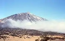 | Province of Santa Cruz de Tenerife, 28°16′17″N 16°38′37″W | Natural: (vii), (viii) | 18,990 (46,900) | 2007 | The national park features the Teide stratovolcano, which at 3,718 m (12,198 ft) is Spain's tallest mountain and the world's third-tallest volcano.[177] |
| Thimlich Ohinga Archaeological Site | 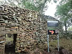 | Migori County, 0°58′23″S 34°15′30″E | Cultural: (iii), (iv), (v) | 21 (52) | 2018 | Dating back to the 16th century CE, the dry-stone walled settlement is the largest and best preserved traditional enclosures of its kind.[178] |
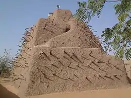
| Timbuktu |
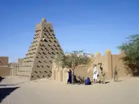 | Timbuktu Cercle, 16°46′24″N 2°59′58″W | Cultural: (ii), (iv), (v) | — | 1988 | The city was a centre for the propagation of Islam in the 15th and 16th centuries, and features three mosques and many madrasahs.[179] The sites were deemed endangered after the Battle of Gao in June 2012, which followed several weeks of constant threats to the area. Days later, some sites within Timbuktu were destroyed by Ansar Dine, an Islamist group, citing religious reasons.[180] |
| Timgad | 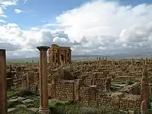 | Batna Province, 35°29′03″N 6°28′07″E | Cultural: (ii), (iii), (iv) | 0.04 (0.099) | 1982 | A military colony built by Emperor Trajan in 100 CE, the site features cardo and decumanus streets, typical of a Roman town.[181] |
| Tipasa | 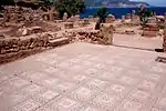 | Tipaza, 36°35′31″N 2°26′58″E | Cultural: (iii), (iv) | 52 (130) | 1982 | First a Carthaginian trading center, Tipasa was converted into a military base by the Romans. Heavy Christian influences can be seen from the 3rd and 4th centuries, though Tipasa went into steady decline in the Byzantine period.[182] |
| Tiya | 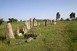 | Southern Nations, Nationalities, and People's Region, 8°26′06″N 38°36′44″E | Cultural: (i), (iv) | — | 1980 | The archaeological site contains 36 monuments, which includes 32 carved stelae covered with symbols hard to decrypt.[183] |
| Tomb of Askia |
 | Gao Region, 16°17′23″N 0°02′40″E | Cultural: (ii), (iii), (iv) | 4 (9.9) | 2004 | Built in 1495, the pyramid was built as a tomb for Emperor Askia Mohamed. It represents the power of an empire that controlled the trans-Saharan gold trade.[184] The site was deemed endangered after the Battle of Gao in June 2012, which followed several weeks of constant threats to the area.[185] |
| Tombs of Buganda Kings at Kasubi |
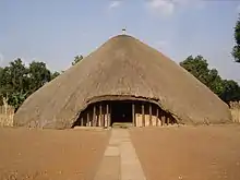 | Kampala District, 0°20′55″N 32°33′05″E | Cultural: (i), (iii), (iv), (vi) | 27 (67) | 2001 | The tombs, built after 1884, are a major example of prime architecture using organic materials, principally wood, thatch, reed, and wattle and daub.[186] The tombs were almost completely destroyed by a fire in March 2010, prompting the World Heritage Committee to reluctantly mark the site as being in danger. The Ugandan government has since called for the reconstruction of the tombs, and UNESCO has agreed to mobilise funds for the project.[187][188] |
| Tsingy de Bemaraha Strict Nature Reserve | 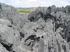 | Melaky, 18°40′00″S 44°45′00″E | Natural: (vii), (x) | 152,000 (380,000) | 1990 | The canyon of the Manambolo River comprises karstic and limestone landscapes cut into peaks and a forest of limestone needles. It also holds undisturbed forests, lakes and mangrove swamps, which are the habitat for lemurs and birds.[189] |
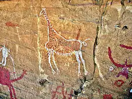
| Tsodilo | 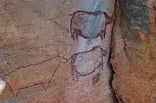 | North-West, 18°45′00″S 21°44′00″E | Cultural: (i), (iii), (vi) | 4,800 (12,000) | 2001 | The site features more than 4,500 rock art paintings in the Kalahari Desert. Archaeological records provide evidence of human and environmental activities ranging over 100,000 years.[190] |
| Twyfelfontein or ǀUi-ǁais | 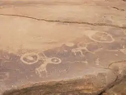 | Kunene, 20°35′44″S 14°22′21″E | Cultural: (iii), (v) | 57 (140) | 2007 | The site has one of the largest concentrations of rock engravings in Africa, which range from a period of over 2,000 years.[191] |
| Vallée de Mai Nature Reserve | 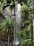 | Praslin, 4°19′45″S 55°44′15″E | Natural: (vii), (viii), (ix), (x) | 20 (49) | 1983 | The natural palm forest is preserved in almost its original state.[192] |
| Virunga National Park |
 | North Kivu and Orientale, 0°55′00″N 29°10′00″E | Natural: (vii), (viii), (x) | 800,000 (2,000,000) | 1979 | The park comprises swamps, savannas, and snowfields.[193] Virunga was inscribed on the World Heritage Committee's List of World Heritage in Danger in 1994, due to the genocide in Rwanda and the subsequent increase of the refugee population in the park, deforestation, poaching, departure of park staff, and depletion of forests.[194] |
| Vredefort Dome | 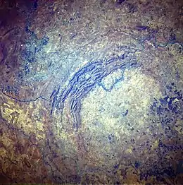 | Free State and North West, 26°52′S 27°16′E | Natural: (viii) | 30,000 (74,000) | 2005 | The crater, with a diameter of 190 km (120 mi), is the largest, oldest, and most deeply eroded astrobleme found on Earth, dating back more than two billion years.[195] |
| W-Arly-Pendjari Complex | 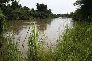 | 11°53′3″N 2°29′16″E | Natural: (ix), (x) | 1,494,831 (3,693,810); buffer zone 1,101,221 (2,721,180) | 1996[lower-alpha 5] | The parks are in the zone between savanna and forest lands, and are an important ecosystem for the biogeographical area.[196] |
| Wadi Al-Hitan (Whale Valley) | 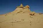 | Faiyum Governorate, 29°20′00″N 30°11′00″E | Natural: (viii) | 20,015 (49,460) | 2005 | Located in western Egypt, the site contains fossil remains of the now extinct Archaeoceti, mapping the evolution of the whales from a land-based to an aquatic mammal.[197] |
Performance of Africa in UNESCO
The countries are divided according to their regions. Blue for Northern Africa, orange for Easthern Africa, purple for Central Africa, green for Western Africa and red for Southern Africa.
See also
Notes
- For purposes of this article, "Africa" includes the entire African continent, along with certain Atlantic and Indian ocean islands in the geographic vicinity of Africa that remain under the sovereignty of European states. This differs from UNESCO's regional classification which places several North African countries in the "Arab States" region, while World Heritage Sites on the islands are included in the "Europe and North America" region with their respective metropolitan states. Also see the table legend.
- Syria has 6 sites on the World Heritage in Danger list.
- Fossil Hominid Sites of South Africa was originally inscribed as Fossil Hominid Sites of Sterkfontein, Swartkrans, Kromdraai, and Environs. The World Heritage Committee adopted the changed name in 2013.
- Kunta Kinteh Island and Related Sites was originally inscribed as James Island and Related Sites. The World Heritage Committee adopted the changed name in 2011.
- Extended in 2017 to include Arli National Park and Pendjari National Park. The name of the site was changed accordingly from W National Park of Niger at the time of inscription to the present name in 2017.
References
- United Nations Educational, Scientific and Cultural Organization (n.d.), World Heritage List, archived from the original on 1 November 2015, retrieved 5 November 2015.
- "Number of World Heritage properties inscribed each Year". UNESCO. Retrieved 8 September 2011.
- Intergovernmental Committee for the Protection of the World Cultural and Natural Heritage, Second Session, Final Report (PDF) (Report). Washington, D.C.: UNESCO. 5–8 September 1978. pp. 7–8. Retrieved 8 September 2011.
- Hegarty, Stephanie (20 September 2011). "Sada Mire: Uncovering Somalia's Heritage". BBC. Retrieved 19 January 2014.
- "The Criteria for Selection". UNESCO. Retrieved 10 September 2011.
- "Launch of African World Heritage Fund" (Press release). UNESCO. 3 May 2006. Retrieved 10 September 2011.
- Annual Report 2010 (PDF) (Report). African World Heritage Fund. Retrieved 10 September 2011.
- "UNESCO meeting to promote African human origin sites and the World Heritage Convention" (Press release). UNESCO. Retrieved 10 September 2011.
- "World Heritage in Danger". UNESCO. Retrieved 28 May 2010.
- "The World Heritage Committee". UNESCO. Retrieved 10 September 2011.
- "Sessions". UNESCO. Retrieved 10 September 2011.
- United Nations Educational, Scientific and Cultural Organization (n.d.), List of World Heritage in Danger, archived from the original on 30 September 2015, retrieved 5 November 2015.
- "Kahuzi-Biega National Park – Threats to the Site (1997)". UNESCO. Retrieved 10 September 2011.
- "Manovo-Gounda St Floris National Park – Threats to the Site (1997)". UNESCO. Retrieved 10 September 2011.
- "Comoé National Park – Threats to the Site (2003)". UNESCO. Retrieved 10 September 2011.
- "Air and Ténéré Natural Reserves – Threats to the Site (1992)". UNESCO. Retrieved 10 September 2011.
- "Mining threats on the rise in World Heritage Sites" (Press release). IUCN. 27 June 2011. Retrieved 10 September 2011.
- Concerns Regarding the Protection of the World Cultural and Natural Heritage, Thirty-Fifth Session (PDF) (Report). Paris: UNESCO. 19–29 June 2011. pp. 20–21. Retrieved 10 September 2011.
- "Abu Mena – Threats to the Site (2001)". UNESCO. Retrieved 10 September 2011.
- "Ngorongoro Conservation Area – History". UNESCO. Retrieved 10 September 2011.
- "Rwenzori Mountains National Park – History". UNESCO. Retrieved 10 September 2011.
- "Tipasa – History". UNESCO. Retrieved 10 September 2011.
- "Garamba National Park – History". UNESCO. Retrieved 10 September 2011.
- "Timbuktu – History". UNESCO. Retrieved 30 June 2012.
- Connolly, K. (25 June 2009). "Bridge takes Dresden off Unesco world heritage list". The Guardian. Retrieved 10 September 2009.
- "Number of World Heritage Properties by region". UNESCO. Retrieved 10 September 2011.
- "Aapravasi Ghat". UNESCO. Retrieved 28 May 2010.
- "Abu Mena". UNESCO. Retrieved 28 May 2010.
- "Abu Mena – Threats to the Site (2001)". UNESCO. Retrieved 27 August 2010.
- "Air and Ténéré Natural Reserves". UNESCO. Retrieved 28 May 2010.
- "Air and Ténéré Natural Reserves – Threats to the Site (1992)". UNESCO. Retrieved 28 August 2010.
- "Decision 33COM 7A.10 – Air and Ténéré Natural Reserves (Niger) (N 573)". UNESCO. Retrieved 28 August 2010.
- "Aksum". UNESCO. Retrieved 28 May 2010.
- "Al Qal'a of Beni Hammad". UNESCO. Retrieved 28 May 2010.
- "Aldabra Atoll". UNESCO. Retrieved 28 May 2010.
- "Amphitheatre of El Jem". UNESCO. Retrieved 28 May 2010.
- "Ancient ferrous metallurgy sites of Burkina Faso". UNESCO. Retrieved 9 July 2019.
- "Ancient Ksour of Ouadane, Chinguetti, Tichitt and Oualata". UNESCO. Retrieved 28 May 2010.
- "Ancient Thebes with its Necropolis". UNESCO. Retrieved 28 May 2010.
- "Archaeological Site of Carthage". UNESCO. Retrieved 28 May 2010.
- "Archaeological Site of Cyrene". UNESCO. Retrieved 28 May 2010.
- "Archaeological Site of Leptis Magna". UNESCO. Retrieved 28 May 2010.
- "Archaeological Site of Sabratha". UNESCO. Retrieved 28 May 2010.
- "Archaeological Site of Volubilis". UNESCO. Retrieved 28 May 2010.
- "Archaeological Sites of the Island of Meroe". UNESCO. Retrieved 17 August 2011.
- "Asante Traditional Buildings". UNESCO. Retrieved 28 May 2010.
- "Asmara: a Modernist City of Africa". UNESCO. Retrieved 16 July 2017.
- "Barberton Makhonjwa Mountains". UNESCO. Retrieved 1 August 2018.
- "Banc d'Arguin National Park". UNESCO. Retrieved 28 May 2010.
- "Bassari Country: Bassari, Fula and Bedik Cultural Landscapes". UNESCO. Retrieved 4 August 2013.
- "Bwindi Impenetrable National Park". UNESCO. Retrieved 28 May 2010.
- "Cape Floral Region Protected Areas". UNESCO. Retrieved 28 May 2010.
- "Chongoni Rock-Art Area". UNESCO. Retrieved 28 May 2010.
- "Cidade Velha, Historic Centre of Ribeira Grande". UNESCO. Retrieved 28 May 2010.
- "Cliff of Bandiagara (Land of the Dogons)". UNESCO. Retrieved 28 May 2010.
- "Comoé National Park". UNESCO. Retrieved 28 May 2010.
- "Comoé National Park – Threats to the Site (2003)". UNESCO. Retrieved 30 August 2010.
- "Dja Faunal Reserve". UNESCO. Retrieved 28 May 2010.
- "Djémila". UNESCO. Retrieved 28 May 2010.
- "Djoudj National Bird Sanctuary". UNESCO. Retrieved 28 May 2010.
- "Dougga / Thugga". UNESCO. Retrieved 28 May 2010.
- "Ecosystem and Relict Cultural Landscape of Lopé-Okanda". UNESCO. Retrieved 28 May 2010.
- "Ennedi Massif: Natural and Cultural Landscape". UNESCO. Retrieved 6 August 2016.
- "Fasil Ghebbi, Gondar Region". UNESCO. Retrieved 28 May 2010.
- "Fort Jesus, Mombasa". UNESCO. Retrieved 11 July 2011.
- "Forts and Castles, Volta, Greater Accra, Central and Western Regions". UNESCO. Retrieved 28 May 2010.
- "Fossil Hominid Sites of Sterkfontein, Swartkrans, Kromdraai, and Environs". UNESCO. Retrieved 28 May 2010.
- "French Austral Lands and Seas". UNESCO. Retrieved 9 July 2019.
- "Garajonay National Park". UNESCO. Retrieved 28 May 2010.
- "Garamba National Park". UNESCO. Retrieved 28 May 2010.
- "Decision – 08COM X.26–27 – Inscriptions on the List of World Heritage in Danger". UNESCO. Retrieved 10 September 2011.
- "Decision – 16COM X.E – Removed from the World Heritage List in Danger: Garamba National Park (Zaire)". UNESCO. Retrieved 10 September 2011.
- Convention Concerning the Protection of the World Cultural and Natural Heritage, Eighth Ordinary Session (PDF) (Report). Buenos Aires: UNESCO. 29 October – 2 November 1994. Retrieved 10 September 2011.
- "VII.37 Garamba National Park (Zaire)". Convention Concerning the Protection of the World Cultural and Natural Heritage, Twentieth Session (Report). Merida, Mexico: UNESCO. 2–7 December 1996. Retrieved 10 September 2011.
- "Gebel Barkal and the Sites of the Napatan Region". UNESCO. Retrieved 28 May 2010.
- "Gough and Inaccessible Islands". UNESCO. Retrieved 28 May 2010.
- "Great Zimbabwe National Monument". UNESCO. Retrieved 28 May 2010.
- "Harar Jugol, the Fortified Historic Town". UNESCO. Retrieved 28 May 2010.
- "Historic Cairo". UNESCO. Retrieved 28 May 2010.
- "Historic Centre of Agadez". UNESCO. Retrieved 4 August 2013.
- "Historic City of Meknes". UNESCO. Retrieved 28 May 2010.
- "Historic Town of Grand-Bassam". UNESCO. Retrieved 19 September 2012.
- "Ichkeul National Park". UNESCO. Retrieved 28 May 2010.
- "iSimangaliso Wetland Park". UNESCO. Retrieved 28 May 2010.
- "Island of Gorée". UNESCO. Retrieved 28 May 2010.
- "Island of Mozambique". UNESCO. Retrieved 28 May 2010.
- "Island of Saint-Louis". UNESCO. Retrieved 28 May 2010.
- "Kahuzi-Biega National Park". UNESCO. Retrieved 28 May 2010.
- "Kahuzi-Biega National Park – Threats to the Site (1997)". UNESCO. Retrieved 10 September 2011.
- "Kairouan". UNESCO. Retrieved 28 May 2010.
- "Kasbah of Algiers". UNESCO. Retrieved 28 May 2010.
- "Kenya Lake System in the Great Rift Valley and Australia's Ningaloo Coast inscribed on UNESCO's World Heritage List". UNESCO. Retrieved 28 June 2011.
- "Kenya Lake System in the Great Rift Valley". UNESCO. Retrieved 28 June 2011.
- "Khami Ruins National Monument". UNESCO. Retrieved 28 May 2010.
- "ǂKhomani Cultural Landscape". UNESCO. Retrieved 16 July 2017.
- "Kilimanjaro National Park". UNESCO. Retrieved 28 May 2010.
- "Kondoa Rock-Art Sites". UNESCO. Retrieved 28 May 2010.
- "Konso Cultural Landscape". UNESCO. Retrieved 17 August 2011.
- "Koutammakou, the Land of the Batammariba". UNESCO. Retrieved 28 May 2010.
- "Ksar of Ait-Ben-Haddou". UNESCO. Retrieved 28 May 2010.
- "Kunta Kinteh Island and Related Sites". UNESCO. Retrieved 6 November 2015.
- "Lake Malawi National Park". UNESCO. Retrieved 28 May 2010.
- "Lakes of Ounianga". UNESCO. Retrieved 11 July 2013.
- "Lake Turkana National Parks". UNESCO. Retrieved 28 May 2010.
- "Lake Turkana National Parks (Kenya) inscribed on List of World Heritage in Danger". UNESCO. Retrieved 28 June 2018.
- "Lamu Old Town". UNESCO. Retrieved 28 May 2010.
- "Laurisilva of Madeira". UNESCO. Retrieved 28 May 2010.
- "Le Morne Cultural Landscape". UNESCO. Retrieved 28 May 2010.
- "Lower Valley of the Awash". UNESCO. Retrieved 28 May 2010.
- "Lower Valley of the Omo". UNESCO. Retrieved 28 May 2010.
- "M'Zab Valley". UNESCO. Retrieved 28 May 2010.
- "Maloti-Drakensberg Park". UNESCO. Retrieved 4 August 2013.
- "Mana Pools National Park, Sapi and Chewore Safari Areas". UNESCO. Retrieved 28 May 2010.
- "Manovo-Gounda St Floris National Park". UNESCO. Retrieved 28 May 2010.
- "Mapungubwe Cultural Landscape". UNESCO. Retrieved 28 May 2010.
- "Matobo Hills". UNESCO. Retrieved 28 May 2010.
- "Mbanza Kongo, Vestiges of the Capital of the former Kingdom of Kongo". UNESCO. Retrieved 16 July 2017.
- "Medina of Essaouira (formerly Mogador)". UNESCO. Retrieved 28 May 2010.
- "Medina of Fez". UNESCO. Retrieved 28 May 2010.
- "Medina of Marrakesh". UNESCO. Retrieved 28 May 2010.
- "Medina of Sousse". UNESCO. Retrieved 28 May 2010.
- "Medina of Tétouan (formerly known as Titawin)". UNESCO. Retrieved 28 May 2010.
- "Medina of Tunis". UNESCO. Retrieved 28 May 2010.
- "Memphis and its Necropolis – the Pyramid Fields from Giza to Dahshur". UNESCO. Retrieved 28 May 2010.
- "Mosi-oa-Tunya / Victoria Falls". UNESCO. Retrieved 28 May 2010.
- "Mount Kenya National Park/Natural Forest". UNESCO. Retrieved 28 May 2010.
- "Mount Nimba Strict Nature Reserve". UNESCO. Retrieved 28 May 2010.
- "Mount Nimba Strict Nature Reserve – Threats to the Site (1992)". UNESCO. Retrieved 11 September 2011.
- "Decision – 35COM 7A.3 – Mount Nimba Strict Nature Reserve (Côte d'Ivoire/Guinea) (N 155 bis)". UNESCO. Retrieved 11 September 2011.
- "Namib Sand Sea". UNESCO. Retrieved 4 August 2013.
- "Ngorongoro Conservation Area". UNESCO. Retrieved 28 May 2010.
- "Niokolo-Koba National Park". UNESCO. Retrieved 28 May 2010.
- "Decision – 31COM 7B.1 – State of conservation of World Heritage Properties – Niokolo-Koba National Park". UNESCO. Retrieved 11 September 2011.
- "Nubian Monuments from Abu Simbel to Philae". UNESCO. Retrieved 28 May 2010.
- "Okapi Wildlife Reserve". UNESCO. Retrieved 28 May 2010.
- "Okapi Wildlife Reserve – Threats to the Site (1997)". UNESCO. Retrieved 11 September 2011.
- "Okavango Delta". UNESCO. Retrieved 6 December 2014.
- "Old Towns of Djenné". UNESCO. Retrieved 28 May 2010.
- "Old Town of Ghadamès". UNESCO. Retrieved 28 May 2010.
- "Osun-Osogbo Sacred Grove". UNESCO. Retrieved 28 May 2010.
- "Pitons, cirques and remparts of Reunion Island". UNESCO. Retrieved 10 July 2011.
- "Portuguese City of Mazagan (El Jadida)". UNESCO. Retrieved 28 May 2010.
- "Punic Town of Kerkuane and its Necropolis". UNESCO. Retrieved 28 May 2010.
- "Rabat, modern capital and historic city: a shared heritage". UNESCO. Retrieved 30 June 2012.
- "Rainforests of the Atsinanana". UNESCO. Archived from the original on 27 August 2011. Retrieved 28 May 2010.
- "Decision – 34COM 7B.2 – Rainforests of Atsinanana (Madagascar) (N 1257)". UNESCO. Retrieved 11 September 2011.
- "Richtersveld Cultural and Botanical Landscape". UNESCO. Retrieved 28 May 2010.
- "Risco Caido and the Sacred Mountains of Gran Canaria Cultural Landscape". UNESCO. Retrieved 9 July 2019.
- "Robben Island". UNESCO. Retrieved 28 May 2010.
- "Rock-Art Sites of Tadrart Acacus". UNESCO. Retrieved 28 May 2010.
- "Rock-Hewn Churches, Lalibela". UNESCO. Retrieved 28 May 2010.
- "Royal Hill of Ambohimanga". UNESCO. Retrieved 28 May 2010.
- "Royal Palaces of Abomey". UNESCO. Retrieved 28 May 2010.
- "Ruins of Kilwa Kisiwani and Ruins of Songo Mnara". UNESCO. Retrieved 28 May 2010.
- "Decision – 28COM 15B.41 – Ruins of Kilwa Kisiwani and Ruins of Songo Mnara (United Republic of Tanzania)". UNESCO. Retrieved 11 September 2011.
- United Nations Educational, Scientific and Cultural Organization (17 June 2014), Tanzania's Ruins of Kilwa Kisiwani and Ruins of Songo Mnara removed from UNESCO List of World Heritage in Danger, archived from the original on 5 September 2015, retrieved 5 November 2015.
- "Ruins of Loropéni". UNESCO. Retrieved 11 November 2015.
- "Ruwenzori Mountains National Park". UNESCO. Retrieved 28 May 2010.
- "Sacred Mijikenda Kaya Forests". UNESCO. Retrieved 28 May 2010.
- "Saint Catherine Area". UNESCO. Retrieved 28 May 2010.
- "Salonga National Park". UNESCO. Retrieved 28 May 2010.
- "Decision – 23COM X.B.21 – SOC: Salonga National Park (Democratic Republic of the Congo (DRC))". UNESCO. Retrieved 11 September 2011.
- "Saloum Delta". UNESCO. Retrieved 17 August 2011.
- "Sanganeb Marine National Park and Dungonab Bay – Mukkawar Island Marine National Park". UNESCO. Retrieved 6 August 2016.
- "San Cristóbal de la Laguna". UNESCO. Retrieved 28 May 2010.
- "Sangha Trinational". UNESCO. Retrieved 11 November 2015.
- "Selous Game Reserve". UNESCO. Retrieved 28 May 2010.
- United Nations Educational, Scientific and Cultural Organization (18 June 2014), Poaching puts Tanzania's Selous Game Reserve on List of World Heritage in Danger, archived from the original on 22 October 2015, retrieved 5 November 2015.
- "Serengeti National Park". UNESCO. Retrieved 28 May 2010.
- "Simien National Park". UNESCO. Retrieved 1 August 2010.
- "Simien National Park – Threats to the Site (1996)". UNESCO. Retrieved 11 September 2011.
- "Stone Circles of Senegambia". UNESCO. Retrieved 28 May 2010.
- "Stone Town of Zanzibar". UNESCO. Retrieved 28 May 2010.
- "Sukur Cultural Landscape". UNESCO. Retrieved 28 May 2010.
- "Taï National Park". UNESCO. Retrieved 28 May 2010.
- "Tassili n'Ajjer". UNESCO. Retrieved 28 May 2010.
- "Teide National Park". UNESCO. Retrieved 28 May 2010.
- "Thimlich Ohinga Archaeological Site". UNESCO. Retrieved 1 August 2018.
- "Timbuktu". UNESCO. Retrieved 28 May 2010.
- "Ansar Dine fighters destroy Timbuktu shrines". Al Jazeera. 30 June 2012. Retrieved 30 June 2012.
- "Timgad". UNESCO. Retrieved 28 May 2010.
- "Tipasa". UNESCO. Retrieved 11 January 2011.
- "Tiya". UNESCO. Retrieved 28 May 2010.
- "Tomb of Askia". UNESCO. Retrieved 28 May 2010.
- "Heritage sites in northern Mali placed on List of World Heritage in Danger". UNESCO. 28 June 2012. Retrieved 30 June 2012.
- "Tombs of Buganda Kings at Kasubi". UNESCO. Retrieved 28 May 2010.
- "Uganda tombs to be reconstructed". Afrol News. 13 April 2010. Retrieved 11 September 2011.
- "Decision – 34COM 7B.53 – Tombs of Buganda Kings at Kasubi (Uganda) (C 1022)". UNESCO. Retrieved 11 September 2011.
- "Tsingy de Bemaraha Strict Nature Reserve". UNESCO. Retrieved 28 May 2010.
- "Tsodilo". UNESCO. Retrieved 28 May 2010.
- "Twyfelfontein or /Ui-//aes". UNESCO. Retrieved 28 May 2010.
- "Vallée de Mai Nature Reserve". UNESCO. Retrieved 28 May 2010.
- "Virunga National Park". UNESCO. Retrieved 28 May 2010.
- "Virunga National Park – Threats to the Site (1994)". UNESCO. Retrieved 11 September 2011.
- "Vredefort Dome". UNESCO. Retrieved 28 May 2010.
- "W-Arly-Pendjari Complex". UNESCO. Retrieved 29 September 2017.
- "Wadi Al-Hitan (Whale Valley)". UNESCO. Retrieved 28 May 2010.
External links
- agoras.typepad.fr/regard_eloigne/dominique-sewane/
- www.sciencespo.fr/psia/users/dominiquesewane
- http://www.unesco.org/fr/university-twinning-and-networking/access-by-region/africa/togo/unesco-chair-in-influence-of-african-thought-preservation-of-african-cultural-heritage-718/
| Locations | ||
|---|---|---|
| Related | ||