List of crossings of Accotink Creek
This is a complete list of current bridges and other crossings of Accotink Creek from its mouth at the Potomac River to its source.
Crossings
All locations are in Virginia. Pedestrian-only bridges are marked in italics.
| Image | Crossing | Opened | Coordinates | Notes |
|---|---|---|---|---|
| Fort Belvoir | ||||
| Beaver Pond Trail | ca. 2015[1] | Replaced older footbridge[1] | ||
| Poe Road | 1981[2] | |||
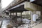
| 2015, 2016[2] | 38.7079°N 77.1688°W | |||
| Farrar Drive | 2011[2] | |||
| Ehlers Road | 1975[2] | |||
| Newington | ||||
| 2001[2] | ||||
| CSX Transportation RF&P Subdivision | 38.7228°N 77.2041°W | |||
 |
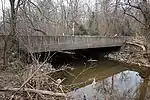
1993[2] | 38.7249°N 77.2039°W | ||
 |
1950[2] | |||
| Fullerton Road | 1976, 1992[2] | |||
| Fort Belvoir North | ||||
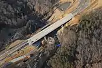
_at_the_exit_for_Boudinot_Drive_in_Newington%252C_Fairfax_County%252C_Virginia.jpg.webp) |
2010, 2011[2] | 38.7456°N 77.1973°W | ||
 |
Barta Road | 2010[2] | ||
| Springfield–West Springfield | ||||
| 1976[2] | ||||
 |
1989[2] | 38.7619°N 77.2082°W | ||
 |
Cross County Trail | |||
 |
1964[2] | |||
 |
Cross County Trail | |||
 |
Cross County Trail | |||
 |
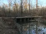
Norfolk Southern Railway Washington District | 38.7927°N 77.2188°W | ||
| North Springfield–West Springfield | ||||
 |
Accotink Loop Trail | |||
.jpg.webp) |
Lake Accotink dam | 38.7933°N 77.2187°W | ||
 |
Accotink Loop Trail | |||
 |
1972[2] | |||
| Annandale | ||||
 |
Cross County Trail | |||
 |
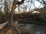
1961, 2011, 2012[2] | 38.8344°N 77.2186°W | ||
 |
Cross County Trail | after 1995[3] | ||
 |
Cross County Trail | after 1995[3] | ||
 |
Cross County Trail | after 1995[3] | ||
 |
King Arthur Road | 1964[2] | ||
 |
Woodburn Road | 1990[2] | ||
| Mantua | ||||
| 1988[2] | ||||
| 1968[2] | ||||
 |
Cross County Trail | after 1995[3] | ||
| Fairfax | ||||
 |
1983[4] | 38.8615°N 77.2701°W | ||
 |
Wilcoxon Park footbridge | |||
 |
Wilcoxon Park footbridge | |||
 |
Old Lee Highway | 1976[4] | ||
 |
Wilcoxon Park footbridge | |||
 |
1978[4] | 38.8637°N 77.2831°W | ||
 |
Ranger Road Park footbridge | |||
 |
1978[4] | 38.8628°N 77.2897°W | ||
 |
Footbridge to Dale Drive | |||
 |
Van Dyck Park footbridge | |||
 |
University Drive | |||
 |
Belle's Bird Sanctuary footbridge | 2014[4] | ||
 |
2014[4] | 38.8508°N 77.3078°W | Replaced earlier bridge[5] | |
 |
Meadow Bridge Lane | |||
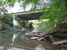
_at_Railroad_Avenue_in_Fairfax%252C_Virginia.jpg.webp) |
1971[4] | 38.8481°N 77.3123°W | ||
 |
Judicial Drive | |||
 |
Fairfax Nursing Center footbridge | |||
 |
Presbyterian Way | |||
 |
Woodland Drive | |||
 |
Poplar Street | |||
References
- Sanford, Walter (March 28, 2016). "New suspension bridge over Accotink Creek". Walter Sanford's Photoblog. Retrieved December 31, 2020.
- "Fairfax County, Virginia". National Bridge Inventory. Retrieved December 31, 2020 – via BridgeReports.com.
- "General Management Plan / Conceptual Development Plan and Project Implementation Plan: Eakin / Eakin (Mantua) / Accotink Stream Valley Park". Fairfax County Park Authority. June 1995. p. 2. Retrieved January 3, 2021.
- "Fairfax, Virginia". National Bridge Inventory. Retrieved December 31, 2020 – via BridgeReports.com.
- "Chain Bridge Road (Route 123) Over Accotink Creek Bridge Replacement". City of Fairfax, VA. Retrieved December 31, 2020.
This article is issued from Wikipedia. The text is licensed under Creative Commons - Attribution - Sharealike. Additional terms may apply for the media files.