List of highways in Terrell County, Texas
The following is a list of all state highways in Terrell County, Texas maintained by the Texas Department of Transportation. All state highways in Texas are paved.
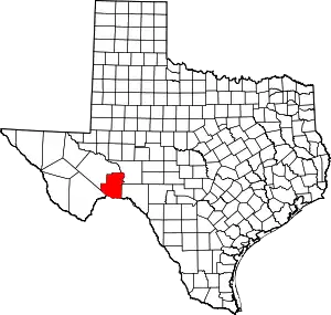
Location of Terrell County
U.S. highways
| Route Name | Direction | Termini | Junctions | Length[1] | Remarks |
|---|---|---|---|---|---|
| W/E | Pecos County Val Verde County |
57.9 miles (93.2 km) | Passes through Sanderson and Dryden | ||
| S/N | Pecos County |
10.5 miles (16.9 km) | Southern terminus at Sanderson |
State highways
| Route Name | Direction | Termini | Junctions | Length[1] | Remarks |
|---|---|---|---|---|---|
| S/N | Pecos County |
52.9 miles (85.1 km) | Southern terminus at Dryden |
Farm and ranch to market roads
| Route Name | Direction | Termini | Junctions | Length | Remarks |
|---|---|---|---|---|---|
| S/N | Val Verde County |
0.6 miles (1.0 km)[1] | Terminates at US 90 just west of county line | ||
| W/E | Pecos County |
33.1 miles (53.3 km)[1] | |||
| S/N | Pecos County |
18.3 miles (29.5 km)[1] | |||
| W/E | Dead end |
3.0 miles (4.8 km)[8] |
Historic roads
| Route Name | Direction | Termini | Remarks |
|---|---|---|---|
| W/E | Pecos County Val Verde County |
Replaced by US 90 in 1939 | |
| S/N | Reeves County Reeves County |
Replaced by US 285 in 1939 | |
| S/N | Pecos County |
Replaced by SH 349 in 1990 |
Adjacent countries and counties
- Crockett County (northeast)
- Val Verde County (southeast)
- Mexico (south)
- Brewster County (southwest)
- Pecos County (northwest)
References
- Texas Department of Transportation, Statewide Planning Map using map's measurement utility
- Transportation Planning and Programming Division (n.d.). "U.S. Highway No. 90". Highway Designation Files. Texas Department of Transportation.
- Transportation Planning and Programming Division (n.d.). "U.S. Highway No. 285". Highway Designation Files. Texas Department of Transportation.
- Transportation Planning and Programming Division (n.d.). "State Highway No. 349". Highway Designation Files. Texas Department of Transportation.
- Transportation Planning and Programming Division (n.d.). "Ranch to Market Road No. 1865". Highway Designation Files. Texas Department of Transportation.
- Transportation Planning and Programming Division (n.d.). "Ranch to Market Road No. 2400". Highway Designation Files. Texas Department of Transportation.
- Transportation Planning and Programming Division (n.d.). "Ranch to Market Road No. 2886". Highway Designation Files. Texas Department of Transportation.
- Transportation Planning and Programming Division (n.d.). "Ranch to Market Road No. 3166". Highway Designation Files. Texas Department of Transportation.
- Texas State Library and Archives Commission, "Official Map of the Highway System of Texas", 15 June 1933
- Transportation Planning and Programming Division (n.d.). "Farm to Market Road No. 1217". Highway Designation Files. Texas Department of Transportation.
This article is issued from Wikipedia. The text is licensed under Creative Commons - Attribution - Sharealike. Additional terms may apply for the media files.