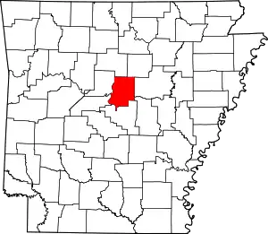
List of lakes of Faulkner County, Arkansas
Lakes
- Boone Pond, 34°57′38″N 092°20′53″W, el. 282 feet (86 m) [1]
- Grassy Lake, 34°56′44″N 092°23′27″W, el. 256 feet (78 m) [2]
Reservoirs

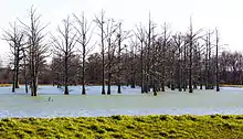
Lake Conway
- Indian Head Lake, 35°02′41″N 092°07′02″W, el. 335 feet (102 m) [3]
- Bailey Lake, 35°01′22″N 092°12′54″W, el. 469 feet (143 m) [4]
- Beaver Fork Lake, 35°08′08″N 092°26′14″W, el. 295 feet (90 m) [5]
- Bivans Lake, 35°18′42″N 092°16′37″W, el. 735 feet (224 m) [6]
- Blacks Lake, 35°02′58″N 092°17′25″W, el. 302 feet (92 m) [7]
- Blacks Lake Number Two, 35°02′26″N 092°16′57″W, el. 302 feet (92 m) [8]
- Browns Lake, 34°59′24″N 092°34′37″W, el. 279 feet (85 m) [9]
- Brushlake Reservoir, 34°58′28″N 092°14′24″W, el. 351 feet (107 m) [10]
- Carter Lake, 35°01′19″N 092°26′12″W, el. 344 feet (105 m) [11]
- Davis Lake, 34°59′10″N 092°28′30″W, el. 472 feet (144 m) [12]
- Days Lake, 35°06′54″N 092°25′11″W, el. 404 feet (123 m) [13]
- Dears Pond, 35°10′34″N 092°29′53″W, el. 276 feet (84 m) [14]
- Deihl Lake, 35°06′12″N 092°14′59″W, el. 394 feet (120 m) [15]
- Gentry Lake, 35°06′56″N 092°26′05″W, el. 453 feet (138 m) [16]
- Jewell Lake, 34°57′46″N 092°28′28″W, el. 279 feet (85 m) [17]
- Lake Bennett, 35°17′09″N 092°17′08″W, el. 509 feet (155 m) [18]
- Lake Carol-Dan, 35°05′46″N 092°31′47″W, el. 295 feet (90 m) [19]
- Lake Conway, 34°57′33″N 092°24′19″W, el. 259 feet (79 m) [20]
- Lake Conway Nursery Pond, 34°59′24″N 092°23′01″W, el. 269 feet (82 m) [21]
- Lawrences Lake, 35°12′44″N 092°24′39″W, el. 312 feet (95 m) [22]
- Meers Lake, 34°58′31″N 092°17′04″W, el. 381 feet (116 m) [23]
- Montgomery Lake, 35°17′51″N 092°19′36″W, el. 630 feet (190 m) [24]
- Murray Lake, 34°52′01″N 092°27′50″W, el. 249 feet (76 m) [25]
- Nalholz Lake, 35°07′42″N 092°13′45″W, el. 466 feet (142 m) [26]
- Parks Lake, 35°02′51″N 092°18′24″W, el. 289 feet (88 m) [27]
- Pool Eight, 35°04′36″N 092°32′19″W, el. 253 feet (77 m) [28]
- Roberts Pond, 34°59′24″N 092°24′25″W, el. 269 feet (82 m) [29]
- Robins Lake, 35°06′55″N 092°25′45″W, el. 453 feet (138 m) [30]
- Stevens Lake, 34°59′55″N 092°31′20″W, el. 305 feet (93 m) [31]
- Stone Lake, 34°57′54″N 092°28′06″W, el. 272 feet (83 m) [32]
- Torian Lake, 35°09′45″N 092°29′44″W, el. 272 feet (83 m) [33]
- Tupelo Bayou Site One Reservoir, 35°01′56″N 092°30′19″W, el. 272 feet (83 m) [34]
- Tupelo Bayou Site Two Reservoir, 35°00′06″N 092°32′07″W, el. 259 feet (79 m) [35]
- Watson Lake, 34°59′21″N 092°14′17″W, el. 449 feet (137 m) [36]
- Williams Lake, 35°06′25″N 092°09′48″W, el. 374 feet (114 m) [37]
- Wisley Lake, 34°57′44″N 092°30′24″W, el. 282 feet (86 m) [38]
See also
- List of lakes in Arkansas
Notes
- "Boone Pond". Geographic Names Information System. United States Geological Survey.
- "Grassy Lake". Geographic Names Information System. United States Geological Survey.
- "Indian Head Lake". Geographic Names Information System. United States Geological Survey.
- "Bailey Lake". Geographic Names Information System. United States Geological Survey.
- "Beaver Fork Lake". Geographic Names Information System. United States Geological Survey.
- "Bivans Lake". Geographic Names Information System. United States Geological Survey.
- "Blacks Lake". Geographic Names Information System. United States Geological Survey.
- "Blacks Lake Number Two". Geographic Names Information System. United States Geological Survey.
- "Browns Lake". Geographic Names Information System. United States Geological Survey.
- "Brushlake Reservoir". Geographic Names Information System. United States Geological Survey.
- "Carter Lake". Geographic Names Information System. United States Geological Survey.
- "Davis Lake". Geographic Names Information System. United States Geological Survey.
- "Days Lake". Geographic Names Information System. United States Geological Survey.
- "Dears Pond". Geographic Names Information System. United States Geological Survey.
- "Deihl Lake". Geographic Names Information System. United States Geological Survey.
- "Gentry Lake". Geographic Names Information System. United States Geological Survey.
- "Jewell Lake". Geographic Names Information System. United States Geological Survey.
- "Lake Bennett". Geographic Names Information System. United States Geological Survey.
- "Lake Carol-Dan". Geographic Names Information System. United States Geological Survey.
- "Lake Conway". Geographic Names Information System. United States Geological Survey.
- "Lake Conway Nursery Pond". Geographic Names Information System. United States Geological Survey.
- "Lawrences Lake". Geographic Names Information System. United States Geological Survey.
- "Meers Lake". Geographic Names Information System. United States Geological Survey.
- "Montgomery Lake". Geographic Names Information System. United States Geological Survey.
- "Murray Lake". Geographic Names Information System. United States Geological Survey.
- "Nalholz Lake". Geographic Names Information System. United States Geological Survey.
- "Parks Lake". Geographic Names Information System. United States Geological Survey.
- "Pool Eight". Geographic Names Information System. United States Geological Survey.
- "Roberts Pond". Geographic Names Information System. United States Geological Survey.
- "Robins Lake". Geographic Names Information System. United States Geological Survey.
- "Stevens Lake". Geographic Names Information System. United States Geological Survey.
- "Stone Lake". Geographic Names Information System. United States Geological Survey.
- "Torian Lake". Geographic Names Information System. United States Geological Survey.
- "Tupelo Bayou Site One Reservoir". Geographic Names Information System. United States Geological Survey.
- "Tupelo Bayou Site Two Reservoir". Geographic Names Information System. United States Geological Survey.
- "Watson Lake". Geographic Names Information System. United States Geological Survey.
- "Williams Lake". Geographic Names Information System. United States Geological Survey.
- "Wisley Lake". Geographic Names Information System. United States Geological Survey.
This article is issued from Wikipedia. The text is licensed under Creative Commons - Attribution - Sharealike. Additional terms may apply for the media files.
