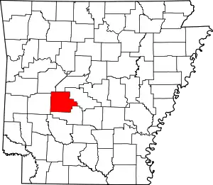
List of lakes of Garland County, Arkansas
Lakes
According to the United States Geological Survey, there are no named lakes in Garland County.
Reservoirs

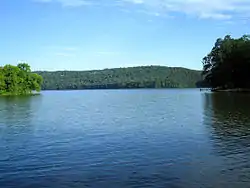
Lake Catherine

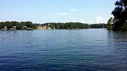
Lake Hamilton

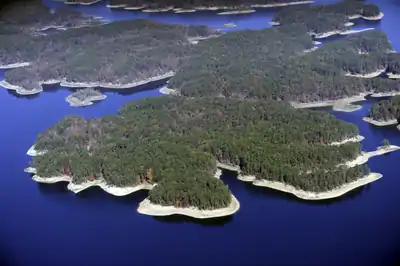
Lake Ouachita
- Arkansas Noname 136 Reservoir, 34°31′19″N 093°17′31″W, el. 653 feet (199 m)[1]
- Bethel Lake, 34°32′21″N 093°03′52″W, el. 610 feet (190 m)[2]
- Big Lake, 34°37′53″N 093°00′31″W, el. 751 feet (229 m)[3]
- Camp Clear Fork Reservoir, 34°30′27″N 093°23′39″W, el. 709 feet (216 m)[4]
- Country Club Lake, 34°32′47″N 093°00′23″W, el. 745 feet (227 m)[5]
- Desoto Lake, 34°32′15″N 093°02′03″W, el. 604 feet (184 m)[6]
- Dillon Lake, 34°32′37″N 093°03′35″W, el. 630 feet (190 m)[7]
- Forest Lake, 34°33′48″N 093°00′16″W, el. 686 feet (209 m)[8]
- Fountain Lake, 34°34′34″N 092°58′12″W, el. 574 feet (175 m)[9]
- Hot Springs Reservoir, 34°34′23″N 093°05′36″W, el. 659 feet (201 m)[10]
- Lake Catherine, 34°27′16″N 092°57′34″W, el. 305 feet (93 m)[11]
- Lake Coronado, 34°39′16″N 092°57′56″W, el. 630 feet (190 m)[12]
- Lake Cortez, 34°40′51″N 092°58′41″W, el. 636 feet (194 m)[13]
- Lake Desoto, 34°40′41″N 093°01′05″W, el. 732 feet (223 m)[14]
- Lake Hamilton, 34°25′54″N 093°07′32″W, el. 400 feet (120 m)[15]
- Lake Ouachita, 34°36′23″N 093°20′52″W, el. 577 feet (176 m)[16]
- Lake Pineda, 34°38′31″N 092°59′38″W, el. 669 feet (204 m)[17]
- Lake Segovia, 34°40′16″N 093°02′54″W, el. 791 feet (241 m)[18]
- Nooner Lake, 34°36′52″N 092°55′52″W, el. 518 feet (158 m)[19]
- O'Mahoney Pond, 34°34′30″N 092°57′55″W, el. 623 feet (190 m)[20]
- Rector Lake, 34°31′16″N 093°17′26″W, el. 650 feet (200 m)[21]
- Reynolds Lake, 34°29′32″N 093°18′44″W, el. 591 feet (180 m)[22]
- Ricks Lake, 34°34′00″N 093°05′37″W, el. 797 feet (243 m)[23]
- Ricks Pond, 34°32′18″N 093°02′01″W, el. 673 feet (205 m)[24]
- Roberts Lake, 34°27′11″N 093°13′17″W, el. 518 feet (158 m)[25]
- Sanderson Lake, 34°33′03″N 093°03′24″W, el. 663 feet (202 m)[26]
- Sleepy Valley Lake, 34°32′12″N 093°01′37″W, el. 889 feet (271 m)[27]
- Sleepy Valley Lower Lake, 34°32′06″N 093°01′49″W, el. 594 feet (181 m)[28]
- Sleepy Valley Middle Lake, 34°32′06″N 093°01′49″W, el. 594 feet (181 m)[29]
- Spring Lake, 34°32′26″N 092°48′35″W, el. 436 feet (133 m)[30]
- Tailings Pond, 34°28′00″N 092°56′25″W, el. 423 feet (129 m)[31]
See also
- List of lakes in Arkansas
Notes
- "Arkansas Noname 136 Reservoir". Geographic Names Information System. United States Geological Survey.
- "Bethel Lake". Geographic Names Information System. United States Geological Survey.
- "Big Lake". Geographic Names Information System. United States Geological Survey.
- "Camp Clear Fork Reservoir". Geographic Names Information System. United States Geological Survey.
- "Country Club Lake". Geographic Names Information System. United States Geological Survey.
- "Desoto Lake". Geographic Names Information System. United States Geological Survey.
- "Dillon Lake". Geographic Names Information System. United States Geological Survey.
- "Forest Lake". Geographic Names Information System. United States Geological Survey.
- "Fountain Lake". Geographic Names Information System. United States Geological Survey.
- "Hot Springs Reservoir". Geographic Names Information System. United States Geological Survey.
- "Lake Catherine". Geographic Names Information System. United States Geological Survey.
- "Lake Coronado". Geographic Names Information System. United States Geological Survey.
- "Lake Cortez". Geographic Names Information System. United States Geological Survey.
- "Lake Desoto". Geographic Names Information System. United States Geological Survey.
- "Lake Hamilton". Geographic Names Information System. United States Geological Survey.
- "Lake Ouachita". Geographic Names Information System. United States Geological Survey.
- "Lake Pineda". Geographic Names Information System. United States Geological Survey.
- "Lake Segovia". Geographic Names Information System. United States Geological Survey.
- "Nooner Lake". Geographic Names Information System. United States Geological Survey.
- "O'Mahoney Pond". Geographic Names Information System. United States Geological Survey.
- "Rector Lake". Geographic Names Information System. United States Geological Survey.
- "Reynolds Lake". Geographic Names Information System. United States Geological Survey.
- "Ricks Lake". Geographic Names Information System. United States Geological Survey.
- "Ricks Pond". Geographic Names Information System. United States Geological Survey.
- "Roberts Lake". Geographic Names Information System. United States Geological Survey.
- "Sanderson Lake". Geographic Names Information System. United States Geological Survey.
- "Sleepy Valley Lake". Geographic Names Information System. United States Geological Survey.
- "Sleepy Valley Lower Lake". Geographic Names Information System. United States Geological Survey.
- "Sleepy Valley Middle Lake". Geographic Names Information System. United States Geological Survey.
- "Spring Lake". Geographic Names Information System. United States Geological Survey.
- "Tailings Pond". Geographic Names Information System. United States Geological Survey.
This article is issued from Wikipedia. The text is licensed under Creative Commons - Attribution - Sharealike. Additional terms may apply for the media files.
