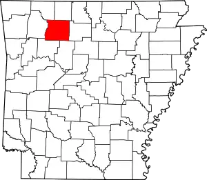
List of lakes of Newton County, Arkansas
Lakes
According to the United States Geological Survey, there are no named lakes in Newton County, Arkansas.
Reservoirs
- Edwards Lake, 36°06′54″N 093°12′25″W, el. 1,086 feet (331 m) [1]
- Fowler Lake, 35°57′13″N 093°24′58″W, el. 2,106 feet (642 m) [2]
- Hurricane Lake, 35°54′15″N 092°57′51″W, el. 997 feet (304 m) [3]
- Lower Hurricane Lake, 35°55′35″N 092°57′48″W, el. 902 feet (275 m) [4]
- Mill Creek Hollow Reservoir, 36°04′30″N 093°08′13″W, el. 820 feet (250 m) [5]
- North Pond, 36°03′18″N 093°10′48″W, el. 866 feet (264 m) [6]
- South Pond, 36°03′12″N 093°10′43″W, el. 846 feet (258 m) [7]
- Sycamore Lake, 35°55′35″N 092°57′48″W, el. 902 feet (275 m) [8]
- Weatherby Lake, 36°01′49″N 093°14′31″W, el. 2,096 feet (639 m) [9]
See also
- List of lakes in Arkansas
Notes
- "Edwards Lake". Geographic Names Information System. United States Geological Survey.
- "Fowler Lake". Geographic Names Information System. United States Geological Survey.
- "Hurricane Lake". Geographic Names Information System. United States Geological Survey.
- "Lower Hurricane Lake". Geographic Names Information System. United States Geological Survey.
- "Mill Creek Hollow Reservoir". Geographic Names Information System. United States Geological Survey.
- "North Pond". Geographic Names Information System. United States Geological Survey.
- "South Pond". Geographic Names Information System. United States Geological Survey.
- "Sycamore Lake". Geographic Names Information System. United States Geological Survey.
- "Weatherby Lake". Geographic Names Information System. United States Geological Survey.
This article is issued from Wikipedia. The text is licensed under Creative Commons - Attribution - Sharealike. Additional terms may apply for the media files.
