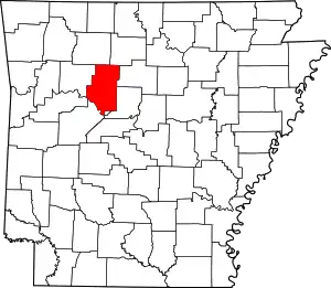
List of lakes of Pope County, Arkansas
Lakes
- Flagg Lake, 35°12′01″N 093°05′28″W, el. 305 feet (93 m) [1]
- Holla Bend, 35°10′58″N 093°04′57″W, el. 289 feet (88 m) [2]
- Lodge Lake, 35°08′33″N 093°05′06″W, el. 299 feet (91 m) [3]
- Long Lake, 35°08′29″N 093°05′12″W, el. 299 feet (91 m) [4]
Reservoirs
- Galla Creek Lake, 35°16′12″N 093°02′58″W, el. 427 feet (130 m) [5]
- Galla Creek Wildlife Lake, 35°10′42″N 093°01′14″W, el. 305 feet (93 m) [6]
- Galla Watershed Site One Reservoir, 35°15′48″N 093°03′07″W, el. 518 feet (158 m) [7]
- Jones Lake, 35°14′18″N 093°02′07″W, el. 371 feet (113 m) [8]
- Lake Atkins, 35°12′32″N 092°57′34″W, el. 318 feet (97 m) [9]
- Lake Irvin, 35°13′04″N 093°07′14″W, el. 325 feet (99 m) [10]
- Lake Russellville, 35°20′18″N 093°08′49″W, el. 420 feet (130 m) [11]
- Lake Vinson, 35°22′21″N 093°16′39″W, el. 581 feet (177 m) [12]
- Lake Yarbrough, 35°17′10″N 093°01′55″W, el. 804 feet (245 m) [13]
- West Fork Point Remove Creek Site 10 Reservoir, 35°24′20″N 092°56′35″W, el. 522 feet (159 m) [14]
- West Fork Point Remove Creek Site 11 Reservoir, 35°22′30″N 092°52′01″W, el. 476 feet (145 m) [15]
- West Fork Point Remove Creek Site 17 Reservoir, 35°19′26″N 092°53′35″W, el. 322 feet (98 m) [16]
- West Fork Point Remove Creek Site 18 Reservoir, 35°21′06″N 092°52′43″W, el. 361 feet (110 m) [17]
- West Fork Point Remove Creek Site 19 Reservoir, 35°22′23″N 092°58′07″W, el. 591 feet (180 m) [18]
- West Fork Point Remove Creek Site Eight Reservoir, 35°26′27″N 092°51′31″W, el. 587 feet (179 m) [19]
- West Fork Point Remove Creek Site Nine Reservoir, 35°26′19″N 092°54′50″W, el. 522 feet (159 m) [20]
- Winthrop Rockefeller Lake, 35°09′29″N 093°03′17″W, el. 285 feet (87 m) [21]
See also
- List of lakes in Arkansas
Notes
- "Flagg Lake". Geographic Names Information System. United States Geological Survey.
- "Holla Bend". Geographic Names Information System. United States Geological Survey.
- "Lodge Lake". Geographic Names Information System. United States Geological Survey.
- "Long Lake". Geographic Names Information System. United States Geological Survey.
- "Galla Creek Lake". Geographic Names Information System. United States Geological Survey.
- "Galla Creek Wildlife Lake". Geographic Names Information System. United States Geological Survey.
- "Galla Watershed Site One Reservoir". Geographic Names Information System. United States Geological Survey.
- "Jones Lake". Geographic Names Information System. United States Geological Survey.
- "Lake Atkins". Geographic Names Information System. United States Geological Survey.
- "Lake Irvin". Geographic Names Information System. United States Geological Survey.
- "Lake Russellville". Geographic Names Information System. United States Geological Survey.
- "Lake Vinson". Geographic Names Information System. United States Geological Survey.
- "Lake Yarbrough". Geographic Names Information System. United States Geological Survey.
- "West Fork Point Remove Creek Site 10 Reservoir". Geographic Names Information System. United States Geological Survey.
- "West Fork Point Remove Creek Site 11 Reservoir". Geographic Names Information System. United States Geological Survey.
- "West Fork Point Remove Creek Site 17 Reservoir". Geographic Names Information System. United States Geological Survey.
- "West Fork Point Remove Creek Site 18 Reservoir". Geographic Names Information System. United States Geological Survey.
- "West Fork Point Remove Creek Site 19 Reservoir". Geographic Names Information System. United States Geological Survey.
- "West Fork Point Remove Creek Site Eight Reservoir". Geographic Names Information System. United States Geological Survey.
- "West Fork Point Remove Creek Site Nine Reservoir". Geographic Names Information System. United States Geological Survey.
- "Winthrop Rockefeller Lake". Geographic Names Information System. United States Geological Survey.
This article is issued from Wikipedia. The text is licensed under Creative Commons - Attribution - Sharealike. Additional terms may apply for the media files.
