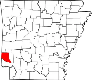
List of lakes of Sevier County, Arkansas
Lakes
- Berks Slough, 33°53′54″N 094°19′55″W, el. 295 feet (90 m) [1]
- Johnson Lake, 34°00′18″N 094°11′21″W, el. 331 feet (101 m) [2]
- Red Lake, 33°49′11″N 094°14′36″W, el. 269 feet (82 m) [3]
- Russey Lake, 33°59′15″N 094°11′37″W, el. 328 feet (100 m) [4]
Reservoirs
- Coulter Lake, 33°57′57″N 094°07′56″W, el. 459 feet (140 m) [5]
- De Queen Lake, 34°05′52″N 094°22′53″W, el. 374 feet (114 m) [6]
- Dierks Lake, 34°08′42″N 094°06′01″W, el. 495 feet (151 m) [7]
- Double K Lake, 33°53′43″N 094°17′25″W, el. 335 feet (102 m) [8]
- Fraser Pond, 33°57′00″N 094°08′37″W, el. 407 feet (124 m) [9]
- Gillham Lake, 34°10′24″N 094°19′13″W, el. 774 feet (236 m) [10]
- Lake Hospitality, 33°49′12″N 094°03′31″W, el. 335 feet (102 m) [11]
- Process City Lake, 34°01′19″N 094°22′04″W, el. 344 feet (105 m) [12]
- Tobin Lake, 33°59′00″N 094°13′30″W, el. 328 feet (100 m) [13]
See also
- List of lakes in Arkansas
Notes
- "Berks Slough". Geographic Names Information System. United States Geological Survey.
- "Johnson Lake". Geographic Names Information System. United States Geological Survey.
- "Red Lake". Geographic Names Information System. United States Geological Survey.
- "Russey Lake". Geographic Names Information System. United States Geological Survey.
- "Coulter Lake". Geographic Names Information System. United States Geological Survey.
- "De Queen Lake". Geographic Names Information System. United States Geological Survey.
- "Dierks Lake". Geographic Names Information System. United States Geological Survey.
- "Double K Lake". Geographic Names Information System. United States Geological Survey.
- "Fraser Pond". Geographic Names Information System. United States Geological Survey.
- "Gillham Lake". Geographic Names Information System. United States Geological Survey.
- "Lake Hospitality". Geographic Names Information System. United States Geological Survey.
- "Process City Lake". Geographic Names Information System. United States Geological Survey.
- "Tobin Lake". Geographic Names Information System. United States Geological Survey.
This article is issued from Wikipedia. The text is licensed under Creative Commons - Attribution - Sharealike. Additional terms may apply for the media files.
