List of listed buildings in Aberdeen/5
List
| Name | Location | Date Listed | Grid Ref. [note 1] | Geo-coordinates | Notes | LB Number [note 2] | Image |
|---|---|---|---|---|---|---|---|
| Tullos Primary School, Girdleness Road | 57°07′53″N 2°04′38″W | Category B | 49995 |  | |||
| Crombie Halls Of Residence, Meston Walk | 57°09′50″N 2°06′15″W | Category A | 50016 | 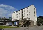 | |||
| 85 Western Road, St Machar Woodside Hall Including Boundary Walls, Gatepiers And Gates | 57°10′10″N 2°07′34″W | Category C(S) | 50052 | | |||
| Old Ford Road, Smoke House | 57°08′21″N 2°05′44″W | Category C(S) | 50217 | | |||
| Palmerston Road, Smoke Houses | 57°08′26″N 2°05′46″W | Category C(S) | 50218 | | |||
| 10-16 (Even Nos) Exchequer Row | 57°08′51″N 2°05′41″W | Category C(S) | 50935 | | |||
| Mearns Quay And Torry Quay, Drainage Terminal And Valve House | 57°08′27″N 2°04′42″W | Category C(S) | 50953 | | |||
| 39-45 (Odd Nos) Union Street (Known As 41 1/2, Crown Court) | 57°08′50″N 2°05′45″W | Category C(S) | 45666 | | |||
| 38-40 Hutcheon Street | 57°09′16″N 2°06′13″W | Category B | 44554 | | |||
| 2 And 4 Upperkirkgate And 11 Gallowgate, Former Students Union | 57°08′57″N 2°05′52″W | Category B | 43377 | | |||
| 6 Rubislaw Den South, Including Gatepiers And Boundary Walls | 57°08′35″N 2°08′08″W | Category C(S) | 20797 | | |||
| 8 Rubislaw Den South, Including Gatepiers And Boundary Walls | 57°08′35″N 2°08′08″W | Category C(S) | 20798 | | |||
| 48 Rubislaw Den South, Including Gatepiers, Boundary Walls And Ancillary Structure | 57°08′33″N 2°08′30″W | Category C(S) | 20813 | | |||
| 56 Rubislaw Den South, Fortune Green, Including Gatepiers And Boundary Walls | 57°08′33″N 2°08′33″W | Category B | 20815 | | |||
| 53-57 (Odd Nos) Victoria Road And 2-8 (Even Nos) Sinclair Road, Torry | 57°08′18″N 2°05′18″W | Category C(S) | 20824 | | |||
| Eday Road Woodend Hospital General Block Including Wards 5/7 & 6/8 | 57°08′53″N 2°10′24″W | Category B | 20827 | | |||
| Garthdee Road, Fountain House | 57°07′17″N 2°07′32″W | Category C(S) | 20834 | | |||
| Fonthill Road And Polmuir Road, Ferryhill South Church, (Church Of Scotland), Including Hall, Gatepiers And Boundary Walls | 57°08′11″N 2°06′18″W | Category B | 20689 | | |||
| 3 Queen's Road, St Joseph's Roman Catholic Primary School | 57°08′33″N 2°07′41″W | Category C(S) | 20709 | | |||
| 31 Queen's Road, Including Gatepiers And Boundary Walls | 57°08′29″N 2°08′01″W | Category C(S) | 20722 | | |||
| 53 Queen's Road, The Queen's Hotel, Including Gatepiers And Boundary Walls | 57°08′27″N 2°08′08″W | Category C(S) | 20729 | | |||
| 14 Queen's Road, Including Gatepiers And Boundary Walls | 57°08′33″N 2°07′52″W | Category C(S) | 20736 | | |||
| 16 Queen's Road, Including Gatepiers And Boundary Walls | 57°08′33″N 2°07′53″W | Category C(S) | 20737 | | |||
| 18 Queen's Road, Including Gatepiers And Boundary Walls | 57°08′33″N 2°07′54″W | Category C(S) | 20738 | | |||
| 56 And 58 Queen's Road, Including Gatepiers And Boundary Walls | 57°08′30″N 2°08′10″W | Category C(S) | 20742 | | |||
| 84 Queen's Road At Bayview Road, Including Gatepiers And Boundary Walls | 57°08′27″N 2°08′22″W | Category B | 20750 | | |||
| 88 Queen's Road, Including Gatepiers And Boundary Walls | 57°08′26″N 2°08′26″W | Category B | 20752 | | |||
| 9 And 9A (Kimberley) Rubislaw Den North, Including Gatepiers And Boundary Walls | 57°08′40″N 2°08′15″W | Category B | 20762 | | |||
| 12 Rubislaw Den North, Including Gatepiers And Boundary Walls | 57°08′42″N 2°08′13″W | Category C(S) | 20770 | | |||
| 22 Rubislaw Den North, Including Gatepiers And Boundary Walls | 57°08′42″N 2°08′17″W | Category C(S) | 20774 | | |||
| 46 Rubislaw Den North, The Red House, Including Boundary Walls | 57°08′41″N 2°08′22″W | Category B | 20777 | | |||
| 58 Rubislaw Den North, Including Gatepiers And Boundary Walls | 57°08′40″N 2°08′28″W | Category B | 20779 | | |||
| 151 King Street | 57°09′04″N 2°05′40″W | Category C(S) | 20643 | | |||
| 30-34 (Even Nos) Schoolhill | 57°08′53″N 2°06′01″W | Category C(S) | 20646 | | |||
| Causewayend School Causewayend Mounthooly | 57°09′18″N 2°06′03″W | Category C(S) | 20650 | | |||
| 10 Exchange Street | 57°08′45″N 2°05′51″W | Category C(S) | 20658 | | |||
| 61-65 (Odd Nos)_The Green | 57°08′45″N 2°05′58″W | Category C(S) | 20667 | | |||
| Skene Street, Esslemont Avenue, Skene Street Church | 57°08′48″N 2°06′47″W | Category B | 20675 | | |||
| Justice Mill Lane, Bon Accord Baths | 57°08′30″N 2°06′38″W | Category B | 20677 | 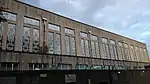 | |||
| 67 Fountainhall Road At Hamilton Place, Including Boundary Walls | 57°08′45″N 2°07′46″W | Category C(S) | 20630 | | |||
| Castle Hill, Cromwellian Fort Bastion | 57°08′54″N 2°05′24″W | Category C(S) | 20604 | | |||
| Union Street, 419,421 | 57°08′36″N 2°06′34″W | Category C(S) | 20545 | | |||
| St. Machar Drive, 66, 68 And 114 High Street, Old Aberdeen | 57°10′02″N 2°06′07″W | Category C(S) | 20479 | | |||
| North Silver Street, 10 | 57°08′48″N 2°06′20″W | Category B | 20492 | | |||
| 67 Union Street And 1 Market Street | 57°08′49″N 2°05′50″W | Category B | 20521 | | |||
| 82-96 (Even Nos) King Street And 2-8 (Even Nos) Frederick Street | 57°09′00″N 2°05′37″W | Category C(S) | 20402 | | |||
| 136-140 (Even Nos) King Street | 57°09′04″N 2°05′38″W | Category B | 20410 | | |||
| 13 And 15 Market Street | 57°08′48″N 2°05′48″W | Category B | 20445 | | |||
| 21 And 23 Market Street | 57°08′47″N 2°05′47″W | Category B | 20446 | | |||
| 43 And 45 Market Street, The Douglas Hotel | 57°08′46″N 2°05′45″W | Category C(S) | 20447 | | |||
| 162-166 (Even Nos) Market Street | 57°08′34″N 2°05′35″W | Category B | 20448 | | |||
| Mount Street, 45 | 57°09′11″N 2°06′50″W | Category C(S) | 20450 | | |||
| Orchard Place, Orchard Cottage | 57°09′42″N 2°06′02″W | Category C(S) | 20453 | | |||
| Queen Street, 17 Woodside | 57°10′13″N 2°07′40″W | Category C(S) | 20454 | | |||
| 1 Great Northern Road, The Northern Hotel | 57°09′44″N 2°07′00″W | Category A | 20331 | 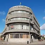 | |||
| Guild Street And 1 Trinity Street, Tivoli Theatre | 57°08′43″N 2°05′52″W | Category A | 20333 | | |||
| 62, 62A And 62B Hamilton Place At Whitehall Road, Including Gatepiers And Boundary Walls | 57°08′52″N 2°07′36″W | Category A | 20334 | 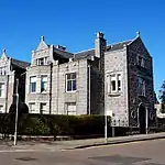 | |||
| 94, 94A And 96 Hamilton Place, Including Gatepiers And Boundary Walls | 57°08′50″N 2°07′45″W | Category A | 20343 | 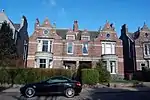 | |||
| High Street, 31 (Formerly) Now 2 Douglas Place, Old Aberdeen | 57°09′54″N 2°06′08″W | Category B | 20352 | | |||
| High Street, 39 (West Side) Old Aberdeen | 57°09′55″N 2°06′08″W | Category C(S) | 20354 | | |||
| High Street, 41 (West Side) And 2 Mackenzie Place, Old Aberdeen | 57°09′55″N 2°06′08″W | Category B | 20355 | | |||
| High Street, 107 (West Side) Old Aberdeen | 57°10′00″N 2°06′09″W | Category B | 20365 | | |||
| 133-141 (Odd Nos) King Street | 57°09′04″N 2°05′39″W | Category C(S) | 20390 | | |||
| 16 And 18 King Street | 57°08′55″N 2°05′36″W | Category C(S) | 20396 | | |||
| Don Street, (N.W. Side) "The Chapter House" "Cruickshanks Lodgings" | 57°10′39″N 2°06′02″W | Category A | 20299 | 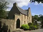 | |||
| Footdee, North Square, Mission Hall | 57°08′38″N 2°04′19″W | Category C(S) | 20315 | | |||
| College Bounds, 32 (East Side) Old Aberdeen | 57°09′45″N 2°06′06″W | Category B | 20231 | | |||
| Dee Place, 7-11 (Odd Nos) | 57°08′31″N 2°06′09″W | Category B | 20254 | | |||
| Dee Place, 18 | 57°08′31″N 2°06′11″W | Category B | 20257 | | |||
| Dee Street, 41 | 57°08′36″N 2°06′12″W | Category C(S) | 20259 | | |||
| Dee Street, 59, 61 | 57°08′34″N 2°06′11″W | Category C(S) | 20261 | | |||
| Old Aberdeen, 15 Don Street (West Side) | 57°10′03″N 2°06′07″W | Category B | 20272 | | |||
| Don Street, 17 (West Side) Old Aberdeen | 57°10′03″N 2°06′07″W | Category B | 20273 | | |||
| Don Street, 55 (West Side) The Dower House, Old Aberdeen | 57°10′06″N 2°06′01″W | Category B | 20282 | | |||
| Don Street, 40-44 (Even Nos) (East Side) Old Aberdeen | 57°10′05″N 2°06′03″W | Category C(S) | 20291 | | |||
| Don Street, 46, 48 (East Side) Don House, Old Aberdeen | 57°10′05″N 2°06′01″W | Category B | 20292 | | |||
| 12 And 13 Castle Street | 57°08′55″N 2°05′34″W | Category C(S) | 20164 | | |||
| 14, 15 And 16 Castle Street | 57°08′55″N 2°05′34″W | Category C(S) | 20165 | | |||
| Chanonry 2 (East Side) Boundary Wall | 57°10′03″N 2°06′08″W | Category B | 20179 | | |||
| Chanonry, 5 (East Side) Old Aberdeen | 57°10′04″N 2°06′09″W | Category B | 20182 | | |||
| Chanonry, 11 Boundary Wall | 57°10′09″N 2°06′15″W | Category B | 20189 | | |||
| Chanonry, 13 Chanonry Lodge, Old Aberdeen | 57°10′08″N 2°06′09″W | Category B | 20192 | | |||
| College Bounds, 7 (West Side) Old Aberdeen | 57°09′43″N 2°06′06″W | Category B | 20209 | | |||
| 29 Albyn Place, Including Gatepiers And Boundary Walls | 57°08′34″N 2°07′18″W | Category B | 20122 | | |||
| 130 Blenheim Place (Former Fountainhall House), Including Gates, Gatepiers And Boundary Walls | 57°08′48″N 2°07′36″W | Category C(S) | 20134 | | |||
| Bon Accord Street, 51-57 (Odd Nos) (Back Properties At 59, 61 Excluded But Including Close Within 57) | 57°08′34″N 2°06′19″W | Category C(S) | 20140 | | |||
| Bon Accord Street, 50-54 (Even Nos) | 57°08′32″N 2°06′19″W | Category C(S) | 20146 | | |||
| Broad Street, Provost Skene's House, Including Archway And South Building | 57°08′54″N 2°05′51″W | Category A | 20156 | 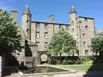 | |||
| Robert Gordon's College, Gateway, Crooked Lane And St. Andrew Street | 57°08′59″N 2°06′11″W | Category B | 20089 | | |||
| King's College New Building, High Street And Sacrist's House, 24 High Street | 57°09′54″N 2°06′06″W | Category B | 20093 | 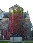 | |||
| 70 Prospect Terrace, Old Ferryhill House, Including Gatepiers And Boundary Walls | 57°08′07″N 2°05′58″W | Category B | 20101 | | |||
| Summerhill House Gatepiers On Anderson Drive North | 57°08′49″N 2°08′56″W | Category B | 20106 | | |||
| Woodside House Off Mugiemoss Road | 57°10′38″N 2°08′35″W | Category B | 20110 | | |||
| Market Cross Of Old Aberdeen, Within Forecourt Of Lecture Hall Of Geography Departments, High Street | 57°09′59″N 2°06′09″W | Category B | 20000 | | |||
| Albert, Prince, Statue, Union Terrace | 57°08′51″N 2°06′18″W | Category B | 20001 | | |||
| Cornhill Road, Royal Cornhill Hospital, Forbes Of Newe Obelisk | 57°09′19″N 2°07′05″W | Category C(S) | 20006 | | |||
| March Stone No. 51 At Top Of Deer Road And West Corner Of Clifton Road Opposite Woodside School | 57°10′15″N 2°07′48″W | Category B | 20031 | | |||
| March Stone No. 53, At Junction Of Hilton Road And Hilton Drive | 57°10′01″N 2°07′48″W | Category B | 20033 | | |||
| March Stone No. 62, Near Junction Of St. Peter Street And Spital | 57°09′26″N 2°05′56″W | Category B | 20042 | | |||
| March Stone No. 65, At Junction Of Golf Road And Seaton Place | 57°10′04″N 2°05′08″W | Category B | 20045 | | |||
| Duthie Park, Hygeia Statue | 57°07′53″N 2°06′05″W | Category B | 20057 | | |||
| Great Western Road And Nellfield Place, Nellfield Cemetery, Including 27 Great Western Road, Gates, Gatepiers And Cemetery Walls | 57°08′21″N 2°06′57″W | Category C(S) | 20058 | | |||
| Hazlehead Park, Lodge, Hazlehead Avenue | 57°08′24″N 2°10′26″W | Category B | 20059 | | |||
| Bridge Of Don, King Street | 57°10′32″N 2°05′26″W | Category B | 20069 | | |||
| Denburn Viaduct Over Lower Denburn Valley | 57°08′52″N 2°06′14″W | Category B | 20075 | | |||
| Union Street Viaduct | 57°08′45″N 2°06′05″W | Category B | 20077 | | |||
| Little Belmont Street, Former Old Town's School | 57°08′50″N 2°06′04″W | Category A | 20082 | | |||
| All Saints' (Episcopal) Church, Smithield Road, Hilton | 57°10′11″N 2°07′46″W | Category B | 19935 | | |||
| Broad Street And Queen Street, Greyfriars John Knox Church | 57°08′55″N 2°05′46″W | Category A | 19941 | _Kirk%252C_Broad_Street%252C_Aberdeen.jpg.webp) | |||
| St. John's Episcopal Church, St. John's Place And Crown Terrace | 57°08′36″N 2°06′04″W | Category B | 19956 | | |||
| Gallowgate, St Margaret Of Scotland (Episcopal) Church, Including Rectory And Boundary Wall | 57°09′05″N 2°05′51″W | Category B | 19960 | | |||
| Union Street, Back Wynd, Schoolhill And Correction Wynd, The Kirk Of St Nicholas Uniting (Church Of Scotland And United Reformed) | 57°08′51″N 2°05′57″W | Category A | 19966 | 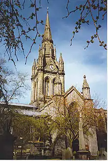 | |||
| St. Mark's Church (C. Of S.) Rosemount Viaduct | 57°08′53″N 2°06′19″W | Category B | 19974 | | |||
| 25 Union Terrace | 57°08′49″N 2°06′19″W | Category B | 19981 | | |||
| Duthie Park, Footbridge Over Upper Lake | 57°07′45″N 2°06′19″W | Category B | 46780 | | |||
| Duthie Park, Gordon Highlanders Celtic Cross Memorial | 57°07′54″N 2°06′10″W | Category C(S) | 46782 | | |||
| Duthie Park, Taylor Well | 57°07′53″N 2°06′17″W | Category C(S) | 46784 | | |||
| Richmondhill Place, Richmondhill House, Including Gatepiers And Boundary Walls | 57°08′53″N 2°08′04″W | Category C(S) | 46996 | | |||
| Urquhart Road, City Hospital, Including Administration Block, East And West Pavilions, North Lodge, East Lodge, Gatepiers, Boundary Walls And Railings | 57°09′15″N 2°05′10″W | Category C(S) | 47352 | | |||
| 21 And 23 Belgrave Terrace, Including Boundary Walls | 57°08′52″N 2°07′06″W | Category C(S) | 47453 | | |||
| 14 Hamilton Place, Including Boundary Walls | 57°08′55″N 2°07′25″W | Category C(S) | 47487 | | |||
| 47 King's Gate, Northsound Radio, Including Gatepiers And Boundary Walls | 57°08′49″N 2°08′06″W | Category C(S) | 47491 | | |||
| Skene Street And Esslemont Avenue, Aberdeen Grammar School, French School (Formerly Westfield School) | 57°08′52″N 2°06′54″W | Category C(S) | 47492 | | |||
| 1 Alford Place (Formerly 2-6 Holburn Street) | 57°08′34″N 2°06′44″W | Category C(S) | 47916 | | |||
| Berryden Road, Meal Mills, (Northern Co-Operative) | 57°09′18″N 2°06′45″W | Category B | 49025 | | |||
| Torry, 82-84 Sinclair Road, John Ross Junior, Smoke House | 57°08′17″N 2°04′55″W | Category B | 50621 | | |||
| 49 Carmelite Street, Former Warehouse | 57°08′43″N 2°05′54″W | Category C(S) | 50933 | | |||
| Footdee, No 2 North Square | 57°08′38″N 2°04′20″W | Category C(S) | 50937 | | |||
| 73-77 (Odd Nos) Union Street, Topshop Topman | 57°08′48″N 2°05′51″W | Category C(S) | 50957 | | |||
| 12 And 14 Virginia Street And 16 Shore Lane | 57°08′49″N 2°05′30″W | Category C(S) | 50961 | | |||
| 75 Waterloo Quay, Voyager House | 57°08′44″N 2°04′58″W | Category C(S) | 50962 | | |||
| Maberly Street, Broadford Works With Returns To Ann Street And Hutcheon Street | 57°09′11″N 2°06′29″W | Category A | 43908 | .jpg.webp) | |||
| 37 And 39 Rubislaw Den South, Including Gatepiers And Boundary Walls | 57°08′32″N 2°08′18″W | Category C(S) | 20794 | | |||
| 4 And 6 Rubislaw Den South (Rear Of), Spademill Bridge Over North Burn Of Rubislaw | 57°08′35″N 2°08′07″W | Category C(S) | 20796 | | |||
| 10 Rubislaw Den South, Including Gatepiers And Boundary Walls | 57°08′35″N 2°08′09″W | Category C(S) | 20799 | | |||
| 28 Rubislaw Den South, Including Gatepiers And Boundary Walls | 57°08′34″N 2°08′18″W | Category B | 20805 | | |||
| 62 And 62A Rubislaw Den South, Including Gatepiers And Boundary Walls | 57°08′33″N 2°08′37″W | Category C(S) | 20818 | | |||
| 64 Rubislaw Den South, Including Gatepiers And Boundary Walls | 57°08′33″N 2°08′40″W | Category B | 20819 | | |||
| 68 And 68A Rubislaw Den South, Including Gatepiers And Boundary Walls | 57°08′33″N 2°08′42″W | Category C(S) | 20821 | | |||
| Queen's Road, Woodend Hospital, East And West Lodges, Former Probationery Wards, Piers And Quadrants | 57°08′40″N 2°10′22″W | Category B | 20831 | | |||
| 55 Queen's Road, Hamilton School, Including Gatepiers And Boundary Walls | 57°08′27″N 2°08′09″W | Category B | 20730 | | |||
| 40 And 42 Queen's Road, Including Gatepiers And Boundary Walls | 57°08′31″N 2°08′04″W | Category B | 20739 | | |||
| 60 Queen's Road, Including Gatepiers And Boundary Walls | 57°08′29″N 2°08′11″W | Category B | 20743 | | |||
| 64 Queen's Road, Including Gatepiers And Boundary Walls | 57°08′29″N 2°08′12″W | Category B | 20745 | | |||
| 96 Queen's Road At Anderson Drive, Earls Court Hotel, Including Gatepiers, Boundary Walls And Railings | 57°08′25″N 2°08′30″W | Category B | 20754 | | |||
| 8 And 10 Rubislaw Den North, Including Boundary Walls | 57°08′42″N 2°08′11″W | Category C(S) | 20769 | | |||
| 14 And 16 Rubislaw Den North, Including Gatepiers And Boundary Walls | 57°08′42″N 2°08′14″W | Category C(S) | 20771 | | |||
| 54 Rubislaw Den North, Including Gatepiers And Boundary Walls | 57°08′41″N 2°08′26″W | Category C(S) | 20778 | | |||
| 395 Hardgate, Outseats House, Including Gatepiers And Boundary Walls | 57°07′49″N 2°06′51″W | Category C(S) | 20641 | | |||
| Warehouse, Broadford Firehose And Canvas Works Maberley Street | 57°09′06″N 2°06′28″W | Category B | 20648 | |
Key
The scheme for classifying buildings in Scotland is:
- Category A: "buildings of national or international importance, either architectural or historic; or fine, little-altered examples of some particular period, style or building type."[1]
- Category B: "buildings of regional or more than local importance; or major examples of some particular period, style or building type, which may have been altered."[1]
- Category C: "buildings of local importance; lesser examples of any period, style, or building type, as originally constructed or moderately altered; and simple traditional buildings which group well with other listed buildings."[1]
In March 2016 there were 47,288 listed buildings in Scotland. Of these, 8% were Category A, and 50% were Category B, with the remaining 42% being Category C.[2]
See also
Notes
- Sometimes known as OSGB36, the grid reference (where provided) is based on the British national grid reference system used by the Ordnance Survey.
• "Guide to National Grid". Ordnance Survey. Retrieved 12 December 2007.
• "Get-a-map". Ordnance Survey. Retrieved 17 December 2007. - Historic Environment Scotland assign a unique alphanumeric identifier to each designated site in Scotland, for listed buildings this always begins with "LB", for example "LB12345".
References
- All entries, addresses and coordinates are based on data from Historic Scotland. This data falls under the Open Government Licence
- "What is Listing?". Historic Environment Scotland. Retrieved 29 May 2018.
- Scotland's Historic Environment Audit 2016 (PDF). Historic Environment Scotland and the Built Environment Forum Scotland. pp. 15–16. Retrieved 29 May 2018.
This article is issued from Wikipedia. The text is licensed under Creative Commons - Attribution - Sharealike. Additional terms may apply for the media files.