List of listed buildings in Dundee/2
List
| Name | Location | Date Listed | Grid Ref. [note 1] | Geo-coordinates | Notes | LB Number [note 2] | Image |
|---|---|---|---|---|---|---|---|
| 353 Kingsway | 56°29′03″N 2°59′13″W | Category B | 49863 |  | |||
| West Ferry, 69 Dundee Road, The Lodge, Including Wall And Gatepiers | 56°28′07″N 2°54′19″W | Category B | 25923 |  | |||
| West Ferry, 62 Dundee Road, St Roque's Cottages | 56°28′09″N 2°53′18″W | Category C(S) | 25930 |  | |||
| Broughty Ferry, Monifieth Road, Jubilee Arch And Fountain, Including Gatepiers At Left And Right | 56°28′13″N 2°51′20″W | Category C(S) | 25858 | 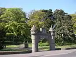 | |||
| Broughty Ferry, 96 Monifieth Road, Seabourne Lodge, Including Gatepiers | 56°28′12″N 2°51′17″W | Category C(S) | 25862 |  | |||
| Broughty Ferry, Queen Street, Public Library | 56°28′06″N 2°52′25″W | Category C(S) | 25869 |  | |||
| Broughty Ferry, 59-63 (Odd Nos) Reres Road, Airlie Lodge, Including Gatepiers And Boundary Walls | 56°28′21″N 2°51′18″W | Category C(S) | 25875 |  | |||
| Linlathen, East Bridge Over Dichty Water | 56°29′05″N 2°52′19″W | Category A | 25892 | .jpg.webp) | |||
| Stannergate, 306-308 Broughty Ferry Road, Including Boundary Wall | 56°28′08″N 2°55′29″W | Category C(S) | 25899 |  | |||
| West Ferry, 30 Albany Road, Balnacraig | 56°28′11″N 2°54′08″W | Category B | 25904 |  | |||
| West Ferry, Craigiebarn Road, Netherton Of Craigie Including Garden Wall | 56°28′18″N 2°54′56″W | Category B | 25916 |  | |||
| West Ferry, Craigiebarn Road, Craigiebarn, Including Garden Walls | 56°28′18″N 2°54′52″W | Category B | 25917 |  | |||
| West Ferry, 23 Douglas Terrace | 56°28′08″N 2°53′17″W | Category B | 25920 |  | |||
| Broughty Ferry, 150, 152 And 154 Brook Street, Masonic Hall | 56°28′02″N 2°52′36″W | Category B | 25772 |  | |||
| Broughty Ferry, Camperdown Street, Grove Academy, Including Boundary Walls And Railings | 56°28′12″N 2°52′49″W | Category B | 25774 |  | |||
| Broughty Ferry, 37 And 37A Camperdown Street, Cambus Lodge_Including Gatepiers And Boundary Walls | 56°28′11″N 2°52′33″W | Category C(S) | 25777 |  | |||
| Broughty Ferry, 42 Camphill Road, Craig-Gowan, Including_Walls And Gatepiers | 56°28′09″N 2°52′03″W | Category B | 25782 | 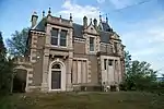 | |||
| Broughty Ferry, 44, 46 And 48 Camphill Road, Rowanbank, Including Wall, Gatepiers, Stable And Coach House | 56°28′10″N 2°52′00″W | Category B | 25783 |  | |||
| Broughty Ferry, 1-13 (Inclusive) Castle Terrace, Including Wall And Gatepiers, And Wall At Castle Street | 56°27′54″N 2°51′56″W | Category C(S) | 25788 |  | |||
| Broughty Ferry, Chapel Lane, Off Fisher Street, Old Burial Ground | 56°27′57″N 2°52′47″W | Category B | 25789 |  | |||
| Broughty Ferry, 8-18 Gray Street, Ferry House | 56°27′55″N 2°52′26″W | Category B | 25825 |  | |||
| Broughty Ferry, The Harbour | 56°27′50″N 2°52′19″W | Category B | 25828 | 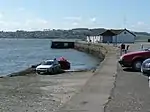 | |||
| Broughty Ferry, 6 Hermitage Road, The Hermitage Including Walls And Gatepiers | 56°28′06″N 2°52′12″W | Category B | 25832 |  | |||
| Broughty Ferry, 1A Hill Street | 56°28′11″N 2°52′28″W | Category C(S) | 25834 |  | |||
| Broughty Ferry, 21 Hill Street, Dunalistair Gardens, Vc House, Including Retaining Wall | 56°28′14″N 2°52′14″W | Category B | 25837 |  | |||
| Broughty Ferry, Hill Street, Lodge To Birchwood Roy (Formerly To Castleroy) | 56°28′14″N 2°52′11″W | Category B | 25838 |  | |||
| Broughty Ferry, 2 Hill Street, Including Boundary Wall, Gatepiers And Gateway | 56°28′11″N 2°52′29″W | Category C(S) | 25839 |  | |||
| Broughty Ferry, 8, 8A And 10 Hill Street, Herschel House | 56°28′09″N 2°52′22″W | Category C(S) | 25841 |  | |||
| 42-6 Wilkie's Lane, St Joseph's Roman Catholic Church And Presbytery, "Mount St Joseph" | 56°27′36″N 2°59′17″W | Category B | 25686 |  | |||
| Barnhill 11 Panmure Terrace, The Gorse, Including Former Coach House And Stable, Boundary Walls And Gatepiers | 56°28′24″N 2°51′09″W | Category C(S) | 25746 |  | |||
| Broughty Ferry, 19 Beach Crescent, Traquair | 56°27′55″N 2°52′24″W | Category B | 25760 |  | |||
| Broughty Ferry, 99 Beach Crescent And 1-5 (Odd Nos) St Vincent Street, The Red House | 56°27′52″N 2°52′17″W | Category B | 25763 |  | |||
| 21-29 (Odd Nos) Union Street | 56°27′32″N 2°58′16″W | Category B | 25580 |  | |||
| 31-47 Union Street, 25 Yeaman Shore | 56°27′32″N 2°58′15″W | Category B | 25582 |  | |||
| 10-16 (Even Nos) Perth Road | 56°27′24″N 2°58′44″W | Category C(S) | 25583 |  | |||
| 416, 418 Perth Road, Including Railings | 56°27′23″N 3°00′05″W | Category C(S) | 25609 |  | |||
| 428 Perth Road, Including Railings | 56°27′23″N 3°00′07″W | Category C(S) | 25613 |  | |||
| 1A West Bell Street, 18 Constitution Road, Regional Music Centre, Including Gatepiers And Railings, Formerly Bell Street Up Church | 56°27′45″N 2°58′30″W | Category B | 25622 |  | |||
| 474 Perth Road St Helens House, Lodge, Gatepiers And Boundary Walls | 56°27′20″N 3°00′46″W | Category B | 25628 |  | |||
| 484 Perth Road, Taypark With Boundary Walls | 56°27′21″N 3°00′54″W | Category B | 25630 |  | |||
| 10-22 (Even Nos) Whitehall Crescent | 56°27′33″N 2°58′10″W | Category B | 25649 |  | |||
| 3, 5, 7, Rockfield Street And 48, 50, 52 Shaftesbury Road Including Garden Walls And Gatepiers | 56°27′25″N 3°00′14″W | Category B | 25650 |  | |||
| 26-36 (Even Nos) Whitehall Street | 56°27′34″N 2°58′12″W | Category B | 25669 |  | |||
| 2-14 (Even Nos) Reform Street, 49, 50, 51 High Street | 56°27′39″N 2°58′14″W | Category B | 25525 |  | |||
| 38 And 40 Reform Street, 1 And 3 Bank Street | 56°27′41″N 2°58′18″W | Category B | 25533 |  | |||
| 60-64 (Even Nos) Reform Street, Meadow House | 56°27′43″N 2°58′20″W | Category B | 25538 |  | |||
| 239-257 (Odd Nos) Perth Road, Windsor Terrace, Including Boundary Walls And Gatepiers | 56°27′24″N 2°59′53″W | Category C(S) | 25539 |  | |||
| 33, 35 South Tay Street | 56°27′31″N 2°58′35″W | Category B | 25550 |  | |||
| 307-313 (Odd Nos) Perth Road, 1 Grosvenor Road, 62-6 (Even Nos) Shaftesbury Road, Grosvenor Terrace Boundary Walls And Gatepiers | 56°27′25″N 3°00′23″W | Category B | 25557 |  | |||
| 2, 4 South Tay Street, 115-121, (Odd Nos) Nethergate | 56°27′27″N 2°58′32″W | Category B | 25560 |  | |||
| 43-65 (Odd Nos) Trades Lane | 56°27′44″N 2°57′54″W | Category B | 25574 |  | |||
| 7 Guthrie Street, Railwaymen's Social Club, Former Ward Foundry Office | 56°27′40″N 2°58′49″W | Category C(S) | 25427 |  | |||
| 37, 39 Hyndford Street With Boundary Wall | 56°27′34″N 3°00′05″W | Category C(S) | 25445 |  | |||
| 2 Panmure Terrace, With Boundary Walls | 56°28′01″N 2°58′55″W | Category B | 25446 |  | |||
| Harrison Road, Timex Factory | 56°29′04″N 3°01′19″W | Category B | 25448 |  | |||
| 3 Panmure Terrace Druimbeg, With Boundary Walls | 56°28′01″N 2°58′57″W | Category B | 25450 |  | |||
| Pitalpin Street,335 South Road, Lochee, Pitalpin House | 56°28′29″N 3°01′31″W | Category B | 25460 |  | |||
| 2 Magdalen Place | 56°27′14″N 2°59′14″W | Category C(S) | 25462 |  | |||
| 105 Magdalen Yard Road, And 1A Osbourne Place, Osbourne Villa And Raewood Villa With Boundary Walls | 56°27′14″N 2°59′44″W | Category B | 25496 |  | |||
| 1-9 (Odd Nos) Milnbank Road And 2-12 (Even Nos) Polepark Road | 56°27′44″N 2°59′27″W | Category C(S) | 25502 |  | |||
| 2 Union Terrace, And Returns To Constitution Road And Constitution Terrace, Terrace House, With Boundary Walls And Gatepiers | 56°27′58″N 2°58′41″W | Category B | 25506 |  | |||
| Meadowside And Barrack Street, The Howff | 56°27′42″N 2°58′22″W | Category A | 25312 | 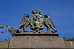 | |||
| 57 Forfar Road | 56°28′47″N 2°57′07″W | Category C(S) | 25315 |  | |||
| Gardner Street, Lawside Convent Of Mercy, Or St Joseph's Convent, Including Chapel, And Boundary Walls | 56°28′04″N 2°59′46″W | Category B | 25319 |  | |||
| Harefield Road, Florence Booth House, Formerly Clement Park, Including Stable Wall And Garden Balustrade | 56°28′35″N 3°00′31″W | Category B | 25330 |  | |||
| 4 Meadowside, Head Post Office | 56°27′44″N 2°58′25″W | Category B | 25336 | 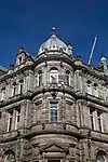 | |||
| 55 High Street Lochee, Tsb Former Dundee Savings Bank | 56°28′16″N 3°00′32″W | Category B | 25349 |  | |||
| 9, 11 Laurel Bank, Including Gatepiers And Boundary Walls | 56°27′55″N 2°58′32″W | Category C(S) | 25389 |  | |||
| 2, 4 Laurel Bank, With Boundary Walls, Railings And Gatepiers | 56°27′54″N 2°58′38″W | Category B | 25393 |  | |||
| 10 Laurel Bank, And Return To Prospect Place, With Boundary Walls, And Gatepiers | 56°27′56″N 2°58′35″W | Category C(S) | 25401 |  | |||
| 12 Laurel Bank, And Return To Prospect Place, With Boundary Walls And Gatepiers | 56°27′56″N 2°58′34″W | Category B | 25405 |  | |||
| 141, 143 Nethergate | 56°27′26″N 2°58′35″W | Category B | 25406 |  | |||
| 143C Nethergate | 56°27′27″N 2°58′36″W | Category B | 25410 |  | |||
| 1 High Street | 56°27′40″N 2°58′07″W | Category C(S) | 25215 |  | |||
| Crescent Street, Wallacetown Parish Church (Now Also Trinity Church, Church Of Scotland) | 56°28′03″N 2°57′36″W | Category B | 25216 |  | |||
| 1 Dudhope Terrace | 56°28′00″N 2°58′52″W | Category B | 25226 |  | |||
| 3 Dudhope Terrace | 56°28′00″N 2°58′55″W | Category B | 25233 |  | |||
| 70-73 (Inclusive Nos) High Street, Including Gardyne's Land, Gray's Close And Clock With Model Of The Town House | 56°27′40″N 2°58′11″W | Category A | 25239 | .jpg.webp) | |||
| 1-10 (Inclusive Nos) City Square And 5-8 (Inclusive Nos) High Street, East Wing Of City Square | 56°27′38″N 2°58′09″W | Category C(S) | 25255 |  | |||
| 234-238 (Even Nos) Hilltown, 4, 6 Stirling Street | 56°28′09″N 2°58′30″W | Category B | 25260 |  | |||
| 14-22 (Inclusive Nos) City Square, 22-24 (Inclusive Nos) High Street And 2-18 (Even Nos) Crichton Street, West Wing Of City Square | 56°27′37″N 2°58′12″W | Category B | 25262 | 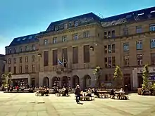 | |||
| 5-19 (Odd Nos) King Street And 28, 30, 32 Cowgate | 56°27′52″N 2°58′01″W | Category B | 25271 |  | |||
| 1-31 (Odd Nos) Lyon Street, And 30 Albert Street | 56°28′07″N 2°57′33″W | Category B | 25287 |  | |||
| 1 And 3 Perth Road, Ellenbank And Union Mount, University Of Dundee, Including Gatepiers And Boundary Wall | 56°27′26″N 2°58′48″W | Category B | 25289 | 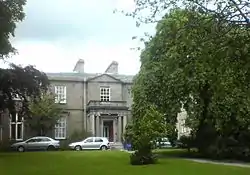 | |||
| 60 Small's Wynd, Old Technical Institute, Including Former College Hall, Boundary Wall And Gatepiers | 56°27′27″N 2°58′44″W | Category B | 25308 |  | |||
| Taylor's Lane, Seafield Works (West Side Of Taylor's Lane Only) | 56°27′19″N 2°59′39″W | Category A | 25111 |  | |||
| 11-19 (Odd Nos) Cowgate, Caxton House | 56°27′49″N 2°58′05″W | Category C(S) | 25120 |  | |||
| 11, 13 Crichton Street | 56°27′35″N 2°58′13″W | Category B | 25128 |  | |||
| 2 Wallace Street, Blackscroft And Constable Street, Wallace Craigie Works Offices | 56°27′58″N 2°57′29″W | Category B | 25136 |  | |||
| 2 Clive Street With Boundary Walls | 56°28′37″N 2°57′23″W | Category B | 25149 |  | |||
| 16-19 (Inclusive Nos) Dock Street/3-9 (Odd Nos) Exchange Street/15 Shore Terrace, Former Exchange Coffee House | 56°27′37″N 2°58′03″W | Category A | 25150 | .jpg.webp) | |||
| 56 West Henderson's Wynd, Former Meadow Or North Dudhope Mill | 56°27′44″N 2°59′04″W | Category B | 25152 |  | |||
| 2, 4 Constitution Terrace And 82, Constitution Street Including Boundary Walls And Gatepiers | 56°28′00″N 2°58′43″W | Category B | 25161 |  | |||
| 3 Coupar Angus Road Lochee West Church Manse | 56°28′29″N 3°00′45″W | Category C(S) | 25176 |  | |||
| Blacks Croft And Foundry Lane, "Ricks", Former St Roques Public Library, Including Railings, Balusters And Garden Walls | 56°27′54″N 2°57′42″W | Category B | 25191 |  | |||
| 2 Euclid Street, High School Preparatory Department | 56°27′45″N 2°58′28″W | Category B | 25193 |  | |||
| 2, 4 Candle Lane And 99 Seagate And 25-37 (Odd Nos) Trades Lane, Watson's Bond, Hm Customs Warehouse No 4 (Excluding 1 And 2-Storey Building) | 56°27′45″N 2°58′01″W | Category A | 25194 |  | |||
| 26 Castle Street, Castle Chambers | 56°27′38″N 2°58′05″W | Category B | 25028 |  | |||
| West Marketgait, 2 Guthrie Street And 30 East Henderson's Wynd, Former Tay Works Calender | 56°27′40″N 2°58′43″W | Category B | 25037 |  | |||
| 42-48 (Even Nos) Castle Street/2-8 (Even Nos) Exchange Street | 56°27′38″N 2°58′03″W | Category B | 25039 |  | |||
| Castle Street And Shore Terrace, North West Corner, Lampstandard | 56°27′37″N 2°58′04″W | Category C(S) | 25043 |  | |||
| 82-86 (Even Nos) Broughty Ferry Road | 56°28′00″N 2°57′09″W | Category B | 25045 |  | |||
| 19, 21 Commercial Street | 56°27′40″N 2°58′00″W | Category C(S) | 25055 |  | |||
| Caird Park, Mains Farm, Former Granary And Horse Mill Only | 56°29′03″N 2°57′34″W | Category C(S) | 25074 |  | |||
| 34 Commercial Street Former Flour Mill | 56°27′39″N 2°58′03″W | Category B | 25091 |  | |||
| Clatto Reservoir, With Sluice House, Entrance Railings And Gatepiers | 56°29′57″N 3°01′39″W | Category B | 25106 |  | |||
| Clatto Reservoir, Waterworks Cottage | 56°29′53″N 3°01′27″W | Category B | 25109 |  | |||
| 64, 66 Barrack Street And Return Elevation To South Ward Road, Friarfield House | 56°27′41″N 2°58′26″W | Category B | 24941 |  | |||
| Marine Parade, Harbour Workshops And Patent Slip | 56°27′36″N 2°57′38″W | Category A | 24957 |  | |||
| Telford Light, Dundee Waterfront Near Tay Bridge | 56°27′32″N 2°57′55″W | Category B | 24966 |  | |||
| 7, 9, 11 Bell Street, Baltic Chambers | 56°27′48″N 2°58′20″W | Category C(S) | 24973 |  | |||
| Barrack Rd Dundee Royal Infirmary Original Block Out Patients Dept & Urology Theatre | 56°27′55″N 2°58′51″W | Category A | 24982 |  | |||
| Constable Street And Return Elevation To Dens Street (E Side) | 56°27′56″N 2°57′43″W | Category B | 24985 |  | |||
| 17, 18 Baxter Park Terrace, 35 Park Avenue | 56°28′17″N 2°57′11″W | Category B | 25004 |  | |||
| 8 Bingham Terrace The Anchorage | 56°28′24″N 2°56′45″W | Category B | 25012 |  | |||
| 36, 38 Bingham Terrace | 56°28′26″N 2°56′31″W | Category C(S) | 25023 |  | |||
| 1 Albany Terrace, With Boundary Walls And Gatepiers | 56°28′03″N 2°58′56″W | Category B | 24924 |  | |||
| Albert Square, Statue Of Robert Burns | 56°27′44″N 2°58′19″W | Category B | 24925 |  | |||
| 28 Annfield Road, Baltic Works, Chimney And Former Mill | 56°27′29″N 2°59′31″W | Category B | 24927 |  | |||
| West Ferry, 22 Douglas Terrace | 56°28′08″N 2°53′15″W | Category C(S) | 25922 |  | |||
| West Ferry, 4 Duntrune Terrace, Melford Including Enclosing Wall And Gatepiers | 56°28′24″N 2°53′18″W | Category C(S) | 25933 |  | |||
| West Ferry, 92 And 94 Grove Road | 56°28′27″N 2°53′26″W | Category C(S) | 25945 |  | |||
| Broughty Ferry, 357 King Street, Links House, With Gatepiers And Boundary Walls At S, E And W | 56°27′55″N 2°52′13″W | Category B | 25846 |  | |||
| Broughty Ferry, 37 Monifieth Road, Kazarami, Including Boundary Wall | 56°28′05″N 2°52′00″W | Category B | 25851 |  | |||
| Broughty Ferry, 47 And 49 Monifieth Road, Including Wall And Gatepiers | 56°28′06″N 2°51′56″W | Category C(S) | 25852 |  | |||
| Broughty Ferry, 51 And 53 Monifieth Road, Including Garage, Walls And Gatepiers | 56°28′06″N 2°51′54″W | Category C(S) | 25853 |  | |||
| Broughty Ferry, 71 Monifieth Road, Reres Lodge, Including_Gatepiers And Boundary Wall | 56°28′07″N 2°51′46″W | Category C(S) | 25855 |  | |||
| Broughty Ferry, Queen Street, Guliston House, Former Queen Street Church, Including Wall And Railings | 56°28′06″N 2°52′28″W | Category B | 25873 |  | |||
| Broughty Ferry, 41 Reres Road, Former Stable Court To Rocknowe House | 56°28′17″N 2°51′35″W | Category C(S) | 25874 |  | |||
| Broughty Ferry, 30 Seafield Road, The Pines, Including Gatepiers, Boundary Wall And Lampstandard | 56°27′31″N 2°58′15″W | Category C(S) | 25882 |  | |||
| Broughty Ferry, 2 Whinnybrae, Eastern Primary School, Including Wall And Entrance Gates, And Playsheds And_Lavatories At Rear | 56°28′05″N 2°52′06″W | Category A | 25887 | 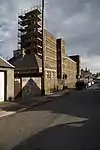 | |||
| Lammerton, Road Bridge Over Murroes Burn | 56°29′25″N 2°53′12″W | Category B | 25890 |  | |||
| Linlathen, West Bridge Over Dichty Water | 56°29′00″N 2°52′40″W | Category A | 25893 |  | |||
| Stannergate, 310 Broughty Ferry Road, Ingleside, Including Gatepiers And Boundary Walls | 56°28′08″N 2°55′27″W | Category B | 25900 |  | |||
| West Ferry, 3 Albert Road, Broomfield Nurseries, Including Conservatory, Formerly Broomhall | 56°28′16″N 2°53′07″W | Category B | 25907 |  | |||
| West Ferry, 4 And 6 Bayfield Road And 16 Albert Road, Lynfield, Including Gatepiers And Wall | 56°28′12″N 2°53′04″W | Category B | 25910 |  | |||
| West Ferry, Beach Lane, Railway Footbridge | 56°28′07″N 2°53′31″W | Category B | 25911 |  | |||
| West Ferry, Claypotts Road, Claypotts Castle | 56°28′35″N 2°53′24″W | Category A | 25913 | 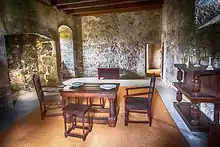 | |||
| Broughty Ferry, 1, 3 And 5 Camphill Road, Enclosing Wall And Gatepiers Only | 56°28′07″N 2°52′29″W | Category C(S) | 25778 |  | |||
| Broughty Ferry, 115 Fisher Street, Barometer Cottage | 56°27′54″N 2°52′37″W | Category B | 25800 |  | |||
| Broughty Ferry, Fisher Street, Lifeboat House, Including Slipway | 56°27′54″N 2°52′38″W | Category B | 25805 |  | |||
| Broughty Ferry, 20 Gray Street | 56°27′55″N 2°52′25″W | Category B | 25826 |  | |||
| Broughty Ferry, 22 Gray Street | 56°27′56″N 2°52′25″W | Category B | 25827 |  | |||
| 1-6 (Inclusive Nos) Windsor Place | 56°27′15″N 2°59′49″W | Category B | 25687 |  | |||
| Baldovie, Baldovie Toll House | 56°29′20″N 2°53′33″W | Category B | 25735 |  | |||
| Balmossie, Panmure Bleachfield, Cottages And Stable Block | 56°28′56″N 2°50′40″W | Category B | 25740 |  | |||
| Balmossie, Panmure Bleachfield, House/Tenement | 56°28′58″N 2°50′54″W | Category B | 25741 |  | |||
| Barnhill, Invermark Terrace, Barnhill St Margaret's Church | 56°28′25″N 2°50′52″W | Category B | 25743 |  | |||
| Barnhill, 6 And 8 Panmure Terrace, Ferncroft, Including Garage, Gatepiers And Gates | 56°28′23″N 2°51′08″W | Category B | 25749 |  | |||
| Barnhill, 27 Strathmore Street, Barnhill Cemetery Lodge | 56°28′29″N 2°51′25″W | Category C(S) | 25750 |  |
Key
The scheme for classifying buildings in Scotland is:
- Category A: "buildings of national or international importance, either architectural or historic; or fine, little-altered examples of some particular period, style or building type."[1]
- Category B: "buildings of regional or more than local importance; or major examples of some particular period, style or building type, which may have been altered."[1]
- Category C: "buildings of local importance; lesser examples of any period, style, or building type, as originally constructed or moderately altered; and simple traditional buildings which group well with other listed buildings."[1]
In March 2016 there were 47,288 listed buildings in Scotland. Of these, 8% were Category A, and 50% were Category B, with the remaining 42% being Category C.[2]
See also
Notes
- Sometimes known as OSGB36, the grid reference (where provided) is based on the British national grid reference system used by the Ordnance Survey.
• "Guide to National Grid". Ordnance Survey. Retrieved 12 December 2007.
• "Get-a-map". Ordnance Survey. Retrieved 17 December 2007. - Historic Environment Scotland assign a unique alphanumeric identifier to each designated site in Scotland, for listed buildings this always begins with "LB", for example "LB12345".
References
- All entries, addresses and coordinates are based on data from Historic Scotland. This data falls under the Open Government Licence
- "What is Listing?". Historic Environment Scotland. Retrieved 29 May 2018.
- Scotland's Historic Environment Audit 2016 (PDF). Historic Environment Scotland and the Built Environment Forum Scotland. pp. 15–16. Retrieved 29 May 2018.
This article is issued from Wikipedia. The text is licensed under Creative Commons - Attribution - Sharealike. Additional terms may apply for the media files.