List of listed buildings in Dundee/3
List
| Name | Location | Date Listed | Grid Ref. [note 1] | Geo-coordinates | Notes | LB Number [note 2] | Image |
|---|---|---|---|---|---|---|---|
| Barnhill, Strathmore Street, Barnhill Cemetery, Gilroy Mausoleum | 56°28′35″N 2°51′25″W | Category B | 25752 |  | |||
| Broughty Ferry, 11-13 Beach Crescent, Including Enclosing Wall | 56°27′55″N 2°52′25″W | Category B | 25759 |  | |||
| Broughty Ferry, 41-47 (Odd Nos) Beach Crescent, Beach House | 56°27′54″N 2°52′22″W | Category B | 25762 |  | |||
| 389 Perth Road Ardshiel, Formerly The Hirsel, Including Boundary Walls | 56°27′28″N 3°01′46″W | Category B | 25579 |  | |||
| 9, 11, 13 Ward Road, 1 Rattray Street, 4 Nicoll Street | 56°27′43″N 2°58′31″W | Category B | 25604 |  | |||
| 414 Perth Road, Including Railings | 56°27′23″N 3°00′04″W | Category C(S) | 25607 |  | |||
| 31 Ward Road, Strathmore Lodge, Salvation Army Hostel, Including Gatepiers And Boundary Wall | 56°27′42″N 2°58′40″W | Category B | 25608 |  | |||
| 6 Ward Road Baptist Church | 56°27′41″N 2°58′29″W | Category B | 25614 |  | |||
| 470 Perth Road Harris Academy, Including Janitor's House, Railing And Gatepiers Excluding Addition At West | 56°27′22″N 3°00′32″W | Category B | 25625 |  | |||
| 6 West Bell Street, Sheriff Court Buildings, Including Boundary Walls And Railings | 56°27′44″N 2°58′40″W | Category B | 25631 | 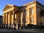 | |||
| West Bell Street, War Memorial To Dundee City Police | 56°27′43″N 2°58′42″W | Category C(S) | 25633 |  | |||
| 10-16 (Even Nos) Whitehall Crescent, Lampstandard | 56°27′34″N 2°58′09″W | Category C(S) | 25647 |  | |||
| 15 Roseangle And Mcvicar's Lane, Johnfield | 56°27′21″N 2°59′00″W | Category B | 25652 |  | |||
| 26-42 (Even Nos) Whitehall Crescent, 1-8 (Inclusive Nos) Dock Street Tay Hotel | 56°27′32″N 2°58′10″W | Category B | 25653 | 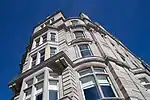 | |||
| 41 Roseangle (Front Block Only) With Boundary Walls | 56°27′14″N 2°59′10″W | Category C(S) | 25658 |  | |||
| 14-24 (Even Nos) Whitehall Street | 56°27′35″N 2°58′12″W | Category B | 25667 |  | |||
| 21 Perth Road (Dundee University) Former Hermonhill House | 56°27′24″N 2°59′04″W | Category B | 25526 |  | |||
| 31 South Tay Street | 56°27′30″N 2°58′34″W | Category B | 25548 |  | |||
| 299 Perth Road And 2 Rockfield Street, East Rockfield, With Boundary Walls And Gatepiers | 56°27′25″N 3°00′17″W | Category C(S) | 25551 |  | |||
| 319 Perth Road, West Park Hall, Lodge, Boundary Walls And Gatepiers | 56°27′26″N 3°00′37″W | Category B | 25561 |  | |||
| 6, 8, 10 South Tay Street, 1 Tay Square | 56°27′28″N 2°58′33″W | Category B | 25562 |  | |||
| 327 Perth Road Ardmere, House And Lodge, Boundary Walls And Gatepiers | 56°27′24″N 3°00′44″W | Category B | 25565 |  | |||
| 15-29 (Odd Nos) Tay Street Lane | 56°27′31″N 2°58′33″W | Category C(S) | 25572 |  | |||
| 289-297 (Odd Nos) Hawkhill "Gowrie Place" Including Gatepiers, Garden Walls And Railings | 56°27′24″N 2°59′41″W | Category B | 25435 |  | |||
| Methven Street, Lochee Old Parish Church And Hall (Formerly St Ninian's Church Of Scotland) | 56°28′24″N 3°00′35″W | Category B | 25436 |  | |||
| 8 Panmure Terrace, With Boundary Walls And Gatepiers | 56°28′01″N 2°59′01″W | Category B | 25454 |  | |||
| 9 St Mary's Lane, St Mary's Primary School, With Boundary Walls And Railings | 56°28′17″N 3°00′29″W | Category B | 25466 |  | |||
| Salem Street, Salem Chapel Church Of Christ | 56°27′51″N 2°58′32″W | Category C(S) | 25470 |  | |||
| 53 Magdalen Yard Road And 50 Thomson Street | 56°27′12″N 2°59′20″W | Category B | 25472 |  | |||
| 170 Nethergate, Spring Grove Cottage, Including Boundary Walls And Railings | 56°27′24″N 2°58′39″W | Category B | 25474 |  | |||
| 6 Nicoll Street, 3 Rattray Street, Dundee Institute Of Technology Annexe, Formerly Foresters' Halls | 56°27′43″N 2°58′31″W | Category B | 25480 |  | |||
| 15 Springhill | 56°28′07″N 2°57′00″W | Category B | 25485 |  | |||
| 11-19 (Odd Nos) Panmure Street | 56°27′47″N 2°58′10″W | Category B | 25492 |  | |||
| 21-25 (Odd Nos) Panmure Street | 56°27′47″N 2°58′09″W | Category C(S) | 25495 |  | |||
| 8 Panmure Street | 56°27′48″N 2°58′11″W | Category C(S) | 25501 |  | |||
| 15-20 (Inclusive) Trottick Mains | 56°29′31″N 2°58′14″W | Category C(S) | 25503 |  | |||
| 32 Milnbank Road With Railings And Boundary Walls | 56°27′43″N 2°59′33″W | Category B | 25511 |  | |||
| 2 Norwood Crescent, Pine-Mount, With Thatched Summerhouse, Boundary Wall And Gatepiers | 56°27′33″N 3°00′52″W | Category C(S) | 25517 |  | |||
| St Salvador Street And Church Street, St Salvador's Episcopal Church And Hall | 56°28′12″N 2°58′17″W | Category A | 25314 | .jpg.webp) | |||
| 5-9 Meadowside Or Albert Square, Former Gaelic Free Church Or Albert Square Church | 56°27′44″N 2°58′16″W | Category B | 25316 | .jpg.webp) | |||
| 95, 97 Seagate, Loyal Order Of Ancient Shepherds, Central Halls | 56°27′46″N 2°58′01″W | Category B | 25321 |  | |||
| 51, 53 Meadowside | 56°27′49″N 2°58′13″W | Category B | 25335 |  | |||
| 7-15 (Odd Nos) Murraygate | 56°27′43″N 2°58′07″W | Category B | 25350 |  | |||
| 25-31 (Odd Nos) Murraygate | 56°27′44″N 2°58′06″W | Category B | 25354 |  | |||
| 35-39 (Odd Nos) Murraygate, Bank Of Scotland, Including Railings And Lampstandards | 56°27′45″N 2°58′05″W | Category B | 25358 |  | |||
| 1, 3, 5 Blackness Avenue And 299 Hawkhill With Boundary Walls And Gatepiers | 56°27′25″N 2°59′44″W | Category B | 25364 |  | |||
| Invergowrie Drive Invergowrie House | 56°27′41″N 3°02′14″W | Category A | 25369 |  | |||
| Kinghorne Road, The High Kirk Including Railings | 56°28′11″N 2°59′01″W | Category B | 25373 |  | |||
| 434, 436 Blackness Road, Balcairn With Stables, Boundary Walls And Gatepiers | 56°27′32″N 3°01′13″W | Category C(S) | 25396 |  | |||
| 123-131 (Odd Nos) Nethergate | 56°27′27″N 2°58′32″W | Category B | 25398 |  | |||
| 23 Farington Street, Tillyloss With Boundary Walls And Railings | 56°27′30″N 3°01′02″W | Category C(S) | 25412 |  | |||
| Law Road Water Tower | 56°28′14″N 2°59′00″W | Category B | 25413 | 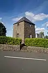 | |||
| 30 Farington Street, Moraig With Boundary Walls And Gatepiers | 56°27′31″N 3°01′04″W | Category C(S) | 25416 |  | |||
| Longtown Road, St Ninian's Episcopal Church | 56°28′39″N 2°55′53″W | Category C(S) | 25424 |  | |||
| Cowgate, Cowgait Port Or Wishart Arch | 56°27′54″N 2°57′51″W | Category A | 25209 | 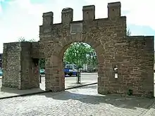 | |||
| Eadie's Road, Forebank House | 56°27′59″N 2°58′13″W | Category B | 25228 |  | |||
| 24 Forebank Road Including Garden Walls | 56°28′00″N 2°58′12″W | Category C(S) | 25241 |  | |||
| 61 King Street, Wishart Centre Former Wishart Memorial Church Including Railings | 56°27′54″N 2°57′53″W | Category B | 25275 |  | |||
| 2 King Street, St Andrews Church, Including Graveyard, Gate-Piers, Railings And Gates. (Church Of Scotland) | 56°27′53″N 2°58′05″W | Category A | 25279 |  | |||
| Off Perth Road, Geddes Quadrangle, Harris Building, University Of Dundee | 56°27′27″N 2°58′50″W | Category B | 25281 |  | |||
| 4 King Street, Former Kail Kirk Or Glasite Church, Now Hall Of St Andrews Church | 56°27′52″N 2°58′03″W | Category B | 25283 |  | |||
| 3, 5 Forfar Road | 56°28′32″N 2°57′15″W | Category C(S) | 25292 |  | |||
| 7 Forfar Road And 12 Madeira Street | 56°28′32″N 2°57′15″W | Category C(S) | 25295 |  | |||
| 55, 55A, 59 And 61 Small's Wynd, Former Fleming Gymnasium, Boiler House And Jute Shed, University Of Dundee | 56°27′27″N 2°58′47″W | Category B | 25300 |  | |||
| 24 Powrie Place | 56°28′01″N 2°58′17″W | Category B | 25302 |  | |||
| 3-9 (Odd Nos) Crichton Street, Crichton Buildings | 56°27′36″N 2°58′13″W | Category B | 25124 |  | |||
| 67 And 69 Clepington Road With Boundary Wall | 56°28′40″N 2°57′17″W | Category C(S) | 25133 |  | |||
| 41-57 (Odd Nos) Albert Street, 2 Raglan Street | 56°28′08″N 2°57′27″W | Category B | 25160 |  | |||
| 32, 33, 34 Dock Street | 56°27′38″N 2°57′59″W | Category C(S) | 25162 |  | |||
| 110, 116 Albert Street, St John's Episcopal Church And Former Hall | 56°28′14″N 2°57′28″W | Category B | 25168 |  | |||
| 12, 14 Constitution Terrace, And 72, 74 Constitution Street, With Boundary Walls And Garden Balustrade | 56°28′01″N 2°58′40″W | Category C(S) | 25169 |  | |||
| 69 Dalkeith Road Former Manse Of Dundee, Now Auchinhove | 56°28′22″N 2°56′52″W | Category B | 25184 |  | |||
| 5 Arthurstone Terrace, Arthurstone Public Library | 56°28′10″N 2°57′32″W | Category B | 25187 | _-_geograph.org.uk_-_9110.jpg.webp) | |||
| 20-24 (Even Nos) Castle Street, Former St Paul's Episcopal Chapel | 56°27′39″N 2°58′06″W | Category B | 25024 |  | |||
| 40, 42 Bingham Terrace | 56°28′26″N 2°56′30″W | Category C(S) | 25027 |  | |||
| 44, 46 Bingham Terrace | 56°28′26″N 2°56′28″W | Category C(S) | 25032 |  | |||
| 28-38 (Even Nos) Castle Street | 56°27′38″N 2°58′05″W | Category B | 25033 |  | |||
| 3, 5, 7 Commercial Street, Including Travelling Crane And Hydraulic Lift | 56°27′40″N 2°57′58″W | Category B | 25046 |  | |||
| Methven Street, Camperdown Works, Arcade Fronting Boiler House | 56°28′21″N 3°00′16″W | Category B | 25061 |  | |||
| 27-33 (Odd Nos) Commercial Street | 56°27′41″N 2°58′02″W | Category B | 25063 |  | |||
| 73-99 (Odd Nos) Commercial Street/15, 17 Meadowside/2-10 (Even Nos) Murraygate | 56°27′45″N 2°58′11″W | Category A | 25075 |  | |||
| Camperdown House, Camperdown Country Park | 56°29′04″N 3°02′34″W | Category A | 25078 | 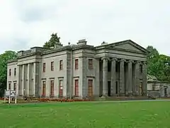 | |||
| Lochee, Stewart's Lane, Donald's Lane And Pitalpin Street, Pitalpin Works | 56°28′30″N 3°01′29″W | Category B | 25108 |  | |||
| Bright Street Boys Brigade Hall, Former Camperdown Works Half-Timer's School | 56°28′26″N 3°00′35″W | Category B | 24946 |  | |||
| 46 Ancrum Road, Lochee Park Lodge And Gatepiers | 56°28′06″N 3°00′40″W | Category B | 24958 |  | |||
| 27, 29, 31 Bank Street | 56°27′39″N 2°58′23″W | Category B | 24959 |  | |||
| 25 Brown Street, Old Tay Works Mills, Engine Houses And Chimney | 56°27′42″N 2°58′46″W | Category A | 24960 |  | |||
| Baffin Street And Lilybank Rd Glebelands Primary School | 56°28′06″N 2°57′12″W | Category B | 24967 |  | |||
| Burnside Street, Former Camperdown Works Jute Warehouses 5, 6, 7, 8, 14, 15 | 56°28′16″N 3°00′17″W | Category B | 24975 |  | |||
| Baxter Park, North Lodge Pitkerro Road | 56°28′26″N 2°57′12″W | Category C(S) | 24996 |  | |||
| 7-21 (Odd Nos) Castle Street, Former Theatre Royal | 56°27′38″N 2°58′07″W | Category B | 25001 |  | |||
| 9-17 (Odd Nos) Guthrie Street And Return Elevation To Blinshall Street, Former East Mill | 56°27′40″N 2°58′51″W | Category B | 25007 |  | |||
| Kemback Street And Return Elevation To Craigie Street, Wellfield Works (Buildings With Elevations To Kemback And Craigie Streets Only) | 56°28′15″N 2°57′19″W | Category B | 25018 |  | |||
| 14-18 (Even Nos), Castle Street | 56°27′39″N 2°58′06″W | Category C(S) | 25020 |  | |||
| Camperdown Dock, Transit Shed 25, Or G Shed | 56°27′48″N 2°57′22″W | Category B | 24928 |  | |||
| Balgay Park, Mills Observatory | 56°27′54″N 3°00′45″W | Category B | 48924 | 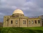 | |||
| Perth Road, University Of Dundee, The Tower | 56°27′26″N 2°58′41″W | Category B | 51058 | 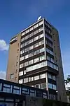 | |||
| Mains Parish Wwi Black Watch Memorial, Caird Park | 56°29′09″N 2°57′23″W | Category B | 51412 |  | |||
| West Ferry, 20 Dundee Road, Taycliff, Including Gatepiers And Boundary Wall | 56°28′08″N 2°53′56″W | Category C(S) | 25926 |  | |||
| West Ferry, 64 Dundee Road | 56°28′08″N 2°53′16″W | Category C(S) | 25931 |  | |||
| West Ferry, 7 Ellieslea Road, Hazelwood, (Formerly Carmel Bank) Including Lamp Standard, Gatepiers And Boundary Walls | 56°28′16″N 2°53′38″W | Category B | 25934 |  | |||
| West Ferry, 11 Fairfield Road, Craigmore Lodge | 56°28′13″N 2°54′02″W | Category C(S) | 25937 |  | |||
| West Ferry, 10 Fairfield Road And 54 And 56 Strathern Road, Invergarry Including Gatepiers And Enclosing Wall At 58 Strathern Road | 56°28′19″N 2°54′02″W | Category B | 25942 |  | |||
| Broughty Ferry, 20-24 (Even Nos) Monifieth Road | 56°28′03″N 2°52′03″W | Category C(S) | 25860 |  | |||
| Broughty Ferry, Reres Road, Reres House, Including Coach House Block And Terraced Garden Walls | 56°28′10″N 2°51′47″W | Category B | 25876 |  | |||
| Broughty Ferry, 23 Seafield Road, Including Walls And Entrance Gate | 56°28′17″N 2°52′42″W | Category B | 25880 |  | |||
| Lammerton, Former Lammerton School | 56°29′26″N 2°53′09″W | Category C(S) | 25889 |  | |||
| Linlathen, Arbroath Road, Linlathen South Lodge, Including Wall, Gatepiers And Quadrants | 56°28′48″N 2°52′41″W | Category B | 25891 |  | |||
| Pitkerro, Pitkerro House, Former Coach House And Stable Court | 56°29′33″N 2°53′22″W | Category C(S) | 25896 |  | |||
| West Ferry, 47 Albany Road And 8 Ellieslea Road, Milton Bank, Including Wall And Gatepiers | 56°28′19″N 2°53′36″W | Category B | 25903 |  | |||
| West Ferry, 1 Albert Road, Aystree Lodge, Including Boundary Wall | 56°28′14″N 2°53′12″W | Category B | 25906 |  | |||
| West Ferry, 1 Belsize Road And 2 Strathern Road, Belsize House, Including Lamp Standard And Gatepiers | 56°28′12″N 2°54′38″W | Category C(S) | 25912 |  | |||
| West Ferry, 43 Craigie Drive, The Wyck, Including Wall And Gatepiers, Garage And Garden Shed | 56°28′09″N 2°55′00″W | Category B | 25915 |  | |||
| Broughty Ferry, 151 Brook Street, Ymca Mainblock | 56°28′04″N 2°52′39″W | Category B | 25766 |  | |||
| Broughty Ferry, 33 Camperdown Street, St Stephen's And West Manse, Including Wall And Gatepiers | 56°28′11″N 2°52′36″W | Category B | 25775 |  | |||
| Broughty Ferry, 61-73 (Odd Nos) Fisher Street | 56°27′55″N 2°52′42″W | Category C(S) | 25795 |  | |||
| Broughty Ferry, Fisher Street, Quay And Pier, Including Bollards, Lamp Standards And Moor Rings | 56°27′53″N 2°52′31″W | Category B | 25806 |  | |||
| Broughty Ferry, 5 Fort Street, St James Church And Hall, And Former Fishermen's Reading Room | 56°27′56″N 2°52′39″W | Category C(S) | 25807 | 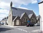 | |||
| Broughty Ferry, 37-41 (Odd Nos) Fort Street And 146 King Street | 56°27′57″N 2°52′37″W | Category B | 25808 |  | |||
| Broughty Ferry, 6-8 (Even Nos) Fort Street | 56°27′55″N 2°52′37″W | Category C(S) | 25810 |  | |||
| Broughty Ferry, 50 Fort Street | 56°27′59″N 2°52′35″W | Category C(S) | 25816 |  | |||
| Broughty Ferry, 21-25 (Odd Nos) Forthill Road, Ayrebrayde, Including Stable And Coach House, Gatepiers, Gates And Boundary Wall | 56°28′24″N 2°52′31″W | Category B | 25817 |  | |||
| Broughty Ferry, 81 And 83 Gray Street | 56°28′00″N 2°52′25″W | Category B | 25821 |  | |||
| Broughty Ferry, The Harbour, Broughty Castle | 56°27′47″N 2°52′13″W | Category A | 25829 |  | |||
| Broughty Ferry, 17 King Street | 56°28′01″N 2°52′52″W | Category C(S) | 25843 |  | |||
| 11 Westfield Place, Westfield Cottage | 56°27′20″N 2°59′12″W | Category B | 25683 |  | |||
| 57 Magdalen Yard Road And 26,28 Paton's Lane With Boundary Walls And Gatepiers | 56°27′13″N 2°59′24″W | Category B | 25689 |  | |||
| Barnhill, Strathmore Street, Barnhill Cemetery Including Boundary Walls, Gates And Gatepiers | 56°28′33″N 2°51′25″W | Category C(S) | 25751 |  | |||
| Broughty Ferry, 1 Ambrose Street | 56°27′54″N 2°52′32″W | Category C(S) | 25753 |  | |||
| Broughty Ferry, 3 Ambrose Street | 56°27′54″N 2°52′32″W | Category C(S) | 25754 |  | |||
| Broughty Ferry, 9 Beach Crescent, Including Enclosing Wall | 56°27′55″N 2°52′26″W | Category B | 25758 |  | |||
| Broughty Ferry, Beach Crescent, 9 Lamp Standards | 56°27′53″N 2°52′22″W | Category B | 25764 |  | |||
| 2-10 (Even Nos) Union Street, 40 Nethergate | 56°27′34″N 2°58′16″W | Category B | 25584 |  | |||
| 18-38 (Even Nos) Perth Road | 56°27′24″N 2°58′44″W | Category C(S) | 25585 |  | |||
| 40 Perth Road | 56°27′24″N 2°58′47″W | Category B | 25587 |  | |||
| 14 Ward Road | 56°27′41″N 2°58′32″W | Category B | 25618 |  | |||
| 488 Perth Road, Cidhmore House And Lodge | 56°27′21″N 3°01′01″W | Category B | 25632 |  | |||
| 7 And 9 Whitehall Crescent | 56°27′34″N 2°58′11″W | Category B | 25637 |  | |||
| Riverside Drive, Vernonholme House, Garage, Lodge And Gatepiers | 56°27′19″N 3°01′26″W | Category B | 25646 |  | |||
| 28 Whitehall Crescent, Lampstandard | 56°27′32″N 2°58′12″W | Category C(S) | 25655 |  | |||
| 18, 20 Victoria Road Hilltown, And 47-51 (Odd Nos) Dudhope Street | 56°27′53″N 2°58′16″W | Category B | 25524 |  | |||
| 34 Reform Street | 56°27′41″N 2°58′16″W | Category B | 25531 |  | |||
| 259 Perth Road And Seymour Street, Seymour Lodge, Including Wall And Railings To Seymour Street, Excluding Additions At Rear | 56°27′25″N 2°59′59″W | Category A | 25542 | 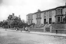 | |||
| 261 Perth Road Including Boundary Walls | 56°27′25″N 3°00′00″W | Category C(S) | 25545 |  | |||
| 301 Perth Road Rockfield, With Boundary Walls And Gatepiers | 56°27′25″N 3°00′18″W | Category C(S) | 25553 |  | |||
| 24-32 (Even Nos) South Tay Street | 56°27′30″N 2°58′36″W | Category B | 25566 |  | |||
| 387 Perth Road Or 2 Hazel Avenue Morar, Including Boundary Walls | 56°27′28″N 3°01′45″W | Category B | 25577 |  | |||
| 106 Nethergate, Mecca Playhouse Tower (Formerly Green's Playhouse) | 56°27′31″N 2°58′23″W | Category B | 25437 |  | |||
| 112-116 (Even Nos) Nethergate, Meadowside St Paul's Church Of Scotland, Cornerstone Coffee House And Church Of Scotland Bookshop | 56°27′30″N 2°58′22″W | Category B | 25441 |  | |||
| 150 Nethergate, St Andrew's Roman Catholic Cathedral, Including Presbytery And Former Sea Wall To South | 56°27′27″N 2°58′29″W | Category B | 25455 |  |
Key
The scheme for classifying buildings in Scotland is:
- Category A: "buildings of national or international importance, either architectural or historic; or fine, little-altered examples of some particular period, style or building type."[1]
- Category B: "buildings of regional or more than local importance; or major examples of some particular period, style or building type, which may have been altered."[1]
- Category C: "buildings of local importance; lesser examples of any period, style, or building type, as originally constructed or moderately altered; and simple traditional buildings which group well with other listed buildings."[1]
In March 2016 there were 47,288 listed buildings in Scotland. Of these, 8% were Category A, and 50% were Category B, with the remaining 42% being Category C.[2]
See also
Notes
- Sometimes known as OSGB36, the grid reference (where provided) is based on the British national grid reference system used by the Ordnance Survey.
• "Guide to National Grid". Ordnance Survey. Retrieved 12 December 2007.
• "Get-a-map". Ordnance Survey. Retrieved 17 December 2007. - Historic Environment Scotland assign a unique alphanumeric identifier to each designated site in Scotland, for listed buildings this always begins with "LB", for example "LB12345".
References
- All entries, addresses and coordinates are based on data from Historic Scotland. This data falls under the Open Government Licence
- "What is Listing?". Historic Environment Scotland. Retrieved 29 May 2018.
- Scotland's Historic Environment Audit 2016 (PDF). Historic Environment Scotland and the Built Environment Forum Scotland. pp. 15–16. Retrieved 29 May 2018.
This article is issued from Wikipedia. The text is licensed under Creative Commons - Attribution - Sharealike. Additional terms may apply for the media files.