List of listed buildings in Edinburgh/21
List
| Name | Location | Date Listed | Grid Ref. [note 1] | Geo-coordinates | Notes | LB Number [note 2] | Image |
|---|---|---|---|---|---|---|---|
| 19 And 20 East Terrace | 55°59′23″N 3°23′41″W | Category B | 40348 |  | |||
| 6A And 6B Newhalls Road, Hawes Garage | 55°59′24″N 3°23′07″W | Category C(S) | 40355 |  | |||
| 1 And 2 Smith's Land | 55°59′22″N 3°23′45″W | Category C(S) | 40372 |  | |||
| 3-5 (Odd Nos) Spottiswoode Street | 55°56′20″N 3°11′54″W | Category B | 30595 |  | |||
| 14 Spottiswoode Street | 55°56′20″N 3°11′52″W | Category B | 30601 |  | |||
| 9-11 (Incl Nos) Warrender Park Crescent Incl Railings | 55°56′17″N 3°12′06″W | Category B | 30611 |  | |||
| 45-47 Warrender Park Road | 55°56′19″N 3°11′44″W | Category B | 30619 |  | |||
| 36-40 (Even Nos) Warrender Park Road | 55°56′17″N 3°11′38″W | Category C(S) | 30641 |  | |||
| 48-54 (Even Nos)Warrender Park Rd & 29-35 Marchmont Road | 55°56′17″N 3°11′40″W | Category C(S) | 30643 |  | |||
| 2-4 (Incl Nos) Warrender Park Terrace Including Railings | 55°56′21″N 3°11′45″W | Category B | 30645 |  | |||
| 127 Grange Loan | 55°55′51″N 3°11′35″W | Category B | 30508 |  | |||
| 16 Greenhill Gardens Including Gatepiers | 55°56′06″N 3°12′19″W | Category B | 30516 |  | |||
| 28 Greenhill Gardens | 55°56′02″N 3°12′17″W | Category C(S) | 30518 |  | |||
| 6 Kilgraston Road Incl Conservatory Pedestrian Gateway & Boundary Walls | 55°55′58″N 3°11′36″W | Category B | 30528 |  | |||
| 35 Marchmont Crescent | 55°56′15″N 3°11′37″W | Category B | 30534 |  | |||
| 15-19 Odd Nos Marchmont Road | 55°56′21″N 3°11′41″W | Category B | 30541 |  | |||
| 46-50 (Even Nos) Marchmont Road | 55°56′16″N 3°11′43″W | Category C(S) | 30559 |  | |||
| 126-134 (Even Nos) Marchmont Road | 55°56′07″N 3°11′40″W | Category B | 30566 |  | |||
| 4 Oswald Road Incl Boundary Wall And Gatepiers | 55°55′48″N 3°11′38″W | Category B | 30588 |  | |||
| 14 Oswald Road With Boundary Walls And Gates | 55°55′38″N 3°11′38″W | Category A | 30589 | 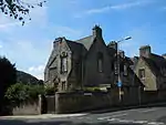 | |||
| 6 6A And 6B St Margarets Road | 55°56′03″N 3°12′10″W | Category C(S) | 30590 |  | |||
| Melville Drive (Eastern End) 2 Ornamental Pillars | 55°56′25″N 3°11′00″W | Category B | 30453 | %252C_Pillars_-_20170917160514.jpg.webp) | |||
| 7, 7A, And 7B Palmerston Road | 55°56′10″N 3°11′34″W | Category C(S) | 30457 |  | |||
| 9A, 9B, And 9C Palmerston Road Including Boundary Walls And Gatepiers | 55°56′09″N 3°11′34″W | Category B | 30458 |  | |||
| 14-18 (Inclusive Nos) Rillbank Terrace And 4 Rillbank_Crescent | 55°56′21″N 3°11′22″W | Category B | 30463 |  | |||
| 3 And 5 St Catherine's Place | 55°56′13″N 3°11′04″W | Category C(S) | 30471 |  | |||
| 4 And 5 Sylvan Place | 55°56′21″N 3°11′26″W | Category B | 30484 |  | |||
| 2-8 (Even Nos) Warrender Park Road | 55°56′17″N 3°11′30″W | Category B | 30487 | 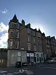 | |||
| 1-3 Blackford Road Including Boundary Walls | 55°55′55″N 3°11′58″W | Category B | 30496 |  | |||
| 7 Clinton Road, East Morningside House, Lodge | 55°55′56″N 3°12′08″W | Category C(S) | 30500 |  | |||
| 19, 21, 23 Grange Road, Primrose Villas | 55°56′12″N 3°11′01″W | Category C(S) | 30390 |  | |||
| 49 And 51 Grange Road | 55°56′10″N 3°11′13″W | Category B | 30391 | 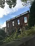 | |||
| 11 Kilgraston Road (Lodge) And 5 And 6 Easdaile Bank (Easdale House) Including Gatepiers And Boundary Walls | 55°55′55″N 3°11′32″W | Category C(S) | 30403 |  | |||
| 15 Lauder Road, St Andrews Cottage, Including Boundary Walls And Pedestrian Gateway | 55°56′01″N 3°11′07″W | Category C(S) | 30404 |  | |||
| 28 And 30 Lauder Road With Gatepiers And Boundary Walls | 55°56′05″N 3°11′14″W | Category C(S) | 30414 |  | |||
| 1 Lauriston Place, Royal Infirmary, Lodge, Forecourt Ramp Walls, Gatepiers, Gates, Boundary Walls, Railings And Lamp Standards | 55°56′39″N 3°11′40″W | Category B | 30310 |  | |||
| 1 Princes Street And 2-18 (Even Nos) North Bridge, The Balmoral Hotel (Former North British Hotel) | 55°57′10″N 3°11′23″W | Category B | 30315 | 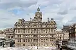 | |||
| New Mart Road, John Swan And Sons Livestock Market Including Caretaker's House, Gates And Gatepiers | 55°55′40″N 3°14′55″W | Category B | 30317 |  | |||
| Queensferry Road And Quality Street, Walls To Former Policies | 55°57′43″N 3°17′06″W | Category B | 30319 |  | |||
| Niddrie Mains Road And Craigmillar Castle Loan, The Whitehouse | 55°55′57″N 3°08′19″W | Category B | 30325 |  | |||
| 8 And 9 Argyle Place | 55°56′20″N 3°11′28″W | Category C(S) | 30336 |  | |||
| 210 Causewayside | 55°56′07″N 3°10′47″W | Category C(S) | 30344 |  | |||
| 5 And 5A Chalmers Crescent | 55°56′13″N 3°11′30″W | Category B | 30347 |  | |||
| 4 Dick Place, Wellfield Including Boundary Walls And Gatepiers | 55°56′04″N 3°10′54″W | Category B | 30358 | 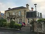 | |||
| 38 Dick Place,_Lodge, Including Gatepiers And Boundary_Walls | 55°56′00″N 3°11′19″W | Category B | 30363 |  | |||
| 46A Dick Place And Boundary Walls | 55°55′57″N 3°11′23″W | Category A | 30367 |  | |||
| 5 And 7 Barnshot Road, With Boundary Wall And Gates. (Campbell Cottage And Loudon Cottage) | 55°54′22″N 3°15′22″W | Category C(S) | 30225 |  | |||
| Hmso Store, 11 Bankhead Broadway, Sighthill Industrial Estate | 55°55′27″N 3°17′46″W | Category A | 30250 |  | |||
| 8 Dell Road | 55°54′31″N 3°15′22″W | Category C(S) | 30257 |  | |||
| 99 Dalkeith Road, Marchhall Place And Marchhall Crescent, Including 2 Marchhall Place, Priestfield Parish Church And Gatepiers | 55°56′11″N 3°10′11″W | Category A | 30267 |  | |||
| Salisbury Place, Longmore House, Former Longmore Hospital, Including Mortuary, Chapel, Boundary Walls, Gatepiers And Railings | 55°56′15″N 3°10′50″W | Category B | 30273 |  | |||
| 5, 7 And 9 Ellersly Road, Stable Courtyard (Side Entrance To Westerlea, Capability Scotland Buildings), Including Wall And Adjoining Buildings At Left | 55°56′48″N 3°14′50″W | Category C(S) | 30276 |  | |||
| 8 Leven Street, Bennets Bar | 55°56′30″N 3°12′12″W | Category B | 30279 |  | |||
| 3 Easter Belmont Road, 'Wellhouse' | 55°56′54″N 3°15′11″W | Category C(S) | 30292 |  | |||
| 70 And 71 Princes Street | 55°57′09″N 3°11′45″W | Category B | 30146 |  | |||
| 22 And 24 St Giles Street | 55°57′01″N 3°11′31″W | Category B | 30163 |  | |||
| 3-11 (Odd Nos) Shandwick Place | 55°56′59″N 3°12′30″W | Category B | 30175 |  | |||
| 53-61 (Odd Nos) Shandwick Place, Wilkies Buildings | 55°56′57″N 3°12′34″W | Category B | 30177 |  | |||
| 94 And 96 Spring Gardens, (Former Elsie Inglis Memorial Hospital Nurses' Home) | 55°57′18″N 3°09′57″W | Category C(S) | 30200 |  | |||
| 2 Lauriston Gardens, Macauley House, Including Boundary And Retaining Walls And Railings | 55°56′40″N 3°11′58″W | Category C(S) | 30206 |  | |||
| Granton Harbour, Western Breakwater Pier And Esparto Wharf | 55°59′13″N 3°13′47″W | Category B | 30219 |  | |||
| 7-9 (Inclusive Nos) North Bank Street | 55°56′59″N 3°11′37″W | Category B | 30064 | 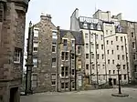 | |||
| 68-76 (Even Nos) Broughton Street, Including Railings | 55°57′32″N 3°11′27″W | Category B | 30075 |  | |||
| 22 And 24 Cockburn Street | 55°57′02″N 3°11′23″W | Category B | 30088 |  | |||
| Lanark Road 43 Cross Keys Inn, Slateford | 55°55′21″N 3°14′57″W | Category B | 30121 |  | |||
| 112-116 (Even Nos) Lauriston Place | 55°56′41″N 3°12′03″W | Category B | 30125 |  | |||
| 122-126 (Even Nos) Lauriston Place, Including Boundary Walls And Railings | 55°56′41″N 3°12′05″W | Category C(S) | 30127 |  | |||
| 46 Laverockbank Road, Strathavon Lodge With Ancillary Structure, Boundary Walls And Gatepiers | 55°58′44″N 3°12′08″W | Category C(S) | 30131 |  | |||
| 24 York Place, Including Railings | 55°57′23″N 3°11′28″W | Category A | 29985 |  | |||
| 32 York Place, Raeburn House, Including Railings | 55°57′24″N 3°11′25″W | Category A | 29989 |  | |||
| 7 And 9 York Road, With Boundary Wall And Railings | 55°58′36″N 3°12′11″W | Category C(S) | 29996 |  | |||
| 22 York Road, Grange House, With Boundary Wall And Gatepiers | 55°58′40″N 3°12′11″W | Category A | 29997 |  | |||
| 21 Young Street | 55°57′11″N 3°12′22″W | Category A | 30004 |  | |||
| 8 And 8A Young Street, The Oxford Bar, And 2 Young Street Lane South | 55°57′10″N 3°12′17″W | Category B | 30005 |  | |||
| James Craig Walk, Scottish Office, Formerly 27-31 (Inclusive Nos) St James's Square | 55°57′16″N 3°11′22″W | Category B | 30027 | _-_entrance_in_Archivists'_Garden.jpg.webp) | |||
| 323 Cowgate And High School Yards, Salvation Army Building (Former Heriot School) | 55°56′56″N 3°11′01″W | Category B | 30032 |  | |||
| 80 And 82 West Bow | 55°56′54″N 3°11′39″W | Category C(S) | 29907 |  | |||
| Whitehill Street 14-22 Newcraighall | 55°56′07″N 3°05′24″W | Category C(S) | 29913 |  | |||
| 2 West Coates, Yumi Restaurant, Including Boundary Walls And Obelisk | 55°56′46″N 3°13′42″W | Category C(S) | 29918 |  | |||
| 5A-31 (Odd Numbers) William Street | 55°56′59″N 3°12′44″W | Category B | 29929 |  | |||
| 243 Willowbrae Road, Duddingston Forge, With Boundary Wall, Gate Piers, And Railings | 55°56′45″N 3°08′08″W | Category B | 29937 |  | |||
| 15 Woodhall Road, Allermuir, With Boundary Wall And Gate Piers | 55°54′23″N 3°15′28″W | Category A | 29948 |  | |||
| 9-13 (Odd Nos) York Place, Including Railings | 55°57′21″N 3°11′30″W | Category A | 29961 |  | |||
| 1-4 (Inclusive Nos) Warriston Crescent And 1-4 (Inclusive Nos) Warriston Place, With Railings | 55°57′48″N 3°12′01″W | Category A | 29893 |  | |||
| 91 And 93 West Bow, Including Crocket's Land | 55°56′54″N 3°11′41″W | Category A | 29904 |  | |||
| 9 Victoria Street, (Former St John's Church) | 55°56′55″N 3°11′37″W | Category B | 29876 |  | |||
| 21, 23, 25, 27 Walker Street | 55°57′01″N 3°12′52″W | Category A | 29880 |  | |||
| 33-37 (Odd Nos) Scotland Street, Including Railings | 55°57′37″N 3°11′42″W | Category B | 29778 |  | |||
| 4-10B (Even Nos) Scotland Street, Including Railings | 55°57′34″N 3°11′43″W | Category B | 29780 |  | |||
| 13 Infirmary Street And Boundary Wall | 55°56′55″N 3°11′07″W | Category C(S) | 29794 |  | |||
| 74-76 (Inclusive Nos) South Bridge And 1, 1A And 1B Chambers Street | 55°56′53″N 3°11′13″W | Category C(S) | 29796 |  | |||
| 3 Spylaw Avenue, Acharra, With Boundary Wall, Gatepiers And Garage | 55°54′27″N 3°16′00″W | Category B | 29804 |  | |||
| 37, 38, 39 And 40 Spylaw Street, Allendale | 55°54′29″N 3°15′26″W | Category C(S) | 29825 |  | |||
| St Leonard's Lane, St Leonard's Station Including Outbuilding At Gate And Gatepiers | 55°56′35″N 3°10′40″W | Category B | 29731 |  | |||
| 4-8B (Even Nos) St Vincent Street, Including Railings | 55°57′28″N 3°12′10″W | Category B | 29750 |  | |||
| 23-32 (Inclusive Nos) Saxe Coburg Place Including Boundary Walls And Railings | 55°57′39″N 3°12′32″W | Category A | 29766 |  | |||
| 3 And 3A St Andrew Square | 55°57′12″N 3°11′33″W | Category A | 29696 |  | |||
| 23 And 23A St Andrew Square With Railings | 55°57′18″N 3°11′38″W | Category A | 29700 |  | |||
| 26 St Andrew Square With Railings | 55°57′18″N 3°11′36″W | Category A | 29703 |  | |||
| 35 St Andrew Square With Lamp Standards And Railings | 55°57′17″N 3°11′31″W | Category A | 29704 |  | |||
| St. Bernard's Crescent 28-30 | 55°57′26″N 3°12′49″W | Category B | 29718 |  | |||
| St. Bernard's Row Gatepiers | 55°57′36″N 3°12′39″W | Category B | 29723 |  | |||
| 7, 8 Rothesay Terrace, Including Boundary Wall | 55°57′03″N 3°13′04″W | Category B | 29670 |  | |||
| 19, 20, 21, 22, 23, 24, 25 Rothesay Terrace | 55°57′01″N 3°13′09″W | Category B | 29673 |  | |||
| West Register Street, Cafe Royal | 55°57′14″N 3°11′26″W | Category A | 29619 | 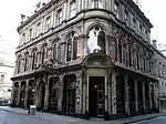 | |||
| 77-81 (Odd Nos) Rose Street And 52 Rose Street North Lane | 55°57′08″N 3°12′02″W | Category B | 29637 |  | |||
| 85 And 87 Rose Street And 51 Rose Street North Lane | 55°57′08″N 3°12′03″W | Category C(S) | 29638 |  | |||
| 116 Rose Street | 55°57′07″N 3°12′03″W | Category B | 29648 |  | |||
| 1 Rosebery Crescent, Including Railings | 55°56′46″N 3°13′08″W | Category C(S) | 29657 |  | |||
| 38 Queen Street And 63 And 65 Frederick Street With Railings | 55°57′15″N 3°12′03″W | Category A | 29553 |  | |||
| 51 Queen Street With Railings And Lamp Standards | 55°57′14″N 3°12′11″W | Category A | 29560 |  | |||
| 58 Queen Street With Railings | 55°57′14″N 3°12′14″W | Category A | 29564 |  | |||
| 64 Queen Street With Railings And Lamp Standards | 55°57′13″N 3°12′18″W | Category A | 29568 |  | |||
| 27, 27A-B And 29 Raeburn Place | 55°57′32″N 3°12′41″W | Category C(S) | 29581 |  | |||
| 4-10 (Inclusive Nos) Ramsay Garden, Including Terrace, Retaining Wall, Steps And Gateway | 55°56′58″N 3°11′47″W | Category A | 29594 | .jpg.webp) | |||
| 16-20 (Even Nos) Pilrig Street And Boundary Walls | 55°57′51″N 3°10′45″W | Category B | 29494 |  | |||
| 42-46 (Inclusive Nos) And 42A Princes Street And 1 South St David Street, Incorporating The Old Waverley Hotel | 55°57′11″N 3°11′35″W | Category B | 29504 | 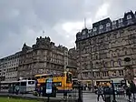 | |||
| 125A And 126 Princes Street | 55°57′04″N 3°12′17″W | Category B | 29514 |  | |||
| 130 Princes Street | 55°57′04″N 3°12′19″W | Category B | 29517 |  | |||
| 14 Queen Street With Front Wall And Lamp Standards | 55°57′18″N 3°11′50″W | Category A | 29538 |  | |||
| 18-20 (Inclusive Nos) Queen Street With Railings | 55°57′17″N 3°11′55″W | Category A | 29542 |  | |||
| 1 North Gyle Farm Court Gyle House | 55°56′32″N 3°18′29″W | Category C(S) | 29441 |  | |||
| 2-5 (Inclusive Nos) Northumberland Place, Including Railings And Lamps | 55°57′26″N 3°11′45″W | Category A | 29444 |  | |||
| 67 And 69 Northumberland Street, Including Railings And Lamp | 55°57′24″N 3°12′07″W | Category A | 29453 |  | |||
| Old Church Lane, Chalfont St Arthur, Duddingston | 55°56′30″N 3°08′50″W | Category B | 29464 |  | |||
| 51 Mount Vernon Road, Snellfield | 55°54′52″N 3°09′28″W | Category B | 29382 |  | |||
| 19-23 (Odd Nos) Nelson Street, Including Railings And Lamps | 55°57′27″N 3°11′44″W | Category A | 29387 |  | |||
| 25-29 (Odd Nos) Nelson Street, Including Railings And Lamps | 55°57′28″N 3°11′44″W | Category A | 29388 |  | |||
| 33 Murrayfield Road, Kinellan House And Lodge | 55°56′54″N 3°14′57″W | Category B | 29389 |  | |||
| Nicolson Square 25 | 55°56′44″N 3°11′08″W | Category B | 29415 |  | |||
| Nicolson Street, 106-108 | 55°56′41″N 3°11′01″W | Category B | 29426 |  | |||
| Nicolson Street West, 1 And 85, 87 Nicolson Street | 55°56′42″N 3°11′04″W | Category B | 29431 |  | |||
| 15 Minto Street, Including Boundary Walls | 55°56′08″N 3°10′32″W | Category B | 29347 |  | |||
| 40-43 (Inclusive Nos) Minto Street, Including Railings, Boundary Walls And Pedestrian Gate | 55°56′10″N 3°10′38″W | Category B | 29359 | 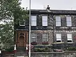 | |||
| 48 Minto Street | 55°56′12″N 3°10′40″W | Category B | 29362 | 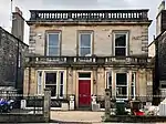 | |||
| 50 Minto Street, Including Gatepiers And Boundary Walls | 55°56′13″N 3°10′40″W | Category B | 29364 | 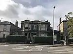 | |||
| 1, 2, 3 Melville Crescent, 45 Melville Street And 20 Walker Street, Including Railings, Arched Lamp Holders, Ancillary Structures And Boundary Walls To Rear | 55°56′59″N 3°12′53″W | Category A | 29319 | 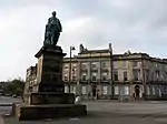 | |||
| 13 Minto Street, Haig Memorial House, Including Boundary Walls | 55°56′09″N 3°10′33″W | Category C(S) | 29345 |  | |||
| 5 Westmost Close | 55°58′50″N 3°11′45″W | Category C(S) | 29281 |  | |||
| 37-43 (Odd Nos) Leith Street And 8 And 12 Calton Road | 55°57′15″N 3°11′15″W | Category B | 29253 |  | |||
| Lanark Road, 476 Juniper Green Manse | 55°54′25″N 3°16′38″W | Category B | 29206 |  | |||
| Lanark Road, 508 Hunter's House Juniper Green | 55°54′16″N 3°17′01″W | Category C(S) | 29209 |  | |||
| 5, 6 And 7 Laverockbank Road, With Boundary Wall | 55°58′39″N 3°12′02″W | Category B | 29222 |  | |||
| 481 And 483 Lawnmarket, Gladstone's Land | 55°56′58″N 3°11′38″W | Category A | 29233 | 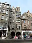 | |||
| Huntly Street 1-8 | 55°57′44″N 3°11′57″W | Category B | 29126 |  | |||
| 11-15 (Odd Nos) India Street, Including Railings And Lamps | 55°57′20″N 3°12′19″W | Category A | 29128 |  | |||
| 14 India Street, Including Railings And Lamp | 55°57′19″N 3°12′21″W | Category A | 29133 | 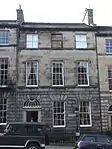 | |||
| 10 Infirmary Street, Infirmary Street Baths | 55°56′53″N 3°11′06″W | Category B | 29143 |  | |||
| Inverleith Place 59-61 | 55°57′59″N 3°12′49″W | Category C(S) | 29153 |  | |||
| Inverleith Row, 11, 12 And 12A | 55°57′56″N 3°12′14″W | Category B | 29159 |  |
Key
The scheme for classifying buildings in Scotland is:
- Category A: "buildings of national or international importance, either architectural or historic; or fine, little-altered examples of some particular period, style or building type."[1]
- Category B: "buildings of regional or more than local importance; or major examples of some particular period, style or building type, which may have been altered."[1]
- Category C: "buildings of local importance; lesser examples of any period, style, or building type, as originally constructed or moderately altered; and simple traditional buildings which group well with other listed buildings."[1]
In March 2016 there were 47,288 listed buildings in Scotland. Of these, 8% were Category A, and 50% were Category B, with the remaining 42% being Category C.[2]
Notes
- Sometimes known as OSGB36, the grid reference (where provided) is based on the British national grid reference system used by the Ordnance Survey.
• "Guide to National Grid". Ordnance Survey. Retrieved 12 December 2007.
• "Get-a-map". Ordnance Survey. Retrieved 17 December 2007. - Historic Environment Scotland assign a unique alphanumeric identifier to each designated site in Scotland, for listed buildings this always begins with "LB", for example "LB12345".
References
- All entries, addresses and coordinates are based on data from Historic Scotland. This data falls under the Open Government Licence
- "What is Listing?". Historic Environment Scotland. Retrieved 29 May 2018.
- Scotland's Historic Environment Audit 2016 (PDF). Historic Environment Scotland and the Built Environment Forum Scotland. pp. 15–16. Retrieved 29 May 2018.
This article is issued from Wikipedia. The text is licensed under Creative Commons - Attribution - Sharealike. Additional terms may apply for the media files.