List of listed buildings in Edinburgh/27
List
| Name | Location | Date Listed | Grid Ref. [note 1] | Geo-coordinates | Notes | LB Number [note 2] | Image |
|---|---|---|---|---|---|---|---|
| Glenbrook Road, Glenbrook House With Outbuildings Railings, Gates And Gatepiers | 55°52′41″N 3°22′09″W | Category C(S) | 26817 |  | |||
| 27-31 (Odd Nos) Bernard Street And 1 Seaport Street With Gatepiers And Railings | 55°58′32″N 3°10′05″W | Category A | 26821 |  | |||
| Slateford Road Caledonian Brewery | 55°56′08″N 3°13′53″W | Category B | 26833 |  | |||
| Colinton Road Napier University Merchiston Castle Gateway | 55°55′59″N 3°12′48″W | Category B | 26841 |  | |||
| 104-108 Commercial Street, Macdonald House (Former Leith Nautical College) With Front Wall And Railings; Eh6 6Nn | 55°58′40″N 3°10′36″W | Category B | 26852 |  | |||
| Glenbrook Road, The Stables, (Former Stables To Glenpark House) | 55°52′51″N 3°21′57″W | Category B | 26857 |  | |||
| Robertson Avenue St Andrew's Works Front Block | 55°56′06″N 3°14′05″W | Category C(S) | 26755 |  | |||
| 8 Bridge Road (Former Lodge To Larch Grove) With Boundary Walls, Railings And Gatepiers | 55°53′09″N 3°20′25″W | Category B | 26765 |  | |||
| Cluny Gardens And 5 Braid Road, Morningside Parish Church (Church Of Scotland) With Boundary Walls, Gatepiers, Lamp Posts And Railings | 55°55′28″N 3°12′31″W | Category B | 26770 |  | |||
| 37 Bellfield Street | 55°57′09″N 3°06′27″W | Category B | 26776 |  | |||
| 12 Claremont Park With Boundary Wall And Gatepiers | 55°58′12″N 3°09′15″W | Category B | 26791 |  | |||
| 1 Cockburn Farm Cockburn House (Cockburn Farm Dairy) With Boundary Wall And Sundials | 55°52′18″N 3°21′51″W | Category A | 26792 |  | |||
| 1 Abercorn Terrace, Including Boundary Walls And Gateway | 55°57′03″N 3°06′29″W | Category C(S) | 26711 |  | |||
| Ashley Terrace Craiglockhart Primary School With Caretaker's Lodge Playshed Gates Gatepiers And Railings | 55°55′56″N 3°13′41″W | Category B | 26717 |  | |||
| 4, 5 And 6 Greyfriars Place | 55°56′48″N 3°11′29″W | Category B | 18973 |  | |||
| Dalmeny Village, 6 Main Street | 55°58′55″N 3°22′22″W | Category C(S) | 5535 |  | |||
| Dalmeny Village, 11 Main Street | 55°58′54″N 3°22′26″W | Category C(S) | 5540 |  | |||
| Dalmeny Village, 14 And 15 Main Street | 55°58′54″N 3°22′29″W | Category C(S) | 5542 |  | |||
| Easter Dalmeny Tank | 55°59′02″N 3°21′57″W | Category C(S) | 5545 |  | |||
| Carlowrie, Carlowrie Farm Steading | 55°57′55″N 3°21′51″W | Category C(S) | 5555 |  | |||
| Carlowrie, Railway Bridge At Carlowrie Cottages | 55°57′58″N 3°22′35″W | Category C(S) | 5556 |  | |||
| 6 Cramond Bridge, Cramond Brig Inn Former Coach-House, Including Wall | 55°57′55″N 3°19′01″W | Category C(S) | 5569 |  | |||
| Camus Park, Comiston House Dovecot | 55°54′16″N 3°13′02″W | Category B | 45836 |  | |||
| Camus Park, Gatepiers To W Of Comiston House Stables | 55°54′16″N 3°13′05″W | Category C(S) | 45837 |  | |||
| 11 And 13 Valleyfield Street, The Carpet Mill (Former Agricultural Hall) | 55°56′29″N 3°12′10″W | Category C(S) | 45915 |  | |||
| 3 Forth Street | 55°57′27″N 3°11′17″W | Category B | 45944 |  | |||
| Warriston Road And Logie Green Road, Waterston's Printing Works | 55°57′58″N 3°11′49″W | Category C(S) | 45962 |  | |||
| 143 Grange Loan, Astley Ainslie Hospital, Garden Wall Incorporating Carved Panels To North Of Millbank Pavilion | 55°55′49″N 3°12′02″W | Category C(S) | 46194 |  | |||
| Nos 71-81 (Odd Nos) Morningside Road | 55°55′50″N 3°12′35″W | Category B | 46296 |  | |||
| 62 East Trinity Road And 1 York Road, Corbiesteps, With Boundary Wall And Gatepiers | 55°58′34″N 3°12′11″W | Category C(S) | 46727 |  | |||
| 64 East Trinity Road, Rose Cottage, With Boundary Wall And Gatepiers | 55°58′34″N 3°12′12″W | Category C(S) | 46728 |  | |||
| 36-46 (Even Nos) East Fountainbrige Including Railings | 55°56′43″N 3°12′16″W | Category B | 47026 |  | |||
| 14-18 (Inclusive Nos) Leven Terrace, Including Railings | 55°56′28″N 3°12′04″W | Category C(S) | 47046 |  | |||
| Duddingston, The Causeway, Bella Vista, Garden Pavilion | 55°56′33″N 3°08′59″W | Category C(S) | 47154 |  | |||
| 2 And 2A Ravelston Park, Including Boundary Walls | 55°57′10″N 3°13′40″W | Category B | 47264 |  | |||
| 65 Dean Path, Dean Parish Church (Church Of Scotland) And Hall, With Boundary Walls, Gates And Railings | 55°57′16″N 3°13′18″W | Category B | 47354 |  | |||
| 3 And 4 Lockharton Gardens | 55°55′34″N 3°13′59″W | Category B | 47614 |  | |||
| 17-19 (Odd Nos) Clermiston View, St Andrew's Church Including Bell-Tower | 55°57′26″N 3°16′54″W | Category B | 47716 |  | |||
| 13-23 (Odd Nos) Shandwick Place | 55°56′59″N 3°12′31″W | Category C(S) | 47728 |  | |||
| 29-37 (Odd Nos) Shandwick Place, The Maitland Hotel | 55°56′58″N 3°12′33″W | Category C(S) | 47729 |  | |||
| 15A East Terrace, Ancillary Building | 55°59′22″N 3°23′40″W | Category C(S) | 47775 |  | |||
| 30 And 31 High Street | 55°59′24″N 3°23′44″W | Category B | 47785 |  | |||
| 4 Mid Terrace, Tyn Twill | 55°59′23″N 3°23′44″W | Category C(S) | 47788 |  | |||
| 36 Castle Terrace | 55°56′48″N 3°12′10″W | Category A | 47857 | 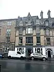 | |||
| 14-20 (Even Nos) Cowgate (Former Cowgatehead Free Church) | 55°56′53″N 3°11′37″W | Category B | 47859 | .jpg.webp) | |||
| King's Stables Road, St Cuthbert's Church Halls, Including Boundary Walls, Railings, Gates, Gatepiers And Lamp Standards | 55°56′57″N 3°12′18″W | Category C(S) | 47883 |  | |||
| Lauriston Place, George Heriot's School Gatehouse, Terraces, War Memorial, Boundary Walls, Railings And Gates | 55°56′43″N 3°11′37″W | Category B | 47885 | 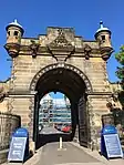 | |||
| Lauriston Place, George Heriot's School, Preparatory Department | 55°56′47″N 3°11′45″W | Category C(S) | 47886 |  | |||
| 30 And 32 Lauriston Place, Including Boundary Wall, Railings And Gate | 55°56′43″N 3°11′48″W | Category B | 47890 |  | |||
| 34 And 36 Lauriston Place, Including Boundary Wall, Gate And Railings | 55°56′43″N 3°11′48″W | Category B | 47891 | 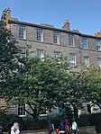 | |||
| Edinburgh Castle, Vaults | 55°56′54″N 3°12′01″W | Category A | 48232 |  | |||
| 4-8 (Even Nos) Forrest Road | 55°56′46″N 3°11′27″W | Category C(S) | 48240 |  | |||
| Mound Place, New College Quadrangle, Statue Of John Knox | 55°56′59″N 3°11′42″W | Category C(S) | 48246 |  | |||
| 13-16 (Inclusive Nos) Ramsay Garden | 55°56′57″N 3°11′48″W | Category A | 48247 | 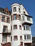 | |||
| 11-14 (Inclusive Nos) Teviot Place | 55°56′44″N 3°11′25″W | Category C(S) | 48250 |  | |||
| West Princes Street Gardens, Royal Scots Memorial | 55°57′04″N 3°11′50″W | Category B | 48253 | 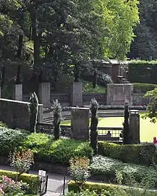 | |||
| 562 Queensferry Road, Barnton Hotel | 55°57′39″N 3°18′19″W | Category C(S) | 48508 |  | |||
| 33 Assembly Street | 55°58′29″N 3°09′57″W | Category C(S) | 48533 |  | |||
| 1-7 (Inclusive Nos) Angle Park Terrace Including The Athletic Arms | 55°56′20″N 3°13′26″W | Category C(S) | 48568 |  | |||
| William Street Ne Lane (South Side) | 55°56′59″N 3°12′45″W | Category C(S) | 48874 |  | |||
| Douglas Crescent Gardens, Railings And Gates | 55°56′58″N 3°13′18″W | Category B | 48886 |  | |||
| 7 Kinellan Road, Mcneil House, Including Boundary Walls | 55°56′53″N 3°15′01″W | Category B | 48890 |  | |||
| 27 Murrayfield Avenue, Including Gatepiers And Boundary Walls | 55°56′53″N 3°14′17″W | Category B | 48896 |  | |||
| 9 Osborne Terrace, Including Boundary Walls And Gatepier | 55°56′44″N 3°13′32″W | Category C(S) | 48902 |  | |||
| 4 Succoth Place, Including Boundary Wall | 55°56′59″N 3°14′13″W | Category C(S) | 48916 |  | |||
| 2 Wester Coates Avenue, Including Boundary Walls | 55°56′50″N 3°13′42″W | Category B | 48917 |  | |||
| 12 Wester Coates Gardens, Including Gatepiers And Boundary Walls | 55°56′54″N 3°13′49″W | Category C(S) | 48919 |  | |||
| 1 Abercorn Gardens With Boundary Wall And Railings | 55°57′19″N 3°08′25″W | Category C(S) | 49039 |  | |||
| 14-17 (Inclusive Nos) Market Street | 55°57′03″N 3°11′26″W | Category B | 49066 |  | |||
| 2 Cranston Street, Former Canongate Christian Institute, Including Gatepiers | 55°57′04″N 3°11′01″W | Category C(S) | 49078 |  | |||
| 63 East London Street, London Street Primary School, Including Girls' And Boys' Playsheds, Boundary Walls, Railings And Gatepiers | 55°57′35″N 3°11′14″W | Category B | 49146 |  | |||
| Royal Botanic Garden, Inverleith Row, Caledonian Hall (Former Royal Caledonian Horticultural Society Hall) | 55°57′52″N 3°12′20″W | Category B | 49214 |  | |||
| 117 Nicolson Street, Southside Community Centre, Former Nicolson Street Church With Wall And Railings | 55°56′39″N 3°11′03″W | Category B | 49458 | 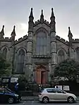 | |||
| Castlebrae Business Centre (Former Niddrie Marischal School), Harewood Road, With Lodge | 55°56′06″N 3°08′15″W | Category B | 49459 |  | |||
| Holyrood Park, Meadowbank Lodge | 55°57′16″N 3°09′28″W | Category C(S) | 49513 |  | |||
| 67 Whitehill Street, Newcraighall Primary School Including Boundary Wall And Gatepiers | 55°56′06″N 3°05′17″W | Category C(S) | 49520 |  | |||
| 64 Bridge Road, The Royal Bank Of Scotland | 55°54′27″N 3°15′31″W | Category C(S) | 49553 |  | |||
| 5 Spylaw Park | 55°54′30″N 3°16′07″W | Category C(S) | 49568 |  | |||
| East Fettes Avenue, Fettes College, Malcolm House | 55°58′00″N 3°13′33″W | Category B | 49630 |  | |||
| 10-12 (Inclusive Nos) Brunton Place And 2 Brunton Terrace | 55°57′28″N 3°10′27″W | Category B | 49745 |  | |||
| 12 Carlton Terrace Including Railings And Boundary Walls | 55°57′24″N 3°10′26″W | Category A | 49754 | 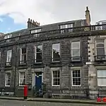 | |||
| 17 Regent Terrace Including Railings And Boundary Walls | 55°57′18″N 3°10′35″W | Category A | 49780 | 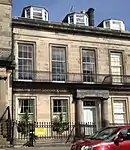 | |||
| 23 Regent Terrace, Including Railings And Boundary Walls | 55°57′19″N 3°10′32″W | Category A | 49786 | 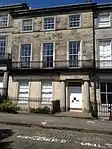 | |||
| 29 Regent Terrace Including Railings And Boundary Walls | 55°57′20″N 3°10′30″W | Category A | 49794 | 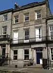 | |||
| 9 Royal Terrace Including Railings And Boundary Walls | 55°57′24″N 3°10′48″W | Category A | 49807 |  | |||
| 15 Royal Terrace Including Railings And Boundary Walls | 55°57′24″N 3°10′45″W | Category A | 49812 |  | |||
| 26 Royal Terrace Including Railings And Boundary Walls | 55°57′24″N 3°10′39″W | Category A | 49817 | 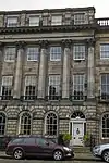 | |||
| 40 George Square, University Of Edinburgh, Arts Faculty, David Hume Tower (Block A) And Lecture Block (Block B) Including Stepped Podium | 55°56′36″N 3°11′12″W | Category A | 50189 | _And_Lecture_Block_(block_B)_Including_Steppe_-_20140421174922.jpg.webp) | |||
| 42 George Square, University Of Edinburgh, Arts Faculty, William Robertson Building (Block C) | 55°56′38″N 3°11′12″W | Category B | 50192 |  | |||
| 55 Abbeyhill | 55°57′16″N 3°10′25″W | Category B | 51170 | 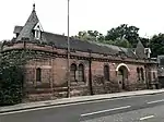 | |||
| Holyroodhouse, Queen's Gallery (Former Holyrood Free Church And Former Free Church School) | 55°57′09″N 3°10′26″W | Category B | 51177 | 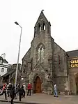 | |||
| 6 South Gray's Close, Panmure St Anne's (Former St Anne's School) | 55°56′57″N 3°11′06″W | Category C(S) | 51181 |  | |||
| Belford Road, Belford Bridge | 55°57′03″N 3°13′19″W | Category B | 51337 | 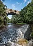 | |||
| 7 And 9 Laverockbank Avenue And 13-17 (Consecutive Nos) Laverockbank Crescent Including Lockup Garages | 55°58′46″N 3°11′59″W | Category B | 51773 |  | |||
| Dundas Castle Keep | 55°58′31″N 3°24′54″W | Category A | 45474 |  | |||
| Dundas Castle, Dundas Loch Bridge | 55°58′03″N 3°24′39″W | Category B | 45475 |  | |||
| 106 St Stephen Street, Including Railings | 55°57′29″N 3°12′20″W | Category C(S) | 45521 |  | |||
| 116 Fountainbridge, Fountainbridge Telephone Exchange Including Boundary Walls, Gatepiers And Gates | 55°56′36″N 3°12′34″W | Category B | 44933 |  | |||
| 48-52 (Even Nos) Leamington Terrace Including Boundary Walls, Gates And Railings | 55°56′20″N 3°12′29″W | Category C(S) | 44942 |  | |||
| 98-106 (Even Nos) And 122 Willowbrae Road, Former Willowbrae House, Including Service Accommodation, Lodge And Boundary Walls And Railings | 55°57′10″N 3°08′45″W | Category C(S) | 44948 |  | |||
| 5 And 7 Oak Lane Including Boundary Walls | 55°57′15″N 3°16′54″W | Category C(S) | 44753 |  | |||
| 12 Kirk Loan, Corstorphine Public Library Including Boundary Walls, Gatepiers, Gates, Railings And Lamp Standards | 55°56′27″N 3°16′51″W | Category C(S) | 44764 |  | |||
| 64-66 Albion Road, With Wall And Railings To Pavement | 55°57′39″N 3°09′59″W | Category B | 44625 |  | |||
| Mayfield Road And West Mains Road, University Of Edinburgh, King's Buildings, Zoology | 55°55′26″N 3°10′23″W | Category B | 44230 |  | |||
| Observatory Road, Blackford Hill, The Royal Observatory, Gate Lodge, Gates, Gatepiers And Boundary Walls | 55°55′23″N 3°11′14″W | Category B | 44250 |  | |||
| 42 Newhaven Main Street | 55°58′50″N 3°11′41″W | Category B | 43707 |  | |||
| 243 Newhaven Road, Willow Bank, Including Boundary Wall And Gatepiers | 55°58′47″N 3°11′36″W | Category C(S) | 43714 |  | |||
| 6 Wester Close | 55°58′50″N 3°11′43″W | Category C(S) | 43729 |  | |||
| Portgower Place, The Grange Cricket Club Pavilion | 55°57′35″N 3°12′47″W | Category B | 43497 |  | |||
| 22 Hill Street | 55°57′12″N 3°12′10″W | Category A | 43304 |  | |||
| 10-15 (Inclusive Nos) Princes Street | 55°57′12″N 3°11′25″W | Category C(S) | 43313 |  | |||
| 21-23 (Inclusive Nos) Princes Street | 55°57′12″N 3°11′28″W | Category C(S) | 43314 |  | |||
| 78 Princes Street And 2-4 Hanover Street | 55°57′08″N 3°11′49″W | Category B | 43320 |  | |||
| 84-87 (Inclusive Nos) Princes Street, Incorporating The New Club | 55°57′08″N 3°11′53″W | Category A | 43322 |  | |||
| 144-147 (Inclusive Nos) Princes Street | 55°57′01″N 3°12′27″W | Category B | 43328 |  | |||
| 26 Thistle Street | 55°57′15″N 3°11′57″W | Category C(S) | 43362 |  | |||
| 18 Young Street And 10 Young Street Lane South | 55°57′10″N 3°12′21″W | Category A | 43368 |  | |||
| Ellen's Glen Road (Off Lasswade Road), Southfield Hospital | 55°54′33″N 3°09′01″W | Category B | 43251 |  | |||
| 31 And 33 Castle Street | 55°57′08″N 3°12′11″W | Category B | 43282 |  | |||
| 111, 113 And 113A George Street With Railings | 55°57′09″N 3°12′15″W | Category B | 43288 |  | |||
| 45-49 (Odd Nos) Hanover Street | 55°57′11″N 3°11′48″W | Category B | 43294 |  | |||
| 29-33 Newington Road,Former Royal Bank Of Scotland | 55°56′19″N 3°10′44″W | Category B | 43160 | 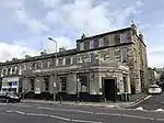 | |||
| 3 Priestfield Road | 55°56′08″N 3°10′05″W | Category C(S) | 43165 |  | |||
| 2-4 (Even Nos) Priestfield Road | 55°56′07″N 3°10′04″W | Category C(S) | 43167 |  | |||
| 3 Priestfield Road North, Kingsview | 55°56′12″N 3°10′03″W | Category C(S) | 43171 |  | |||
| 55 And 56 High Street | 55°59′23″N 3°23′36″W | Category B | 40383 |  | |||
| 8 The Loan, Priory Lodge | 55°59′24″N 3°23′51″W | Category C(S) | 40393 |  | |||
| 10 The Loan, Loan House | 55°59′23″N 3°23′50″W | Category B | 40394 |  | |||
| 12-15 West Terrace, Wall And Railings | 55°59′24″N 3°23′47″W | Category C(S) | 40409 |  | |||
| 1 And 2 Bellstane | 55°59′27″N 3°23′51″W | Category C(S) | 40334 |  | |||
| 2 Brewery Close | 55°59′23″N 3°23′47″W | Category C(S) | 40336 |  | |||
| 7 East Terrace | 55°59′23″N 3°23′36″W | Category B | 40339 |  | |||
| 15 East Terrace | 55°59′22″N 3°23′40″W | Category B | 40344 |  | |||
| 5 And 6 Stoneycroft Road, St. Catherine's Bank And Bonnyview | 55°59′22″N 3°23′33″W | Category C(S) | 40368 |  | |||
| 7 Whitehouse Terrace Including Gatepiers And Boundary Walls | 55°55′54″N 3°11′42″W | Category B | 30676 |  | |||
| 18-20 (Incl Nos) Warrender Park Crescent | 55°56′19″N 3°12′04″W | Category B | 30614 |  | |||
| 53-55 (Odd Nos) Warrender Park Road | 55°56′19″N 3°11′46″W | Category B | 30621 |  | |||
| 91-95 (Odd Nos) Warrender Park Road | 55°56′18″N 3°11′55″W | Category B | 30629 |  | |||
| 103-105 (Odd Nos) Warrender Park Road | 55°56′18″N 3°11′57″W | Category B | 30631 |  | |||
| 127 Warrender Park Road | 55°56′16″N 3°12′03″W | Category B | 30636 |  | |||
| 11-13 (Incl Nos) Warrender Park Terrace Incl Railings | 55°56′21″N 3°11′48″W | Category B | 30648 |  | |||
| Whitehouse Loan Police Box | 55°56′06″N 3°12′04″W | Category B | 30662 |  | |||
| 123 Grange Loan Formerly Dunard Incl Gatepiers Boundary Wall | 55°55′50″N 3°11′29″W | Category C(S) | 30506 |  | |||
| 1 Hope Terrace Including Boundary Walls | 55°56′00″N 3°12′01″W | Category C(S) | 30525 |  | |||
| 21 Marchmont Road | 55°56′20″N 3°11′41″W | Category B | 30542 |  | |||
| 20 Marchmont Road | 55°56′19″N 3°11′43″W | Category B | 30556 |  | |||
| 111-115 (Odd Nos) Marchmont Road | 55°56′07″N 3°11′38″W | Category B | 30448 | 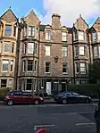 | |||
| 1-3 (Inclusive Nos) Roseneath Street | 55°56′18″N 3°11′31″W | Category B | 30464 |  | |||
| 19 St Thomas Road | 55°55′48″N 3°11′06″W | Category B | 30472 |  | |||
| 12-16 (Even Nos) Warrender Park Road | 55°56′17″N 3°11′31″W | Category B | 30488 | 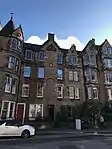 |
Key
The scheme for classifying buildings in Scotland is:
- Category A: "buildings of national or international importance, either architectural or historic; or fine, little-altered examples of some particular period, style or building type."[1]
- Category B: "buildings of regional or more than local importance; or major examples of some particular period, style or building type, which may have been altered."[1]
- Category C: "buildings of local importance; lesser examples of any period, style, or building type, as originally constructed or moderately altered; and simple traditional buildings which group well with other listed buildings."[1]
In March 2016 there were 47,288 listed buildings in Scotland. Of these, 8% were Category A, and 50% were Category B, with the remaining 42% being Category C.[2]
Notes
- Sometimes known as OSGB36, the grid reference (where provided) is based on the British national grid reference system used by the Ordnance Survey.
• "Guide to National Grid". Ordnance Survey. Retrieved 12 December 2007.
• "Get-a-map". Ordnance Survey. Retrieved 17 December 2007. - Historic Environment Scotland assign a unique alphanumeric identifier to each designated site in Scotland, for listed buildings this always begins with "LB", for example "LB12345".
References
- All entries, addresses and coordinates are based on data from Historic Scotland. This data falls under the Open Government Licence
- "What is Listing?". Historic Environment Scotland. Retrieved 29 May 2018.
- Scotland's Historic Environment Audit 2016 (PDF). Historic Environment Scotland and the Built Environment Forum Scotland. pp. 15–16. Retrieved 29 May 2018.
This article is issued from Wikipedia. The text is licensed under Creative Commons - Attribution - Sharealike. Additional terms may apply for the media files.