List of listed buildings in Edinburgh/29
List
| Name | Location | Date Listed | Grid Ref. [note 1] | Geo-coordinates | Notes | LB Number [note 2] | Image |
|---|---|---|---|---|---|---|---|
| Ferry Road, 372 Dunkeld Lodge | 55°58′17″N 3°12′40″W | Category C(S) | 28750 |  | |||
| Ferry Road, 376 | 55°58′16″N 3°12′44″W | Category C(S) | 28751 |  | |||
| 71-75 (Odd Nos) Dublin Street, Including Railings | 55°57′29″N 3°11′38″W | Category B | 28687 |  | |||
| 32-38 (Even Nos) Dublin Street, Including Railings | 55°57′26″N 3°11′39″W | Category B | 28693 |  | |||
| 24-28 (Even Nos) Dundas Street, Including Railings | 55°57′26″N 3°11′59″W | Category B | 28717 |  | |||
| 88-102 (Even Nos) Dundas Street, Including Railings | 55°57′32″N 3°12′02″W | Category B | 28722 |  | |||
| Gilmerton, Drum Street, The Cove | 55°54′20″N 3°07′59″W | Category B | 28662 |  | |||
| 25 Cramond Glebe Road, The Old Schoolhouse, Including Boundary Wall And Gatepiers | 55°58′39″N 3°18′03″W | Category B | 28607 |  | |||
| 71 Dalkeith Road Including Boundary Walls And Pedestrian Gate | 55°56′15″N 3°10′16″W | Category C(S) | 28616 |  | |||
| 18 Holyrood Park Road, St Leonard's Hall Including Boundary Walls | 55°56′24″N 3°10′16″W | Category A | 28619 | 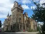 | |||
| 39-43 (Odd Numbers) Dean Path, Including Boundary Wall | 55°57′10″N 3°13′10″W | Category B | 28636 |  | |||
| 27 And 29 Cockburn Street | 55°57′03″N 3°11′24″W | Category B | 28577 |  | |||
| 298 Colinton Road, Heather Cottage | 55°54′29″N 3°15′13″W | Category C(S) | 28579 |  | |||
| Cowgate 28-36 | 55°56′53″N 3°11′35″W | Category B | 28599 |  | |||
| Chapel Street (Off) Chapel House (Archibald Bennet & Co) | 55°56′42″N 3°11′07″W | Category B | 28500 |  | |||
| 2-4 (Inclusive Nos) North Charlotte Street With Railings And Lamp Standards | 55°57′10″N 3°12′24″W | Category A | 28509 |  | |||
| 167 And 169 Canongate | 55°57′05″N 3°10′49″W | Category A | 28433 | 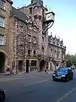 | |||
| 250-254 (Even Nos) Canongate | 55°57′02″N 3°11′00″W | Category B | 28456 |  | |||
| 51-55 (Odd Nos) North Castle Street With Railings And Boundary Walls To Rear | 55°57′12″N 3°12′13″W | Category A | 28466 |  | |||
| 22-26 (Even Nos) Castle Street With Railings | 55°57′07″N 3°12′13″W | Category B | 28473 |  | |||
| Buccleuch Place 5, 6 | 55°56′34″N 3°11′08″W | Category B | 28381 |  | |||
| Buccleuch Place 36, 37 And 16-26 Buccleuch Street | 55°56′36″N 3°11′07″W | Category B | 28392 |  | |||
| 26 Calton Hill Including Railings And Boundary Walls | 55°57′16″N 3°11′08″W | Category B | 28410 |  | |||
| 28 Calton Hill, Rock House, Including Boundary Walls, Gateway And Gate | 55°57′16″N 3°11′07″W | Category A | 28411 | .jpg.webp) | |||
| 136 And 138 Calton Road And 2-12 (Even Nos) Campbell's Close, Former Brewery Maltings | 55°57′09″N 3°10′39″W | Category B | 28412 |  | |||
| 56 And 56A Candlemaker Row | 55°56′50″N 3°11′31″W | Category C(S) | 28418 |  | |||
| Canon Street 4 (Originally 1-4) | 55°57′42″N 3°11′54″W | Category C(S) | 28421 |  | |||
| Canon Street 7 | 55°57′43″N 3°11′55″W | Category C(S) | 28422 |  | |||
| 10 And 12 Blacket Place, Including Boundary Walls | 55°56′15″N 3°10′26″W | Category B | 28310 |  | |||
| 63-67 (Odd Nos) Blackfriars Street, Lodge Of Journeymen Masons | 55°56′57″N 3°11′08″W | Category C(S) | 28328 |  | |||
| 17 Boswall Road, Manor House, With Boundary Walls, Railings, Gates And Gateposts | 55°58′47″N 3°12′42″W | Category B | 28337 |  | |||
| 21 And 23 Boswall Road, Forthview House, With Boundary Walls, Railings, Gates And Gateposts | 55°58′47″N 3°12′40″W | Category B | 28339 |  | |||
| 1 Broughton Road, Heriot Hill House With Boundary Walls And Gatepiers | 55°57′46″N 3°11′50″W | Category B | 28358 |  | |||
| 27-33 (Odd Nos) Broughton Street | 55°57′26″N 3°11′16″W | Category B | 28360 |  | |||
| 35 And 37 Broughton Street | 55°57′26″N 3°11′17″W | Category A | 28361 |  | |||
| 73-79 (Odd Nos) Broughton Street | 55°57′30″N 3°11′21″W | Category B | 28365 |  | |||
| 17-20 (Inclusive Nos) Bank, Including Part Of 451 Lawnmarket To Rear | 55°56′59″N 3°11′35″W | Category A | 28264 |  | |||
| 6 Barnshot Road, The Croft, With Boundary Wall And Gates | 55°54′21″N 3°15′24″W | Category B | 28271 |  | |||
| 17 Barnshot Road, Abden With Boundary Wall, Gate Piers, Railings And Garage | 55°54′21″N 3°15′20″W | Category B | 28273 |  | |||
| Bath Place 8-20 Portobello | 55°57′18″N 3°06′41″W | Category B | 28276 |  | |||
| 13, 15 Bell's Brae (Formerly Old Tollbooth Or Cathedral Mission) | 55°57′08″N 3°12′58″W | Category A | 28293 |  | |||
| 13 Blacket Place, Including Boundary Walls | 55°56′12″N 3°10′28″W | Category B | 28301 |  | |||
| Arboretum Road, 15 Fairfield Inverleith | 55°58′07″N 3°12′56″W | Category B | 28259 |  | |||
| 9, 9A, 9B Albany Street, Including Railings | 55°57′24″N 3°11′33″W | Category A | 28220 |  | |||
| 25, 25B Albany Street, Including Railings | 55°57′25″N 3°11′29″W | Category A | 28223 |  | |||
| 5 Caroline Park, Dovecot And Boundary Wall To North West Of Caroline Park House | 55°58′54″N 3°14′31″W | Category B | 28139 |  | |||
| Liberton Drive, Liberton House, Dovecot | 55°54′43″N 3°10′19″W | Category A | 28141 |  | |||
| Lochend Road South, Lochend Park, Lochend Castle Dovecot | 55°57′44″N 3°09′39″W | Category B | 28142 | 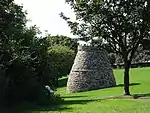 | |||
| Belford Road, Former Bell's Mills Granary | 55°57′01″N 3°13′20″W | Category A | 28149 |  | |||
| Slateford House 53 Lanark Road | 55°55′21″N 3°14′59″W | Category B | 28196 |  | |||
| Camus Park, Comiston House Stables | 55°54′17″N 3°13′02″W | Category B | 28045 |  | |||
| Drylaw House, Pair Of Gatepiers Off Groathill Road North | 55°57′54″N 3°15′00″W | Category C(S) | 28062 |  | |||
| Duddingston House Temple Duddingston Golf Course | 55°56′33″N 3°08′11″W | Category A | 28068 |  | |||
| 82, Craigs Road, East Craigs (Scottish Agricultural Science Agency) | 55°56′56″N 3°18′36″W | Category C(S) | 28069 |  | |||
| Inch House Glenallan Drive Old Dalkeith Road And Gilmerton Road | 55°55′30″N 3°09′32″W | Category A | 28078 |  | |||
| Kingston Grange Kingston Avenue | 55°55′08″N 3°08′53″W | Category B | 28083 |  | |||
| Kingston Grange (Liberton Golf Club) Lodge (Original S. Section Only) And Gates On Gilmerton Road | 55°55′01″N 3°09′06″W | Category B | 28084 |  | |||
| Millbank Redhall Bank Road And Boag's Mill Road | 55°55′06″N 3°15′24″W | Category B | 28090 |  | |||
| 19 Winton Loan, Morton House Belvedere | 55°53′46″N 3°11′34″W | Category A | 28094 |  | |||
| 47 And 49 Mortonhall Gate, Mortonhall House With Terraces, Fountain Statue Plinth And Burial Ground | 55°54′10″N 3°10′55″W | Category A | 28096 |  | |||
| Niddrie Marischal House Tombhouse Niddrie Marischal Terrace | 55°55′51″N 3°07′15″W | Category B | 28103 |  | |||
| Ravelston Dykes Road, Ravelston Tower (Old Ravelston House) | 55°57′08″N 3°15′22″W | Category A | 28113 |  | |||
| Infirmary Street, University Of Edinburgh Archaeology Department | 55°56′55″N 3°11′03″W | Category B | 27999 |  | |||
| Botanical Gardens Memorial To Sir Charles Linnaeus Arboretum Road And Inverleith Row | 55°58′01″N 3°12′27″W | Category A | 27916 | 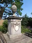 | |||
| 12 And 13 Wellington Place | 55°58′18″N 3°10′09″W | Category C(S) | 27925 |  | |||
| Brunstane Bridge Brunstane Road South | 55°56′29″N 3°05′56″W | Category B | 27939 |  | |||
| Dean Bridge At Queensferry Road | 55°57′11″N 3°12′52″W | Category A | 27941 |  | |||
| Regent Bridge Carrying Waterloo Place Over Calton Road Including Railings | 55°57′13″N 3°11′14″W | Category A | 27945 |  | |||
| South Bridge, Including Railings | 55°56′55″N 3°11′13″W | Category B | 27950 |  | |||
| Scotland Street Tunnel Royal Crescent, Foot Of Scotland Street | 55°57′38″N 3°11′44″W | Category B | 27953 |  | |||
| Union Canal Slateford Aqueduct Over Inglis Green Road And Water Of Leith | 55°55′24″N 3°14′59″W | Category B | 27958 | 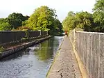 | |||
| 10 Lasswade Road, Dr Guthrie's School With Boundary Walls, Gatepiers, Gates And War Memorial | 55°54′43″N 3°09′32″W | Category B | 27970 |  | |||
| 1B West Coates, Donaldson's Hospital (School For The Deaf), Including Chapel, Fountain, Steps And Balustrades To Terraces, Pavilions, Boundary Wall, Piers, Railings, Gatepiers, Gates, And Lodges | 55°56′50″N 3°13′33″W | Category A | 27971 | 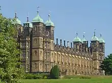 | |||
| 25 Chambers Street, Crown Office (Former Heriot-Watt University) | 55°56′51″N 3°11′24″W | Category B | 27981 | 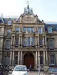 | |||
| Queen Street And North Charlotte Street, Catherine Sinclair Monument | 55°57′11″N 3°12′27″W | Category A | 27832 |  | |||
| 10 Pattison Street | 55°58′25″N 3°09′48″W | Category C(S) | 27839 |  | |||
| Charlotte Square, Albert Memorial And Walls And Railings Of Garden | 55°57′06″N 3°12′28″W | Category A | 27840 | 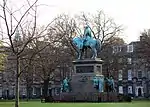 | |||
| East Princes Street Gardens, Adam Black Monument | 55°57′08″N 3°11′40″W | Category A | 27842 | 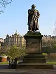 | |||
| East Princes Street Gardens, Livingstone Monument | 55°57′09″N 3°11′34″W | Category A | 27864 |  | |||
| George Street And Frederick Street, Statue Of William Pitt | 55°57′11″N 3°12′01″W | Category A | 27868 | 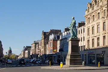 | |||
| Canongate, Well At Queensberry House | 55°57′08″N 3°10′35″W | Category B | 27895 | 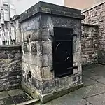 | |||
| 18, 19 And 20 Shore Place, Wishart's Warehouse | 55°58′29″N 3°10′14″W | Category B | 27897 |  | |||
| 7 Stead's Place | 55°58′05″N 3°10′30″W | Category B | 27900 |  | |||
| 18 Straiton Place | 55°57′12″N 3°06′32″W | Category B | 27738 |  | |||
| 5 Forrest Hill, University Of Edinburgh, Territorial Army Centre And School Of Artificial Intelligence | 55°56′46″N 3°11′31″W | Category B | 27773 | .jpg.webp) | |||
| Ratho Village, 62-64 (Even Nos), Main Street | 55°55′19″N 3°22′49″W | Category B | 27781 |  | |||
| 10 And 12 West Brighton Crescent | 55°57′06″N 3°07′08″W | Category C(S) | 27790 |  | |||
| St Andrew Square, Melville Monument With Boundary Walls And Railings | 55°57′15″N 3°11′35″W | Category A | 27816 | 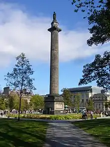 | |||
| 12 Windsor Place, The Post Office | 55°57′06″N 3°06′44″W | Category B | 27818 |  | |||
| Union Canal, Bridge No 17 (Near Clifton Hall) | 55°55′16″N 3°25′31″W | Category B | 27824 |  | |||
| 15 Rosefield Avenue | 55°57′09″N 3°07′01″W | Category B | 27671 |  | |||
| Ratho Village, Baird Road (Off), Kirkton Farm Comprising Cottages And Former Maltings | 55°55′24″N 3°22′53″W | Category B | 27680 |  | |||
| 1 Tipperlinn Road And 65 Colinton Road With Boundary Walls And Gatepiers | 55°55′53″N 3°12′59″W | Category B | 27688 |  | |||
| 244-252 (Even Nos) Leith Walk | 55°57′59″N 3°10′33″W | Category C(S) | 27717 |  | |||
| George Iv Bridge And Victoria Street, Edinburgh Central Library Fine Art Department | 55°56′55″N 3°11′33″W | Category B | 27592 |  | |||
| 413-431 Lawnmarket, | 55°57′00″N 3°11′33″W | Category B | 27598 | 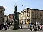 | |||
| 34 Regent Street | 55°57′12″N 3°06′43″W | Category C(S) | 27618 |  | |||
| 5 Belford Road, Hawthornbank Lane, Drumsheugh Baths | 55°57′08″N 3°12′59″W | Category A | 27621 | 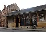 | |||
| Newliston House, Walled Garden | 55°56′44″N 3°25′39″W | Category B | 27627 |  | |||
| Waterloo Place And North Bridge And 10 Calton Road, Waverleygate (Former General Post Office) Including Wall And Lamp Standards | 55°57′11″N 3°11′17″W | Category A | 27631 | 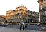 | |||
| 48 Regent Street | 55°57′14″N 3°06′40″W | Category B | 27633 |  | |||
| Princes Street, General Register House With Area Walls And Steps To Front | 55°57′13″N 3°11′21″W | Category A | 27636 | 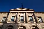 | |||
| Ransfield Road, Ransfield Farm And Gatepiers | 55°55′02″N 3°22′09″W | Category C(S) | 27637 |  | |||
| 23 Jordan Lane, Whitebank, With Boundary Wall | 55°55′39″N 3°12′21″W | Category C(S) | 27508 |  | |||
| 11 And 13 Regent Street | 55°57′10″N 3°06′43″W | Category C(S) | 27539 |  | |||
| 14, 15, 15A Junction Place, Great Junction Street School With Swimming Baths And Stalk (Also Known As Dr Bell's School) | 55°58′19″N 3°10′29″W | Category B | 27565 |  | |||
| Kirkliston Village, 3 And 5 (Odd Nos), High Street | 55°57′15″N 3°24′02″W | Category C(S) | 27467 |  | |||
| Kirkliston Village, 11-13 (Odd Nos), High Street | 55°57′15″N 3°24′03″W | Category C(S) | 27476 |  | |||
| 189-199 (Odd Nos) Great Junction Street And 5 Bangor Road | 55°58′25″N 3°10′37″W | Category C(S) | 27483 |  | |||
| 286 Portobello High Street | 55°57′06″N 3°06′34″W | Category C(S) | 27500 |  | |||
| 5 Greenhill Park With Boundary Wall And Gatepiers | 55°56′01″N 3°12′33″W | Category B | 27373 |  | |||
| 36, 36A 38 (4 Flats), 40 And 40A (Even Nos) Prince Regent Street With Steps And Railings To Front; Eh6 4At | 55°58′35″N 3°10′57″W | Category C(S) | 27388 |  | |||
| St Luke's Parish Church (C Of S), East Fettes Avenue | 55°57′37″N 3°13′12″W | Category B | 27414 |  | |||
| 23-25 South Fort Street, Children's Centre, With Boundary Walls And Railings; Eh6 4Dl | 55°58′27″N 3°10′58″W | Category B | 27415 |  | |||
| 199 And 201 Portobello High Street | 55°57′08″N 3°06′49″W | Category C(S) | 27418 |  | |||
| Ingliston House (Hq Of Royal Highland And Agricultural Society) | 55°56′25″N 3°22′18″W | Category A | 27436 |  | |||
| 1 Gillsland Road South, Red House | 55°55′50″N 3°13′12″W | Category B | 27290 |  | |||
| 1-7 (Odd Nos) Pitt Street With Railings; Eh6 4Bx | 55°58′24″N 3°11′17″W | Category B | 27291 |  | |||
| Gogar Station Road, Gogar Bank House, Walled Garden And Bridges | 55°55′28″N 3°19′22″W | Category A | 27292 |  | |||
| 9-13 (Odd Nos) Marlborough Street | 55°57′09″N 3°06′40″W | Category C(S) | 27301 |  | |||
| 84 Constitution Street | 55°58′26″N 3°10′05″W | Category B | 27330 |  | |||
| Lothian Road, St Cuthbert's Church (Church Of Scotland), Churchyard And Monuments, Boundary Walls Gatepiers And Railings | 55°56′59″N 3°12′20″W | Category A | 27339 | 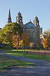 | |||
| 92 Constitution Street And 27 Queen Charlotte Street | 55°58′26″N 3°10′05″W | Category A | 27344 |  | |||
| 11 Greenhill Gardens | 55°56′06″N 3°12′22″W | Category C(S) | 27345 |  | |||
| Charlotte Square, West Register House (Former St George's Church) | 55°57′06″N 3°12′34″W | Category A | 27360 | .JPG.webp) | |||
| 20, 22 And 22A Pittville Street | 55°57′09″N 3°06′19″W | Category C(S) | 27230 |  | |||
| 6, 8 And 10 Merchiston Place | 55°56′08″N 3°12′39″W | Category B | 27231 |  | |||
| 12 East Brighton Crescent | 55°57′02″N 3°07′01″W | Category B | 27247 |  | |||
| Restalrig Road South, Deanery Wall, Between Nos 62A And 64 | 55°57′28″N 3°08′55″W | Category B | 27258 |  | |||
| 159 Constitution Street And 23 Laurie Street | 55°58′16″N 3°10′13″W | Category C(S) | 27264 |  | |||
| 77 Promenade Temple Hall Hotel, (Formerly Beachborough Villa), Including Hall, Boundary Walls And Railings | 55°57′02″N 3°06′01″W | Category B | 27278 |  | |||
| 47 Figgate Lane | 55°57′20″N 3°06′47″W | Category C(S) | 27280 |  | |||
| George Street, St Andrew's And St George's Church With Railings And Lamp Standards | 55°57′15″N 3°11′45″W | Category A | 27283 | 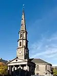 | |||
| 6 St Mary's Place With Boundary Walls And Gatepiers | 55°56′58″N 3°06′15″W | Category C(S) | 27286 |  | |||
| 16 And 16A Napier Road With Boundary Walls And Railings | 55°56′03″N 3°13′03″W | Category C(S) | 27287 |  | |||
| 4 And 6 Merchiston Crescent | 55°56′06″N 3°12′51″W | Category B | 27171 |  | |||
| 57/57B Constitution Street And 49 And 51/1 And 2 Mitchell Street, Former Leith Post Office | 55°58′28″N 3°10′02″W | Category B | 27174 |  | |||
| Glasgow Road, Norton House Hotel | 55°55′57″N 3°23′02″W | Category B | 27178 |  | |||
| 1 Craigentinny Crescent | 55°57′24″N 3°08′13″W | Category C(S) | 27182 |  | |||
| 4 And 4A Merchiston Park | 55°56′09″N 3°12′44″W | Category C(S) | 27189 |  | |||
| 3C Craigentinny Crescent, Craigentinny Marbles (The William Henry Miller Mausoleum) | 55°57′26″N 3°08′14″W | Category A | 27191 |  | |||
| 6 And 6A Merchiston Park | 55°56′09″N 3°12′44″W | Category C(S) | 27198 |  | |||
| 67 Colinton Road, George Watson's College, Music School | 55°55′47″N 3°12′57″W | Category B | 27202 |  | |||
| 30 And 32 Brighton Place | 55°57′07″N 3°07′00″W | Category B | 27125 |  | |||
| 3 Pittville Street (Abercorn House) | 55°57′05″N 3°06′27″W | Category C(S) | 27130 |  | |||
| 14-16 Abinger Gardens And Ormidale Terrace, Murrayfield Parish Church (Church Of Scotland) | 55°56′46″N 3°14′26″W | Category B | 27148 |  | |||
| Holy Cross, Church Of The (Episcopal) Quality Street And East Barnton Avenue Davidson's Mains | 55°57′54″N 3°16′29″W | Category B | 27039 |  | |||
| 35 Brighton Place St John The Evangelist (Roman Catholic Church) | 55°57′06″N 3°06′55″W | Category A | 27046 |  | |||
| 3 Carpet Lane And 42 The Shore (Donaldson's Warehouse) | 55°58′33″N 3°10′09″W | Category A | 27078 |  | |||
| Chamberlain Road, Tomb Of John Livingstone | 55°56′04″N 3°12′22″W | Category C(S) | 26960 |  |
Key
The scheme for classifying buildings in Scotland is:
- Category A: "buildings of national or international importance, either architectural or historic; or fine, little-altered examples of some particular period, style or building type."[1]
- Category B: "buildings of regional or more than local importance; or major examples of some particular period, style or building type, which may have been altered."[1]
- Category C: "buildings of local importance; lesser examples of any period, style, or building type, as originally constructed or moderately altered; and simple traditional buildings which group well with other listed buildings."[1]
In March 2016 there were 47,288 listed buildings in Scotland. Of these, 8% were Category A, and 50% were Category B, with the remaining 42% being Category C.[2]
Notes
- Sometimes known as OSGB36, the grid reference (where provided) is based on the British national grid reference system used by the Ordnance Survey.
• "Guide to National Grid". Ordnance Survey. Retrieved 12 December 2007.
• "Get-a-map". Ordnance Survey. Retrieved 17 December 2007. - Historic Environment Scotland assign a unique alphanumeric identifier to each designated site in Scotland, for listed buildings this always begins with "LB", for example "LB12345".
References
- All entries, addresses and coordinates are based on data from Historic Scotland. This data falls under the Open Government Licence
- "What is Listing?". Historic Environment Scotland. Retrieved 29 May 2018.
- Scotland's Historic Environment Audit 2016 (PDF). Historic Environment Scotland and the Built Environment Forum Scotland. pp. 15–16. Retrieved 29 May 2018.
This article is issued from Wikipedia. The text is licensed under Creative Commons - Attribution - Sharealike. Additional terms may apply for the media files.