List of listed buildings in Edinburgh/31
List
| Name | Location | Date Listed | Grid Ref. [note 1] | Geo-coordinates | Notes | LB Number [note 2] | Image |
|---|---|---|---|---|---|---|---|
| 54 And 54A St Albans Road | 55°55′50″N 3°10′58″W | Category B | 30470 |  | |||
| 10 Sciennes House Place, Former Causewayside Police Station | 55°56′16″N 3°10′53″W | Category B | 30478 | 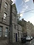 | |||
| 10 Sciennes Road, Sciennes Primary School Including Playground Shelters, Gatepiers, Boundary Walls And Railings | 55°56′18″N 3°11′16″W | Category B | 30479 |  | |||
| 54 And 56 Grange Loan | 55°56′00″N 3°10′50″W | Category C(S) | 30384 |  | |||
| 8 Grange Road. Rockville Lodge, Including Boundary Walls | 55°56′12″N 3°10′53″W | Category B | 30393 | 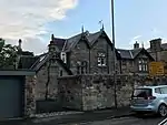 | |||
| 50 Lauder Road And 10 Hatton Place With Boundary Wall | 55°56′15″N 3°11′19″W | Category C(S) | 30421 |  | |||
| 56-60 (Even Nos) Marchmont Crescent | 55°56′14″N 3°11′35″W | Category B | 30436 | 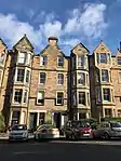 | |||
| 62-66 (Even Nos) Marchmont Crescent | 55°56′13″N 3°11′35″W | Category B | 30437 | 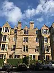 | |||
| 1 Lauriston Place, Royal Infirmary, Medical Pavilions, Including Jubilee Pavilion And Linking Corridor | 55°56′35″N 3°11′36″W | Category B | 30307 | 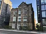 | |||
| 2-20 (Even Nos) Earl Grey Street, And 2 West Tollcross, Methodist Central Hall | 55°56′39″N 3°12′17″W | Category B | 30326 | 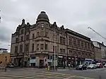 | |||
| 55 Fountainhall Road Including Boundary Walls And Gatepiers | 55°56′06″N 3°11′02″W | Category C(S) | 30373 |  | |||
| Canongate/ Cranston Street, Police Box | 55°57′03″N 3°11′02″W | Category B | 30238 |  | |||
| 39 Barnton Avenue, Woodcroft Including Stable Block | 55°57′57″N 3°17′09″W | Category B | 30284 |  | |||
| 124 Mcdonald Road, Former Territorial Army Administration Block | 55°57′50″N 3°11′10″W | Category B | 30285 |  | |||
| 2 Easter Belmont Road, 'Cuill' | 55°56′56″N 3°15′10″W | Category C(S) | 30296 |  | |||
| 4 Easter Belmont Road | 55°56′56″N 3°15′12″W | Category C(S) | 30297 |  | |||
| 137 And 138 Princes Street | 55°57′02″N 3°12′24″W | Category B | 30148 |  | |||
| 9-13 (Odd Nos) Calton Hill | 55°57′15″N 3°11′11″W | Category B | 30203 |  | |||
| Granton Harbour, Mid Pier Including Slipways, Wharves And Lamp Standards | 55°59′10″N 3°13′18″W | Category A | 30216 |  | |||
| Granton Harbour, Mid Pier, Leading Light | 55°59′09″N 3°13′21″W | Category B | 30218 |  | |||
| Barnton House (Formerly) East Gates And Associated Well, East Barnton Avenue And Quality Street Davidson's Mains | 55°57′55″N 3°16′29″W | Category B | 30053 |  | |||
| Craiglockhart Dell West Grotto | 55°55′13″N 3°14′58″W | Category B | 30057 |  | |||
| 34-40 (Even Nos) Broughton Street, And 1-7 (Odd Nos) Barony Street, Including Railings | 55°57′29″N 3°11′23″W | Category A | 30070 |  | |||
| Duddingston, The Causeway, Bella Vista Studio (Former Billiards-House) With Lamp Standards | 55°56′33″N 3°08′57″W | Category C(S) | 30076 |  | |||
| 35-39 (Odd Nos) Cockburn Street | 55°57′03″N 3°11′23″W | Category B | 30080 |  | |||
| 6 Cockburn Street | 55°57′02″N 3°11′28″W | Category B | 30086 |  | |||
| 1 Saxe Coburg Terrace And 29-35 Hamilton Place | 55°57′35″N 3°12′24″W | Category B | 30096 |  | |||
| 90 And 90A George Street And 78 Rose Street Lane North | 55°57′08″N 3°12′07″W | Category A | 30107 |  | |||
| 86-90 (Even Nos) Grassmarket | 55°56′53″N 3°11′43″W | Category B | 30112 |  | |||
| 42 Laverockbank Road, Rose Villa, With Boundary Walls And Gatepiers | 55°58′43″N 3°12′07″W | Category C(S) | 30130 |  | |||
| 34 York Place, Including Railings | 55°57′23″N 3°11′25″W | Category A | 29990 |  | |||
| 3 York Road, With Boundary Wall And Gatepiers | 55°58′35″N 3°12′11″W | Category B | 29994 |  | |||
| 19 Young Street | 55°57′11″N 3°12′21″W | Category A | 30003 |  | |||
| 13 And 15 South College Street | 55°56′48″N 3°11′13″W | Category B | 30018 |  | |||
| Nicolson Street, Edinburgh Festival Theatre | 55°56′48″N 3°11′11″W | Category B | 30023 |  | |||
| Grindlay Street, Royal Lyceum Theatre | 55°56′49″N 3°12′15″W | Category A | 30031 |  | |||
| Rodney Street Tunnel | 55°57′41″N 3°11′45″W | Category B | 30037 |  | |||
| 5 Drummond Street, Former St Patrick's Roman Catholic School Including Boundary Walls | 55°56′52″N 3°11′05″W | Category B | 30048 |  | |||
| 114-118 (Even Nos) West Bow | 55°56′53″N 3°11′39″W | Category B | 29911 |  | |||
| 1 West Register Street And 1-3 (Inclusive Nos) Gabriel's Road, Guildford Arms | 55°57′13″N 3°11′25″W | Category B | 29927 | 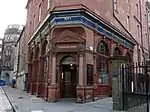 | |||
| 260 Willowbrae Road With Boundary Walls And Railings | 55°56′45″N 3°08′11″W | Category B | 29933 |  | |||
| 14 Duddingston Mills | 55°56′49″N 3°08′02″W | Category C(S) | 29938 |  | |||
| Windsor Place Windsor Place Lodge Portobello | 55°57′05″N 3°06′45″W | Category B | 29941 |  | |||
| 1 Woodhall Road, Dell Court, With Boundary And Retaining Walls, Steps, Gatepiers And Gate | 55°54′26″N 3°15′19″W | Category C(S) | 29946 |  | |||
| 4 Woodhall Road, The Hollies, With Boundary Wall And Railings | 55°54′25″N 3°15′27″W | Category C(S) | 29954 |  | |||
| 12 Woodhall Road, With Boundary Wall And Railings | 55°54′24″N 3°15′30″W | Category C(S) | 29957 |  | |||
| 45, 45A And 45B York Place, Including Railings | 55°57′22″N 3°11′21″W | Category B | 29968 |  | |||
| 29 Waterloo Place, Calton Convening Rooms | 55°57′15″N 3°11′09″W | Category A | 29897 |  | |||
| 16-20 (Even Nos) Waterloo Place | 55°57′13″N 3°11′13″W | Category A | 29899 |  | |||
| 87 And 87A West Bow | 55°56′54″N 3°11′41″W | Category B | 29902 |  | |||
| 60-64 (Even Nos) Thistle Street | 55°57′14″N 3°11′59″W | Category B | 29844 |  | |||
| 2 Pier Place | 55°58′51″N 3°11′43″W | Category C(S) | 29849 |  | |||
| 30 Trinity Crescent, With Railings And Gateposts | 55°58′47″N 3°12′14″W | Category C(S) | 29855 |  | |||
| 8-20 (Even Nos) Victoria Street | 55°56′56″N 3°11′37″W | Category B | 29871 |  | |||
| 21 And 23 Scotland Street, Including Railings | 55°57′36″N 3°11′41″W | Category B | 29775 |  | |||
| 24 St Andrew Square With Railings | 55°57′18″N 3°11′37″W | Category C(S) | 29701 |  | |||
| 59-63 (Odd Nos) Rose Street | 55°57′09″N 3°11′57″W | Category B | 29634 |  | |||
| 89-93 (Odd Nos) Rose Street | 55°57′08″N 3°12′04″W | Category B | 29639 | 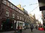 | |||
| 43, Hogarth House, And 44 Queen Street With Railings And Lamp Standards | 55°57′15″N 3°12′08″W | Category A | 29556 |  | |||
| 45-47 (Inclusive Nos) Queen Street With Railings And Lamp Standard | 55°57′14″N 3°12′08″W | Category A | 29557 |  | |||
| 61, 61A, 62 & 63 Queen Street | 55°57′13″N 3°12′17″W | Category A | 29567 |  | |||
| 65 Queen Street With Railings And Lamp Standard | 55°57′13″N 3°12′19″W | Category A | 29569 |  | |||
| 7 Queensferry Road, Dean Park House (Stewart's Melville Boarding House) Including Former Coach House | 55°57′16″N 3°13′46″W | Category A | 29575 |  | |||
| 8 Pentland Avenue With Boundary Wall And Gate | 55°54′32″N 3°15′41″W | Category C(S) | 29483 |  | |||
| 42 Pentland Avenue, Binley Cottage, With Boundary Wall And Gatepiers | 55°54′27″N 3°15′57″W | Category B | 29485 |  | |||
| 1 Pentland Road, Stonehouse, With Boundary Wall, Gatepiers And Garden Terrace | 55°54′32″N 3°15′51″W | Category A | 29486 |  | |||
| 19 And 20 Princes Street, Incorporating The Royal British Hotel | 55°57′12″N 3°11′27″W | Category B | 29502 |  | |||
| 47-52 (Inclusive Nos) Princes Street And South St David Street, Jenners Department Store, Including Gothic Streetlight | 55°57′11″N 3°11′39″W | Category A | 29505 | 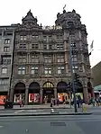 | |||
| 11-13 (Inclusive Nos) Queen Street With Front Walls And Railings | 55°57′18″N 3°11′48″W | Category A | 29536 |  | |||
| 9-13 (Odd Nos) Nelson Street, Including Railings And Lamps | 55°57′25″N 3°11′46″W | Category A | 29385 |  | |||
| 5 New Street, Canongate Venture, Including Boundary Walls And Gatepiers | 55°57′05″N 3°10′58″W | Category C(S) | 29393 |  | |||
| 190 And 192 Newhaven Road, Including Gatepiers And Boundary Walls | 55°58′38″N 3°11′32″W | Category B | 29399 |  | |||
| 18 And 20 Nicolson Street | 55°56′47″N 3°11′06″W | Category B | 29418 |  | |||
| Nicolson Street, 94-98 | 55°56′41″N 3°11′01″W | Category B | 29423 |  | |||
| 51 Minto Street, Birch House, Including Boundary Wall And Pedestrian Gate | 55°56′13″N 3°10′41″W | Category B | 29365 |  | |||
| 176-180 (Even Nos) Morrison Street, Including Railings | 55°56′47″N 3°12′43″W | Category B | 29377 |  | |||
| 2 Mound Place, Patrick Geddes Hall (Part) | 55°56′59″N 3°11′45″W | Category A | 29380 | %252C_2_Mound_Place_(Mound_Place%252C_Lister_House)%252C_Edinburgh_(1).jpg.webp) | |||
| 7-14 (Inclusive Numbers) Melville Place | 55°57′05″N 3°12′42″W | Category B | 29323 |  | |||
| 3 Merchant Street | 55°56′52″N 3°11′32″W | Category B | 29329 |  | |||
| Main Street 27 Rose Cottage Davidsons Mains | 55°57′56″N 3°16′25″W | Category C(S) | 29278 |  | |||
| 13 And 15 Leith Street | 55°57′14″N 3°11′17″W | Category B | 29250 |  | |||
| 1, 1A And 3 Leven Street | 55°56′31″N 3°12′14″W | Category C(S) | 29259 |  | |||
| 60 And 62 Laverockbank Road And 20 Starbank Road, Starbank Arms | 55°58′47″N 3°12′08″W | Category B | 29225 |  | |||
| 4, 5, 6 Melville Crescent, 43 Melville Street, 19 Walker Street Including Railings And Arched Lamp Holders | 55°57′00″N 3°11′36″W | Category A | 29230 |  | |||
| Inverleith Place, 52-54 | 55°58′00″N 3°12′54″W | Category B | 29154 |  | |||
| Inverleith Row, 8 | 55°57′54″N 3°12′13″W | Category A | 29157 |  | |||
| Inverleith Row, 15 And 15A | 55°57′57″N 3°12′15″W | Category B | 29161 |  | |||
| Inverleith Row, 27 | 55°58′04″N 3°12′22″W | Category B | 29170 |  | |||
| Inverleith Terrace 16 The Little House | 55°57′49″N 3°12′14″W | Category B | 29187 |  | |||
| 9 And 9A Holyrood Road And 18 Gullan's Close | 55°56′58″N 3°10′58″W | Category C(S) | 29089 |  | |||
| 107-119 (Odd Nos) High Street | 55°57′02″N 3°11′11″W | Category B | 29039 |  | |||
| 10-12 (Even Nos) High Street | 55°57′01″N 3°11′04″W | Category B | 29056 |  | |||
| High Street, Tweedale Court, Walling To West Of Court And To South Of Tweedale House | 55°57′01″N 3°11′04″W | Category B | 29058 |  | |||
| 56, 58 And 60 High Street And 1 And 3 Blackfriars Street | 55°57′01″N 3°11′10″W | Category B | 29064 |  | |||
| 2 Granton Road, Including Boundary Wall | 55°58′15″N 3°12′53″W | Category B | 28929 |  | |||
| 7 Granton Square, The Anchorage | 55°58′50″N 3°13′25″W | Category C(S) | 28931 |  | |||
| 66-68 (Even Nos) Grassmarket | 55°56′52″N 3°11′45″W | Category B | 28940 | 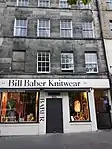 | |||
| 98 Grassmarket And 105 West Bow | 55°56′53″N 3°11′41″W | Category A | 28943 | 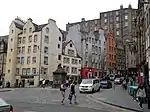 | |||
| 6 South Gray Street, Including Boundary Walls, Gatepiers And Pedestrian Gateway | 55°56′03″N 3°10′37″W | Category B | 28946 |  | |||
| 11 Upper Gray Street Including Boundary Walls | 55°56′11″N 3°10′43″W | Category B | 28952 |  | |||
| 137, 137A, 139 And 141 George Street With Railings | 55°57′08″N 3°12′22″W | Category B | 28860 |  | |||
| 14 George Street, Former Commercial Bank, Incorporating Boundary Walls, Railings And Balustrades, Flanking Gateways And Pavilions, And Lamp Standards | 55°57′12″N 3°11′44″W | Category A | 28862 |  | |||
| 26 George Street And 53 And 55 Hanover Street | 55°57′12″N 3°11′49″W | Category A | 28865 | 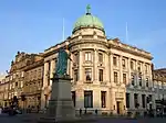 | |||
| 112 George Street With Railings And Lamp Standards | 55°57′08″N 3°12′15″W | Category A | 28883 |  | |||
| 118 George Street With Railings | 55°57′07″N 3°12′17″W | Category B | 28884 |  | |||
| 120-124 (Even Nos) George Street, Tsb Offices, With Railings | 55°57′07″N 3°12′17″W | Category B | 28885 |  | |||
| Gillespie Road 21, Pentland Cottage | 55°54′25″N 3°16′06″W | Category B | 28894 |  | |||
| 23 Gilmore Place Including Boundary Walls | 55°56′30″N 3°12′17″W | Category C(S) | 28903 |  | |||
| 46 Gilmore Place | 55°56′29″N 3°12′29″W | Category C(S) | 28915 |  | |||
| 5, 7 And 7A Frederick Street (Formerly Queen's Club) | 55°57′07″N 3°11′58″W | Category B | 28779 |  | |||
| 6-10 (Even Nos) Frederick Street | 55°57′07″N 3°12′00″W | Category B | 28788 |  | |||
| 20 And 22 Frederick Street (And 77 Rose Street) | 55°57′08″N 3°12′01″W | Category B | 28791 |  | |||
| 4 Gayfield Square Including Boundary Wall, Gatepiers And Railings | 55°57′32″N 3°11′10″W | Category B | 28800 |  | |||
| George Square 55 | 55°56′38″N 3°11′14″W | Category A | 28823 | 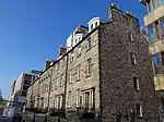 | |||
| George Square 59 | 55°56′39″N 3°11′14″W | Category A | 28826 |  | |||
| 43 George Street | 55°57′13″N 3°11′55″W | Category B | 28835 |  | |||
| 6 Easter Belmont Road, 'Ardnasaid' | 55°56′56″N 3°15′16″W | Category B | 28727 |  | |||
| 3 Fishmarket Square And 2 Wester Close | 55°58′50″N 3°11′42″W | Category C(S) | 28766 |  | |||
| 6-10A (Even Nos) Dublin Street, Including Railings | 55°57′22″N 3°11′36″W | Category B | 28689 |  | |||
| 48 Duddingston Road West | 55°56′40″N 3°08′21″W | Category B | 28698 |  | |||
| 12-16 (Even Nos) Dundas Street, Including Railings | 55°57′23″N 3°11′57″W | Category B | 28714 |  | |||
| 1A Upper Dean Terrace And 2 Danube Street | 55°57′23″N 3°12′42″W | Category A | 28646 |  | |||
| 58 Dalkeith Road, Physician And Firkin Public House | 55°56′18″N 3°10′26″W | Category B | 28621 |  | |||
| 74 Dalkeith Road, Blacket Avenue Lodge And Gatepiers | 55°56′14″N 3°10′17″W | Category B | 28625 |  | |||
| Upper Coltbridge Terrace St George's School Main Block Only | 55°57′01″N 3°13′58″W | Category B | 28582 |  | |||
| 39 Corstorphine Road, Including Boundary Wall | 55°56′43″N 3°14′32″W | Category C(S) | 28587 |  | |||
| 11 And 13 South Charlotte Street With Railings And Lamp Standard | 55°57′04″N 3°12′21″W | Category A | 28514 | 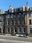 | |||
| 64 Canongate, Queensberry House | 55°57′07″N 3°10′34″W | Category A | 28440 | 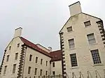 | |||
| 168-172 (Even Nos) Canongate | 55°57′04″N 3°10′49″W | Category B | 28448 | 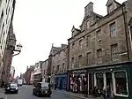 | |||
| 28 Castle Street With Railings And Lamp Standards | 55°57′07″N 3°12′13″W | Category A | 28474 |  | |||
| 36-40 (Even Nos) North Castle Street With Railings | 55°57′10″N 3°12′15″W | Category A | 28476 |  | |||
| 54-58 (Even Nos) And 58A North Castle Street With Railings | 55°57′12″N 3°12′16″W | Category A | 28479 |  | |||
| 3 And 4 Castle Terrace, Including Boundary Wall And Railings | 55°56′55″N 3°12′21″W | Category B | 28481 |  | |||
| 53 And 54 Bruntsfield Place Including Boundary Walls | 55°56′20″N 3°12′19″W | Category B | 28376 |  | |||
| 105 Buccleuch Street | 55°56′31″N 3°11′02″W | Category C(S) | 28396 |  | |||
| 17-21 (Odd Nos) Blackfriars Street (Former United Presbyterian Church) | 55°57′00″N 3°11′09″W | Category B | 28323 |  | |||
| 9-15 (Odd Nos) Blair Street | 55°56′58″N 3°11′17″W | Category B | 28330 |  | |||
| 55-63 (Odd Nos) Broughton Street | 55°57′29″N 3°11′20″W | Category B | 28363 |  | |||
| Blacket Avenue And Minto Street Gatepiers And Boundary Walls To Blacket Estate | 55°56′08″N 3°10′34″W | Category B | 28297 |  | |||
| 4 Blacket Place, Including Boundary Walls | 55°56′15″N 3°10′24″W | Category B | 28308 |  | |||
| Ann Street 50 | 55°57′21″N 3°12′43″W | Category B | 28250 |  | |||
| 6, 8 And 10 Bangholm Bower Avenue, Bangholm Bower House | 55°58′18″N 3°12′26″W | Category B | 28262 |  | |||
| 141 Redford Road, Drummond Scrolls | 55°54′20″N 3°14′29″W | Category B | 28116 |  | |||
| 159 Newhaven Road, Victoria Park House | 55°58′34″N 3°11′35″W | Category C(S) | 28126 |  | |||
| Woodhall House Woodhall Road | 55°54′06″N 3°17′07″W | Category B | 28130 |  | |||
| 9 Bonaly Road With Boundary Wall, Gate Piers And Gates | 55°54′08″N 3°15′32″W | Category C(S) | 28150 |  | |||
| Dreghorn Mains, Woodend Cottage | 55°54′04″N 3°14′04″W | Category C(S) | 28169 |  | |||
| Spylaw Farm Steading Off Gillespie Road Colinton | 55°54′22″N 3°16′17″W | Category C(S) | 28200 |  | |||
| Cammo Road, Cammo Estate, Water Tower (Off Cammo Walk) | 55°57′15″N 3°19′17″W | Category B | 28039 |  | |||
| Gilmerton, The Drum, Mercat Cross | 55°54′25″N 3°07′11″W | Category C(S) | 28053 |  |
Key
The scheme for classifying buildings in Scotland is:
- Category A: "buildings of national or international importance, either architectural or historic; or fine, little-altered examples of some particular period, style or building type."[1]
- Category B: "buildings of regional or more than local importance; or major examples of some particular period, style or building type, which may have been altered."[1]
- Category C: "buildings of local importance; lesser examples of any period, style, or building type, as originally constructed or moderately altered; and simple traditional buildings which group well with other listed buildings."[1]
In March 2016 there were 47,288 listed buildings in Scotland. Of these, 8% were Category A, and 50% were Category B, with the remaining 42% being Category C.[2]
Notes
- Sometimes known as OSGB36, the grid reference (where provided) is based on the British national grid reference system used by the Ordnance Survey.
• "Guide to National Grid". Ordnance Survey. Retrieved 12 December 2007.
• "Get-a-map". Ordnance Survey. Retrieved 17 December 2007. - Historic Environment Scotland assign a unique alphanumeric identifier to each designated site in Scotland, for listed buildings this always begins with "LB", for example "LB12345".
References
- All entries, addresses and coordinates are based on data from Historic Scotland. This data falls under the Open Government Licence
- "What is Listing?". Historic Environment Scotland. Retrieved 29 May 2018.
- Scotland's Historic Environment Audit 2016 (PDF). Historic Environment Scotland and the Built Environment Forum Scotland. pp. 15–16. Retrieved 29 May 2018.
This article is issued from Wikipedia. The text is licensed under Creative Commons - Attribution - Sharealike. Additional terms may apply for the media files.