List of listed buildings in Edinburgh/8
List
| Name | Location | Date Listed | Grid Ref. [note 1] | Geo-coordinates | Notes | LB Number [note 2] | Image |
|---|---|---|---|---|---|---|---|
| 27-31 (Odd Nos) Causewayside | 55°56′19″N 3°10′53″W | Category B | 43144 | 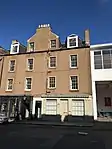 | |||
| 45-79 (Odd Nos) Causewayside | 55°56′17″N 3°10′52″W | Category C(S) | 43145 |  | |||
| Dalkeith Road, Salisbury Green Gate Lodge | 55°56′17″N 3°10′20″W | Category B | 43151 |  | |||
| 11 And 13 Marchhall Crescent | 55°56′10″N 3°10′03″W | Category C(S) | 43157 |  | |||
| 43-45 (Inclusive Nos) West Preston Street And 15 - 19 (Odd Nos) Causewayside | 55°56′20″N 3°10′53″W | Category B | 43175 | 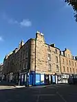 | |||
| 5 High Street | 55°59′26″N 3°23′50″W | Category C(S) | 40374 |  | |||
| 17 High Street, Queensferry Arms Hotel | 55°59′25″N 3°23′47″W | Category B | 40376 |  | |||
| 20, 21, 21A And 22 High Street | 55°59′25″N 3°23′46″W | Category C(S) | 40378 |  | |||
| 2 And 3 Mid Terrace | 55°59′23″N 3°23′44″W | Category C(S) | 40396 |  | |||
| Station Road, 1, 3, 5 And 7 (Coach House) Ashburnham Gardens, Ashburnham House | 55°59′15″N 3°23′08″W | Category B | 40414 |  | |||
| 8, 9/1, 9/2, 9/3 East Terrace | 55°59′23″N 3°23′36″W | Category B | 40340 |  | |||
| Newhalls Road, Hawes Pier, Lighthouse | 55°59′35″N 3°23′13″W | Category B | 40353 |  | |||
| 5 Edinburgh Road, Craig View | 55°59′24″N 3°23′34″W | Category C(S) | 40359 |  | |||
| 138,140 And 142(Formerly 14) Whitehouse Loan,Clinton House Including Conservatory ,Lodge(136 Whitehouse Loan) Gatepiers And Boundary Walls | 55°55′58″N 3°12′06″W | Category B | 30671 |  | |||
| 2 South Lauder Road, Masson Hall, Including Gates And_Boundary Walls | 55°55′55″N 3°11′00″W | Category B | 30680 |  | |||
| 7-9 (Odd Nos) Spottiswoode Street | 55°56′20″N 3°11′54″W | Category B | 30596 |  | |||
| 5-11 (Incl Nos) Strathearn Place And 132 (Formerly 12) Whitehouse Loan | 55°56′00″N 3°12′04″W | Category B | 30602 |  | |||
| 23-27 (Odd Nos) Warrender Park Road | 55°56′18″N 3°11′37″W | Category B | 30615 | 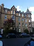 | |||
| 71-77 (Odd Nos) Warrender Park Rd 16-20 Spottiswoode Street | 55°56′19″N 3°11′51″W | Category B | 30627 |  | |||
| 107-111 (Odd Nos) Warrender Park Road | 55°56′18″N 3°11′58″W | Category B | 30632 |  | |||
| 117-119 (Odd Nos) Warrender Park Rd & 5 Marchmont Street | 55°56′17″N 3°12′00″W | Category B | 30634 |  | |||
| 123 And 125 Warrender Park Road | 55°56′16″N 3°12′03″W | Category B | 30635 |  | |||
| 38 And 39 Warrender Park Terrace | 55°56′20″N 3°12′00″W | Category C(S) | 30659 |  | |||
| 42-43 Warrender Park Terrace And 14-15 Marchmont Street | 55°56′19″N 3°12′01″W | Category B | 30661 |  | |||
| 12-15 (Inclusive Nos) Glenisla Gardens | 55°55′38″N 3°11′23″W | Category B | 30504 |  | |||
| 129 Grange Loan | 55°55′51″N 3°11′37″W | Category B | 30509 |  | |||
| 12 And 14 Greenhill Gardens | 55°56′07″N 3°12′19″W | Category B | 30515 |  | |||
| 18 Greenhill Gardens Incl Gates Gatepiers & Boundary Walls | 55°56′06″N 3°12′19″W | Category C(S) | 30517 |  | |||
| 32-34 (Even Nos) Greenhill Gardens | 55°56′01″N 3°12′17″W | Category B | 30519 |  | |||
| 42 Greenhill Gardens St Bennets Incl Gatepiers And Boundary Walls | 55°55′57″N 3°12′17″W | Category B | 30520 |  | |||
| 33 Marchmont Crescent | 55°56′16″N 3°11′37″W | Category B | 30533 |  | |||
| 37 And 39 Marchmont Crescent | 55°56′15″N 3°11′37″W | Category B | 30535 |  | |||
| 1-9 (Odd Nos) Marchmont Rd & 1 Marchmont Crescent | 55°56′22″N 3°11′41″W | Category B | 30539 |  | |||
| 43-47 (Odd Nos) Marchmont Road | 55°56′16″N 3°11′40″W | Category B | 30546 |  | |||
| 58-62 (Even Nos) Marchmont Road | 55°56′15″N 3°11′42″W | Category B | 30561 |  | |||
| 136-144 (Even Nos) Marchmont Road | 55°56′06″N 3°11′40″W | Category B | 30567 |  | |||
| 1 Marchmont Street | 55°56′17″N 3°12′03″W | Category B | 30568 |  | |||
| 4 Marchmont Street | 55°56′19″N 3°12′04″W | Category B | 30571 |  | |||
| 31 Mortonhall Rd With Boundary Walls Gates Gatepiers & Railings | 55°55′38″N 3°11′39″W | Category A | 30577 |  | |||
| 25 (Formerly No 5) Oswald Rd Including Boundary Walls | 55°55′42″N 3°11′36″W | Category C(S) | 30586 |  | |||
| 11-21 Millerfield Place | 55°56′20″N 3°11′18″W | Category B | 30455 |  | |||
| 1 And 3 Palmerston Road | 55°56′12″N 3°11′31″W | Category B | 30456 |  | |||
| 10 Palmerston Road Including Boundary Walls And Gatepiers | 55°56′08″N 3°11′31″W | Category C(S) | 30460 |  | |||
| 1-3 (Inclusive Nos) Rillbank Crescent | 55°56′21″N 3°11′23″W | Category B | 30461 |  | |||
| 8-10 (Inclusive Nos) Sciennes Gardens | 55°56′14″N 3°11′02″W | Category C(S) | 30473 |  | |||
| 40 Sciennes | 55°56′17″N 3°10′56″W | Category C(S) | 30474 |  | |||
| 18 Warrender Park Road | 55°56′17″N 3°11′32″W | Category B | 30489 | 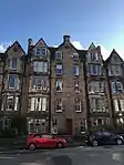 | |||
| 2 Alvanley Terrace | 55°56′15″N 3°12′10″W | Category B | 30493 |  | |||
| 3 And 4 Alvanley Terrace Links Hotel And Park Hotel | 55°56′16″N 3°12′10″W | Category B | 30494 |  | |||
| 3 And 5 Clinton Road, East Morningside House Including Dovecot, Gatepiers, Garden And Boundary Walls | 55°55′58″N 3°12′11″W | Category A | 30499 |  | |||
| 1-5 Glenisla Gardens | 55°55′39″N 3°11′18″W | Category B | 30502 | 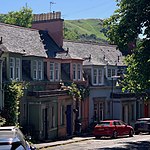 | |||
| 54 Fountainhall Road Including Boundary Walls And Gatepiers | 55°55′53″N 3°10′59″W | Category B | 30377 |  | |||
| 57 And 59 Grange Road Including Boundary Walls | 55°56′09″N 3°11′23″W | Category C(S) | 30392 |  | |||
| 28 Mansionhouse Road | 55°56′05″N 3°11′17″W | Category B | 30431 |  | |||
| 44-48 (Even Nos) Marchmont Crescent | 55°56′15″N 3°11′34″W | Category B | 30434 | 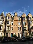 | |||
| 1 Lauriston Place, Edinburgh Royal Infirmary, Main Block, Including Linked Original Ward Pavilions | 55°56′40″N 3°11′34″W | Category A | 30306 | 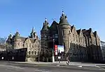 | |||
| 1 Lauriston Place, Royal Infirmary, Former Nurses Home With Linking Conservatory And Fountain | 55°56′38″N 3°11′36″W | Category B | 30309 |  | |||
| 4 And 5 Argyle Park Terrace | 55°56′22″N 3°11′32″W | Category B | 30332 |  | |||
| 2 And 3 Argyle Place | 55°56′21″N 3°11′28″W | Category C(S) | 30333 |  | |||
| 6 And 7 Argyle Place | 55°56′20″N 3°11′28″W | Category C(S) | 30335 |  | |||
| 2-6 (Inclusive Nos) Beaufort Road | 55°56′06″N 3°11′36″W | Category B | 30342 | 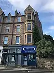 | |||
| 26, 26A, 28 And 30 Fountainhall Road | 55°55′57″N 3°10′49″W | Category C(S) | 30376 |  | |||
| Grassmarket, Police Box | 55°56′52″N 3°11′40″W | Category B | 30235 |  | |||
| Lawnmarket, South Side, Police Box | 55°56′58″N 3°11′35″W | Category B | 30236 | .jpg.webp) | |||
| Hunter Square, Police Box | 55°57′00″N 3°11′17″W | Category B | 30237 |  | |||
| Rutland Square, Police Box | 55°56′56″N 3°12′32″W | Category B | 30246 |  | |||
| High Street, Group Of K6 Telephone Kiosks (At 150-164 High Street) | 55°57′00″N 3°11′21″W | Category B | 30254 |  | |||
| Cammo Road, Cammo Estate, Rubble Bridge | 55°57′35″N 3°19′08″W | Category B | 30263 |  | |||
| 31 Salisbury Road, Former Longmore Hospital, Nurses' Home | 55°56′17″N 3°10′35″W | Category B | 30274 |  | |||
| 118-144 (Even Nos, Excluding No 120) Lothian Road, And 1 And 7 Morrison St, Lothian House | 55°56′42″N 3°12′20″W | Category B | 30289 |  | |||
| 165 Broughton Road, Powderhall Refuse Depot | 55°58′01″N 3°11′20″W | Category B | 30290 |  | |||
| 11 Easter Belmont Road, 'Lismhor' | 55°56′50″N 3°15′22″W | Category B | 30295 |  | |||
| 3 West Silvermills Lane, Silvermills House | 55°57′34″N 3°12′18″W | Category B | 30302 |  | |||
| 60 Princes Street | 55°57′10″N 3°11′42″W | Category B | 30145 | 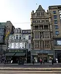 | |||
| 109,110 And 111 Princes Street | 55°57′06″N 3°12′07″W | Category B | 30147 |  | |||
| 9, 10, 11 Queensferry Street | 55°57′02″N 3°12′34″W | Category B | 30150 |  | |||
| 1-7 (Inclusive Nos) Roseburn Cliff | 55°56′47″N 3°14′01″W | Category C(S) | 30154 |  | |||
| 10 Russell Place, With Boundary Wall | 55°58′37″N 3°12′16″W | Category B | 30155 |  | |||
| 12-20 (Even Nos) St Giles Street | 55°57′00″N 3°11′31″W | Category B | 30162 |  | |||
| St Leonard Street 64, The Coalyard House, Formerly Called Hermits And Termits | 55°56′32″N 3°10′43″W | Category B | 30164 |  | |||
| 3-11 (Odd Nos) St Mary's Street | 55°57′02″N 3°11′03″W | Category B | 30165 | 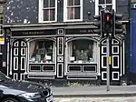 | |||
| 2 St Mary's Street And 274-278 (Even Nos) Canongate | 55°57′02″N 3°11′02″W | Category B | 30166 | 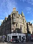 | |||
| 4-28 (Even Nos) St Mary's Street | 55°57′00″N 3°11′01″W | Category B | 30167 |  | |||
| 25 And 27 Shandwick Place, The Maitland Hotel | 55°56′59″N 3°12′32″W | Category C(S) | 30176 |  | |||
| 97-101 (Odd Nos) Shandwick Place | 55°56′56″N 3°12′38″W | Category B | 30179 |  | |||
| Shandwick Place 2, 4 And 1-4 (Consecutive Numbers) Quensferry Street, Including H P Mathers Bar | 55°57′01″N 3°12′31″W | Category B | 30180 |  | |||
| Summer Place, 6-8 And 1, 2 Inverleith Terrace | 55°57′51″N 3°12′08″W | Category B | 30186 |  | |||
| 54-60 (Even Nos) West Port And 1-12 (Inclusive Nos) Aitchison's Close Including Garden Walls And Railings | 55°56′47″N 3°11′59″W | Category C(S) | 30194 |  | |||
| 1 Frogston Road West, Fairmilehead Parish Church (Church Of Scotland) | 55°54′06″N 3°12′13″W | Category B | 30210 |  | |||
| 60 The Pleasance, University Of Edinburgh Societies' Centre | 55°56′51″N 3°10′55″W | Category B | 30051 |  | |||
| 32 Hailes Avenue, Hailes House | 55°54′44″N 3°15′47″W | Category B | 30058 |  | |||
| 42-48A (Even Nos) Broughton Street, And 2, 4 Barony Street, Including Railings | 55°57′30″N 3°11′24″W | Category A | 30071 |  | |||
| 47-53 (Odd Nos) Cockburn Street | 55°57′03″N 3°11′22″W | Category B | 30082 |  | |||
| 36-40 (Even Nos) Cockburn Street | 55°57′02″N 3°11′21″W | Category B | 30090 |  | |||
| Lauriston Place, Fire Station, Including Ancillary Building, Boundary Wall, Gatepiers And Railings | 55°56′44″N 3°11′59″W | Category A | 30123 | 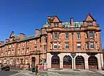 | |||
| 46 Lauriston Street | 55°56′42″N 3°12′03″W | Category B | 30129 |  | |||
| 55 Lothian Street, Jericho House, Including Railings And Gate | 55°56′46″N 3°11′23″W | Category B | 30138 | 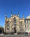 | |||
| 10 And 10A York Place, Including Railings | 55°57′22″N 3°11′32″W | Category A | 29978 |  | |||
| 1-5 (Odd Nos) Young Street And 38 Young Street Lane North | 55°57′11″N 3°12′17″W | Category B | 29999 |  | |||
| 17 Young Street And 22 Young Street Lane North | 55°57′11″N 3°12′21″W | Category A | 30002 |  | |||
| 22 Young Street And 12 Young Street Lane South | 55°57′10″N 3°12′22″W | Category A | 30008 |  | |||
| The Pleasance, University Of Edinburgh, Former Quaker Meeting House | 55°56′51″N 3°10′54″W | Category B | 30014 |  | |||
| Stockbridge Church (Excluding Halls) Deanhaugh Street | 55°57′31″N 3°12′36″W | Category B | 30019 |  | |||
| Odeon Cinema 7 Clerk Street | 55°56′33″N 3°11′00″W | Category B | 30028 | 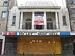 | |||
| North Bridge | 55°57′06″N 3°11′17″W | Category A | 30035 | 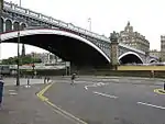 | |||
| Stock Bridge, With Retaining Walls And Railings On Hamilton Place | 55°57′29″N 3°12′32″W | Category B | 30036 |  | |||
| Preston Street School East Preston Street And Dalkeith Road | 55°56′23″N 3°10′35″W | Category B | 30047 |  | |||
| Whitehill Street 2-12 Newcraighall | 55°56′07″N 3°05′27″W | Category C(S) | 29912 |  | |||
| 20 Duddingston Mills, Outbuildings And Boundary Walls | 55°56′47″N 3°08′05″W | Category C(S) | 29939 |  | |||
| 34-38 (Even Nos) Montgomery Street And 31 Windsor Street Including Railings | 55°57′33″N 3°10′52″W | Category B | 29943 |  | |||
| 11 And 13 Woodhall Road, With Boundary Wall | 55°54′24″N 3°15′24″W | Category B | 29947 |  | |||
| 1-3C (Odd Nos) York Place, And 15-19 (Inclusive Nos) North St Andrew Street, Including Railings | 55°57′20″N 3°11′33″W | Category A | 29958 |  | |||
| 5, 5A York Place, Including Railings | 55°57′21″N 3°11′32″W | Category A | 29959 |  | |||
| 21 York Place, And 38 Elder Street, Including Railings And Lamps | 55°57′21″N 3°11′27″W | Category A | 29963 |  | |||
| 33-37 (Odd Nos) York Place, Including Railings | 55°57′22″N 3°11′23″W | Category A | 29966 |  | |||
| 39-43 (Odd Nos) York Place, Including Railings | 55°57′22″N 3°11′22″W | Category A | 29967 |  | |||
| 113-118 (Consecutive Nos) Lower Granton Road | 55°58′48″N 3°13′02″W | Category C(S) | 29887 |  | |||
| 1A, 1, 1B, 2, 3 Wardie Steps | 55°58′47″N 3°12′59″W | Category C(S) | 29891 |  | |||
| Dean Path And Damside, 1-54 Well Court Including Woodbarn Hall And Clock Tower | 55°57′08″N 3°13′04″W | Category A | 29900 | 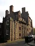 | |||
| 11, 13, 15 Stafford Street, 33, 35 Alva Street | 55°56′59″N 3°12′40″W | Category B | 29828 |  | |||
| 17-29 (Odd Numbers) Stafford Street, 34, 36 Alva Street | 55°57′01″N 3°12′42″W | Category B | 29829 |  | |||
| 66-68 (Even Nos) Thistle Street | 55°57′13″N 3°12′00″W | Category B | 29845 |  | |||
| 72-76 (Even Nos) Thistle Street | 55°57′13″N 3°12′01″W | Category B | 29846 |  | |||
| 20-25 (Inclusive Nos) Union Place And 2 Union Street | 55°57′27″N 3°11′08″W | Category B | 29861 |  | |||
| 5 And 5A Union Street Including Railings And Boundary Wall | 55°57′28″N 3°11′08″W | Category B | 29862 |  | |||
| 1 And 3 Victoria Street | 55°56′54″N 3°11′39″W | Category C(S) | 29869 |  | |||
| 5 And 7 Victoria Street | 55°56′55″N 3°11′38″W | Category C(S) | 29870 |  | |||
| 22, 24, 26, 28 Walker Street | 55°57′00″N 3°12′54″W | Category A | 29883 |  | |||
| 12-14A (Even Nos) Scotland Street, And 12B Scotland Street Lane With 11 West Scotland Street Lane | 55°57′35″N 3°11′43″W | Category B | 29781 |  | |||
| 4-6 (Inclusive Nos) South Bridge And 5-7 (Inclusive Nos) Niddry Street | 55°57′00″N 3°11′14″W | Category C(S) | 29788 |  | |||
| 53-67 (Inclusive Nos) South Bridge And 1 Drummond Street | 55°56′52″N 3°11′10″W | Category B | 29795 |  | |||
| St Patrick Square 1-11 | 55°56′36″N 3°10′59″W | Category B | 29733 |  | |||
| St Patrick Street 3, 4 And 5 | 55°56′37″N 3°11′01″W | Category C(S) | 29740 |  | |||
| St Stephen Street 41-61 | 55°57′29″N 3°12′23″W | Category B | 29746 |  | |||
| 22-104 (Even Nos) St Stephen Street, Including Railings And Lamp | 55°57′28″N 3°12′22″W | Category B | 29748 |  | |||
| 10-14 (Even Nos) St Vincent Street, And 81 Cumberland Street, Including Railings | 55°57′29″N 3°12′10″W | Category B | 29751 |  | |||
| 16-18A (Even Nos) St Vincent Street, And 72 And 72A Cumberland Street, Including Railings | 55°57′30″N 3°12′11″W | Category B | 29752 |  | |||
| 15 And 17 Salisbury Road, Including Boundary Walls, Gatepiers, And Carriage Gate | 55°56′18″N 3°10′29″W | Category B | 29753 |  | |||
| Saxe Coburg Street 1, 2 And 72-76 Henderson Row | 55°57′36″N 3°12′22″W | Category B | 29768 |  | |||
| 5-9A (Odd Nos) Scotland Street, Including Railings | 55°57′34″N 3°11′40″W | Category B | 29772 |  | |||
| 11 And 13 Scotland Street, Including Railings | 55°57′35″N 3°11′41″W | Category B | 29773 |  | |||
| 4-7 (Inclusive Numbers) Rustic Cottages With Boundary Wall And Gates | 55°54′28″N 3°15′12″W | Category B | 29684 |  | |||
| 23-29 (Inclusive Nos) Rutland Square, Including Railings And Lamp Standards | 55°56′56″N 3°12′35″W | Category A | 29690 |  | |||
| 32 Rutland Square And 27 Rutland Street, Including Railings And Lamp Standards | 55°56′57″N 3°12′32″W | Category A | 29692 |  | |||
| 22-26 (Even Nos) Rutland Street, Including Railings And Lamp Standards | 55°56′57″N 3°12′29″W | Category B | 29694 |  | |||
| 12, 12A And 13 St Andrew Square, Guardian Royal Exchange | 55°57′13″N 3°11′40″W | Category A | 29697 |  | |||
| 21 And 22 St Andrew Square And 1-5 (Odd Nos) North St David Street With Railings, IBM Ltd | 55°57′18″N 3°11′40″W | Category A | 29698 |  | |||
| 37 St Andrew Square, Bank Of Scotland, With Railings And Lamp Standards | 55°57′15″N 3°11′29″W | Category A | 29706 |  | |||
| St Bernard's Crescent 12 And 12A And 25-27 Danube Street | 55°57′26″N 3°12′44″W | Category B | 29715 |  | |||
| St. Bernard's Row 8-16 | 55°57′34″N 3°12′38″W | Category B | 29720 |  |
Key
The scheme for classifying buildings in Scotland is:
- Category A: "buildings of national or international importance, either architectural or historic; or fine, little-altered examples of some particular period, style or building type."[1]
- Category B: "buildings of regional or more than local importance; or major examples of some particular period, style or building type, which may have been altered."[1]
- Category C: "buildings of local importance; lesser examples of any period, style, or building type, as originally constructed or moderately altered; and simple traditional buildings which group well with other listed buildings."[1]
In March 2016 there were 47,288 listed buildings in Scotland. Of these, 8% were Category A, and 50% were Category B, with the remaining 42% being Category C.[2]
Notes
- Sometimes known as OSGB36, the grid reference (where provided) is based on the British national grid reference system used by the Ordnance Survey.
• "Guide to National Grid". Ordnance Survey. Retrieved 12 December 2007.
• "Get-a-map". Ordnance Survey. Retrieved 17 December 2007. - Historic Environment Scotland assign a unique alphanumeric identifier to each designated site in Scotland, for listed buildings this always begins with "LB", for example "LB12345".
References
- All entries, addresses and coordinates are based on data from Historic Scotland. This data falls under the Open Government Licence
- "What is Listing?". Historic Environment Scotland. Retrieved 29 May 2018.
- Scotland's Historic Environment Audit 2016 (PDF). Historic Environment Scotland and the Built Environment Forum Scotland. pp. 15–16. Retrieved 29 May 2018.
This article is issued from Wikipedia. The text is licensed under Creative Commons - Attribution - Sharealike. Additional terms may apply for the media files.