List of listed buildings in Edinburgh/9
List
| Name | Location | Date Listed | Grid Ref. [note 1] | Geo-coordinates | Notes | LB Number [note 2] | Image |
|---|---|---|---|---|---|---|---|
| 1-11 (Inclusive Nos) St Colme Street, Including Railings | 55°57′12″N 3°12′30″W | Category A | 29724 | 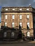 | |||
| 1-96 (Inclusive Nos) Rosemount Buildings | 55°56′40″N 3°12′37″W | Category B | 29662 |  | |||
| 9, 10, 11, 12, 13, 14, 15, 16 Rothesay Terrace | 55°57′02″N 3°13′07″W | Category B | 29671 |  | |||
| 1-13A (Inclusive Nos) Royal Crescent, 24 And 24A Dundonald Street And 26-28 (Even Nos) Scotland Street, Including Railings And Lamps | 55°57′34″N 3°11′48″W | Category A | 29679 |  | |||
| 1-8 (Inclusive Nos) Randolph Place, And 1 Randolph Crescent, Including Railings, With 1, 1A Randolph Lane | 55°57′05″N 3°12′37″W | Category A | 29602 | 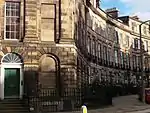 | |||
| Gilmerton, 96 Ravenscroft Street, Annville | 55°54′12″N 3°08′08″W | Category C(S) | 29608 |  | |||
| Richmond Street West 7-15A And 1-9 Davie Street | 55°56′43″N 3°11′01″W | Category B | 29628 |  | |||
| 10-14 (Even Nos) Robertson's Close | 55°56′54″N 3°11′10″W | Category B | 29630 |  | |||
| 55 And 57 Rose Street And 41 Rose Street North Lane, Rose Street Brewery | 55°57′09″N 3°11′56″W | Category B | 29633 | 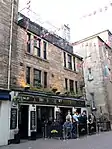 | |||
| 110-114 (Even Nos) Rose Street And 72 Rose Street South Lane | 55°57′07″N 3°12′03″W | Category B | 29647 |  | |||
| 138-142 (Even Nos) Rose Street | 55°57′07″N 3°12′06″W | Category B | 29649 |  | |||
| 170 Rose Street And 116-122 (Even Nos) Rose Street South Lane | 55°57′05″N 3°12′14″W | Category B | 29652 | 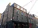 | |||
| 2 And 3 Rosebery Crescent, Including Railings | 55°56′46″N 3°13′08″W | Category C(S) | 29658 |  | |||
| 4 And 5 Rosebery Crescent, Including Railings | 55°56′47″N 3°13′08″W | Category C(S) | 29659 |  | |||
| 30 And 31 Queen Street And Railings | 55°57′16″N 3°12′00″W | Category B | 29549 |  | |||
| 60 Queen Street And 58A, 60 And 62 North Castle Street | 55°57′13″N 3°12′16″W | Category A | 29566 |  | |||
| 4, 5, 6, 7, 8 Queensferry Street | 55°57′01″N 3°12′33″W | Category B | 29577 |  | |||
| 31, 31A And 33 Raeburn Place | 55°57′32″N 3°12′42″W | Category C(S) | 29582 |  | |||
| 32, 34 And 34A Raeburn Place, Including Boundary Walls | 55°57′33″N 3°12′41″W | Category C(S) | 29587 |  | |||
| Raeburn Place, 40, 42 | 55°57′34″N 3°12′42″W | Category B | 29588 |  | |||
| Raeburn Place, 112, Raeburn House, Formerly Somerset Cottage | 55°57′34″N 3°12′53″W | Category B | 29590 |  | |||
| 1-3 (Inclusive Nos) Ramsay Garden | 55°56′58″N 3°11′47″W | Category A | 29593 | .jpg.webp) | |||
| 10, 10A Randolph Cliff, Deanbrae House, Miller Row, Bell's Brae, Including Boundary Wall | 55°57′09″N 3°12′51″W | Category B | 29598 | 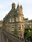 | |||
| 2-9A (Inclusive Nos) Randolph Cliff, Including Railings | 55°57′08″N 3°12′47″W | Category A | 29599 | .jpg.webp) | |||
| 2-14 (Inclusive) Parkside Street And 66-72 (Even) St Leonard's Street | 55°56′30″N 3°10′40″W | Category C(S) | 29479 |  | |||
| 40 Pentland Avenue, Westfield, With Boundary Wall And Gatepiers | 55°54′28″N 3°15′55″W | Category B | 29484 |  | |||
| 6 Westmost Close | 55°58′50″N 3°11′45″W | Category C(S) | 29492 |  | |||
| 22-28 (Even Nos) Pilrig Street And Boundary Walls | 55°57′51″N 3°10′45″W | Category B | 29495 |  | |||
| 94-96 (Inclusive Nos) Princes Street | 55°57′07″N 3°11′57″W | Category A | 29507 |  | |||
| 99 And 99A Princes Street And 2 And 4 Frederick Street | 55°57′06″N 3°12′00″W | Category B | 29509 |  | |||
| 112 Princes Street, Debenham's (Former Conservative Club) | 55°57′05″N 3°12′08″W | Category B | 29512 |  | |||
| 123 Princes Street | 55°57′04″N 3°12′15″W | Category B | 29513 |  | |||
| Quality Street 13-19 Davidson's Mains, Raeburn Cottage And Dover Cottage | 55°57′49″N 3°16′24″W | Category B | 29527 |  | |||
| Quality Street 21-27 (Odd Nos) Davidson's Mains Myrtlebank And Ryedale With Railings | 55°57′50″N 3°16′24″W | Category B | 29528 |  | |||
| 16 Queen Street With Railings | 55°57′18″N 3°11′51″W | Category B | 29540 |  | |||
| 19-33 (Odd Nos) Northumberland Street, Including Railings And Lamps | 55°57′26″N 3°11′52″W | Category A | 29447 | 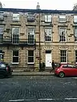 | |||
| 39-41 (Odd Nos) Northumberland Street, Including Railings And Lamp | 55°57′25″N 3°11′59″W | Category A | 29448 |  | |||
| 6-12 (Even Nos) Northumberland Street, Including Railings And Lamp | 55°57′25″N 3°11′50″W | Category A | 29454 |  | |||
| 38-40A (Even Nos) Northumberland Street, Including Railings And Lamps | 55°57′24″N 3°11′59″W | Category A | 29457 |  | |||
| Old Church Lane, Duddingston Manse And Boundary Wall, Duddingston | 55°56′28″N 3°08′49″W | Category B | 29468 |  | |||
| Duddingston Loch, The Thomson Tower | 55°56′26″N 3°08′54″W | Category B | 29469 | 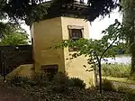 | |||
| 176 Newhaven Road Including Boundary Wall | 55°58′36″N 3°11′31″W | Category C(S) | 29396 |  | |||
| 3-6 (Inclusive Nos) West Newington Place | 55°56′16″N 3°10′46″W | Category B | 29404 |  | |||
| 39-47 (Odd Nos), 53-73 (Odd Nos) Newington Road And 4 East Newington Place | 55°56′18″N 3°10′42″W | Category B | 29406 | 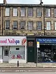 | |||
| 10 Newington Road, Jaipur Mansion Restaurant | 55°57′01″N 3°11′21″W | Category B | 29408 |  | |||
| 7-11 (Inclusive Nos) Nicolson Square | 55°56′46″N 3°11′10″W | Category C(S) | 29413 |  | |||
| Nicolson Street, 78 And 1-5 West Richmond Street | 55°56′43″N 3°11′02″W | Category B | 29420 |  | |||
| Nicolson Street, 80-84 | 55°56′42″N 3°11′02″W | Category B | 29421 |  | |||
| Nicolson Street, 100, 102 | 55°56′41″N 3°11′01″W | Category B | 29424 |  | |||
| Nicolson Street, 110-122 | 55°56′40″N 3°11′01″W | Category B | 29427 |  | |||
| Nicolson Street, 134-140 And 48 East Crosscauseway | 55°56′38″N 3°11′00″W | Category B | 29430 |  | |||
| 14 Minto Street, Including Boundary Walls | 55°56′08″N 3°10′33″W | Category B | 29346 |  | |||
| 23, 23A And 23B Minto Street Including Boundary Walls And Pedestrian Gate | 55°56′04″N 3°10′28″W | Category B | 29353 |  | |||
| 47 Minto Street, Including Boundary Wall And Pedestrian Gateway | 55°56′12″N 3°10′39″W | Category B | 29361 | 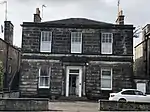 | |||
| 19-36A (Inclusive Nos) Moray Place, Including Railings And Lamps | 55°57′19″N 3°12′36″W | Category A | 29369 | 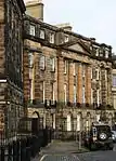 | |||
| Meadow Lane Hope Park Halls | 55°56′32″N 3°11′11″W | Category B | 29317 | 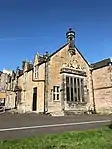 | |||
| 7, 8, 9 Melville Crescent, 42 Melville Street, 17 Walker Street Including Railings And Arched Lamp Holders | 55°56′58″N 3°12′48″W | Category A | 29321 |  | |||
| 2-24 (Even Numbers) Melville Street, 21, 22 Queensferry Street. 31 Stafford Street, Including Railings And Arched Lamp Holders | 55°57′02″N 3°12′41″W | Category A | 29326 | 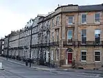 | |||
| 2 - 12 (Even Nos) Middleby Street, Including Boundary Walls | 55°56′04″N 3°10′32″W | Category A | 29334 |  | |||
| 2 Minto Street, Including Boundary Walls | 55°56′14″N 3°10′39″W | Category C(S) | 29337 |  | |||
| 6 Minto Street, Including Boundary Walls | 55°56′12″N 3°10′36″W | Category B | 29341 |  | |||
| 8 Newhaven Main Street | 55°58′49″N 3°11′34″W | Category C(S) | 29287 |  | |||
| 1-10A (Inclusive Nos) West Maitland Street | 55°56′49″N 3°12′55″W | Category B | 29290 |  | |||
| 31 And 32 West Maitland Street, Including Railings To Palmerston Place | 55°56′49″N 3°12′56″W | Category B | 29293 |  | |||
| Malta Terrace, 3-9 | 55°57′35″N 3°12′36″W | Category B | 29295 |  | |||
| 3-17 (Odd Numbers) Manor Place | 55°56′53″N 3°12′51″W | Category A | 29296 |  | |||
| 19-29 (Odd Numbers) Manor Place Including Railings | 55°56′55″N 3°12′53″W | Category A | 29297 |  | |||
| 1-10 Mansfield Place, Including Railings | 55°57′35″N 3°11′30″W | Category A | 29302 |  | |||
| Mary's Place, 3-6 | 55°57′32″N 3°12′51″W | Category B | 29307 |  | |||
| 38 Mayfield Terrace, Newington Lodge, Including Boundary Walls, Gatepiers, And Entablatured Entrance Gate | 55°56′07″N 3°10′10″W | Category B | 29314 |  | |||
| 1, 1A, 2 Lynedoch Place | 55°57′06″N 3°12′46″W | Category B | 29274 |  | |||
| Lanark Road 547 Gowanlea | 55°54′10″N 3°17′11″W | Category B | 29205 |  | |||
| Lauriston Park 1-12 | 55°56′38″N 3°12′03″W | Category B | 29214 |  | |||
| 38-44 Lauriston Place, Including Boundary Wall, Railings And Gates | 55°56′42″N 3°11′49″W | Category B | 29219 | 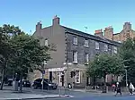 | |||
| 437-449 (Odd Nos) Lawnmarket, Including Part Of 451 Lawnmarket To Rear | 55°56′59″N 3°11′35″W | Category B | 29228 | 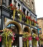 | |||
| 330 Lawnmarket | 55°56′57″N 3°11′38″W | Category B | 29243 |  | |||
| Inverleith Place 39 | 55°58′03″N 3°12′35″W | Category B | 29151 |  | |||
| Inverleith Row, 21 And 22 | 55°58′02″N 3°12′20″W | Category B | 29167 |  | |||
| Inverleith Row, 28 And 29 | 55°58′04″N 3°12′22″W | Category B | 29171 |  | |||
| Inverleith Row, 36 And 37 | 55°58′07″N 3°12′25″W | Category B | 29174 |  | |||
| Inverleith Row, 52 And 53 | 55°58′12″N 3°12′30″W | Category B | 29181 |  | |||
| Inverleith Row 54, 55 | 55°58′13″N 3°12′31″W | Category C(S) | 29182 |  | |||
| Inverleith Terrace, 7, 8 | 55°57′50″N 3°12′10″W | Category C(S) | 29185 |  | |||
| 2-10 (Even Nos) Keir Street, Including Boundary Wall And Railings | 55°56′44″N 3°11′48″W | Category B | 29197 |  | |||
| 1 And 3 Hill Street | 55°57′13″N 3°12′07″W | Category A | 29080 |  | |||
| 15A-25 (Inclusive Nos) Hillside Crescent | 55°57′30″N 3°10′40″W | Category B | 29087 |  | |||
| 2 And 4 Hope Street And 46 Queensferry Street | 55°57′02″N 3°12′31″W | Category B | 29092 |  | |||
| Hope Park Square 6 And 8A | 55°56′32″N 3°11′09″W | Category B | 29096 |  | |||
| 7,7A, 8 And 8A Hopetoun Crescent And Railings | 55°57′41″N 3°11′05″W | Category A | 29098 |  | |||
| 17 And 18 Hopetoun Crescent With Railings | 55°57′43″N 3°11′00″W | Category A | 29099 |  | |||
| 3-7 (Odd Nos) Howe Street, Including Railings | 55°57′21″N 3°12′06″W | Category A | 29107 |  | |||
| 21-23B (Odd Nos) Howe Street, And 71 And 75 Northumberland Street, Including Railings | 55°57′24″N 3°12′07″W | Category A | 29112 |  | |||
| 28 And 30 Howe Street, Including Railings | 55°57′23″N 3°12′10″W | Category B | 29120 |  | |||
| 45 High Street, John Knox House | 55°57′02″N 3°11′06″W | Category A | 29033 | 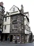 | |||
| 57 And 59 High Street | 55°57′02″N 3°11′07″W | Category B | 29035 | 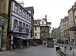 | |||
| High Street, 7 Old Fishmarket Close | 55°56′57″N 3°11′22″W | Category B | 29042 |  | |||
| 209-213 (Odd Nos) High Street Including 1-6 (Inclusive Nos) Jackson's Close | 55°57′01″N 3°11′20″W | Category A | 29046 |  | |||
| 48 And 50 High Street | 55°57′01″N 3°11′09″W | Category B | 29066 |  | |||
| 126-140 (Even Nos) High Street | 55°56′59″N 3°11′19″W | Category B | 29067 |  | |||
| 14-18 (Even Nos) Grove Street, Including Railings | 55°56′43″N 3°12′47″W | Category B | 28982 |  | |||
| Hamilton Place 6-10 And 1-6 Glanville Place | 55°57′28″N 3°12′29″W | Category B | 28992 |  | |||
| 3 And 5 Hamilton Place | 55°57′31″N 3°12′30″W | Category B | 28993 |  | |||
| Hamilton Place 18-26 | 55°57′30″N 3°12′28″W | Category B | 28995 |  | |||
| 71 Hanover Street With Railings | 55°57′14″N 3°11′50″W | Category A | 28999 |  | |||
| 56-60 Henderson Row | 55°57′36″N 3°12′21″W | Category B | 29023 |  | |||
| 1-6 (Inclusive Nos) Grosvenor Gardens, Including Railings | 55°56′47″N 3°13′12″W | Category B | 28975 |  | |||
| 1-25 (Odd Nos) Grosvenor Street, Including Railings | 55°56′48″N 3°13′00″W | Category B | 28977 |  | |||
| Glenogle Road And Saxe-Coburg Place, Glenogle Swim Centre Including Stack | 55°57′40″N 3°12′33″W | Category B | 28924 |  | |||
| 1 Grassmarket And 2 King's Stables Road | 55°56′50″N 3°11′54″W | Category C(S) | 28932 |  | |||
| 9 Grassmarket And 3-9 (Odd Nos) West Port, Including The Fiddlers Arms | 55°56′49″N 3°11′53″W | Category B | 28934 | 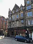 | |||
| 26 And 28 Grassmarket | 55°56′51″N 3°11′49″W | Category B | 28937 | 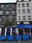 | |||
| 74-84 (Even Nos) Grassmarket | 55°56′52″N 3°11′43″W | Category B | 28942 | 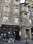 | |||
| 4A And 4B South Gray Street, Including Boundary Walls And Pedestrian Gateway | 55°56′04″N 3°10′38″W | Category B | 28944 |  | |||
| 27 And 29 Upper Gray Street, Including Boundary Walls | 55°56′10″N 3°10′41″W | Category B | 28955 |  | |||
| 40 And 42 Upper Gray Street Including Boundary Walls | 55°56′08″N 3°10′42″W | Category C(S) | 28961 |  | |||
| 2-42A (Even Nos) Great King Street And 45-51 (Odd Nos) Dundas Street, Including Railings And Lamps With 6 South East Cumberland Street Lane, Including Walls | 55°57′30″N 3°11′53″W | Category A | 28964 |  | |||
| 67 George Street | 55°57′12″N 3°12′00″W | Category B | 28843 |  | |||
| 109 George Street And 34 And 34A North Castle Street With Railings | 55°57′09″N 3°12′15″W | Category B | 28852 |  | |||
| 127 And 129 George Street With Railings And Lamp Standards | 55°57′09″N 3°12′20″W | Category B | 28857 |  | |||
| 22 And 24 George Street, The Royal Society | 55°57′12″N 3°11′47″W | Category A | 28864 |  | |||
| 30, 30A And 32 George Street And 54 And 56 Hanover Street | 55°57′12″N 3°11′51″W | Category A | 28866 |  | |||
| 62-66 (Even Nos) George Street, Bank Of Scotland, Including 48 Rose Street North Lane | 55°57′10″N 3°11′58″W | Category A | 28873 |  | |||
| 78 And 80 George Street, National Westminster Bank | 55°57′09″N 3°12′04″W | Category A | 28876 | 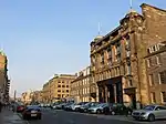 | |||
| 21-25 (Inclusive Nos) George Iv Bridge, 17 Merchant Street And 31 And 33 Candlemaker Row | 55°56′51″N 3°11′31″W | Category B | 28889 | .jpg.webp) | |||
| 31-39 George Iv Bridge | 55°56′51″N 3°11′28″W | Category C(S) | 28892 |  | |||
| 26 Gillespie Road, The Hermitage, With Boundary Wall, Gatepiers, Garden Gate And Garage | 55°54′27″N 3°16′07″W | Category B | 28899 |  | |||
| 31-37 (Odd Nos) Gilmore Place Including Boundary Walls | 55°56′29″N 3°12′21″W | Category C(S) | 28906 |  | |||
| 67 And 69 Gilmore Place Including Boundary Walls | 55°56′28″N 3°12′32″W | Category C(S) | 28907 |  | |||
| 71 And 73 Gilmore Place Including Boundary Walls | 55°56′27″N 3°12′33″W | Category C(S) | 28909 |  | |||
| 44 Gilmore Place Including Boundary Wall | 55°56′29″N 3°12′28″W | Category C(S) | 28914 |  | |||
| 21 And 23 Upper Gilmore Place Including Boundary Walls | 55°56′26″N 3°12′28″W | Category B | 28919 |  | |||
| 37-41 (Odd Nos) Frederick Street With Railings | 55°57′12″N 3°12′01″W | Category B | 28784 |  | |||
| 1-25A (Inclusive Nos) Gardner's Crescent And 109-115 (Odd Nos) Morrison Street Including Railings | 55°56′45″N 3°12′38″W | Category A | 28797 | 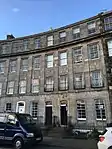 | |||
| 5 Gayfield Square Including Boundary Wall, Railings, Gatepiers And Overthrow | 55°57′32″N 3°11′11″W | Category B | 28801 |  | |||
| 18-20 (Inclusive Nos) Gayfield Square Including Railings | 55°57′35″N 3°11′08″W | Category B | 28806 |  | |||
| George Square 16 And 17 | 55°56′38″N 3°11′27″W | Category A | 28809 | 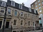 | |||
| George Square 25 | 55°56′35″N 3°11′25″W | Category A | 28818 | 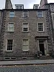 | |||
| George Square 60 | 55°56′40″N 3°11′15″W | Category A | 28827 | 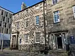 | |||
| 3 George Street (Incorporating Former No 13), Standard Life | 55°57′15″N 3°11′43″W | Category A | 28829 |  | |||
| 49-55 (Odd Nos) George Street | 55°57′13″N 3°11′56″W | Category B | 28838 |  | |||
| 8-10A (Even Nos) Dundonald Street, Including Railings And Lamp | 55°57′33″N 3°11′47″W | Category B | 28725 |  | |||
| 25-29 (Inclusive Nos) Elm Row And 1-5 (Odd Nos) Montgomery Street | 55°57′34″N 3°10′58″W | Category C(S) | 28735 |  | |||
| 146 And 148 Ferry Road Including Boundary Walls | 55°58′28″N 3°11′12″W | Category B | 28746 |  | |||
| Ferry Road, 378, 380 | 55°58′16″N 3°12′45″W | Category C(S) | 28752 |  | |||
| 492 Ferry Road, Ashbrook, Including Gatepiers And Boundary Wall | 55°58′13″N 3°13′26″W | Category B | 28753 |  | |||
| 13-24 (Inclusive Nos) Fettes Row, And 104 And 106 Dundas Street, Including Railings And Lamps With 11 North West Cumberland Street Lane | 55°57′32″N 3°12′06″W | Category B | 28755 |  | |||
| 2 Fishmarket Square | 55°58′50″N 3°11′42″W | Category C(S) | 28765 |  | |||
| 23-37 (Inclusive Numbers) Drumsheugh Gardens, Including Mews, Boundary Walls And Ancillary Buildings To Rear (Lynedoch Place Lane) | 55°57′05″N 3°12′56″W | Category B | 28676 |  | |||
| 37A, 38, 39, 40, 41, 42, 43, 44 Drumsheugh Gardens, 1 Chester Street And 1 Rothesay Place, Including Railings, Ancillary Buildings And Boundary Walls To Rear | 55°57′03″N 3°12′58″W | Category B | 28677 |  | |||
| 26-30 (Even Nos) Dublin Street, Including Railings | 55°57′26″N 3°11′38″W | Category B | 28692 |  |
Key
The scheme for classifying buildings in Scotland is:
- Category A: "buildings of national or international importance, either architectural or historic; or fine, little-altered examples of some particular period, style or building type."[1]
- Category B: "buildings of regional or more than local importance; or major examples of some particular period, style or building type, which may have been altered."[1]
- Category C: "buildings of local importance; lesser examples of any period, style, or building type, as originally constructed or moderately altered; and simple traditional buildings which group well with other listed buildings."[1]
In March 2016 there were 47,288 listed buildings in Scotland. Of these, 8% were Category A, and 50% were Category B, with the remaining 42% being Category C.[2]
Notes
- Sometimes known as OSGB36, the grid reference (where provided) is based on the British national grid reference system used by the Ordnance Survey.
• "Guide to National Grid". Ordnance Survey. Retrieved 12 December 2007.
• "Get-a-map". Ordnance Survey. Retrieved 17 December 2007. - Historic Environment Scotland assign a unique alphanumeric identifier to each designated site in Scotland, for listed buildings this always begins with "LB", for example "LB12345".
References
- All entries, addresses and coordinates are based on data from Historic Scotland. This data falls under the Open Government Licence
- "What is Listing?". Historic Environment Scotland. Retrieved 29 May 2018.
- Scotland's Historic Environment Audit 2016 (PDF). Historic Environment Scotland and the Built Environment Forum Scotland. pp. 15–16. Retrieved 29 May 2018.
This article is issued from Wikipedia. The text is licensed under Creative Commons - Attribution - Sharealike. Additional terms may apply for the media files.