List of listed buildings in Glasgow/10
List
| Name | Location | Date Listed | Grid Ref. [note 1] | Geo-coordinates | Notes | LB Number [note 2] | Image |
|---|---|---|---|---|---|---|---|
| 1012 Great Western Road, Boundary Walls And Gatepiers | 55°53′03″N 4°18′26″W | Category B | 32336 |  | |||
| Victoria Park Drive North, North Gatepiers To Victoria Park And Gates | 55°52′40″N 4°19′57″W | Category B | 32341 |  | |||
| 7, 11, 13, 21, 29 And 35 Winton Lane | 55°53′10″N 4°17′54″W | Category B | 32345 | | |||
| Gairbraid Avenue, Former Fire Station | 55°53′26″N 4°17′29″W | Category C(S) | 32351 | | |||
| 70 Earlbank Avenue, Scotstoun East Church And Halls | 55°52′46″N 4°20′48″W | Category C(S) | 32277 | | |||
| 140-142 Medwyn Street, Whiteinch Baths | 55°52′29″N 4°20′08″W | Category B | 32278 | | |||
| 78 - 104 (Even Nos) Park Road And 9 South Woodside Road | 55°52′22″N 4°16′47″W | Category C(S) | 32244 | | |||
| Park Terrace Balustrade Railings And Gateway To Kelvingrove Park | 55°52′12″N 4°16′52″W | Category A | 32246 |  | |||
| 2, 12, 18, 24, 30 Willowbank Street And 176, 178, 180, 182, 184, 188 Woodlands Road | 55°52′14″N 4°16′32″W | Category B | 32261 | | |||
| 52-68 (Even Nos) Woodlands Road And 4 Baliol Street | 55°52′07″N 4°16′22″W | Category B | 32265 | | |||
| 11A, 15, 17 Lynedoch Street | 55°52′06″N 4°16′27″W | Category B | 32225 | | |||
| Park Gardens, Stairway To Park Street South | 55°52′05″N 4°16′49″W | Category A | 32241 |  | |||
| Colebrooke Street/Great Western Road Glasgow Academy War Memorial And School Boundary Wall | 55°52′31″N 4°16′50″W | Category B | 32187 | | |||
| Eldon Street/Park Road St Silas English Church (Episcopal Church) | 55°52′20″N 4°16′48″W | Category B | 32189 | | |||
| 2, 4 And 10 Great George Street And 63 Bank Street | 55°52′25″N 4°17′01″W | Category B | 32196 | | |||
| 380 Bearsden Road, Canal Restaurant (Former Robinson Dunn Offices) | 55°53′42″N 4°19′19″W | Category C(S) | 32170 | | |||
| 31, 33, 35 Lynedoch Street And 92, 96 Woodside Terrace Lane, Former Trinity College | 55°52′05″N 4°16′34″W | Category A | 32171 |  | |||
| 60 North Hanover Street And 63 North Frederick Street, Glasgow College Of Building And Printing | 55°51′45″N 4°14′57″W | Category B | 48414 |  | |||
| Clyde Street, Statue Of Dolores Ibarruri, La Pasionaria | 55°51′23″N 4°15′30″W | Category B | 49920 |  | |||
| 79 Springkell Avenue, `Whitehall' Including Gatepiers And Boundary Walls | 55°50′17″N 4°17′33″W | Category B | 49928 | | |||
| 12-20 (Even Nos) Coburg Street | 55°51′11″N 4°15′28″W | Category C(S) | 50012 | | |||
| 74 Victoria Crescent Road, Former Notre Dame Training College Chapel And Practising School Including Boundary Walls | 55°52′38″N 4°18′00″W | Category C(S) | 50028 | | |||
| 30 Maitland Street, Scottish Ambulance Service And 54 Milton Street, St Andrew's House, St Andrew's Ambulance Association | 55°52′04″N 4°15′24″W | Category A | 50073 |  | |||
| 35 Dowanhill Street, Dowanvale Free Church Of Scotland | 55°52′19″N 4°18′03″W | Category C(S) | 50182 | | |||
| 58 Bridge Street And 2 And 4 Nelson Street, The Laurieston Bar | 55°51′11″N 4°15′33″W | Category C(S) | 51537 | | |||
| Victoria Park, Clock | 55°52′31″N 4°19′51″W | Category C(S) | 51738 | | |||
| Glencairn Drive, Titwood Tennis Clubhouse | 55°50′18″N 4°17′01″W | Category C(S) | 44656 | | |||
| 372 Albert Drive, Knowehead With Gatepiers, Gates And Boundary Walls | 55°50′34″N 4°17′41″W | Category B | 44113 | | |||
| 129 Holehouse Drive, Blawarthill Hospital Reception/ Administration Block, Gates, Gatepiers And Boundary Walls | 55°53′23″N 4°22′04″W | Category C(S) | 43475 | | |||
| 11 Newlands Road, Dunstaffnage Including Perimeter Walls And Gatepiers | 55°49′16″N 4°17′04″W | Category B | 33945 | | |||
| 181 Shawbridge Street, Pollokshaws Uf Church | 55°49′21″N 4°17′56″W | Category B | 33963 | | |||
| 73 Craigpark, Our Lady Of Good Counsel Roman Catholic Church | 55°51′45″N 4°13′21″W | Category A | 33891 | .jpg.webp) | |||
| 247-249 (Odd Nos) Duke Street, Former Duke Street Hospital | 55°51′31″N 4°13′33″W | Category B | 33896 | | |||
| 285-295 (Odd Nos) Duke Street And 3, 5, 7 Westercraigs | 55°51′31″N 4°13′28″W | Category B | 33897 | | |||
| 176 Duke Street, Kirkhaven | 55°51′32″N 4°13′48″W | Category A | 33899 | | |||
| 202-210 (Even Nos) Hunter Street | 55°51′32″N 4°13′55″W | Category B | 33901 | | |||
| 129 Roslea Drive, Meadowpark Street And Finlay Drive, Dennistoun Public School, St Dennis Rc Primary School | 55°51′34″N 4°12′50″W | Category B | 33904 | | |||
| 130-132 Springburn Road, Office To St Rollox Railway Works (Block Fronting Street) | 55°52′25″N 4°13′58″W | Category B | 33906 | | |||
| 31 Westercraigs | 55°51′38″N 4°13′27″W | Category C(S) | 33909 | | |||
| 47 Greenhead Street, 22 And 24 Macphail Street, Buchanan House (Formerly Greenhead School), Including Gatepiers And Railings | 55°50′53″N 4°13′54″W | Category B | 33845 | | |||
| 89 James Street | 55°50′54″N 4°13′45″W | Category B | 33849 | | |||
| 35 Tureen Street, Tureen Street School, Three Main Blocks Including Janitor's Lodge | 55°51′17″N 4°13′49″W | Category B | 33860 | | |||
| 17 Watson Street | 55°51′25″N 4°14′33″W | Category A | 33862 | | |||
| 1127 Cathcart Road And Carmunnock Road, Mount Florida Primary School Including Playground Walls, Gatepiers And Railings | 55°49′28″N 4°15′27″W | Category B | 33801 |  | |||
| 29-35 (Odd Nos) East Campbell Street, Lodging House Mission Including Hall, Vestry | 55°51′23″N 4°14′14″W | Category B | 33829 | | |||
| Glasgow Green, Doulton Fountain In Front Of People's Palace | 55°51′06″N 4°14′10″W | Category A | 33836 | 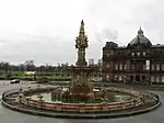 | |||
| 62 Belmont Street, 93 And 99 Garriochmill Road, Kelvin Stevenson Memorial Church (Church Of Scotland) And Caretaker's House | 55°52′38″N 4°16′44″W | Category A | 33753 | 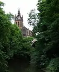 | |||
| 36-42 (Even Nos) Clouston Street And 1-7 (Odd Nos) Sanda Street With Railings | 55°52′53″N 4°17′13″W | Category B | 33758 | | |||
| 115 Kelvin Drive, Lismore House, With Gates, Gatepiers And Retaining Walls | 55°52′52″N 4°17′25″W | Category B | 33770 | | |||
| 343-7 (Odd Nos) St George's Road, Woodside Library | 55°52′20″N 4°16′02″W | Category B | 33780 | 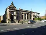 | |||
| Croftfoot Road, Mill Street, Gatepiers, Formerly To Castlemilk House | 55°48′53″N 4°12′53″W | Category C(S) | 33715 | | |||
| Delvin Road Bridge, Over River Cart | 55°49′03″N 4°15′34″W | Category B | 33716 | | |||
| 118, 120 Carmunnock Road, Kilmailing Road, Old Cathcart Parish Church (Fragments), Churchyard Including Boundary Walls | 55°49′05″N 4°15′23″W | Category B | 33719 | | |||
| Old Castle Road, Railway Bridge Over River Cart And Old Castle Road | 55°49′04″N 4°15′35″W | Category B | 33723 | | |||
| Old Castle Road, Cathcart Castle | 55°48′47″N 4°15′23″W | Category C(S) | 33724 | | |||
| 2317 Maryhill Road, Gates, Gatepiers Quadrant Walls And Railings To West Of Scotland Science Park (Formerly To Garscube Estate) | 55°54′13″N 4°18′42″W | Category C(S) | 33730 | | |||
| Balmore Road, Lambhill Bridge | 55°53′49″N 4°15′57″W | Category C(S) | 33740 | | |||
| 591 Tollcross Road, Tollcross House Lodge, Tollcross Park | 55°50′46″N 4°11′02″W | Category B | 33649 | | |||
| Hamilton Road, Daldowie Dovecot | 55°50′27″N 4°07′45″W | Category A | 33668 | 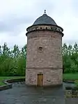 | |||
| Ballater Street, King's Bridge | 55°50′48″N 4°14′15″W | Category C(S) | 33680 | | |||
| 99 Calder Street, Kingarth Lane, Calder Street Public Baths And Wash House | 55°50′18″N 4°15′47″W | Category B | 33683 | 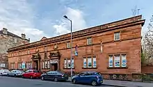 | |||
| 311 (Odd Nos) Calder Street, Council Social Work Department, Formerly Holy Cross Infants Rc School, Formerly Batson Street School | 55°50′12″N 4°15′21″W | Category B | 33684 | 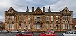 | |||
| 183 Meiklerig Crescent And Templeland Road St James' Pollok Church Of Scotland Including Hall And Gatepiers | 55°50′04″N 4°20′55″W | Category B | 33601 | | |||
| 179 Braidfauld Street, St Margaret's Tollcross Church Including Boundary Walls Gates And Railings | 55°50′30″N 4°10′39″W | Category B | 33627 | 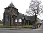 | |||
| 41 Broad Street (Engineering Works) | 55°51′03″N 4°13′25″W | Category B | 33628 | | |||
| 330-346 (Even Nos) Paisley Road, Former Kingston Public Halls, Library And Police Office | 55°51′15″N 4°16′28″W | Category B | 33524 | | |||
| 1 & 3 Paisley Road West And 2 & 4 Admiral Street Including Old Toll Bar Public House | 55°51′13″N 4°16′45″W | Category B | 33525 | | |||
| 25 And 27 Paisley Road West And 1, 7, 9 And 11 Stanley Street | 55°51′12″N 4°16′47″W | Category B | 33541 | | |||
| 11 Eldon Street, Park Drive, Park Avenue, St Andrew's Teachers Training College, Former Queen's College, With Railings | 55°52′17″N 4°16′45″W | Category B | 33548 | | |||
| 18 Carillon Road, 67 Clifford Street, Ibrox Parish Church | 55°50′59″N 4°18′05″W | Category B | 33575 | 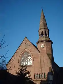 | |||
| 598-612 (Even Nos) And 612A Shields Road, Including Boundary Walls And Gatepiers | 55°50′27″N 4°16′39″W | Category B | 33481 | | |||
| 37, 39, 45 Bridge Street | 55°51′12″N 4°15′29″W | Category C(S) | 33493 | | |||
| 63, 65, 67 Bridge Street | 55°51′11″N 4°15′30″W | Category B | 33494 | | |||
| 71 Oxford Street, 78 Nicholson Street And 3, 15 Oxford Street | 55°51′11″N 4°15′19″W | Category B | 33522 | | |||
| 67 Glencairn Drive, Fragment Of Pollokshields - Glencairn Church, Including Boundary Walls | 55°50′18″N 4°16′43″W | Category C(S) | 33408 | | |||
| 70 And 72 Glencairn Drive, Pollokshields Burgh Hall, Including Lodge And Gateway To Maxwell Park | 55°50′19″N 4°17′15″W | Category A | 33411 | 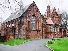 | |||
| 10 Leslie Road, Including Boundary Walls And Gatepiers | 55°50′29″N 4°16′47″W | Category C(S) | 33418 | 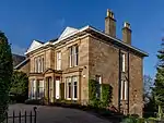 | |||
| 41 Newark Drive, Newark Lodge (Original Part), Including Boundary Walls | 55°50′25″N 4°17′04″W | Category B | 33433 | | |||
| 14 Newark Drive, Including Boundary Walls And Gatepiers | 55°50′23″N 4°16′44″W | Category B | 33435 | | |||
| Carmunnock, 80 Busby Road Carnbooth House, Lodge And Gatepiers | 55°47′12″N 4°14′42″W | Category C(S) | 33317 | | |||
| 881, 883, 885, 887 Govan Road, 2, 4 Shaw St | 55°51′50″N 4°18′59″W | Category B | 33346 | | |||
| Govan Road, Auxiliary Accumulator Tower, West End Of Princes Dock | 55°51′22″N 4°17′58″W | Category C(S) | 33347 | | |||
| 1 Pacific Quay And Return Elevation To Govan Road, Former Prince's Dock Hydraulic Power Station | 55°51′25″N 4°17′15″W | Category A | 33360 | | |||
| 199-221 (Odd Nos) Albert Drive, Tower Buildings | 55°50′31″N 4°16′24″W | Category B | 33369 | | |||
| 332 Albert Drive, Including Boundary Walls And Gatepiers | 55°50′40″N 4°17′08″W | Category B | 33381 | | |||
| 10 Bruce Road Castramont, Including Boundary Walls And Gatepiers | 55°50′40″N 4°16′43″W | Category B | 33391 | | |||
| 68 West George Street, 12 Nelson Mandela Place, Royal Faculty of Procurators | 55°51′44″N 4°15′17″W | Category A | 33235 | 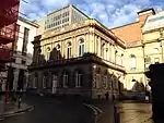 | |||
| 134, 134A, 136 West George Street | 55°51′45″N 4°15′24″W | Category B | 33239 | | |||
| 81, 83 West Regent Street | 55°51′47″N 4°15′30″W | Category C(S) | 33259 | | |||
| 111, 113 West Regent Street, 121-127 (Odd Nos) Wellington Street And 86 West Regent Lane | 55°51′48″N 4°15′35″W | Category B | 33266 | | |||
| 19-23 (Odd Nos) West Nile Street And 2-6 (Even Nos) Drury Street | 55°51′40″N 4°15′20″W | Category B | 33286 | | |||
| 133 Balornock Road, Stobhill Hospital | 55°53′36″N 4°13′05″W | Category B | 33290 | | |||
| Elder Park, Statue Of Mrs John Elder | 55°51′41″N 4°19′32″W | Category A | 33304 | 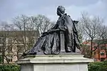 | |||
| 1345 Govan Road, Southern General Hospital, Administration Block | 55°51′43″N 4°20′16″W | Category B | 33306 | | |||
| 612 Old Renfrew Road Shiels House | 55°52′17″N 4°21′20″W | Category B | 33311 | | |||
| 1055-1065 (Odd Nos) Sauchiehall Street, 23 Radnor Street | 55°52′01″N 4°17′22″W | Category C(S) | 33186 | | |||
| 3-7 (Odd Nos) Scott Street | 55°51′57″N 4°15′54″W | Category B | 33200 | | |||
| 75-95 (Odd Nos) Union Street, Caledonian Chambers | 55°51′35″N 4°15′26″W | Category B | 33204 | 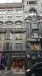 | |||
| 30-46 (Even Nos) Washington Street | 55°51′30″N 4°16′09″W | Category C(S) | 33211 | | |||
| 261 St Vincent Street, St Vincent Street Church (Originally Up, Former United Free Church Of Scotland, Now Free Church) | 55°51′44″N 4°15′56″W | Category A | 33150 | 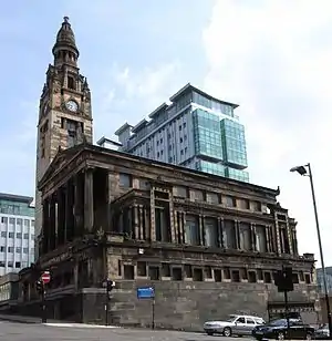 | |||
| 78 St Vincent Street | 55°51′41″N 4°15′20″W | Category B | 33151 | | |||
| 250 St Vincent Street | 55°51′45″N 4°15′50″W | Category B | 33166 | 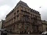 | |||
| 217 Sauchiehall Street, And 114, 116 Sauchiehall Lane, Formerly Willow Tea Rooms | 55°51′54″N 4°15′40″W | Category A | 33173 | 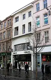 | |||
| King George V Bridge Over River Clyde, From Oswald Street To Commerce Street | 55°51′23″N 4°15′35″W | Category B | 33081 | 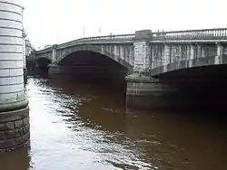 | |||
| 52 Lumsden Street And Overnewton Street, Overnewton Centre, Former Overnewton School | 55°51′58″N 4°17′34″W | Category B | 33084 | | |||
| 26, 32 Minerva Street | 55°51′48″N 4°16′57″W | Category B | 33086 | | |||
| 13, 15 And 17 Renfield Street | 55°51′40″N 4°15′26″W | Category B | 33101 | | |||
| 28-36 (Even Nos) Renfield Street | 55°51′43″N 4°15′22″W | Category B | 33104 | | |||
| 256-262 (Even Nos) Renfrew Street | 55°52′01″N 4°16′05″W | Category B | 33110 | | |||
| 22, 24 St Enoch Square | 55°51′28″N 4°15′21″W | Category B | 33123 | 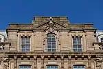 | |||
| 38-44 (Even Nos) St Enoch Square | 55°51′26″N 4°15′21″W | Category B | 33125 | | |||
| 42-50 (Even Nos) Gordon Street | 55°51′39″N 4°15′23″W | Category B | 33032 | | |||
| 86-94 (Even Nos) Hill Street | 55°52′02″N 4°15′54″W | Category B | 33043 | 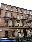 | |||
| 122 Hill Street | 55°52′03″N 4°16′01″W | Category B | 33046 | | |||
| 43, 45, 47 Hope Street And 1A Cadogan Street, 'Atlantic Chambers' | 55°51′35″N 4°15′34″W | Category A | 33050 | 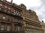 | |||
| 106, 108, 110 Hope Street (Known As 108) | 55°51′40″N 4°15′30″W | Category A | 33056 | 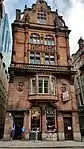 | |||
| 65-73 (Odd Nos) James Watt Street (Known As 69 James Watt Street), Atlantic Apartments | 55°51′30″N 4°15′51″W | Category A | 33068 | | |||
| 21-31 (Odd Nos) (Known As 21) Buchanan Street And 8-28 (Even Nos) Mitchell Street | 55°51′31″N 4°15′20″W | Category A | 32991 | 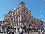 | |||
| 63-69 (Odd Nos) Buchanan Street, Former Glasgow Herald Building | 55°51′34″N 4°15′18″W | Category B | 32994 | | |||
| 235-245 (Odd Nos) Buchanan Street, The George Hotel | 55°51′50″N 4°15′12″W | Category B | 33005 | | |||
| 2-6 (Even Nos) Corunna Street And 1147-1153 (Odd Nos) Argyle Street | 55°51′53″N 4°17′07″W | Category B | 33014 | | |||
| 1G Gilmorehill, University Of Glasgow, Engineering Building | 55°52′17″N 4°17′11″W | Category B | 32919 | | |||
| 1K Gilmorehill, University of Glasgow, Pearce Lodge, Comprising Gateway, Janitor's House and Classrooms | 55°52′19″N 4°17′09″W | Category A | 32925 |  | |||
| 1 University Gardens, Hillhead | 55°52′22″N 4°17′21″W | Category B | 32929 |  | |||
| 44-46 (Even Nos) Ashton Lane | 55°52′28″N 4°17′36″W | Category B | 32937 | | |||
| 127, 129 Bath Street | 55°51′51″N 4°15′36″W | Category B | 32958 | | |||
| 207 Bath Street | 55°51′52″N 4°15′51″W | Category B | 32962 | | |||
| 20 Lawrence Street, Partick East Church Of Scotland And Halls | 55°52′24″N 4°17′56″W | Category B | 32884 | | |||
| 1 And 1C Gilmorehill, University Of Glasgow, West Range And Memorial Chapel | 55°52′18″N 4°17′23″W | Category A | 32914 | | |||
| 53 Hillhead Street, Florentine House | 55°52′25″N 4°17′16″W | Category B | 32878 | | |||
| 69-71 (Odd Nos) Queen Street | 55°51′34″N 4°15′09″W | Category B | 32816 | | |||
| 170-180 (Even Nos) Howard Street With 37 Ropework Lane, Former Stockwell Free Church | 55°51′20″N 4°15′04″W | Category B | 32729 |  | |||
| 19 John Street And 45-49 (Odd Nos) Cochrane Street | 55°51′37″N 4°14′54″W | Category B | 32751 | | |||
| 4-8 (Even Nos) John Street | 55°51′36″N 4°14′51″W | Category B | 32752 | | |||
| 30-34 Mcphater Street And 3 And 5 Larbert Street, The Piping Centre, Cowcaddens Former Free Church And Hall | 55°52′02″N 4°15′24″W | Category B | 32755 |  | |||
| 42 Miller Street | 55°51′31″N 4°15′03″W | Category A | 32760 | | |||
| 151-153 (Odd Nos) Trongate | 55°51′26″N 4°14′53″W | Category B | 32776 | | |||
| 190 Trongate And 2-4 (Even Nos) Glassford Street | 55°51′27″N 4°14′56″W | Category A | 32789 |  | |||
| 20 Turnbull Street, 21 Steel Street, Tent Hall | 55°51′17″N 4°14′41″W | Category B | 32791 | | |||
| 42 Virginia Street | 55°51′31″N 4°14′59″W | Category A | 32798 |  | |||
| 24-28 (Even Nos) Walls Street | 55°51′30″N 4°14′36″W | Category B | 32799 | | |||
| 29 College Street, Telephone Exchange | 55°51′34″N 4°14′31″W | Category B | 32676 | | |||
| George Square, Thomas Campbell Statue | 55°51′40″N 4°15′00″W | Category B | 32693 |  | |||
| George Square, Lamp Standards | 55°51′40″N 4°15′00″W | Category B | 32700 | 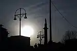 | |||
| George Square, Robert Burns Statue | 55°51′40″N 4°15′02″W | Category B | 32703 | 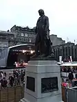 | |||
| 68-74 (Even Nos) Glassford Street | 55°51′33″N 4°14′55″W | Category C(S) | 32715 | | |||
| 64 Buchanan Street | 55°51′35″N 4°15′14″W | Category B | 32636 | | |||
| 66-72 (Even Nos) Buchanan Street, Rowan House | 55°51′35″N 4°15′14″W | Category B | 32637 | | |||
| 164A-168 (Even Nos) Buchanan Street With 10 Dundas Lane, Brittania Buildings | 55°51′45″N 4°15′11″W | Category A | 32643 | .jpg.webp) | |||
| 39-69 (Odd Nos) Candleriggs And 5-15 (Odd Nos) Wilson Street | 55°51′30″N 4°14′45″W | Category B | 32644 | |
Key
The scheme for classifying buildings in Scotland is:
- Category A: "buildings of national or international importance, either architectural or historic; or fine, little-altered examples of some particular period, style or building type."[1]
- Category B: "buildings of regional or more than local importance; or major examples of some particular period, style or building type, which may have been altered."[1]
- Category C: "buildings of local importance; lesser examples of any period, style, or building type, as originally constructed or moderately altered; and simple traditional buildings which group well with other listed buildings."[1]
In March 2016 there were 47,288 listed buildings in Scotland. Of these, 8% were Category A, and 50% were Category B, with the remaining 42% being Category C.[2]
See also
Notes
- Sometimes known as OSGB36, the grid reference (where provided) is based on the British national grid reference system used by the Ordnance Survey.
• "Guide to National Grid". Ordnance Survey. Retrieved 12 December 2007.
• "Get-a-map". Ordnance Survey. Retrieved 17 December 2007. - Historic Environment Scotland assign a unique alphanumeric identifier to each designated site in Scotland, for listed buildings this always begins with "LB", for example "LB12345".
References
- All entries, addresses and coordinates are based on data from Historic Scotland. This data falls under the Open Government Licence
- "What is Listing?". Historic Environment Scotland. Retrieved 29 May 2018.
- Scotland's Historic Environment Audit 2016 (PDF). Historic Environment Scotland and the Built Environment Forum Scotland. pp. 15–16. Retrieved 29 May 2018.
This article is issued from Wikipedia. The text is licensed under Creative Commons - Attribution - Sharealike. Additional terms may apply for the media files.