List of listed buildings in Glasgow/12
List
| Name | Location | Date Listed | Grid Ref. [note 1] | Geo-coordinates | Notes | LB Number [note 2] | Image |
|---|---|---|---|---|---|---|---|
| 79-89 (Odd Nos) Glassford Street, The Trades House | 55°51′33″N 4°14′57″W | Category A | 32713 | 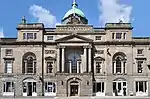 | |||
| 111 High Street And 2 And 4 Blackfriars Street, The Black Bull | 55°51′30″N 4°14′32″W | Category C(S) | 32720 |  | |||
| 104 Argyle Street | 55°51′30″N 4°15′14″W | Category C(S) | 32615 | | |||
| 106-114 (Even Nos) Argyle Street | 55°51′30″N 4°15′15″W | Category B | 32616 | 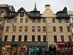 | |||
| 23 Saltoun Street, Belmont And Hillhead Parish Church, Church Of Scotland | 55°52′39″N 4°17′36″W | Category A | 32584 | 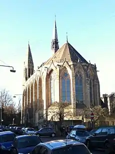 | |||
| 1 Sydenham Road | 55°52′46″N 4°18′08″W | Category B | 32585 | | |||
| 160 Observatory Road, Notre Dame High School | 55°52′42″N 4°17′57″W | Category A | 32571 | .jpg.webp) | |||
| 11 And 11A Horselethill Road And 1A Victoria Circus With Balustrading Walls And Gatepiers | 55°52′45″N 4°17′54″W | Category B | 32525 | | |||
| 25 Hughenden Road, (Hughenden House) | 55°52′54″N 4°18′20″W | Category B | 32526 | | |||
| 5 Kensington Road, Northbank House And Gatepiers | 55°52′45″N 4°18′05″W | Category B | 32537 | | |||
| 730 Great Western Road; Botanic Gardens, Footbridge Over River Kelvin | 55°52′47″N 4°17′17″W | Category B | 32510 | 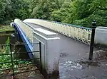 | |||
| 20 Bellshaugh Road; Kelvinside Academy With Boundary Railings And Gateways | 55°52′58″N 4°17′41″W | Category A | 32476 | | |||
| 44 And 44A Queen Mary Avenue | 55°49′57″N 4°15′36″W | Category B | 32443 |  | |||
| 48 Queen Mary Avenue, Marie Stuart Hotel | 55°49′57″N 4°15′34″W | Category C(S) | 32444 |  | |||
| 56 Queen Mary Avenue And 30, 32 Crosshill Avenue | 55°49′55″N 4°15′27″W | Category B | 32445 |  | |||
| 40 Queen's Drive, Former Crosshill Queen's Park Church, Including Boundary Walls With Railings And Gatepiers | 55°49′56″N 4°15′41″W | Category A | 32451 |  | |||
| 12 Airlie Street, Hyndland Public School | 55°52′38″N 4°18′40″W | Category B | 32469 | | |||
| Athole Gardens Piers And Railings To Gardens | 55°52′38″N 4°17′45″W | Category B | 32470 |  | |||
| Pollokshaws Road, Gatepiers To Queen's Park | 55°50′06″N 4°16′21″W | Category C(S) | 32400 |  | |||
| 799 Pollokshaws Road, Camphill House (Within Queen's Park) | 55°49′56″N 4°16′31″W | Category A | 32401 |  | |||
| 20 Balvicar Drive, Balvicar Street, Camphill, Queen's Park Church And Hall | 55°50′03″N 4°16′16″W | Category A | 32359 |  | |||
| 155 Camphill Avenue Thornwood Hall Including Gatepier | 55°49′28″N 4°16′42″W | Category C(S) | 32363 | | |||
| 2 Falloch Road, 60 Lochleven Road, Former Queen's Park Synagogue | 55°49′30″N 4°15′59″W | Category B | 32368 | | |||
| 517 Langside Road, Victoria Infirmary Administration Block | 55°49′41″N 4°16′06″W | Category B | 32370 |  | |||
| 23 Mansionhouse Road St John Residential Home | 55°49′34″N 4°16′28″W | Category B | 32372 |  | |||
| 27 Mansionhouse Road Boswell Country Club | 55°49′31″N 4°16′31″W | Category C(S) | 32374 |  | |||
| 603, 605 Pollokshaws Road, Strathbungo Parish Church | 55°50′15″N 4°16′06″W | Category B | 32397 |  | |||
| 58 Cleveden Drive, "Amalfi House", Boundary Walls And Gatepiers | 55°53′04″N 4°18′23″W | Category B | 32311 | | |||
| 1055 Great Western Road, Nurses Home, Gartnavel Royal Hospital | 55°52′57″N 4°19′12″W | Category B | 32319 | | |||
| 994 Great Western Road "Ravelston" And Gatepiers | 55°52′59″N 4°18′15″W | Category B | 32332 | | |||
| 11, 11A, B, C Winton Drive | 55°53′09″N 4°18′07″W | Category B | 32344 | | |||
| 10 Woodend Drive, All Saints Episcopal Church, Jordanhill | 55°53′07″N 4°19′37″W | Category B | 32346 | | |||
| Hawick Street, Valve House | 55°53′31″N 4°23′03″W | Category C(S) | 32276 | | |||
| 8 And 16 Queen Victoria Drive, Dumbarton Road, Scotstoun West Church And Hall, (Church Of Scotland) | 55°52′46″N 4°21′03″W | Category B | 32279 | | |||
| 14 Victoria Park Drive South, Whiteinch Public Library | 55°52′27″N 4°20′00″W | Category B | 32283 |  | |||
| 1 University Avenue/49 Gibson Street, Glasgow University, Sir Charles Wilson Building, Former Hillhead Congregational Church | 55°52′21″N 4°17′03″W | Category C(S) | 32250 | .jpg.webp) | |||
| 133 Woodlands Road, Church Of St Jude's Congregation (Free Presbyterian Church) | 55°52′10″N 4°16′30″W | Category B | 32262 | | |||
| Woodlands Terrace Stairway To Clifton Street | 55°52′05″N 4°16′45″W | Category A | 32267 |  | |||
| 517-529 (Odd Nos) Great Western Road | 55°52′32″N 4°16′59″W | Category B | 32203 | | |||
| 531-535 (Odd Nos) Great Western Road And 1-3 (Odd Nos) Oakfield Avenue | 55°52′32″N 4°17′00″W | Category B | 32204 | | |||
| Kelvingrove Park Statue Group Of Tigress, Cubs And Peacock | 55°52′06″N 4°16′57″W | Category B | 32209 | | |||
| Kelvingrove Park, Prince Of Wales Bridge | 55°52′13″N 4°17′04″W | Category B | 32210 | | |||
| 61 Arlington Street And 44 Westend Park Street, Arlington Street Baths | 55°52′15″N 4°16′24″W | Category B | 32173 |  | |||
| 65 And 69 Bank Street | 55°52′23″N 4°17′02″W | Category B | 32178 | | |||
| Belmont Street Belmont Bridge | 55°52′39″N 4°16′47″W | Category B | 32182 | | |||
| Argyle Street, Kelvin Hall, Arena And Museum Of Transport | 55°52′06″N 4°17′40″W | Category B | 48034 |  | |||
| Atlas Road, Springburn Railway Station Including Boundary Wall | 55°52′55″N 4°13′51″W | Category B | 49898 |  | |||
| 508-512 (Even Nos) Great Western Road | 55°52′33″N 4°16′57″W | Category B | 49918 | | |||
| 1 Salisbury Street, Former Cumberland Street Station | 55°50′54″N 4°15′24″W | Category B | 49934 | 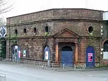 | |||
| Partick, Victoria Park, Partick Curling Club Pavilion | 55°52′33″N 4°19′44″W | Category C(S) | 51588 | | |||
| 101 John Street And 4 Martha Street, University Of Strathclyde Chaplaincy Centre (Former St Paul's Church) | 55°51′44″N 4°14′51″W | Category B | 45641 | | |||
| 46, 48 Garscadden Road, 19, 21, 23 Balvie Drive, Former Old Drumchapel Primary School With Gateways | 55°54′07″N 4°21′56″W | Category C(S) | 43385 | | |||
| 2 Anniesland Road, Public Conveniences | 55°53′25″N 4°19′36″W | Category C(S) | 43033 | | |||
| 1875 Great Western Road, 61-65 (Odd Nos) Munro Place, Former Strathclyde Omnibus Depot With Boundary Walls, Gatepiers And Railings | 55°53′30″N 4°20′01″W | Category B | 43036 | | |||
| 230 Broomhill Drive, Broomhill Cross, Balshagray Church With Boundary Walls And Gatepiers | 55°52′32″N 4°19′12″W | Category B | 33973 | | |||
| 480A And 480B Gallowgate, Elcho Street | 55°51′20″N 4°13′46″W | Category B | 33974 | | |||
| Cathedral Square, The Necropolis | 55°51′46″N 4°13′51″W | Category A | 33890 | 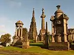 | |||
| 1, 1A Corrour Road, Kingarth Including Perimeter Walls And Gatepiers | 55°49′26″N 4°17′09″W | Category C(S) | 33921 | | |||
| 29 Langside Drive, Newlands Bowling Club Pavilion | 55°49′05″N 4°16′37″W | Category B | 33930 | | |||
| 33 Langside Drive, The Grange Including Boundary Walls And Gatepiers | 55°49′03″N 4°16′39″W | Category C(S) | 33931 | | |||
| 75-77 (Odd Nos) Tobago Street | 55°51′07″N 4°13′52″W | Category C(S) | 33858 | | |||
| Auchinlea Road, Provan Hall Road, Provan Hall | 55°52′18″N 4°07′52″W | Category A | 33863 | 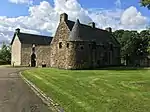 | |||
| Gartloch Road, Gartloch Hospital Former Medical Superintendent's House | 55°52′41″N 4°06′31″W | Category B | 33869 | | |||
| Gartloch Road, Gartloch Hospital Former Mortuary | 55°52′45″N 4°06′28″W | Category B | 33870 | 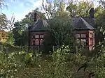 | |||
| 681 Alexandra Parade And 6 Easter Craigs, St Andrew`s East Church And Railings | 55°51′47″N 4°12′31″W | Category A | 33879 | 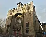 | |||
| 685 Alexandra Parade, St Andrew`s East Church Hall And Railings | 55°51′47″N 4°12′30″W | Category A | 48569 | 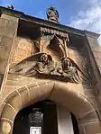 | |||
| Alexandra Parade, Alexandra Park Gateways And Boundary Walls Fronting Alexandra Parade | 55°51′47″N 4°12′35″W | Category C(S) | 33882 | 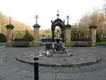 | |||
| 15 Millbrae Road And 18-26 (Even Nos) Overdale Avenue | 55°49′38″N 4°16′12″W | Category C(S) | 33798 | | |||
| 94 Duke Street St Mungo's Rc School Annexe Including Gatepiers (Formerly Alexander's School) | 55°51′34″N 4°14′08″W | Category A | 33827 | .jpg.webp) | |||
| 163-179 (Odd Nos) Gallowgate Dovehill Court (Originally J And G Melior Buildings) | 55°51′21″N 4°14′20″W | Category C(S) | 33831 | | |||
| Glasgow Green, Saltmarket, Sir William Collins Memorial Fountain | 55°51′12″N 4°14′43″W | Category B | 33840 | 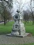 | |||
| 6 St George's Place, 20 Great Western Road And Part 9 Clarendon Court/Clarendon Place | 55°52′17″N 4°16′06″W | Category B | 33779 | | |||
| 325 Carmunnock Road, King's Park, Aikenhead House Walled Garden | 55°48′47″N 4°14′29″W | Category C(S) | 33710 | | |||
| Maryhill Road, Killermont Bridge | 55°54′25″N 4°18′52″W | Category B | 33729 | | |||
| 1346-1364 (Even Nos) Shettleston Road, Eastbank Academy Including Gates And Railings (East End Fe College) | 55°51′04″N 4°09′43″W | Category B | 33647 | | |||
| 75-89 (Odd Nos) Whitevale Street, Public Baths And Washhouse | 55°51′18″N 4°12′59″W | Category B | 33658 | | |||
| 197 Crookston Road, Lodge, Gatepiers And Quadrants | 55°50′25″N 4°21′52″W | Category B | 33591 | | |||
| 510 Crookston Road, Leverndale Hospital, Female Nurses' Home | 55°50′02″N 4°21′51″W | Category B | 33595 | | |||
| 532 Kennishead Road, Kennishead Farmhouse And Steading | 55°48′51″N 4°19′44″W | Category C(S) | 33599 | | |||
| 184 Possil Road Corner With Dawson Road, Rockvilla School Retaining Walls | 55°52′36″N 4°15′31″W | Category B | 33621 | | |||
| Springburn Road, Sighthill Cemetery Memorial To Baird And Hardie | 55°52′34″N 4°14′09″W | Category B | 33624 | | |||
| 197-243 (Odd Nos) Pollokshaws Road, St Andrews Power Station | 55°50′40″N 4°15′35″W | Category B | 33529 | 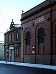 | |||
| 8 And 14 Scotland Street | 55°51′00″N 4°16′04″W | Category B | 33536 | | |||
| 133 Wallace Street And 161 West Street Former Victoria Grain Mills | 55°51′08″N 4°15′53″W | Category B | 33539 | | |||
| Windmillcroft Quay (East End) | 55°51′20″N 4°15′52″W | Category B | 33540 | | |||
| 423 Paisley Road West, Iqra Academy, Former Bellahouston Academy Annexe | 55°51′03″N 4°17′55″W | Category B | 33577 | | |||
| 101 Terregles Avenue, Fotheringay Road, Maxwell Park Station, Including Footbridges | 55°50′15″N 4°17′20″W | Category B | 33489 | 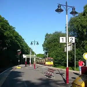 | |||
| 20, 22 Bridge Street And 4 Kingston Street | 55°51′14″N 4°15′32″W | Category B | 33495 | | |||
| 54, 56 Cook Street, Return Elevation To West Street, Former Tradeston Paint Mills | 55°51′06″N 4°15′53″W | Category C(S) | 33505 | | |||
| 144-150 (Even Nos) Norfolk Street And 69, 71 Bridge Street | 55°51′10″N 4°15′31″W | Category B | 33520 | | |||
| 62 Glencairn Drive, Carslogie, Including Boundary Walls And Gatepiers | 55°50′21″N 4°17′03″W | Category C(S) | 33410 | | |||
| 25, 25A Maxwell Drive, Including Boundary Walls And Gatepiers | 55°50′43″N 4°16′57″W | Category B | 33424 | | |||
| 231 Nithsdale Road And Albert Drive, Xaverton House (Formerly Oakleigh), Including Gatepiers And Boundary Walls | 55°50′34″N 4°17′36″W | Category B | 33443 | | |||
| Carmunnock 80 Busby Road Carnbooth House | 55°47′17″N 4°15′07″W | Category B | 33316 | | |||
| Carmunnock, 24 Kirk Road | 55°47′24″N 4°14′08″W | Category B | 33324 | | |||
| 140 Copland Road | 55°51′16″N 4°18′17″W | Category C(S) | 33337 | | |||
| 100-170 Edmiston Drive, Ibrox Stadium (The Stand By Edmiston Drive Only) | 55°51′10″N 4°18′37″W | Category B | 33338 | 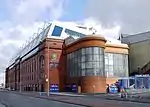 | |||
| 866, 868 Govan Road, Govan Old Parish Church (C Of S) | 55°51′53″N 4°18′47″W | Category A | 33353 | 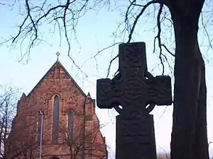 | |||
| 1048 Govan Road, Govan Shipbuilders' Store, Former Engine Works Of Fairfield Shipbuilding And Engineering Company | 55°51′56″N 4°19′25″W | Category A | 33357 | | |||
| 24, 26 Bruce Road, Including Boundary Walls And Gatepiers | 55°50′42″N 4°17′00″W | Category C(S) | 33393 | | |||
| 222, 224 Darnley Street And 1 Leven Street | 55°50′21″N 4°16′18″W | Category B | 33403 |  | |||
| 150-154 (Even Nos) West George Street | 55°51′46″N 4°15′27″W | Category B | 33242 | | |||
| 97, 99 West Regent Street | 55°51′47″N 4°15′32″W | Category C(S) | 33263 | | |||
| 101, 103 West Regent Street | 55°51′47″N 4°15′32″W | Category C(S) | 33264 | | |||
| 126, 128 West Regent Street And 129 Wellington Street | 55°51′49″N 4°15′34″W | Category B | 33273 | | |||
| Stobcross Quay, Stobcross Crane, Otherwise Known As Finnieston Crane | 55°51′30″N 4°17′04″W | Category A | 33285 | 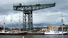 | |||
| 133 Balornock Road, Stobhill Hospital, Water Tower Block | 55°53′36″N 4°13′13″W | Category B | 33289 | | |||
| 1A Drumoyne Drive And Langlands Road, Elder Cottage Hospital | 55°51′38″N 4°19′40″W | Category A | 33300 | | |||
| 2A Drumoyne Drive And Langlands Road, Elder Cottage Hospital (West Block) | 55°51′38″N 4°19′42″W | Category B | 33301 | | |||
| 373-387 (Odd Nos) Sauchiehall Street | 55°51′56″N 4°16′02″W | Category B | 33179 | | |||
| 460, 468 Sauchiehall Street, Baird Hall Of Residence | 55°51′58″N 4°16′05″W | Category B | 33195 |  | |||
| 84-100 (Even Nos) Union Street | 55°51′35″N 4°15′24″W | Category A | 33208 |  | |||
| 159-167 (Odd Nos) West George Street And 136-140 (Even Nos) Hope Street | 55°51′44″N 4°15′28″W | Category B | 33226 | | |||
| 81-91 (Odd Nos) St Vincent Street | 55°51′40″N 4°15′22″W | Category B | 33134 | | |||
| 147 St Vincent Street And 91 Wellington Street | 55°51′42″N 4°15′37″W | Category B | 33143 | | |||
| 203-207 (Odd Nos) St Vincent Street | 55°51′43″N 4°15′45″W | Category C(S) | 33147 | | |||
| 130-136A (Even Nos) St Vincent Street, 124-132 (Even Nos) Hope Street And 61, 63 West George Lane | 55°51′43″N 4°15′28″W | Category B | 33158 | | |||
| 137-143 (Odd Nos) Sauchiehall Street | 55°51′52″N 4°15′29″W | Category B | 33171 | | |||
| 38 New City Road, Dundas Vale Teachers' Centre, Formerly Normal School | 55°52′07″N 4°15′38″W | Category B | 33091 | | |||
| 14, 18 St Enoch Square And 5 St Enoch Place | 55°51′28″N 4°15′21″W | Category B | 33122 | 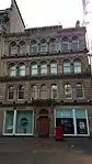 | |||
| 52-58 (Even Nos) Gordon Street 6-16 (Even Nos) Renfield Street And 23-27 (Odd Nos) Drury Street | 55°51′39″N 4°15′23″W | Category B | 33033 | | |||
| 82-92 (Even Nos) Gordon Street And 94-104 (Even Nos), Hope Street, Standard Buildings | 55°51′39″N 4°15′30″W | Category B | 33035 | | |||
| 125 Hill Street | 55°52′02″N 4°16′03″W | Category B | 33039 | | |||
| 254-290 (Even Nos) Hope Street, Theatre Royal | 55°51′59″N 4°15′22″W | Category A | 33061 | 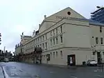 | |||
| Kelvingrove Park At Dumbarton Road, Cameronians Monument | 55°52′10″N 4°17′32″W | Category B | 33072 | 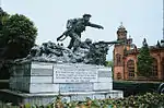 | |||
| 38, 38A Bath Street And Sauchiehall Lane, Former Mechanics' Institute | 55°51′50″N 4°15′18″W | Category B | 32965 | 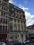 | |||
| 97-113, 117 (Odd Nos) Berkeley Street, 117 Elderslie Street, 100, Kent Road | 55°51′53″N 4°16′35″W | Category B | 32974 | | |||
| 95-99 (Odd Nos) Buchanan Street | 55°51′36″N 4°15′17″W | Category B | 32999 | | |||
| 113-115 (Odd Nos) Buchanan Street And 4 Gordon Street | 55°51′38″N 4°15′16″W | Category A | 33000 | _BUCHANAN_STREET_AND_4_GORDON_STREET.jpg.webp) | |||
| 163 Buchanan Street And Nelson Mandela Place, Former St George's Place, St George's Tron Parish Church (Church Of Scotland) | 55°51′43″N 4°15′14″W | Category A | 33003 | 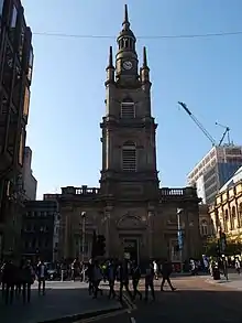 | |||
| 298-306 (Even Nos) Clyde Street, Former Custom House, Now Office Of Procurator Fiscal | 55°51′23″N 4°15′24″W | Category A | 33012 | 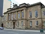 | |||
| 49 Derby Street, 22, 30 Bentinck Street | 55°52′00″N 4°17′05″W | Category A | 33015 | 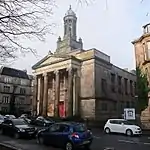 | |||
| 17-21 (Odd Nos) Drury Street, Including The Horseshoe Public House | 55°51′39″N 4°15′23″W | Category A | 33016 | | |||
| 58 Elliot Street | 55°51′35″N 4°16′43″W | Category B | 33019 | 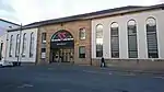 | |||
| 1J Gilmorehill, University Of Glasgow, Natural Philosophy Building | 55°52′18″N 4°17′30″W | Category B | 32923 | 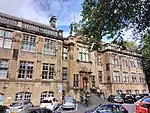 | |||
| 82 University Avenue, University Of Glasgow, Reading Room | 55°52′22″N 4°17′17″W | Category A | 32927 | 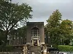 | |||
| 12 University Gardens | 55°52′24″N 4°17′26″W | Category A | 32932 | 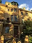 | |||
| 24 Vinicombe Street, Former Botanic Gardens Garage | 55°52′38″N 4°17′24″W | Category A | 32935 | 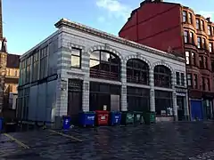 | |||
| 158, 160 Argyle Street And 1 Mitchell Lane | 55°51′30″N 4°15′21″W | Category B | 32949 | | |||
| 186, 188 Argyle Street, The Grant Arms | 55°51′31″N 4°15′27″W | Category B | 32950 | | |||
| 71, B, C, D Partickhill Road | 55°52′31″N 4°18′36″W | Category B | 32892 | | |||
| 74 Partickhill Road | 55°52′32″N 4°18′33″W | Category B | 32898 | | |||
| 76 University Avenue, Wellington Church | 55°52′21″N 4°17′13″W | Category A | 32912 | 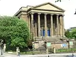 | |||
| 38 Church Street, 10A Dumbarton Road, Western Infirmary, Tennent Memorial Building | 55°52′17″N 4°17′48″W | Category B | 32856 |  | |||
| 8-12 (Even Nos) Cranworth Street, Hillhead Western Baths Club | 55°52′36″N 4°17′27″W | Category B | 32859 | | |||
| 56 Dumbarton Road, University Of Glasgow, Anderson's College Of Medicine | 55°52′13″N 4°17′48″W | Category B | 32867 | | |||
| 46 Fortrose Street And Gatepiers | 55°52′24″N 4°18′29″W | Category B | 32869 | | |||
| Kelvingrove Park Snow Bridge | 55°52′11″N 4°17′37″W | Category B | 32882 |  | |||
| 60 Parson Street, St Mungo's Church | 55°51′56″N 4°14′17″W | Category B | 32814 | | |||
| 111 Queen Street And 46-58 (Even Nos) Royal Exchange Square, Gallery Of Modern Art (Former Stirling's Library, Former Cunninghame Mansion And Former Royal Exchange) | 55°51′36″N 4°15′09″W | Category A | 32818 | 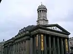 | |||
| 151-157 (Odd Nos) Queen Street (St George's Buildings) | 55°51′38″N 4°15′08″W | Category A | 32819 | _Queen_Street%252C_Glasgow%252C_2018-06-27.jpg.webp) |
Key
The scheme for classifying buildings in Scotland is:
- Category A: "buildings of national or international importance, either architectural or historic; or fine, little-altered examples of some particular period, style or building type."[1]
- Category B: "buildings of regional or more than local importance; or major examples of some particular period, style or building type, which may have been altered."[1]
- Category C: "buildings of local importance; lesser examples of any period, style, or building type, as originally constructed or moderately altered; and simple traditional buildings which group well with other listed buildings."[1]
In March 2016 there were 47,288 listed buildings in Scotland. Of these, 8% were Category A, and 50% were Category B, with the remaining 42% being Category C.[2]
See also
Notes
- Sometimes known as OSGB36, the grid reference (where provided) is based on the British national grid reference system used by the Ordnance Survey.
• "Guide to National Grid". Ordnance Survey. Retrieved 12 December 2007.
• "Get-a-map". Ordnance Survey. Retrieved 17 December 2007. - Historic Environment Scotland assign a unique alphanumeric identifier to each designated site in Scotland, for listed buildings this always begins with "LB", for example "LB12345".
References
- All entries, addresses and coordinates are based on data from Historic Scotland. This data falls under the Open Government Licence
- "What is Listing?". Historic Environment Scotland. Retrieved 29 May 2018.
- Scotland's Historic Environment Audit 2016 (PDF). Historic Environment Scotland and the Built Environment Forum Scotland. pp. 15–16. Retrieved 29 May 2018.
This article is issued from Wikipedia. The text is licensed under Creative Commons - Attribution - Sharealike. Additional terms may apply for the media files.