List of listed buildings in Glasgow/3
List
| Name | Location | Date Listed | Grid Ref. [note 1] | Geo-coordinates | Notes | LB Number [note 2] | Image |
|---|---|---|---|---|---|---|---|
| 2B Kirklee Road And 15 Kirklee Terrace | 55°52′51″N 4°17′47″W | Category B | 32552 |  | |||
| 1-14 (Inclusive Nos) Kirklee Terrace, With Railings, Gatepiers And 1-14 Kirklee Terrace Lane (Inclusive Numbers), Great Western Road | 55°52′49″N 4°17′40″W | Category A | 32553 | | |||
| 3-9 (Inclusive Nos) Lancaster Crescent And 3-9 (Inclusive Nos) Lancaster Crescent Lane; Great Western Road | 55°52′57″N 4°18′06″W | Category B | 32556 | | |||
| 11 Lancaster Crescent, Redlands Hospital, Great Western Road | 55°52′55″N 4°18′02″W | Category B | 32557 | | |||
| 1-10 (Inclusive Nos) Lorraine Gardens And Gatepiers | 55°52′47″N 4°18′06″W | Category B | 32559 | | |||
| 3-9 (Odd Nos) Lorraine Road | 55°52′47″N 4°18′03″W | Category B | 32560 | | |||
| 1-10 (Inclusive Nos) Marchmont Terrace | 55°52′40″N 4°17′46″W | Category B | 32565 | | |||
| 15-19 (Odd Nos) Mirrlees Drive | 55°52′55″N 4°17′49″W | Category B | 32567 | | |||
| 28-30 And 32-34 (Even Nos) Highburgh Road And 10 And 13 Beaumont Gate | 55°52′28″N 4°17′54″W | Category B | 32522 | | |||
| 66-84 (Even Nos) Highburgh Road | 55°52′29″N 4°18′06″W | Category C(S) | 32523 | | |||
| 1-20 (Inclusive Nos) Huntly Gardens, 12 Saltoun Street, 5 Kew Lane And Gatepiers | 55°52′43″N 4°17′40″W | Category B | 32528 | | |||
| 21-34 (Inclusive Nos) Huntly Gardens, 26 Athole Lane | 55°52′39″N 4°17′42″W | Category B | 32529 | | |||
| 21-39 (Odd Nos) Hyndland Road | 55°52′54″N 4°18′13″W | Category A | 32530 | | |||
| 10-20 (Even Nos) Hyndland Road And 1 Montague Lane | 55°52′54″N 4°18′16″W | Category B | 32533 | | |||
| 84-98 (Even Nos) Hyndland Road, 1-3 (Odd Nos) Novar Drive, 2-4 (Even Nos) Queensborough Gardens | 55°52′45″N 4°18′22″W | Category B | 32534 | | |||
| 162 Hyndland Road, Royal Bank Of Scotland, Hyndland Branch | 55°52′35″N 4°18′23″W | Category B | 32535 | | |||
| 11-24 (Inclusive Nos) Kensington Gate | 55°52′47″N 4°17′55″W | Category B | 32536 | | |||
| 1-20 (Inclusive Nos) Kew Terrace, Great Western Road | 55°52′43″N 4°17′35″W | Category B | 32539 | 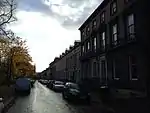 | |||
| 3-11 (Inclusive Nos) Crown Terrace, Rear Gardens Walls And Cast-Iron Railings | 55°52′32″N 4°18′10″W | Category B | 32493 | .jpg.webp) | |||
| 12-17 (Inclusive Nos) Crown Terrace, With Gatepiers And 12 Sydenham Lane | 55°52′33″N 4°18′13″W | Category B | 32494 | | |||
| 1-9 (Inclusive Nos) Devonshire Terrace, And Devonshire Terrace Lane, Great Western Road | 55°52′58″N 4°18′21″W | Category B | 32496 | | |||
| 91-111, 117-127 (Odd Nos) And 118-134 (Even Nos) Dowanhill Street And 58-60 (Even Nos) Dowanside Road | 55°52′30″N 4°17′58″W | Category B | 32497 | 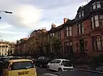 | |||
| 16-26 (Even Nos) Dowanside Road And 2-4 Victoria Crescent Road | 55°52′31″N 4°17′43″W | Category C(S) | 32502 | 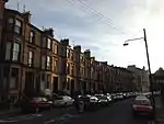 | |||
| 48 And 48A Dowanside Road (Kings Gate) | 55°52′33″N 4°17′53″W | Category B | 32503 | | |||
| 15 And 19-25 (Odd Nos) Dundonald Road, With Retaining Walls And Railings | 55°52′44″N 4°17′54″W | Category C(S) | 32507 | _Moray_Place%252C_53_Queen_Square_And_52_Marywood_Square%252C_Glasgow%252C_Scotland_06.jpg.webp) | |||
| 730 Great Western Road; Botanic Gardens, Kibble Palace | 55°52′44″N 4°17′18″W | Category A | 32513 | 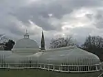 | |||
| 730 Great Western Road; Botanic Gardens, Lodges At Queen Margaret Drive | 55°52′41″N 4°17′24″W | Category B | 32514 | | |||
| Great Western Road And Queen Margaret Drive, Botanic Gardens, Police Box | 55°52′41″N 4°17′24″W | Category B | 32515 | | |||
| 1-11 (Inclusive Nos) Great Western Terrace, 2-34 (Even Nos) Great Western Terrace Lane, 1 And 1B Westbourne Gardens And 19 Westbourne Gardens, With Railings, Lamp Brackets, Boundary And Retaining Walls, Great Western Road | 55°52′51″N 4°18′01″W | Category A | 32517 |  | |||
| 3-15 (Inclusive Nos) Grosvenor Crescent And 8, 16, 18 And 20 Grosvenor Crescent Lane | 55°52′40″N 4°17′34″W | Category B | 32519 | | |||
| 1-17 (Inclusive Nos) Grosvenor Terrace, Great Western Road | 55°52′41″N 4°17′31″W | Category A | 32520 |  | |||
| 35A-44 (Inclusive Nos) Athole Gardens | 55°52′35″N 4°17′41″W | Category C(S) | 32472 |  | |||
| 1-9 (Inclusive Nos) Beaumont Gate | 55°52′29″N 4°17′54″W | Category B | 32473 | | |||
| 14-18 (Inclusive Nos) Beaumont Gate | 55°52′29″N 4°17′52″W | Category B | 32474 | | |||
| 1-16 (Inclusive Nos) Belhaven Terrace And 17-28A (Inclusive Nos) Belhaven Terrace West, Great Western Road | 55°52′46″N 4°17′45″W | Category B | 32475 | | |||
| 11-15 (Inclusive Nos) Bowmont Gardens | 55°52′39″N 4°17′51″W | Category B | 32480 | | |||
| 28-40 (Even Nos) Cleveden Drive, With Walls And Gatepiers | 55°52′59″N 4°18′02″W | Category B | 32484 | | |||
| 4-8 (Even Nos) Cleveden Road, With Gatepiers And Walls | 55°52′59″N 4°18′08″W | Category B | 32487 | | |||
| 3-10 (Inclusive Nos) Crown Circus And 1, 1A And 2 Crown Terrace And 15 And 17 Crown Road North, With Gatepiers And Retaining Wall | 55°52′34″N 4°18′03″W | Category A | 32489 | | |||
| 1-14 (Inclusive Nos) Crown Gardens And Archway To Crown Circus Lane, Gatepiers, Walled And Railed Rear Gardens | 55°52′34″N 4°18′08″W | Category B | 32490 |  | |||
| 54-82 (Even Nos) 29-61 (Odd Nos) Crosshill Avenue | 55°49′53″N 4°15′31″W | Category B | 32429 |  | |||
| 109 Dixon Avenue, Belleisle Street, Holy Cross Church And Presbytery | 55°50′04″N 4°15′28″W | Category B | 32432 |  | |||
| 30, 32 Queen's Drive, St Rule | 55°49′54″N 4°15′37″W | Category B | 32448 |  | |||
| 36, 38 Queen's Drive Including Gatepiers | 55°49′54″N 4°15′39″W | Category C(S) | 32450 | | |||
| 42-76 (Even Nos) Queen's Drive, Royal Crescent Including Railings | 55°49′58″N 4°15′48″W | Category B | 32452 |  | |||
| 78-118 (Even Nos) Queen's Drive 541-545 (Odd Nos) Victoria Road And 370-372 (Even Nos) Langside Road, Crosshill | 55°50′01″N 4°15′53″W | Category B | 32453 |  | |||
| 144-150 (Even Nos) Queen's Drive And 4 Maybank Street Including Railings | 55°50′03″N 4°16′05″W | Category B | 32455 |  | |||
| 152-164 (Even Nos) Queen's Drive And 85, 89 Albert Avenue Including Railings | 55°50′04″N 4°16′08″W | Category B | 32456 |  | |||
| 465-505 (Odd Nos) Victoria Road 1-5 (Odd Nos) Albert Road And 8-18 (Even Nos) Dixon Avenue | 55°50′05″N 4°15′54″W | Category B | 32461 |  | |||
| 69 Dixon Road And Elevation To Warren Street, Govanhill Workspace, Former New Bridgegate Church And Hall | 55°50′00″N 4°15′11″W | Category B | 32467 | 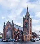 | |||
| 1-20 (Inclusive Nos) Athole Gardens, With Railings And Piers To Gardens | 55°52′37″N 4°17′41″W | Category B | 32471 | 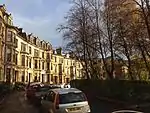 | |||
| 754-782 (Even Nos) Pollokshaws Road, 5, 7, Nithsdale Road And 2 Regent Park Square | 55°50′10″N 4°16′16″W | Category B | 32403 | 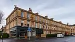 | |||
| 848-856 (Even Nos) Pollokshaws Road 1 Marywood Square And 2 Vennard Gardens | 55°50′04″N 4°16′27″W | Category B | 32406 | _Pollokshaws_Road_1_Marywood_Square_And_2_Vennard_Gardens%252C_Glasgow%252C_Scotland.jpg.webp) | |||
| 4-50 (Even Nos) Queen Square | 55°50′08″N 4°16′22″W | Category B | 32407 | | |||
| 3-49 (Odd Nos) Regent Park Square | 55°50′11″N 4°16′23″W | Category B | 32410 | 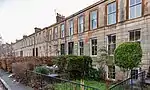 | |||
| 4-44 (Even Nos) Regent Park Square | 55°50′12″N 4°16′22″W | Category B | 32411 | 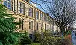 | |||
| 201 And 233 Tantallon Road, Langside Primary School Including Janitor's Lodge, Playground Walls And Gatepiers | 55°49′35″N 4°16′55″W | Category B | 32413 | | |||
| 52, 54 Albert Road And 326 Langside Road Including The Hampden Bar | 55°50′03″N 4°15′50″W | Category C(S) | 32418 | 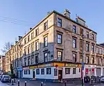 | |||
| 169-193 Allison Street (Odd Nos), 182-220 (Even Nos) Langside Road | 55°50′13″N 4°15′43″W | Category C(S) | 32422 | 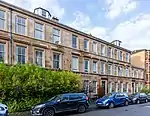 | |||
| 265-289 (Odd Nos) Allison Street 19, 21, 23 Garturk Street And 34 Daisy Street | 55°50′09″N 4°15′32″W | Category A | 32423 | 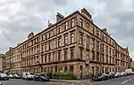 | |||
| 13 And 27 Annette Street, Annette Street Primary School, Including Gatepiers And Railings | 55°50′11″N 4°15′37″W | Category B | 32424 | | |||
| 656, 660 Cathcart Road, (Formerly 125 Dixon Avenue) Dixon Halls Including Gatepiers And Railings | 55°50′03″N 4°15′24″W | Category B | 32427 |  | |||
| Maryhill Road, Forth And Clyde Canal Aqueduct | 55°53′30″N 4°17′34″W | Category B | 32354 |  | |||
| 23-53 (Odd Nos) Camphill Avenue, Iser Lane | 55°49′37″N 4°16′31″W | Category B | 32362 | | |||
| 157 Camphill Avenue Hazelwood | 55°49′27″N 4°16′40″W | Category C(S) | 32364 |  | |||
| 44 Carmichael Place, Battlefield Primary School Including Gates, Gatepiers And Railings | 55°49′29″N 4°16′19″W | Category B | 32365 |  | |||
| 25, 25A Mansionhouse Road | 55°49′32″N 4°16′30″W | Category A | 32373 | 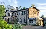 | |||
| 29 & 29A Mansionhouse Road, Carmelite Monastery [Former Rawcliffe Lodge], Including Gate Piers, Railings, Former Stable Block And Boundary Walls | 55°49′29″N 4°16′36″W, Including Gate Piers, Railings, Former Stable Block And Boundary Walls)] | Category B | 32375 | 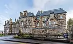 | |||
| Marywood Square Lamp Standard In Front Of No 7 | 55°50′06″N 4°16′27″W | Category B | 32376 | 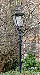 | |||
| Marywood Square Lamp Standard In Front Of No 35 | 55°50′08″N 4°16′31″W | Category B | 32378 | 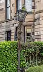 | |||
| 2, 2A-38 (Even Nos) Millbrae Crescent | 55°49′20″N 4°16′33″W | Category A | 32384 | | |||
| 1-10 (Inclusive Nos) Moray Place Including 81 Nithsdale Road | 55°50′14″N 4°16′25″W | Category A | 32386 | 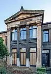 | |||
| 19-25 (Inclusive Nos) Moray Place, 53 Queen Square And 52 Marywood Square | 55°50′11″N 4°16′33″W | Category B | 32388 | _Moray_Place%252C_53_Queen_Square_And_52_Marywood_Square%252C_Glasgow%252C_Scotland_07.jpg.webp) | |||
| 81-95 (Odd Nos) Nithsdale Drive 52, 58 Nithsdale Street, Salisbury Quadrant | 55°50′15″N 4°16′17″W | Category B | 32391 | | |||
| 18-80 (Even Nos) Nithsdale Road And 65 Nithsdale Street | 55°50′12″N 4°16′15″W | Category B | 32394 | 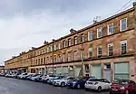 | |||
| 22, 30 Nithsdale Street And 28 March Street | 55°50′15″N 4°16′13″W | Category B | 32395 | | |||
| 749-769 (Odd Nos) Pollokshaws Road And 181, 183 Queen's Drive And 3, 5 Balvicar Street | 55°50′07″N 4°16′18″W | Category B | 32399 | 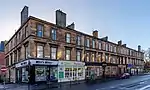 | |||
| 2 Beaconsfield Road, Kelvinside House, Retaining Walls, Balustrading And Gatepiers | 55°53′09″N 4°18′17″W | Category B | 32302 | | |||
| 2-15 (Inclusive Nos) Cleveden Crescent, Cleveden Crescent Lane (All Numbers South) Gatepiers, Boundary Walls And Retaining Walls | 55°53′04″N 4°18′13″W | Category B | 32305 | | |||
| 48 Cleveden Drive, Stoneleigh, And Gatepiers | 55°53′01″N 4°18′15″W | Category A | 32306 | | |||
| 60 Cleveden Drive, Boundary Walls And Gatepiers | 55°53′05″N 4°18′25″W | Category B | 32312 | | |||
| 3 Cleveden Road And 992 Great Western Road, Gatepiers And Boundary Walls, Now Known As Balmanno House | 55°52′59″N 4°18′12″W | Category C(S) | 32313 | | |||
| 17-45 (Odd Nos) Cleveden Road And 1-9B Beaconsfield Road | 55°53′04″N 4°18′11″W | Category B | 32315 | | |||
| Great Western Road, Kelvin Court, 1-52 And 53-100 | 55°53′15″N 4°18′37″W | Category B | 32321 | 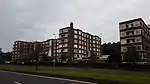 | |||
| 1089 Great Western Road, 1 Whittingehame Gardens | 55°53′09″N 4°18′53″W | Category C(S) | 32322 | | |||
| 64 Burnhouse Street, Maryhill Public Baths And Wash Houses | 55°53′27″N 4°17′31″W | Category B | 32348 | | |||
| 1512-1528 (Even Nos) Maryhill Road | 55°53′29″N 4°17′28″W | Category C(S) | 32353 | | |||
| 1-28 (Inclusive Nos) Woodside Place And 138, 140 Elderslie Street | 55°52′01″N 4°16′23″W | Category A | 32270 | | |||
| 1-22 (Inclusive Nos) Woodside Terrace, 11-63 Woodside Terrace Lane, 4 Claremount Place | 55°52′04″N 4°16′30″W | Category A | 32271 | | |||
| 143, 153 Garscadden Road, Drumchapel Old Parish Church And Hall, Church Of Scotland | 55°54′23″N 4°21′54″W | Category C(S) | 32273 | 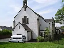 | |||
| 26-40 (Even Nos) Balshagray Drive With Retaining Walls And Gatepiers | 55°52′27″N 4°19′38″W | Category C(S) | 32286 | | |||
| 42-56 (Even Nos) Balshagray Drive And 2 Marlborough Avenue, With Retaining Walls And Gatepiers | 55°52′29″N 4°19′37″W | Category B | 32287 | | |||
| 206-216 (Even Nos) Broomhill Drive | 55°52′32″N 4°19′15″W | Category B | 32291 | | |||
| 19-33 (Odd Nos) Broomhill Terrace And 2 Central Avenue | 55°52′24″N 4°19′37″W | Category C(S) | 32293 | | |||
| 1-21 (Inclusive Nos) Park Terrace And 18-24 (Inclusive Nos) Woodlands Terrace And 2-4 (Even Nos) Park Terrace East Lane And 3 Park Street South | 55°52′07″N 4°16′46″W | Category A | 32245 | 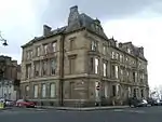 | |||
| 1-18 Queen's Crescent And 106 West Princes Street And 1 Melrose Street | 55°52′15″N 4°16′12″W | Category B | 32247 | | |||
| 14-42 (Even Nos) University Avenue, Students Union | 55°52′21″N 4°17′06″W | Category B | 32252 | 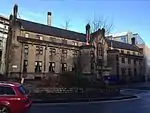 | |||
| 6-10 (Even Nos) Westend Park Street | 55°52′12″N 4°16′29″W | Category C(S) | 32253 | | |||
| 61-91 And 117, 123 (Odd Nos) West Princes Street | 55°52′13″N 4°16′16″W | Category B | 32258 | | |||
| 4-48 (Even Nos) West Princes Street And 201 St George's Road | 55°52′13″N 4°16′09″W | Category B | 32259 | | |||
| 1-17 (Inclusive Nos) Woodlands Terrace | 55°52′06″N 4°16′39″W | Category B | 32266 | 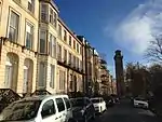 | |||
| 6-19 (Inclusive No) Woodside Crescent | 55°52′03″N 4°16′19″W | Category A | 32268 | | |||
| 1-12 (Inclusive Nos) Lynedoch Place | 55°52′10″N 4°16′34″W | Category B | 32222 |  | |||
| 21-23 (Odd Nos) Lynedoch Street | 55°52′06″N 4°16′30″W | Category B | 32226 | | |||
| 1-27 (Inclusive Nos) Newton Place Gatepiers And Retaining Wall To Sauchiehall Street | 55°51′59″N 4°16′32″W | Category B | 32230 | | |||
| 329-345 (Odd Nos) North Woodside Road | 55°52′32″N 4°16′33″W | Category B | 32231 | | |||
| 7, 9, 11, 15, 17, 19, 21, 23 Oakfield Avenue And 14-16 (Even Nos) Glasgow Street | 55°52′30″N 4°17′02″W | Category B | 32232 | | |||
| 27-29 (Odd Nos) Oakfield Avenue | 55°52′28″N 4°17′03″W | Category B | 32233 | | |||
| 41-53 (Odd Nos) Oakfield Avenue And 18 Great George Street | 55°52′27″N 4°17′04″W | Category A | 32235 | | |||
| 57-69 (Odd Nos) Oakfield Avenue | 55°52′25″N 4°17′06″W | Category B | 32236 | | |||
| 1-29 (Inclusive Nos) Park Circus And 9 Park Street South | 55°52′11″N 4°16′41″W | Category A | 32238 | | |||
| 1-17 (Odd Nos) And 2-8 (Even Nos) Park Circus Place | 55°52′07″N 4°16′40″W | Category A | 32239 |  | |||
| 1-6 (Inclusive Nos) Park Gardens And Park Gardens Lane | 55°52′05″N 4°16′49″W | Category A | 32240 | _Park_Gardens_and_Park_Gardens_Lane%252C_Glasgow%252C_2018-06-27.jpg.webp) | |||
| 1-10 (Inclusive Nos) Park Quadrant | 55°52′14″N 4°16′46″W | Category A | 32243 |  | |||
| 21-27 (Odd Nos) Carnarvon Street And 27-29 (Odd Nos) Baliol Street | 55°52′08″N 4°16′16″W | Category B | 32184 | | |||
| 1-12 (Inclusive Nos) Claremont Terrace 1 Claremont Place And Gatepiers To Claremont Terrace Lane | 55°52′04″N 4°16′40″W | Category A | 32185 | | |||
| 12, 14, 16, 18, 20, 22, 24, 26, 30, 32, 34, 36, 38 Gibson Street And 89 Otago Street | 55°52′21″N 4°16′55″W | Category C(S) | 32190 | | |||
| 1-5 (Odd Nos) Glasgow Street And 46-48 (Even Nos) Otago Street | 55°52′27″N 4°16′56″W | Category B | 32192 | | |||
| 79-99 Great Western Road | 55°52′18″N 4°16′15″W | Category B | 32199 | | |||
| 445-459 (Odd Nos) Great Western Road And 6 Caledonian Crescent, 1-8 (Inclusive Nos) Caledonian Mansions | 55°52′30″N 4°16′52″W | Category A | 32200 | | |||
| 499-505 (Odd Nos) Great Western Road, 4 Bank Street (Former Cooper's Building) | 55°52′31″N 4°16′58″W | Category B | 32202 | | |||
| 6-36 (Even Nos) Hamilton Park Avenue | 55°52′35″N 4°16′59″W | Category B | 32206 | | |||
| 2-28 (Inclusive) Lansdowne Crescent And 386 Great Western Road | 55°52′27″N 4°16′36″W | Category B | 32215 | | |||
| 4-19 (Inclusive) Lynedoch Crescent And 6, 18, 20, 22, Lynedoch Street | 55°52′08″N 4°16′28″W | Category B | 32221 | | |||
| 5, 7, 11, 15, 19, 23, 25, 27 Ashley Street | 55°52′10″N 4°16′25″W | Category B | 32174 | | |||
| 3-25 (Odd Nos) And 10-30 (Even Nos) Baliol Street | 55°52′08″N 4°16′18″W | Category B | 32176 |  | |||
| 3-18 (Inclusive Nos) Belmont Crescent | 55°52′37″N 4°16′53″W | Category B | 32181 | | |||
| 40-44 (Even Nos) Fortrose Street, Hyndland Primary School With Ancillary Building, Boundary Walls, Gatepiers, Gates And Railings | 55°52′21″N 4°18′26″W | Category C(S) | 45782 | | |||
| 142 And 144 West Regent Street, Including Railings | 55°51′49″N 4°15′36″W | Category B | 46527 | | |||
| 33, 35 And 41 Oswald Street | 55°51′28″N 4°15′37″W | Category C(S) | 46591 | | |||
| Cecil Street, 14-60 (Even Nos) Sardinia Terrace | 55°52′35″N 4°17′17″W | Category B | 47361 | | |||
| 30 Eldon Street, Former Janitor's House To Former Woodside Public School, With Gatepiers And Railings | 55°52′20″N 4°16′47″W | Category B | 48025 | | |||
| 35 Church Street, Former Church Street School, Including Swimming Pool Block, Janitor's House, Gatepiers, Boundary Walls And Railings | 55°52′16″N 4°17′54″W | Category C(S) | 48969 | | |||
| 42 Marwick Street And 9-29 Walter Street, Haghill Primary School Including Gate Piers, Boundary Walls And Railings And 16 Marwick Street (Janitor's House) | 55°51′43″N 4°12′27″W | Category B | 49650 | | |||
| Montgomery Street And 22 Queen Mary Street, Queen Mary Street Nursery School, Dining Hall And Janitor's House Including Boundary Walls | 55°50′55″N 4°13′10″W | Category B | 49925 | | |||
| 124-130 Cubie Street, Former Telephone Exchange | 55°51′09″N 4°13′25″W | Category C(S) | 49926 | | |||
| 607 Gallowgate, Bellgrove Hotel | 55°51′18″N 4°13′19″W | Category B | 49927 | | |||
| 148 And 150 Monreith Road East Including Boundary Wall | 55°48′59″N 4°16′00″W | Category C(S) | 49929 | | |||
| 180 A-F Centre Street And 90 Wallace Street, Former Southern Fire Station Including Hose Tower And Courtyard Buildings | 55°51′09″N 4°15′45″W | Category B | 49931 | | |||
| 24 Willoughby Drive, 778-792 And 800-812 (Even Nos) Crow Road, 1571-1627 (Odd Nos) Great Western Road And 53-57 (Odd Nos) Ancaster Drive, Anniesland Mansions Including Boundary Walls | 55°53′21″N 4°19′29″W | Category B | 50011 | | |||
| 66 Victoria Crescent Road, Notre Dame Primary School Including Former Girls Training College And Gatepiers, Boundary Walls And Railings | 55°52′37″N 4°17′56″W | Category C(S) | 50026 | | |||
| 123, 131 And 133 Sauchiehall Street | 55°51′52″N 4°15′28″W | Category B | 50773 | | |||
| 2A Viewmount Drive, Former Maryhill Primary School Including Boundary Walls And Railings | 55°53′41″N 4°17′39″W | Category C(S) | 50893 | | |||
| 27 Broomhill Avenue, Former Balshagray Public School Including Swimming Pool And Janitor's House, Gates, Gatepiers And Railings | 55°52′19″N 4°19′27″W | Category C(S) | 51044 | | |||
| 156-174 (Even Nos) Bath Street | 55°51′53″N 4°15′40″W | Category B | 44596 | | |||
| 1-6 Redlands Terrace, (Inclusive Nos) Great Western Road | 55°52′54″N 4°17′58″W | Category B | 44039 | | |||
| Clyde Street, Union Railway Bridge (Also Known As St Enoch Bridge) Over The River Clyde | 55°51′11″N 4°14′58″W | Category B | 44040 | 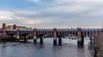 | |||
| 122 Well Street, Bain Square, Calton New Parish Church | 55°51′17″N 4°14′05″W | Category B | 44053 | 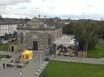 | |||
| 536 Anniesland Road, British Telecom Building Former Scotstoun Telephone Exchange With Boundary Wall And Railings | 55°53′09″N 4°21′01″W | Category C(S) | 43083 | | |||
| 66 Boreland Drive, St David's Church, Church Of Scotland, With Railings And Gatepiers | 55°53′28″N 4°21′19″W | Category B | 43114 | |
Key
The scheme for classifying buildings in Scotland is:
- Category A: "buildings of national or international importance, either architectural or historic; or fine, little-altered examples of some particular period, style or building type."[1]
- Category B: "buildings of regional or more than local importance; or major examples of some particular period, style or building type, which may have been altered."[1]
- Category C: "buildings of local importance; lesser examples of any period, style, or building type, as originally constructed or moderately altered; and simple traditional buildings which group well with other listed buildings."[1]
In March 2016 there were 47,288 listed buildings in Scotland. Of these, 8% were Category A, and 50% were Category B, with the remaining 42% being Category C.[2]
See also
Notes
- Sometimes known as OSGB36, the grid reference (where provided) is based on the British national grid reference system used by the Ordnance Survey.
• "Guide to National Grid". Ordnance Survey. Retrieved 12 December 2007.
• "Get-a-map". Ordnance Survey. Retrieved 17 December 2007. - Historic Environment Scotland assign a unique alphanumeric identifier to each designated site in Scotland, for listed buildings this always begins with "LB", for example "LB12345".
References
- All entries, addresses and coordinates are based on data from Historic Scotland. This data falls under the Open Government Licence
- "What is Listing?". Historic Environment Scotland. Retrieved 29 May 2018.
- Scotland's Historic Environment Audit 2016 (PDF). Historic Environment Scotland and the Built Environment Forum Scotland. pp. 15–16. Retrieved 29 May 2018.
This article is issued from Wikipedia. The text is licensed under Creative Commons - Attribution - Sharealike. Additional terms may apply for the media files.