List of listed buildings in Glasgow/9
List
| Name | Location | Date Listed | Grid Ref. [note 1] | Geo-coordinates | Notes | LB Number [note 2] | Image |
|---|---|---|---|---|---|---|---|
| 4-7 (Odd Nos) Chalmers Gate (Formerly 394 Gallowgate) | 55°51′20″N 4°13′57″W | Category B | 33823 |  | |||
| 71A, 73-77 (Odd Nos) Clouston Street And Railings | 55°52′55″N 4°17′21″W | Category C(S) | 33757 | | |||
| 275-277 (Odd Nos) Garrioch Road And 72, 74, 76 Clouston Street With Railings And Gatepiers | 55°52′56″N 4°17′20″W | Category C(S) | 33763 | | |||
| 485 St George's Road, Former St George In The Fields | 55°52′27″N 4°15′50″W | Category A | 33782 | .jpg.webp) | |||
| 35 Cuthbertson Street And Coplaw Street, Cuthbertson Primary School Including Janitors Lodge, Playground Walls And Gatepiers | 55°50′22″N 4°15′52″W | Category B | 33691 | 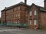 | |||
| Adelphi Street/Glasgow Green, St Andrews Suspension Bridge | 55°50′56″N 4°14′18″W | Category A | 33692 | 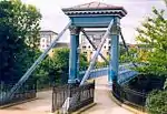 | |||
| 170 Langside Road, Calder Street Govanhill Library | 55°50′16″N 4°15′42″W | Category B | 33695 | 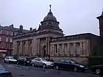 | |||
| Richmond Park, Footbridge Over Polmadie Burn, (Opposite Queensferry Street) | 55°50′19″N 4°13′55″W | Category C(S) | 33699 | | |||
| 201 Ardencraig Road, Castlemilk, St Martin's Roman Catholic Church And Presbytery | 55°48′05″N 4°13′13″W | Category B | 33701 |  | |||
| 325 Carmunnock Road, King's Park, Aikenhead House, Gatepiers On Main Drive | 55°48′58″N 4°14′46″W | Category B | 33709 | | |||
| 325 Carmunnock Road, King's Park, Aikenhead House Stable Block | 55°48′45″N 4°14′34″W | Category B | 33711 | | |||
| Machrie Road, Barlia Terrace, Castlemilk House Bridge | 55°48′29″N 4°13′14″W | Category B | 33721 | | |||
| 100 Acre Road, Acre House With Boundary Walls And Gatepiers | 55°54′14″N 4°18′24″W | Category C(S) | 33727 | | |||
| Maryhill Road, Martyrs Memorial Pillar | 55°53′50″N 4°17′58″W | Category C(S) | 33732 | | |||
| Bilsland Drive Aqueduct | 55°53′05″N 4°16′45″W | Category B | 33745 | 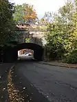 | |||
| 14 Orr Street, Olympia Street, County Bingo | 55°50′58″N 4°13′34″W | Category B | 33642 | 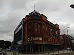 | |||
| 179 Shettleston Road, Including Gates And Railings, Employment Exchange | 55°51′17″N 4°11′48″W | Category B | 33643 | | |||
| 316 Caledonia Road, Rutherglen Road, Southern Necropolis Lodge | 55°50′38″N 4°14′43″W | Category A | 33685 | 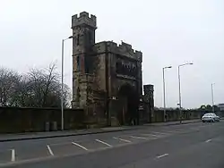 | |||
| 500 Corselet Road, Darnley Mill | 55°48′27″N 4°19′57″W | Category B | 33589 | | |||
| 510 Crookston Road, Leverndale Hospital, Towerview Unit | 55°50′04″N 4°22′14″W | Category A | 33597 | | |||
| Ralston Avenue 109 (Westfield) And 113 (Auldersyde) Including Boundary Walls And Gatepiers | 55°50′31″N 4°22′10″W | Category B | 33606 | | |||
| Salterland Road, Bridge At Salterland | 55°48′45″N 4°22′30″W | Category C(S) | 33607 | | |||
| 104 Elmvale Street, 712 Hawthorn Street, Elmvale Primary School Including Janitor's Lodge And Playground Walls | 55°53′10″N 4°14′02″W | Category B | 33611 | | |||
| 110-136 (Even Nos) Flemington Street, Former Springburn College Including Range To East | 55°52′47″N 4°13′50″W | Category A | 33612 | | |||
| 48, 54 Gourlay Street, Springburn Nursery School, Former Springburn Primary School | 55°52′51″N 4°14′07″W | Category C(S) | 33613 | | |||
| 6, 10 Hillkirk Street St Aloysius Rc Church And Presbytery | 55°53′00″N 4°13′47″W | Category B | 33614 | | |||
| 1448-1456 (Even Nos) Gallowgate And Burgher Street | 55°51′04″N 4°11′51″W | Category B | 33634 | | |||
| 8, 10 Haugh Road And 9 Overnewton Street, St Vincent Masonic Halls | 55°51′58″N 4°17′24″W | Category C(S) | 33545 | | |||
| 5 Sydenham Road Including Gatepiers And Coachhouse | 55°52′41″N 4°18′07″W | Category B | 33547 | | |||
| Lainshaw Drive, Linn Crematorium Including Canopies, Gatepiers, Railings And Lodges | 55°48′02″N 4°15′43″W | Category B | 33549 | | |||
| 995 Paisley Road West, Lodge To Bellahouston Park | 55°50′55″N 4°19′02″W | Category C(S) | 33578 | 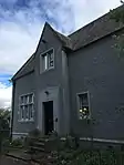 | |||
| 520-532 (Even Nos) Paisley Road West, 8 Ibroxholm Place, 33 Ibroxholm Avenue | 55°51′03″N 4°18′16″W | Category B | 33581 | | |||
| 20 Corkerhill Gardens, Maryland House | 55°50′45″N 4°19′57″W | Category C(S) | 33588 |  | |||
| 32 St Andrews Drive | 55°50′48″N 4°16′52″W | Category B | 33465 | | |||
| 11 Sherbrooke Avenue And Nithsdale Road, Sherbrooke Hotel, Including Boundary Walls, Railings And Gatepiers | 55°50′35″N 4°17′50″W | Category B | 33468 | | |||
| 34 Sherbrooke Avenue Cairn O'Mount, Including Gatepiers And Boundary Walls | 55°50′28″N 4°18′00″W | Category B | 33475 | | |||
| 30, 30A Sutherland Avenue, Ardtornish, Including Boundary Walls And Gatepiers | 55°50′27″N 4°17′52″W | Category B | 33487 | | |||
| 1, 3 Bridge Street And 87 Carlton Place | 55°51′16″N 4°15′29″W | Category B | 33492 | | |||
| Govan Road And Paisley Road Junction, Piazza At North Side, Toll Gate Pier | 55°51′14″N 4°16′45″W | Category B | 33514 | | |||
| 56-64 Kingston Street And Return Elevation To Centre Street | 55°51′15″N 4°15′43″W | Category B | 33516 | | |||
| 27 Newark Drive, Including Boundary Walls, Gatepiers And Gates | 55°50′23″N 4°16′54″W | Category B | 33429 | | |||
| 16 Newark Drive, Including Boundary Walls And Gatepiers | 55°50′24″N 4°16′46″W | Category B | 33436 | | |||
| 193 Nithsdale Road, Including Boundary Walls And Gatepiers | 55°50′29″N 4°17′07″W | Category B | 33439 | | |||
| 195 Nithsdale Road, Including Boundary Walls And Gatepiers | 55°50′29″N 4°17′08″W | Category C(S) | 33440 | | |||
| 174 Nithsdale Road, Ashbank, Including Boundary Walls And Gatepiers | 55°50′29″N 4°16′48″W | Category C(S) | 33446 |  | |||
| 200 Nithsdale Road, Ellisland, Including Boundary Walls And Gatepiers | 55°50′32″N 4°17′11″W | Category A | 33450 | | |||
| 2060 Pollokshaws Road, Pollok House Former Stables, Including Courtyard Ranges | 55°49′35″N 4°18′59″W | Category A | 33457 |  | |||
| 2060 Pollokshaws Road, Pollok House, Shawmuir Lodge On Pollok Avenue, Including Gates And Gatepiers | 55°49′36″N 4°18′03″W | Category B | 33459 | | |||
| 2060 Pollokshaws Road, Pollok House Walled Gardens, Including Drybridge | 55°49′38″N 4°18′56″W | Category B | 33460 | 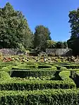 | |||
| 61 St Andrew's Drive, 46 Aytoun Road, Doralee, Including Boundary Walls And Gatepiers | 55°50′37″N 4°17′17″W | Category B | 33463 | | |||
| 65 St Andrews Drive, Including Boundary Walls And Gatepiers | 55°50′30″N 4°17′20″W | Category B | 33464 | | |||
| Carmunnock, 107 Waterside Road, (2-Storey Range Only) | 55°47′29″N 4°14′08″W | Category C(S) | 33329 | | |||
| 831 Govan Road, St Anthony's Rc Church | 55°51′48″N 4°18′52″W | Category B | 33345 | | |||
| 908 Govan Road And Return Elevation To Mckechnie Street, County Bingo Social Club, Former Lyceum Cinema | 55°51′51″N 4°18′55″W | Category B | 33355 | | |||
| 1030, 1048 Govan Road, Govan Shipbuilders Ltd, General Offices (Excluding 1956 Extension To W) | 55°51′56″N 4°19′25″W | Category A | 33356 | | |||
| 137-143 (Odd Nos) Albert Drive And 100, 102 Forth Street | 55°50′29″N 4°16′16″W | Category B | 33366 | | |||
| 165-193 (Odd Nos) Albert Drive, 159 Kenmure Street And 50-54 (Even Nos) Glenapp Street | 55°50′31″N 4°16′21″W | Category B | 33368 | | |||
| 328 Albert Drive, Craigholme School Infant Department, Including Gatepiers And Boundary Walls | 55°50′39″N 4°17′02″W | Category B | 33379 | | |||
| 354 Albert Drive, Including Boundary Walls And Gatepiers | 55°50′41″N 4°17′30″W | Category B | 33384 | | |||
| 48 And 48A Dalziel Drive, Including Boundary Walls And Gatepiers | 55°50′32″N 4°17′36″W | Category B | 33399 | | |||
| 58, 58A Dalziel Drive, Including Boundary Walls And Gatepiers | 55°50′34″N 4°17′47″W | Category B | 33400 | | |||
| Darnley Road/Moray Place, Former Strathbungo Station, Footbridge | 55°50′15″N 4°16′28″W | Category C(S) | 33401 | | |||
| 95 West Regent Street | 55°51′47″N 4°15′31″W | Category C(S) | 33262 | | |||
| 140, 142 Balgrayhill Road, Including Redclyffe | 55°53′18″N 4°13′49″W | Category A | 33288 | | |||
| Springburn Park, Column | 55°53′23″N 4°13′35″W | Category B | 33296 | | |||
| Springburn Park, Statue Of James Reid | 55°53′23″N 4°13′29″W | Category B | 33297 | | |||
| 87,91 Holmfauld Road, Linthouse Buildings | 55°51′57″N 4°19′55″W | Category B | 309 | | |||
| 228A Langlands Road And Elder Park Street, Elder Park Library | 55°51′43″N 4°19′19″W | Category A | 33310 | | |||
| 202-212 (Even Nos) Sauchiehall Street And 8-12 (Even Nos) Cambridge Street | 55°51′55″N 4°15′36″W | Category B | 33191 | 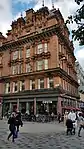 | |||
| 474 Sauchiehall Street | 55°51′59″N 4°16′08″W | Category B | 33196 | | |||
| 101-115 (Odd Nos) Union Street And 59-69 (Odd Nos) Gordon Street | 55°51′37″N 4°15′27″W | Category B | 33205 | | |||
| 64 Waterloo Street | 55°51′39″N 4°15′45″W | Category B | 33215 | | |||
| 139, 141 West George Street | 55°51′44″N 4°15′25″W | Category B | 33225 | | |||
| 299-311 (Odd Nos) West George Street And 103-109 (Odd Nos) Douglas Street | 55°51′47″N 4°15′53″W | Category B | 33232 | | |||
| 47 St Vincent Street And 131-137 (Odd Nos) Buchanan Street, Royal Bank Buildings | 55°51′40″N 4°15′16″W | Category B | 33130 | 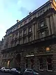 | |||
| 105-113 (Odd Nos) St Vincent Street | 55°51′41″N 4°15′27″W | Category B | 33137 | | |||
| 189, 191 St Vincent Street | 55°51′43″N 4°15′43″W | Category C(S) | 33146 | | |||
| 209-213 (Odd Nos) St Vincent Street | 55°51′43″N 4°15′46″W | Category C(S) | 33148 | | |||
| 1 La Belle Place And 7, 11 Clifton Street And La Belle Allee, Hindu Mandir, Former Queen's Rooms | 55°52′00″N 4°16′45″W | Category A | 33082 | | |||
| 147-159 (Odd Nos) North Street | 55°51′50″N 4°16′18″W | Category B | 33094 | | |||
| 121-125 (Odd Nos) Renfield Street And Renfrew Street, The Pavilion Theatre | 55°51′54″N 4°15′21″W | Category A | 33103 | 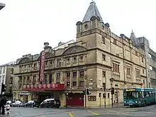 | |||
| 12 Rose Street, Glasgow Film Theatre | 55°51′57″N 4°15′40″W | Category B | 33118 | 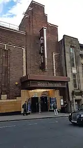 | |||
| 46-64 (Even Nos) St Enoch Square And 27-35 (Odd Nos) Howard Street | 55°51′26″N 4°15′22″W | Category B | 33126 | | |||
| 20-40 (Even Nos) Gordon Street And 1, 3 West Nile Street | 55°51′39″N 4°15′22″W | Category A | 33031 | | |||
| 45-47 (Odd Nos) Hill Street, And 21 Dalhousie Street, St Aloysius College | 55°52′01″N 4°15′50″W | Category B | 33037 | 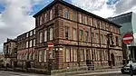 | |||
| 133, 135 Hill Street | 55°52′02″N 4°16′05″W | Category B | 33041 | | |||
| 140-150 (Even Nos) Hill Street, Former Beatson Hospital Annexe | 55°52′04″N 4°16′05″W | Category B | 33047 | 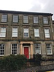 | |||
| 19-23 (Odd Nos) Hope Street | 55°51′33″N 4°15′35″W | Category B | 33049 | | |||
| 154-158 (Even Nos) Hope Street | 55°51′47″N 4°15′27″W | Category C(S) | 33057 | | |||
| 27-59 (Odd Nos) James Watt Street And 42-52 (Even Nos) Brown Street | 55°51′27″N 4°15′52″W | Category B | 33067 | | |||
| 44-54 (Even Nos) James Watt Street (Known As 60 James Watt Street) | 55°51′30″N 4°15′50″W | Category A | 33069 | | |||
| 12-20 (Even Nos) Kelvingrove Street And 26-28 Westminster Terrace | 55°51′55″N 4°17′02″W | Category B | 33073 | | |||
| 152-154 (Even Nos) Bath Street | 55°51′52″N 4°15′39″W | Category C(S) | 32966 | | |||
| 256A Bath Street, Renfield St Stephen's Church, Former St Matthew's Blythswood (Church Of Scotland) | 55°51′55″N 4°16′01″W | Category B | 32970 | 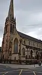 | |||
| 48-52 (Even Nos) Bothwell Street | 55°51′41″N 4°15′39″W | Category B | 32986 | | |||
| 45 Buchanan Street And 34-50 (Even Nos) Mitchell Street, Former Wylie And Lochead's | 55°51′33″N 4°15′19″W | Category A | 32992 | 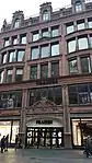 | |||
| 16-20 (Even Nos) Cambridge Street | 55°51′55″N 4°15′36″W | Category B | 33007 | .jpg.webp) | |||
| 3 Gilmorehill, University Of Glasgow, John Macintyre Building, University Avenue, Former Students Union | 55°52′20″N 4°17′20″W | Category B | 32921 | 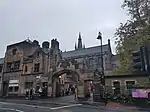 | |||
| 646-654 (Even Nos) Argyle Street, The Buttery | 55°51′39″N 4°16′18″W | Category B | 32952 | | |||
| 30 Queen Margaret Drive, Bbc | 55°52′43″N 4°17′13″W | Category B | 32902 | | |||
| 64 Southpark Avenue, Southpark House | 55°52′26″N 4°17′13″W | Category B | 32907 | 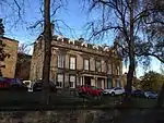 | |||
| 10 Dumbarton Road, Maggie's Centre, Former Western Infirmary Gate Lodge | 55°52′12″N 4°17′42″W | Category C(S) | 32866 | | |||
| 93-95 (Odd Nos) Hyndland Street, Cottier Theatre Complex, Former Dowanhill Church And Halls | 55°52′27″N 4°18′07″W | Category A | 32879 | | |||
| Wilson Street, Police Box | 55°51′31″N 4°14′55″W | Category B | 32803 | 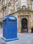 | |||
| 34-36 North Frederick Street, "Gladstone House" | 55°51′42″N 4°14′54″W | Category B | 32811 | | |||
| 134-148 (Even Nos) Queen Street With 13-14 George Square, Olympic House | 55°51′38″N 4°15′05″W | Category B | 32821 | | |||
| 1 St Andrews Square, St Andrews Parish Church (Church Of Scotland) | 55°51′17″N 4°14′34″W | Category A | 32830 | 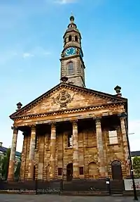 | |||
| 118-126 (Even Nos) Howard Street, Known As 126 Howard Street | 55°51′21″N 4°15′10″W | Category B | 32728 | 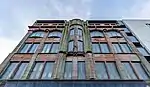 | |||
| 177 Ingram Street With 99 Glassford Street | 55°51′35″N 4°14′56″W | Category A | 32734 | | |||
| 184-188 (Even Nos) Ingram Street And Return Elevation To South Frederick Street | 55°51′36″N 4°14′57″W | Category B | 32747 | | |||
| 13-21 (Odds) James Morrison Street And 2 St Andrew's Square | 55°51′19″N 4°14′34″W | Category B | 32749 | | |||
| 48-54 (Even Nos) Miller Street, (Formerly Stirling's Library) | 55°51′32″N 4°15′03″W | Category A | 32761 | | |||
| 62-70 (Even Nos) Miller Street Known As 70 Miller Street | 55°51′33″N 4°15′02″W | Category B | 32762 | | |||
| 23-25 (Odd Nos) Montrose Street And 8 Cochrane Street | 55°51′37″N 4°14′46″W | Category B | 32764 | | |||
| Smith's Court, South Side (Access From Pend At No 62 Brunswick Street) | 55°51′28″N 4°14′48″W | Category B | 32766 | | |||
| 157-159 (Odd Nos) Trongate Terleys | 55°51′26″N 4°14′54″W | Category B | 32777 | | |||
| 2-16 (Even Nos) Trongate/High Street, Quadrant With Bank Of Scotland | 55°51′25″N 4°14′38″W | Category B | 32780 | | |||
| 106-110 (Even Nos) Trongate And 3-9 (Odd Nos) Candleriggs | 55°51′26″N 4°14′47″W | Category B | 32785 | | |||
| 59-61 (Odd Nos) Virginia Street | 55°51′33″N 4°15′01″W | Category C(S) | 32797 | | |||
| 3 Castle Street, Provand's Lordship With Railings | 55°51′45″N 4°14′13″W | Category A | 32648 | 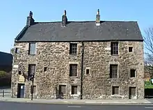 | |||
| Cathedral Square, Memorial Stone | 55°51′46″N 4°14′10″W | Category C(S) | 32659 | | |||
| Cathedral Square, Statue Of William Iii | 55°51′43″N 4°14′11″W | Category A | 32660 | _statue_-_geograph.org.uk_-_940023.jpg.webp) | |||
| 52 Charlotte Street | 55°51′16″N 4°14′27″W | Category A | 32663 | 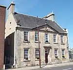 | |||
| Clyde Street, Albert Bridge | 55°51′09″N 4°14′50″W | Category A | 32667 | 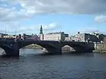 | |||
| 30 George Square And 7 West George Street, The Merchants' House | 55°51′41″N 4°15′06″W | Category A | 32689 | .jpg.webp) | |||
| George Square, Field Marshal Lord Clyde Statue | 55°51′39″N 4°15′01″W | Category B | 32694 | 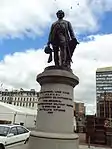 | |||
| George Square, Robert Peel Statue | 55°51′41″N 4°15′04″W | Category B | 32704 | 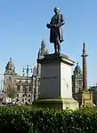 | |||
| George Square Thomas Graham Statue | 55°51′39″N 4°14′58″W | Category B | 32705 | 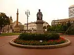 | |||
| 145-195 (Odd Nos) Albion Street | 55°51′36″N 4°14′38″W | Category A | 32607 | _Albion_Street%252C_Glasgow%252C_2018-06-27_straight.jpg.webp) | |||
| 20 Buchanan Street | 55°51′31″N 4°15′16″W | Category B | 32632 | | |||
| 34-58 (Even Nos) Buchanan Street With 7-17 (Odd Nos) Springfield Court, Formerly Prince Of Wales Buildings Now Known As Princes Square | 55°51′33″N 4°15′16″W | Category B | 32634 | 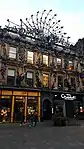 | |||
| 156-164 (Even Nos) Buchanan Street With 48-50 (Even Nos) West George Street, Tower Building | 55°51′44″N 4°15′12″W | Category B | 32642 | 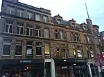 | |||
| 20-26 (Even Nos) Roxburgh Street And 33-35 (Odd Nos) Saltoun Street | 55°52′37″N 4°17′39″W | Category B | 32583 | _ROXBURGH_STREET_AND_33-35_(ODD_NOS)_SALTOUN_STREET.jpg.webp) | |||
| 7 Victoria Circus, (Greenbank), With Outbuildings And Gatepiers | 55°52′43″N 4°18′02″W | Category B | 32591 | | |||
| 4 Victoria Circus, (Northcote) And Gatepiers | 55°52′45″N 4°18′02″W | Category C(S) | 32592 | | |||
| 8-12 (Inclusive Nos) Kirklee Quadrant | 55°52′54″N 4°17′39″W | Category B | 32548 | | |||
| 8 Prince Albert Road And 7 Sydenham Road With Boundary Wall And Gatepiers | 55°52′40″N 4°18′09″W | Category B | 32574 | | |||
| 24 Highburgh Road, And 3 And 7 Caledon Street, Western Telephone Exchange | 55°52′29″N 4°17′49″W | Category B | 32521 | | |||
| 1 Dundonald Road (Fern Tower) And Gatepiers | 55°52′41″N 4°17′51″W | Category B | 32504 | | |||
| 730 Great Western Road; Botanic Gardens, Curators House | 55°52′46″N 4°17′20″W | Category B | 32509 | | |||
| 174 Queen's Drive, Seventh Day Adventist Church | 55°50′07″N 4°16′13″W | Category B | 32458 | 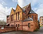 | |||
| 519-537 (Odd Nos) Victoria Road | 55°50′03″N 4°15′55″W | Category C(S) | 32463 | 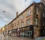 | |||
| Victoria Road, Queen's Park Station | 55°50′07″N 4°16′02″W | Category B | 32466 | 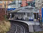 | |||
| 35-53 (Odd Nos) Westmoreland Street, 165 Allison Street | 55°50′11″N 4°15′48″W | Category C(S) | 32468 | | |||
| Sandbank Street, Maryhill High Church, (Church Of Scotland) And Halls To 7 Aray Street | 55°53′33″N 4°17′37″W | Category C(S) | 32357 | | |||
| 30-36 (Even Nos) Sandy Road, 120-124 (Even Nos) Beith Street, Former Partick Fire Station | 55°52′09″N 4°18′55″W | Category B | 32297 |  | |||
| Forth And Clyde Canal Aqueduct (Adjoining Skaethorn Road Bridge) | 55°53′33″N 4°18′06″W | Category A | 32316 | | |||
| 1051 Great Western Road And Adjoining Retaining Walls And Balustrade (Carriages Restaurant) | 55°53′03″N 4°18′34″W | Category B | 32317 | | |||
| 1055 Great Western Road Gartnavel Royal Hospital, Garden, Boundary And Retaining Walls | 55°53′01″N 4°19′09″W | Category A | 32318 |  | |||
| 1099 Great Western Road, 6 Whittingehame Gardens | 55°53′11″N 4°18′59″W | Category C(S) | 32327 | |
Key
The scheme for classifying buildings in Scotland is:
- Category A: "buildings of national or international importance, either architectural or historic; or fine, little-altered examples of some particular period, style or building type."[1]
- Category B: "buildings of regional or more than local importance; or major examples of some particular period, style or building type, which may have been altered."[1]
- Category C: "buildings of local importance; lesser examples of any period, style, or building type, as originally constructed or moderately altered; and simple traditional buildings which group well with other listed buildings."[1]
In March 2016 there were 47,288 listed buildings in Scotland. Of these, 8% were Category A, and 50% were Category B, with the remaining 42% being Category C.[2]
See also
Notes
- Sometimes known as OSGB36, the grid reference (where provided) is based on the British national grid reference system used by the Ordnance Survey.
• "Guide to National Grid". Ordnance Survey. Retrieved 12 December 2007.
• "Get-a-map". Ordnance Survey. Retrieved 17 December 2007. - Historic Environment Scotland assign a unique alphanumeric identifier to each designated site in Scotland, for listed buildings this always begins with "LB", for example "LB12345".
References
- All entries, addresses and coordinates are based on data from Historic Scotland. This data falls under the Open Government Licence
- "What is Listing?". Historic Environment Scotland. Retrieved 29 May 2018.
- Scotland's Historic Environment Audit 2016 (PDF). Historic Environment Scotland and the Built Environment Forum Scotland. pp. 15–16. Retrieved 29 May 2018.
This article is issued from Wikipedia. The text is licensed under Creative Commons - Attribution - Sharealike. Additional terms may apply for the media files.