List of listed buildings in Montrose, Angus
List
| Name | Location | Date Listed | Grid Ref. [note 1] | Geo-coordinates | Notes | LB Number [note 2] | Image |
|---|---|---|---|---|---|---|---|
| 3-7 (Inclusive Nos) Melville Gardens, Victoria Villas, Including Boundary Walls And Railings | 56°42′29″N 2°27′53″W | Category B | 38210 |  | |||
| Eastern Road And Paton's Lane, Chapel Works Or Bond (Centre Buildings) To Paton's Lane | 56°42′38″N 2°27′40″W | Category A | 38212 |  | |||
| Eastern Road And Paton's Lane, Chapel Works Or Bond, East Warehouse | 56°42′37″N 2°27′30″W | Category B | 38214 | 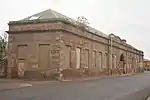 | |||
| 17 Panmure Place, The Rectory, Including Boundary Walls And Gatepiers | 56°42′31″N 2°27′58″W | Category B | 38215 |  | |||
| Montrose Air Station Buildings 46 And 47 | 56°43′29″N 2°27′47″W | Category B | 38227 | 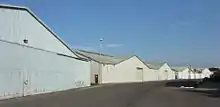 | |||
| 81 High Street, Ivy House Including Boundary Walls | 56°42′42″N 2°28′01″W | Category C(S) | 38070 |  | |||
| 95 High Street | 56°42′41″N 2°28′04″W | Category B | 38074 |  | |||
| High Street, Statue Of Joseph Hume | 56°42′41″N 2°28′05″W | Category B | 38089 |  | |||
| 9 And 11 Castle Place | 56°42′34″N 2°28′08″W | Category B | 38094 |  | |||
| 12 And 13 Castle Place Including Boundary Walls | 56°42′34″N 2°28′08″W | Category C(S) | 38097 |  | |||
| 32 And 34 Bridge Street Including Boundary Walls | 56°42′32″N 2°28′20″W | Category C(S) | 38107 |  | |||
| 40 And 42 Bridge Street, Including Boundary Walls | 56°42′31″N 2°28′21″W | Category C(S) | 38110 |  | |||
| Bridge Street, Post Office | 56°42′34″N 2°28′14″W | Category B | 38113 |  | |||
| 14 South Esk Street, Former Melville Mission Hall | 56°42′32″N 2°28′05″W | Category C(S) | 38166 |  | |||
| 1 And 2 Wharf Street, The Quarter Deck | 56°42′25″N 2°28′28″W | Category C(S) | 38168 |  | |||
| 9-12 (Inclusive Nos) Wharf Street | 56°42′25″N 2°28′25″W | Category C(S) | 38172 |  | |||
| 10 And 12 River Street, Tower At, Including Boundary Walls And Gatepiers | 56°42′20″N 2°28′01″W | Category C(S) | 38175 |  | |||
| 8-11 (Inclusive Numbers) Union Place Including Boundary Walls | 56°42′48″N 2°27′41″W | Category B | 38181 |  | |||
| Bents Road, Montrose Ropeworks, Including Boundary Walls | 56°42′45″N 2°27′38″W | Category C(S) | 38182 |  | |||
| Baltic Street, Congregational Church And Memorial Hall Including Boundary Walls | 56°42′38″N 2°27′56″W | Category B | 38196 |  | |||
| 1 Panmure Place Including Garage, Boundary Walls, Gatepiers And Railings | 56°42′36″N 2°27′54″W | Category B | 38198 |  | |||
| 58 High Street Including Boundary Walls | 56°42′45″N 2°28′07″W | Category B | 38011 |  | |||
| 80 High Street | 56°42′44″N 2°28′07″W | Category B | 38016 |  | |||
| 96 High Street | 56°42′43″N 2°28′08″W | Category B | 38020 |  | |||
| 100 And 102 High Street | 56°42′43″N 2°28′07″W | Category B | 38024 |  | |||
| 118 And 120 High Street, 8 And 10 Hume Street | 56°42′42″N 2°28′09″W | Category C(S) | 38027 |  | |||
| 170 And 172 High Street | 56°42′39″N 2°28′07″W | Category B | 38039 | 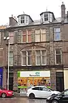 | |||
| 180 And 184 High Street | 56°42′38″N 2°28′07″W | Category B | 38043 |  | |||
| 214 And 216 High Street, Public Library Including Boundary Walls | 56°42′36″N 2°28′09″W | Category A | 38051 | 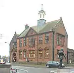 | |||
| 51 And 53 High Street | 56°42′44″N 2°28′04″W | Category C(S) | 38065 |  | |||
| House Of Kinnaber - Doocot | 56°44′51″N 2°26′54″W | Category B | 17688 |  | |||
| Fisherhills, Kinnaber | 56°45′01″N 2°26′39″W | Category B | 17689 |  | |||
| Dubton House | 56°44′11″N 2°29′12″W | Category C(S) | 17745 |  | |||
| Borrowfield House | 56°43′53″N 2°28′49″W | Category B | 17746 |  | |||
| The Cottage, Hillside | 56°44′29″N 2°28′56″W | Category B | 17748 |  | |||
| Gayfield House, Hillside Walled Garden | 56°44′29″N 2°28′42″W | Category B | 17751 |  | |||
| 30 And 31 Christie's Lane Including Boundary Walls | 56°42′40″N 2°27′34″W | Category C(S) | 46177 |  | |||
| 49 - 71 (Odd Nos) Ferry Street | 56°42′24″N 2°27′56″W | Category C(S) | 46180 |  | |||
| 26 High Street Including Boundary Walls | 56°42′47″N 2°28′08″W | Category C(S) | 46199 |  | |||
| 21, 23 And 25 Murray Street Including Boundary Walls | 56°42′56″N 2°28′02″W | Category B | 46230 |  | |||
| 109-113 (Odd Nos) Murray Street | 56°42′50″N 2°28′04″W | Category C(S) | 46236 |  | |||
| 1, 3 And 5 Caledonia Street | 56°42′26″N 2°27′57″W | Category C(S) | 38221 |  | |||
| Montrose Air Station Building 48 | 56°43′27″N 2°27′47″W | Category A | 38228 |  | |||
| Montrose Air Station Building 151 | 56°43′31″N 2°27′45″W | Category C(S) | 38232 |  | |||
| 105 And 109 High Street | 56°42′40″N 2°28′03″W | Category B | 38077 |  | |||
| 36 And 36A Bridge Street, Including Boundary Walls | 56°42′32″N 2°28′21″W | Category B | 38108 |  | |||
| 14, 16 And 18 New Wynd | 56°42′44″N 2°28′02″W | Category C(S) | 38143 |  | |||
| 28 - 33 (Inclusive Numbers) Wharf Street | 56°42′25″N 2°28′20″W | Category C(S) | 38173 |  | |||
| 34 And 35 Wharf Street Including Boundary Walls, And Railings | 56°42′26″N 2°28′19″W | Category C(S) | 38174 |  | |||
| Dorward Road, Dorward House Including Gates, Gatepiers And Railings | 56°43′01″N 2°27′33″W | Category B | 38178 |  | |||
| 4-7 (Inclusive Nos) Union Place Including Boundary Walls | 56°42′47″N 2°27′41″W | Category B | 38180 |  | |||
| 3 Hudson Square | 56°42′39″N 2°27′54″W | Category C(S) | 38194 |  | |||
| 1-8 (Inclusive Nos) Panmure Terrace Including Boundary Walls | 56°42′39″N 2°27′53″W | Category A | 38195 | 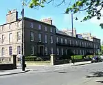 | |||
| 2 Panmure Place Including Boundary Walls And Railings | 56°42′35″N 2°27′55″W | Category B | 38200 |  | |||
| Charleton Road And Coronation Avenue, Ythan Lodge Including Ancillary Structures And Boundary Walls | 56°43′38″N 2°27′51″W | Category C(S) | 37987 |  | |||
| 74 High Street | 56°42′44″N 2°28′07″W | Category B | 38014 |  | |||
| 110-116 (Even Nos) High Street Including Boundary Walls | 56°42′42″N 2°28′07″W | Category B | 38026 |  | |||
| 166 High Street | 56°42′39″N 2°28′06″W | Category C(S) | 38035 | 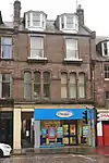 | |||
| 186 And 188 High Street | 56°42′37″N 2°28′07″W | Category B | 38045 | 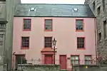 | |||
| Rosemount House Walled Garden | 56°44′41″N 2°29′39″W | Category C(S) | 17739 |  | |||
| 44 Bridge Street Including Boundary Walls, Gatepiers And Railings | 56°42′31″N 2°28′22″W | Category C(S) | 46170 |  | |||
| Castle Place, Tourist Information Office Including Boundary Wall And Railing | 56°42′35″N 2°28′11″W | Category C(S) | 46171 |  | |||
| 7 George Street Including Boundary Walls | 56°42′35″N 2°28′04″W | Category C(S) | 46183 |  | |||
| 9 George Street Including Boundary Walls | 56°42′35″N 2°28′04″W | Category C(S) | 46184 |  | |||
| 19 High Street Including Boundary Walls | 56°42′47″N 2°28′04″W | Category C(S) | 46189 |  | |||
| 97 High Street, 1 Of 2 Houses In Review Close To Rear | 56°42′41″N 2°28′02″W | Category C(S) | 46195 |  | |||
| 117 High Street And Queen's Close | 56°42′40″N 2°28′02″W | Category C(S) | 46198 |  | |||
| 56 High Street Including Boundary Walls | 56°42′45″N 2°28′08″W | Category C(S) | 46201 |  | |||
| 104 High Street Including Boundary Walls | 56°42′43″N 2°28′09″W | Category C(S) | 46204 |  | |||
| 196 And 198 High Street | 56°42′37″N 2°28′07″W | Category B | 46205 |  | |||
| Market Street, St Margaret's Church (St Margaret's Roman Catholic Church) Including Presbytery, Boundary Walls And Gatepiers | 56°42′49″N 2°27′59″W | Category B | 46217 |  | |||
| 20 Market Street And 22 Trades Close | 56°42′49″N 2°28′00″W | Category C(S) | 46218 |  | |||
| 61, 63 And 65 Murray Street | 56°42′54″N 2°28′03″W | Category C(S) | 46233 |  | |||
| 121-125 (Odd Nos) Murray Street | 56°42′50″N 2°28′04″W | Category C(S) | 46237 |  | |||
| 58, 60 And 62 Murray Street | 56°42′54″N 2°28′04″W | Category C(S) | 46239 |  | |||
| 37 North Esk Road, Including Boundary Walls, Gatepiers And Railings | 56°43′03″N 2°28′02″W | Category C(S) | 46247 |  | |||
| 52 North Esk Road Including Boundary Walls | 56°43′16″N 2°27′56″W | Category C(S) | 46250 |  | |||
| Traill Drive, Traill Pavilion | 56°42′44″N 2°26′54″W | Category C(S) | 46254 |  | |||
| 4 Upper Hall Street Including Boundary Walls | 56°42′51″N 2°28′03″W | Category C(S) | 46256 |  | |||
| 1 Esk Road | 56°42′13″N 2°28′50″W | Category B | 44759 |  | |||
| Provost Scott's Road, St Mary's And St Peter's Episcopal Church Including Churchyard, Boundary Walls, Gatepiers And Gates | 56°42′39″N 2°27′48″W | Category A | 38204 | 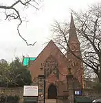 | |||
| Academy Square, Statue Robert Burns | 56°42′37″N 2°27′49″W | Category B | 38206 | 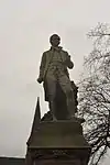 | |||
| 1 Melville Gardens, Esk House Including Boundary Walls And Gatepiers | 56°42′32″N 2°27′52″W | Category B | 38208 |  | |||
| 2 Melville Gardens, Park House Including Boundary Walls And Gatepiers | 56°42′31″N 2°27′52″W | Category B | 38209 |  | |||
| 8-10 (Inclusive Nos) Melville Gardens Including Railings | 56°42′28″N 2°27′54″W | Category C(S) | 38211 |  | |||
| Dock Buildings, Old Custom House Meridian Street Including Ancillary Structures On Erskine Street, Ferry Street And Caledonia Street | 56°42′21″N 2°27′54″W | Category B | 38222 |  | |||
| Montrose Air Station Building 62 | 56°43′31″N 2°27′45″W | Category C(S) | 38229 |  | |||
| Montrose Air Station Building 141 | 56°43′36″N 2°27′39″W | Category B | 38230 |  | |||
| Montrose Air Station Building 142 | 56°43′31″N 2°27′45″W | Category C(S) | 38231 |  | |||
| High Street, Two K6 Telephone Kiosks Adjacent To Town House | 56°42′40″N 2°28′05″W | Category B | 38233 | 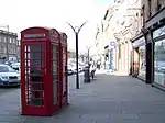 | |||
| 83 High Street | 56°42′42″N 2°28′04″W | Category C(S) | 38071 |  | |||
| High Street, Mooran House,Including Boundary Walls | 56°42′39″N 2°28′03″W | Category B | 38081 |  | |||
| High Street, Town House | 56°42′39″N 2°28′05″W | Category A | 38083 | 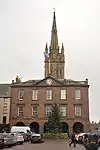 | |||
| 133- 143 (Odd Nos) High Street | 56°42′37″N 2°28′05″W | Category B | 38087 |  | |||
| 5 And 6 Castle Place | 56°42′34″N 2°28′07″W | Category B | 38092 |  | |||
| 10 Castle Place, Straton House Including Boundary Walls | 56°42′33″N 2°28′06″W | Category A | 38095 |  | |||
| 31 And 33 Bridge Street | 56°42′33″N 2°28′16″W | Category C(S) | 38116 |  | |||
| 59 - 63 (Odd Nos) Bridge Street | 56°42′31″N 2°28′19″W | Category C(S) | 38122 |  | |||
| 53 And 55 John Street Including Boundary Walls, Railings And Lamp Standard | 56°42′47″N 2°27′55″W | Category B | 38133 |  | |||
| Provost Scott's Road, Links House Hotel And Ancillary Structures Including Boundary Walls And Gatepiers | 56°42′46″N 2°27′51″W | Category B | 38138 |  | |||
| 10 And 12 New Wynd | 56°42′44″N 2°28′02″W | Category C(S) | 38142 |  | |||
| 30 And 32 New Wynd | 56°42′44″N 2°28′00″W | Category C(S) | 38146 |  | |||
| South Esk Street, South Esk School Including Boundary Walls And Gatepiers | 56°42′27″N 2°28′10″W | Category B | 38165 |  | |||
| 20 The Mall, Mall House Including Boundary Walls, Gatepiers And Railings | 56°43′01″N 2°27′57″W | Category B | 37990 |  | |||
| 2 And 4 High Street And 128 Murray Street Including Boundary Walls | 56°42′49″N 2°28′05″W | Category B | 37996 |  | |||
| 16 And 18 High Street Including Boundary Walls | 56°42′48″N 2°28′06″W | Category B | 37999 |  | |||
| 54 High Street | 56°42′45″N 2°28′07″W | Category B | 38010 |  | |||
| 92 High Street | 56°42′43″N 2°28′07″W | Category B | 38019 |  | |||
| 156 High Street | 56°42′39″N 2°28′07″W | Category C(S) | 38032 |  | |||
| 17 And 21 High Street | 56°42′47″N 2°28′04″W | Category B | 38056 |  | |||
| 29 High Street And 1 John Street | 56°42′47″N 2°28′04″W | Category B | 38059 |  | |||
| Woodside Cottage, Charleton | 56°44′31″N 2°27′13″W | Category B | 19823 |  | |||
| Charleton Steading | 56°44′28″N 2°27′44″W | Category B | 17758 |  | |||
| 10-20 (Even Nos) George Street | 56°42′34″N 2°28′04″W | Category C(S) | 46186 |  | |||
| High Street, Old Church Hall Including Boundary Wall | 56°42′37″N 2°28′03″W | Category C(S) | 46206 |  | |||
| 4 And 6 John Street | 56°42′46″N 2°28′03″W | Category C(S) | 46210 |  | |||
| Melville Gardens, Melville Bowling Clubhouse Including Boundary Walls, Gatepiers And Railings | 56°42′32″N 2°27′54″W | Category C(S) | 46220 |  | |||
| Mid Links, Monument And Drinking-Fountain | 56°42′52″N 2°27′43″W | Category C(S) | 46223 |  | |||
| Montrose North, Signal Box | 56°42′56″N 2°28′20″W | Category C(S) | 46226 | 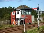 | |||
| 17 And 19 Murray Street | 56°42′57″N 2°28′01″W | Category C(S) | 46229 |  | |||
| 33 And 35 Murray Street | 56°42′56″N 2°28′02″W | Category C(S) | 46232 |  | |||
| 87, 89 And 91 Murray Street | 56°42′52″N 2°28′03″W | Category C(S) | 46234 |  | |||
| North Esk Road, Lochside Church | 56°43′11″N 2°27′58″W | Category C(S) | 46245 | 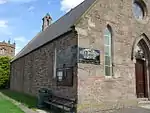 | |||
| 7 Union Street Including Boundary Walls | 56°42′48″N 2°27′39″W | Category C(S) | 46255 |  | |||
| The Limes And Limekilns Cottages | 56°44′13″N 2°29′43″W | Category B | 17742 |  | |||
| Hillside, Former Kinnaber Water Works | 56°44′52″N 2°28′21″W | Category C(S) | 51643 |  | |||
| 10 Gibson Place | 56°42′29″N 2°27′57″W | Category C(S) | 38216 |  | |||
| 69-77 (Odd Nos) High Street | 56°42′43″N 2°28′03″W | Category C(S) | 38068 |  | |||
| 12 Bridge Street Including Boundary Walls And Railings | 56°42′34″N 2°28′17″W | Category C(S) | 38100 |  | |||
| 22 Bridge Street Including Boundary Walls | 56°42′33″N 2°28′18″W | Category B | 38103 |  | |||
| 24 Bridge Street Including Boundary Walls | 56°42′33″N 2°28′19″W | Category C(S) | 38104 |  | |||
| 26 Bridge Street, Including Boundary Walls | 56°42′32″N 2°28′19″W | Category C(S) | 38105 |  | |||
| 28 And 30 Bridge Street Including Boundary Walls | 56°42′32″N 2°28′19″W | Category C(S) | 38106 |  | |||
| 71 Bridge Street | 56°42′31″N 2°28′19″W | Category C(S) | 38124 |  | |||
| 111 And 113 Bridge Street | 56°42′27″N 2°28′25″W | Category C(S) | 38125 |  | |||
| 121 Bridge Street | 56°42′26″N 2°28′26″W | Category C(S) | 38126 |  | |||
| 129 And 131 Bridge Street | 56°42′26″N 2°28′27″W | Category C(S) | 38129 |  | |||
| 1-11 (Odd Nos) St Mary's Road, Scott Terrace | 56°42′36″N 2°27′57″W | Category C(S) | 38149 |  | |||
| 8 St Mary's Road | 56°42′35″N 2°27′59″W | Category C(S) | 38152 |  | |||
| 4 Wharf Street | 56°42′25″N 2°28′27″W | Category C(S) | 38169 |  | |||
| 1-6 (Inclusive Numbers) Wellington Place Including Boundary Walls And Gatepiers | 56°42′51″N 2°27′41″W | Category C(S) | 38179 |  | |||
| 8, 9 And 10 Chapel Place | 56°42′41″N 2°27′52″W | Category B | 38187 |  | |||
| 1 And 3 Panmure Street | 56°42′40″N 2°27′54″W | Category C(S) | 38189 |  | |||
| 1 And 2 Hudson Square Including Boundary Walls And Gatepiers | 56°42′39″N 2°27′54″W | Category B | 38193 |  | |||
| 12 High Street | 56°42′48″N 2°28′06″W | Category B | 37998 |  | |||
| 28 High Street | 56°42′47″N 2°28′06″W | Category B | 38002 |  | |||
| 50 High Street Including Boundary Walls | 56°42′46″N 2°28′08″W | Category B | 38007 |  | |||
| 88 High Street | 56°42′43″N 2°28′08″W | Category C(S) | 38018 |  | |||
| 150 And 152 High Street | 56°42′40″N 2°28′07″W | Category C(S) | 38030 |  | |||
| 176 And 178 High Street | 56°42′38″N 2°28′07″W | Category B | 38042 | 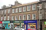 | |||
| 192 And 194 High Street | 56°42′37″N 2°28′07″W | Category B | 38047 |  | |||
| 200 High Street Including Boundary Walls | 56°42′37″N 2°28′08″W | Category C(S) | 38048 |  | |||
| 31 And 33 High Street | 56°42′46″N 2°28′04″W | Category B | 38060 |  | |||
| 35 And 37 High Street Including Boundary Walls | 56°42′45″N 2°28′04″W | Category B | 38061 |  | |||
| Rosemount House | 56°44′43″N 2°29′32″W | Category B | 17738 |  | |||
| Rosemount House Stable And Office Block | 56°44′44″N 2°29′38″W | Category B | 17740 |  | |||
| Gayfield House, Hillside | 56°44′32″N 2°28′45″W | Category B | 17750 |  | |||
| Montrose Royal Mental Hospital - Main Building | 56°44′47″N 2°28′46″W | Category B | 17752 |  | |||
| Charleton Maternity Hospital Icehouse | 56°44′24″N 2°27′36″W | Category C(S) | 17756 |  | |||
| 15C, 15D, 17 And 19 George Street | 56°42′35″N 2°28′03″W | Category C(S) | 46185 |  | |||
| 24 John Street Including Boundary Walls And Railings | 56°42′47″N 2°27′53″W | Category C(S) | 46212 |  | |||
| 28 And 30 The Mall, Cranes Meadow And The Gables, With Boundary Wall | 56°43′05″N 2°27′58″W | Category C(S) | 46214 |  | |||
| 46 And 48 Market Street,The Albert Bar | 56°42′45″N 2°27′59″W | Category C(S) | 46219 |  | |||
| 118 And 120 Murray Street | 56°42′49″N 2°28′05″W | Category C(S) | 46242 |  | |||
| New Wynd And Mill Street, Methodist Church | 56°42′45″N 2°27′53″W | Category B | 46244 |  | |||
| 33 North Esk Road Including Boundary Walls | 56°43′02″N 2°28′02″W | Category C(S) | 46246 |  | |||
| 65 North Esk Road Including Boundary Walls And Railings | 56°43′10″N 2°28′01″W | Category C(S) | 46248 |  | |||
| East Links, Grey Harlings Including Boundary Walls | 56°42′57″N 2°27′15″W | Category C(S) | 46251 | 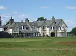 | |||
| 8 Panmure Place Including Boundary Walls And Gatepiers | 56°42′34″N 2°27′56″W | Category C(S) | 46252 |  | |||
| Eastern Road And Marine Avenue, Chapel Works Or Bond, Marine Avenue Mill And Front Office | 56°42′36″N 2°27′38″W | Category B | 38213 |  | |||
| Railway Place, Caledonian House (Former Station) Including Boundary Walls | 56°42′27″N 2°27′49″W | Category B | 38220 | _station.jpg.webp) | |||
| 63 And 65 High Street | 56°42′43″N 2°28′03″W | Category B | 38066 |  | |||
| 119 And 121 High Street | 56°42′39″N 2°28′04″W | Category B | 38082 |  | |||
| 145 High Street Including Boundary Walls And Gatepiers | 56°42′37″N 2°28′05″W | Category C(S) | 38088 |  | |||
| High Street, Statue Of Sir Robert Peel | 56°42′36″N 2°28′06″W | Category B | 38090 | 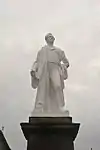 | |||
| 3 And 4 Castle Place, Castlestead Including Boundary Walls And Railings | 56°42′35″N 2°28′06″W | Category B | 38091 |  | |||
| 14 And 15 Castle Place | 56°42′34″N 2°28′09″W | Category B | 38098 | 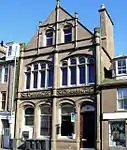 | |||
| 38A And 38B Bridge Street Including Boundary Walls | 56°42′31″N 2°28′21″W | Category C(S) | 38109 |  | |||
| 47 And 49 Bridge Street Including Boundary Walls | 56°42′32″N 2°28′17″W | Category C(S) | 38120 |  | |||
| John Street, Parish Council Chambers Including Gatepiers | 56°42′48″N 2°27′56″W | Category C(S) | 38134 | 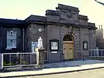 | |||
| 3 Chapel Street, Inverdyke House Including Boundary Walls And Gatepiers | 56°42′46″N 2°27′57″W | Category C(S) | 38136 |  | |||
| 71 Mill Street Including Boundary Walls | 56°42′44″N 2°27′52″W | Category C(S) | 38139 |  | |||
| 6/8 New Wynd | 56°42′44″N 2°28′03″W | Category C(S) | 38141 |  | |||
| West End Park And Western Road, Fragments Of Old Town Walls | 56°42′33″N 2°28′20″W | Category B | 38183 |  | |||
| 29 Baltic Street And 2 Panmure Street | 56°42′39″N 2°27′55″W | Category B | 38191 |  | |||
| 32 High Street | 56°42′47″N 2°28′07″W | Category C(S) | 38003 |  | |||
| 64-68 (Even Nos) High Street | 56°42′44″N 2°28′07″W | Category B | 38012 |  | |||
| 76 - 84 (Even Nos) High Street | 56°42′44″N 2°28′07″W | Category B | 38015 |  | |||
| 158 High Street Including Boundary Walls | 56°42′40″N 2°28′08″W | Category B | 38033 |  | |||
| 182 High Street, Ouchterlony House Including Boundary Walls | 56°42′38″N 2°28′08″W | Category B | 38044 |  | |||
| 190 High Street, The Retreat, Including Boundary Walls | 56°42′37″N 2°28′08″W | Category A | 38046 |  | |||
| 202 And 204 High Street | 56°42′37″N 2°28′08″W | Category B | 38049 |  | |||
| 43 And 45 High Street | 56°42′45″N 2°28′04″W | Category C(S) | 38063 |  | |||
| Newbigging Farm House | 56°43′41″N 2°29′47″W | Category B | 17743 |  | |||
| Dubton Railway Bridge Over Borrowfield Road | 56°44′16″N 2°29′15″W | Category C(S) | 17747 |  | |||
| The Cottage, Hillside Coachhouse Stable And Groom's House | 56°44′29″N 2°28′56″W | Category B | 17749 |  | |||
| Montrose Royal Mental Hospital - Carnegie House | 56°44′48″N 2°28′34″W | Category C(S) | 17753 |  | |||
| Rose Cottage, Kinnaber | 56°44′44″N 2°27′24″W | Category B | 17761 |  | |||
| House Of Kinnaber | 56°44′48″N 2°27′01″W | Category A | 17762 |  | |||
| House Of Kinnaber Walled Garden | 56°44′47″N 2°26′58″W | Category C(S) | 17763 |  | |||
| 10,12 And 14 Murray Street | 56°42′57″N 2°28′03″W | Category C(S) | 45854 |  | |||
| Academy Square, Dean's Lamp | 56°42′37″N 2°27′49″W | Category C(S) | 46163 |  | |||
| 67 Baltic Street, St George's Hall | 56°42′37″N 2°28′03″W | Category C(S) | 46166 |  | |||
| Blackfriars Street, St Margaret's Primary School Including Boundary Walls, Gates, Gatepiers And Railings | 56°42′59″N 2°28′05″W | Category C(S) | 46167 |  | |||
| 1 Chapel Street | 56°42′46″N 2°27′58″W | Category B | 46176 |  | |||
| 43 - 47 (Odd Nos) Ferry Street | 56°42′26″N 2°27′57″W | Category C(S) | 46179 |  | |||
| 94 High Street | 56°42′43″N 2°28′07″W | Category C(S) | 46202 |  | |||
| 98 High Street Including Boundary Walls | 56°42′43″N 2°28′09″W | Category C(S) | 46203 |  | |||
| 139-143 (Odd Nos) Murray Street | 56°42′49″N 2°28′04″W | Category C(S) | 46238 |  | |||
| Railway Viaducts Over South Esk River | 56°42′22″N 2°28′39″W | Category B | 49864 | 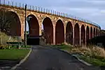 | |||
| Panmure Place, Montrose Academy Including Boundary Walls And Gates | 56°42′34″N 2°27′51″W | Category B | 38207 | 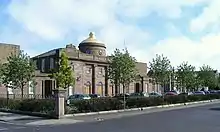 | |||
| 91 High Street | 56°42′41″N 2°28′04″W | Category C(S) | 38073 |  | |||
| High Street, Montrose Parish Church (Church Of Scotland), Including Churchyard, Boundary Walls And Gatepiers | 56°42′38″N 2°28′04″W | Category A | 38084 | 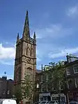 | |||
| Bridge Street, Montrose Infirmary, Including Ancillary Structures To North, And Boundary Walls And Gatepiers To Bridge Street | 56°42′28″N 2°28′28″W | Category A | 38112 | 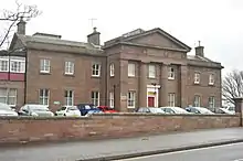 | |||
| 51 - 57 (Odd Nos) Bridge Street | 56°42′32″N 2°28′18″W | Category C(S) | 38121 |  | |||
| 65, 67 And 69 Bridge Street | 56°42′31″N 2°28′19″W | Category C(S) | 38123 |  | |||
| 123 Bridge Street | 56°42′26″N 2°28′26″W | Category C(S) | 38127 |  | |||
| Rosehill Road, Rosehill Cemetery Including Lodges, Boundary Walls, Gatepiers And Gates | 56°43′12″N 2°27′42″W | Category B | 38130 |  | |||
| 25, 27 Baltic Street | 56°42′40″N 2°27′54″W | Category C(S) | 38190 |  | |||
| Panmure Place, St Mary's And St Peter's Episcopal Hall | 56°42′36″N 2°27′54″W | Category C(S) | 38199 |  | |||
| Mid Links, Monument To Provost Scott | 56°42′41″N 2°27′47″W | Category C(S) | 38203 |  | |||
| 146 High Street | 56°42′40″N 2°28′08″W | Category C(S) | 38029 |  | |||
| 160-164 (Even Nos) High Street | 56°42′39″N 2°28′07″W | Category C(S) | 38034 | %252C_Montrose.JPG.webp) | |||
| 23, 25 And 27 High Street | 56°42′47″N 2°28′04″W | Category C(S) | 38057 |  | |||
| Rosemount House West Lodge | 56°44′41″N 2°29′47″W | Category B | 17741 |  | |||
| Charleton Maternity Hospital Walled Garden | 56°44′25″N 2°27′39″W | Category C(S) | 17757 |  | |||
| 39-47 (Odd Nos) Baltic Street | 56°42′36″N 2°27′57″W | Category C(S) | 46165 |  | |||
| 97 High Street, 2 Of 2 Houses In Review Close To Rear | 56°42′41″N 2°28′02″W | Category B | 46196 |  | |||
| 3, 5 And 7 John Street | 56°42′47″N 2°28′04″W | Category C(S) | 46207 |  | |||
| 10, 12 And 14 John Street | 56°42′47″N 2°27′57″W | Category C(S) | 46211 |  | |||
| 34 The Mall Including Boundary Walls And Gatepiers | 56°43′07″N 2°27′58″W | Category C(S) | 46215 |  | |||
| 36 The Mall Including Boundary Walls And Gatepiers | 56°43′08″N 2°27′58″W | Category C(S) | 46216 |  | |||
| 4 Meridian Street, Warehousing | 56°42′19″N 2°27′58″W | Category C(S) | 46221 |  | |||
| Mid Links, Hope Paton Bowling Clubhouse Including Railings | 56°42′50″N 2°27′44″W | Category C(S) | 46222 |  | |||
| Mid Links, War Memorial | 56°42′48″N 2°27′45″W | Category C(S) | 46224 |  | |||
| Mill Street, Knox's United Free Church, Hall And Session House Including Gates And Railings | 56°42′46″N 2°27′52″W | Category B | 46225 | 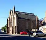 | |||
| 8 Mount Road Including Boundary Walls And Gatepiers | 56°43′01″N 2°27′45″W | Category C(S) | 46227 |  | |||
| 21 Murray Lane | 56°42′56″N 2°28′03″W | Category C(S) | 46228 |  | |||
| 27, 29 And 31 Murray Street Including Boundary Walls | 56°42′56″N 2°28′02″W | Category C(S) | 46231 |  | |||
| 112 - 116 (Even Nos) Murray Street | 56°42′50″N 2°28′05″W | Category C(S) | 46241 |  | |||
| 50 North Esk Road Including Boundary Walls | 56°43′16″N 2°27′56″W | Category C(S) | 46249 |  | |||
| 36 And 37 Wharf Street, South Esk Inn And Railings | 56°42′26″N 2°28′19″W | Category C(S) | 46257 |  | |||
| Bow Butts, Former Bonded Warehouse | 56°42′33″N 2°27′58″W | Category C(S) | 51747 |  | |||
| Montrose Harbour, Inner Harbour Light | 56°42′13″N 2°27′24″W | Category B | 38223 |  | |||
| 9 And 11 Bow Butts, Burness House, Including Gatepiers And Boundary Walls | 56°42′34″N 2°28′00″W | Category C(S) | 38226 |  | |||
| 79 High Street | 56°42′42″N 2°28′04″W | Category B | 38069 |  | |||
| 97 And 99 High Street (Excluding Separate Houses To Rear) | 56°42′41″N 2°28′03″W | Category B | 38075 |  | |||
| 107 High Street With Boswell House, Including Boundary Walls | 56°42′40″N 2°28′03″W | Category B | 38078 |  | |||
| 7 And 8 Castle Place | 56°42′34″N 2°28′08″W | Category B | 38093 |  | |||
| 8 Bridge Street, The Elms, Including Boundary Walls And Railings | 56°42′34″N 2°28′16″W | Category B | 38099 |  | |||
| 125 And 127 Bridge Street | 56°42′26″N 2°28′26″W | Category C(S) | 38128 |  | |||
| John Street, Former St Luke's And St John's Church And Hall Including Boundary Walls, Gatepiers And Railings | 56°42′48″N 2°27′53″W | Category B | 38132 | 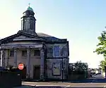 | |||
| 6 Wharf Street | 56°42′25″N 2°28′26″W | Category C(S) | 38170 |  | |||
| Provost Scott's Road, Links Lodge Including Boundary Walls, Gatepiers And Railings | 56°42′47″N 2°27′49″W | Category B | 38184 |  | |||
| 5 Chapel Place Including Boundary Walls | 56°42′42″N 2°27′51″W | Category C(S) | 38186 |  | |||
| North Esk Road, Water Tower | 56°43′13″N 2°27′58″W | Category B | 37989 | 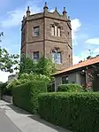 | |||
| 122-126 (Even Nos) Murray Street | 56°42′49″N 2°28′05″W | Category B | 37995 |  | |||
| 20 High Street | 56°42′48″N 2°28′06″W | Category B | 38000 |  | |||
| 40 And 42 High Street | 56°42′46″N 2°28′07″W | Category B | 38004 |  | |||
| 44 And 46 High Street | 56°42′46″N 2°28′07″W | Category B | 38005 |  | |||
| 1, 3 And 5 High Street | 56°42′48″N 2°28′04″W | Category C(S) | 38052 |  | |||
| 15 High Street, Including Boundary Walls | 56°42′48″N 2°28′04″W | Category B | 38055 |  | |||
| 47 And 49 High Street | 56°42′45″N 2°28′04″W | Category C(S) | 38064 |  | |||
| Kinnaber Ice House, Fisherhills, Kinnaber | 56°45′02″N 2°26′40″W | Category B | 17690 |  | |||
| House Of Hedderwick (Locally Hedderwick Castle) | 56°44′05″N 2°29′21″W | Category B | 17744 |  | |||
| Charleton Maternity Hospital | 56°44′17″N 2°27′40″W | Category B | 17755 |  | |||
| Charleton Old Farmhouse S.W. Of Steading | 56°44′27″N 2°27′47″W | Category B | 17759 |  | |||
| 85 Bridge Street Including Railings | 56°42′29″N 2°28′22″W | Category C(S) | 46168 |  | |||
| 133 And 135 Bridge Street | 56°42′25″N 2°28′28″W | Category C(S) | 46169 |  | |||
| Bents Road, Marine House, Former Hotel, Including Boundary Walls Gatepiers And Railings | 56°42′44″N 2°27′16″W | Category C(S) | 46178 |  | |||
| 73 - 77 (Odd Nos) Ferry Street | 56°42′23″N 2°27′56″W | Category C(S) | 46181 |  | |||
| 1, 1A And 3 George Street | 56°42′36″N 2°28′05″W | Category C(S) | 46182 |  | |||
| 9 - 21 (Odd Nos) John Street | 56°42′47″N 2°28′02″W | Category C(S) | 46208 | 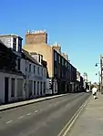 | |||
| 57 John Street Including Boundary Walls And Railings | 56°42′48″N 2°27′54″W | Category B | 46209 |  | |||
| 1, 3 And 5 Lower Hall Street | 56°42′51″N 2°28′06″W | Category C(S) | 46213 |  | |||
| 103 Murray Street | 56°42′51″N 2°28′03″W | Category C(S) | 46235 |  | |||
| Murray Street, Ymca Hostel | 56°42′51″N 2°28′05″W | Category B | 46243 |  | |||
| 101 And 103 High Street Including Boundary Walls | 56°42′41″N 2°28′03″W | Category B | 38076 | 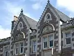 | |||
| 113 And 115 High Street | 56°42′40″N 2°28′03″W | Category B | 38080 |  | |||
| 25 Bridge Street, Castlegait House Including Boundary Walls And Gatepiers | 56°42′33″N 2°28′15″W | Category B | 38114 |  | |||
| George Street And Baltic Street, St Andrew's Church (Church Of Scotland) | 56°42′35″N 2°28′02″W | Category C(S) | 38153 |  | |||
| Montrose Harbour, Old Pier | 56°42′23″N 2°28′18″W | Category C(S) | 38167 |  | |||
| Panmure Place, Natural History Museum Including Boundary Walls, Gatepiers, Gates And Railings | 56°42′37″N 2°27′54″W | Category B | 38197 | 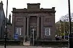 | |||
| 6-10 (Even Nos) High Street Including Boundary Walls | 56°42′49″N 2°28′07″W | Category C(S) | 37997 |  | |||
| 24 High Street | 56°42′47″N 2°28′06″W | Category B | 38001 |  | |||
| 48 High Street | 56°42′46″N 2°28′07″W | Category B | 38006 |  | |||
| 70 And 72 High Street | 56°42′44″N 2°28′07″W | Category B | 38013 |  | |||
| 106 High Street | 56°42′43″N 2°28′07″W | Category B | 38025 |  | |||
| 144 And 148 High Street | 56°42′40″N 2°28′07″W | Category C(S) | 38028 |  | |||
| 154 High Street | 56°42′40″N 2°28′08″W | Category C(S) | 38031 |  | |||
| 174 High Street (Holly House) Including Boundary Walls | 56°42′39″N 2°28′07″W | Category A | 38041 |  | |||
| 208-212 High Street Including Boundary Walls | 56°42′36″N 2°28′07″W | Category B | 38050 |  | |||
| 7, 9 And 11 High Street | 56°42′48″N 2°28′04″W | Category B | 38053 |  | |||
| Tayock Bridge Over Tayock Burn | 56°43′20″N 2°28′42″W | Category C(S) | 19822 |  | |||
| Charleton Lodge | 56°44′10″N 2°27′21″W | Category B | 17760 |  | |||
| 1-5 America Street Including Boundary Walls | 56°42′20″N 2°28′04″W | Category C(S) | 46164 |  | |||
| Castle Street, Melville South Parish Church (Church Of Scotland) Including Boundary Walls, Gatepiers And Railings | 56°42′30″N 2°28′16″W | Category C(S) | 46175 |  | |||
| 22 George Street, George Hotel | 56°42′33″N 2°28′04″W | Category C(S) | 46187 |  | |||
| Graham Street, The Hermitage Including Boundary Walls, Gates And Railings | 56°43′07″N 2°27′54″W | Category C(S) | 46188 |  | |||
| 52 High Street Including Boundary Walls | 56°42′46″N 2°28′07″W | Category B | 46200 |  | |||
| 108 And 110 Murray Street | 56°42′50″N 2°28′05″W | Category C(S) | 46240 |  | |||
| 14 Panmure Place Including Boundary Walls | 56°42′32″N 2°27′58″W | Category C(S) | 46253 |  |
Key
The scheme for classifying buildings in Scotland is:
- Category A: "buildings of national or international importance, either architectural or historic; or fine, little-altered examples of some particular period, style or building type."[1]
- Category B: "buildings of regional or more than local importance; or major examples of some particular period, style or building type, which may have been altered."[1]
- Category C: "buildings of local importance; lesser examples of any period, style, or building type, as originally constructed or moderately altered; and simple traditional buildings which group well with other listed buildings."[1]
In March 2016 there were 47,288 listed buildings in Scotland. Of these, 8% were Category A, and 50% were Category B, with the remaining 42% being Category C.[2]
See also
Notes
- Sometimes known as OSGB36, the grid reference (where provided) is based on the British national grid reference system used by the Ordnance Survey.
• "Guide to National Grid". Ordnance Survey. Retrieved 12 December 2007.
• "Get-a-map". Ordnance Survey. Retrieved 17 December 2007. - Historic Environment Scotland assign a unique alphanumeric identifier to each designated site in Scotland, for listed buildings this always begins with "LB", for example "LB12345".
References
- All entries, addresses and coordinates are based on data from Historic Scotland. This data falls under the Open Government Licence
- "What is Listing?". Historic Environment Scotland. Retrieved 29 May 2018.
- Scotland's Historic Environment Audit 2016 (PDF). Historic Environment Scotland and the Built Environment Forum Scotland. pp. 15–16. Retrieved 29 May 2018.
This article is issued from Wikipedia. The text is licensed under Creative Commons - Attribution - Sharealike. Additional terms may apply for the media files.