List of named islands in the Montebello Islands archipelago

The Montebello Islands is an archipelago lying off the Pilbara coast of north-western Western Australia.

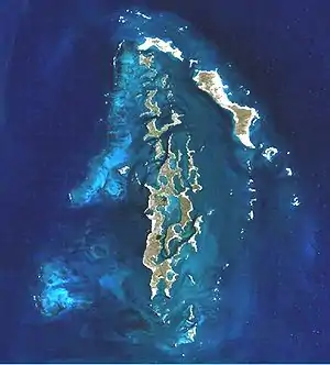
NASA World Wind satellite image of main Montebello Island group

There are about 180 islands in the group, most of which are small, and many of which have not been individually named or gazetted.

The largest islands are Hermite (1,022 ha) and Trimouille (522 ha) which, together, comprise about 70% of the collective land area.[1]

Islands

NameCoordinatesReference
Ah Chong Island20.52389°S 115.54333°E / -20.52389; 115.54333[2]
Alpha Island20.40972°S 115.5225°E / -20.40972; 115.5225[2]
Aster Island20.43°S 115.57889°E / -20.43; 115.57889[2]
Atriplex Island20.43667°S 115.50583°E / -20.43667; 115.50583[2]
Avicennia Island20.50778°S 115.54028°E / -20.50778; 115.54028[2]
Banksia Island20.40278°S 115.515°E / -20.40278; 115.515[2]
Beaufortia Island20.4025°S 115.52361°E / -20.4025; 115.52361[2]
Birthday Island20.38472°S 115.51694°E / -20.38472; 115.51694[2]
Bloodwood Island20.51583°S 115.52833°E / -20.51583; 115.52833[2]
Bluebell Island20.39722°S 115.52056°E / -20.39722; 115.52056[2]
Boab Island20.51472°S 115.52328°E / -20.51472; 115.52328[2]
Boronia Island20.39194°S 115.51389°E / -20.39194; 115.51389[2]
Brooke Island20.43389°S 115.50306°E / -20.43389; 115.50306[2]
Buttercup Island20.485°S 115.53556°E / -20.485; 115.53556[2]
Cajuput Island20.39472°S 115.53472°E / -20.39472; 115.53472[2]
Caladenia Island20.42722°S 115.52667°E / -20.42722; 115.52667[2]
Callitris Island20.49667°S 115.56083°E / -20.49667; 115.56083[2]
Campbell Island20.42806°S 115.54472°E / -20.42806; 115.54472[2]
Capporis Island20.4325°S 115.51889°E / -20.4325; 115.51889[2]
Carnation Island20.37806°S 115.52361°E / -20.37806; 115.52361[2]
Cassia Island20.42222°S 115.57694°E / -20.42222; 115.57694[2]
Clematis Island20.52028°S 115.54694°E / -20.52028; 115.54694[2]
Coolibah Island20.52944°S 115.54167°E / -20.52944; 115.54167[2]
Corkwood Islands20.51028°S 115.525°E / -20.51028; 115.525[2]
Crocus Island20.42167°S 115.52528°E / -20.42167; 115.52528[2]
Dahlia Island20.42889°S 115.57889°E / -20.42889; 115.57889[2]
Daisy Island20.43917°S 115.58056°E / -20.43917; 115.58056[2]
Dandelion Island20.43194°S 115.57972°E / -20.43194; 115.57972[2]
Delta Island20.4425°S 115.54806°E / -20.4425; 115.54806[2]
Dot Island20.43583°S 115.58028°E / -20.43583; 115.58028[2]
Drosera Island20.50944°S 115.52°E / -20.50944; 115.52[2]
Dryandra Island20.51222°S 115.53111°E / -20.51222; 115.53111[2]
Epsilon Island20.44472°S 115.58056°E / -20.44472; 115.58056[2]
Eremophila Island20.5375°S 115.53972°E / -20.5375; 115.53972[2]
Euphorbia Island20.43444°S 115.51833°E / -20.43444; 115.51833[2]
Fairy Tern Island20.40722°S 115.51667°E / -20.40722; 115.51667[2]
Fig Island20.50167°S 115.55889°E / -20.50167; 115.55889[2]
Flag Island20.45806°S 115.58056°E / -20.45806; 115.58056[2]
Foxglove Island20.48222°S 115.54222°E / -20.48222; 115.54222[2]
Frankenia Island20.37694°S 115.52139°E / -20.37694; 115.52139[2]
Gannet Island20.44667°S 115.56861°E / -20.44667; 115.56861[2]
Gardenia Island20.38278°S 115.52833°E / -20.38278; 115.52833[2]
Glossypium Island20.51306°S 115.545°E / -20.51306; 115.545[2]
Goodenia Island20.42694°S 115.51167°E / -20.42694; 115.51167[2]
Grevillea Island20.51944°S 115.54361°E / -20.51944; 115.54361[2]
Hakea Islands20.45222°S 115.60639°E / -20.45222; 115.60639[2]
Hermite Island20.46667°S 115.52472°E / -20.46667; 115.52472[2]
Hibbertia Island20.38667°S 115.53083°E / -20.38667; 115.53083[2]
Hibiscus Island20.38917°S 115.51833°E / -20.38917; 115.51833[2]
Hollyhock Island20.3775°S 115.54778°E / -20.3775; 115.54778[2]
Hovea Island20.44056°S 115.51361°E / -20.44056; 115.51361[2]
How Island20.41944°S 115.55417°E / -20.41944; 115.55417[2]
Ipomoea Island20.43°S 115.52417°E / -20.43; 115.52417[2]
Ivy Island20.49389°S 115.54472°E / -20.49389; 115.54472[2]
Jarrah Islands20.39472°S 115.53139°E / -20.39472; 115.53139[2]
Jasmine Islands20.38667°S 115.53333°E / -20.38667; 115.53333[2]
Jonquil Island20.39722°S 115.5325°E / -20.39722; 115.5325[2]
Karangi Island20.43361°S 115.60361°E / -20.43361; 115.60361[2]
Karara Island20.40056°S 115.53333°E / -20.40056; 115.53333[2]
Karri Islands20.38111°S 115.51444°E / -20.38111; 115.51444[2]
Kennedia Island20.505°S 115.53306°E / -20.505; 115.53306[2]
Kingcup Island20.39056°S 115.53222°E / -20.39056; 115.53222[2]
Kingia Island20.40111°S 115.53222°E / -20.40111; 115.53222[2]
Kunzea Island20.42167°S 115.5275°E / -20.42167; 115.5275[2]
Kurrajong Island20.44083°S 115.53861°E / -20.44083; 115.53861[2]
Leschenaultia Island20.41333°S 115.5425°E / -20.41333; 115.5425[2]
Lily Island20.41972°S 115.58694°E / -20.41972; 115.58694[2]
Livistona Island20.53111°S 115.53528°E / -20.53111; 115.53528[2]
Lobelia Island20.42861°S 115.57556°E / -20.42861; 115.57556[2]
Marigold Island20.45806°S 115.55556°E / -20.45806; 115.55556[2]
Marri Islands20.38389°S 115.52361°E / -20.38389; 115.52361[2]
Melaleuca Island20.41639°S 115.52444°E / -20.41639; 115.52444[2]
Minnieritchie Islands20.46778°S 115.57528°E / -20.46778; 115.57528[2]
Mistletoe Island20.3825°S 115.52083°E / -20.3825; 115.52083[2]
Mulga Islands20.51111°S 115.52194°E / -20.51111; 115.52194[2]
Myoporum Island20.46111°S 115.57917°E / -20.46111; 115.57917[2]
North West Island20.36278°S 115.52583°E / -20.36278; 115.52583[2]
Pansy Island20.37389°S 115.54472°E / -20.37389; 115.54472[2]
Patersonia Island20.3675°S 115.51417°E / -20.3675; 115.51417[2]
Pimelea Island20.42861°S 115.57528°E / -20.42861; 115.57528[2]
Primrose Island20.37083°S 115.51611°E / -20.37083; 115.51611[2]
Ptilotus Island20.46722°S 115.51833°E / -20.46722; 115.51833[2]
Quandong Islands20.45167°S 115.58056°E / -20.45167; 115.58056[2]
Renewal Island20.46722°S 115.54889°E / -20.46722; 115.54889[2]
Rhagodia Island20.44083°S 115.57944°E / -20.44083; 115.57944[2]
Rose Island20.42167°S 115.55111°E / -20.42167; 115.55111[2]
Santalum Island20.43889°S 115.50917°E / -20.43889; 115.50917[2]
Senna Island20.42278°S 115.57694°E / -20.42278; 115.57694[2]
Sesbania Island20.36806°S 115.52°E / -20.36806; 115.52[2]
Sida Island20.47361°S 115.53722°E / -20.47361; 115.53722[2]
Snakewood Island20.50861°S 115.52917°E / -20.50861; 115.52917[2]
Snappy Gum Island20.51889°S 115.52833°E / -20.51889; 115.52833[2]
Solanum Island20.51917°S 115.53111°E / -20.51917; 115.53111[2]
South East Island20.42306°S 115.59028°E / -20.42306; 115.59028[2]
Spar Island20.48639°S 115.56361°E / -20.48639; 115.56361[2]
Spinifex Island20.41917°S 115.51944°E / -20.41917; 115.51944[2]
Stylidium Island20.42972°S 115.5175°E / -20.42972; 115.5175[2]
Swainsona Island20.50667°S 115.52833°E / -20.50667; 115.52833[2]
Triodia Island20.43861°S 115.51222°E / -20.43861; 115.51222[2]
Trimouille Island20.39472°S 115.56389°E / -20.39472; 115.56389[2]
Verticordia Island20.43472°S 115.57972°E / -20.43472; 115.57972[2]
Violet Island20.38889°S 115.57917°E / -20.38889; 115.57917[2]

References

  1. "The Monte Bello Islands". Great Southern Leader (Pingelly, WA : 1907 - 1934). Pingelly, WA: National Library of Australia. 24 December 1930. p. 5. Retrieved 17 December 2015.
  2. Geotags list Archived 21 February 2011 at the Wayback Machine, Kimberley NAP Projects, www.eksa.com.au
This article is issued from Wikipedia. The text is licensed under Creative Commons - Attribution - Sharealike. Additional terms may apply for the media files.