List of neighborhoods in Woodbridge Township, New Jersey
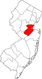
Woodbridge is a township in Middlesex County, New Jersey. According to the United States Census Bureau, the township had a total land area of including 23.213 square miles (60.122 km2). There are many distinct sections,[1][2][3] many of which are census-designated places (CDPs). Some have their own ZIP Codes.
Sections and neighborhoods
_at_Butler_Street_in_Woodbridge_Township%252C_Middlesex_County%252C_New_Jersey.jpg.webp)
_at_Amboy_Avenue_and_Middlesex_County_Route_616_(New_Brunswick_Avenue)_in_Woodbridge_Township%252C_Middlesex_County%252C_New_Jersey.jpg.webp)

_between_Grove_Street_and_Mattison_Street_in_Woodbridge_Township%252C_Middlesex_County%252C_New_Jersey.jpg.webp)
See also
References
- "NJDOT Graphic Information System Maps Middlesex" (PDF). New Jersey Department of Transportation. Retrieved March 2, 2020.
- Virginia B. Troeger and Robert James McEwen, Woodbridge: New Jersey's Oldest Township (Arcadia Publishing, 2002; ISBN 0738523941), p. 103.
- Gannett, Henry (January 28, 1895). "A Geographic Dictionary of New Jersey". U.S. Government Printing Office – via Google Books.
- Locality Search, State of New Jersey. Accessed February 7, 2015.
- "Boynton Beach". Geographic Names Information System. United States Geological Survey.
- https://eu.northjersey.com/story/entertainment/books/2017/03/23/look-north-jersey-shores-forgotten-amusement-parks/98966516/
- Gazetteer of New Jersey Places, United States Census Bureau
- "Edgars". Geographic Names Information System. United States Geological Survey.
- U.S. Geological Survey Geographic Names Information System: Fords Census Designated Place, Geographic Names Information System. Accessed July 5, 2012.
- Gannett, Henry (January 28, 1895). "A Geographic Dictionary of New Jersey". U.S. Government Printing Office – via Google Books.
- "Hazelton". Geographic Names Information System. United States Geological Survey.
- Gazetteer of New Jersey Places, United States Census Bureau
- "Keasbey". Geographic Names Information System. United States Geological Survey.
- Gannett, Henry (January 28, 1895). "A Geographic Dictionary of New Jersey". U.S. Government Printing Office – via Google Books.
- "Sand Hills". Geographic Names Information System. United States Geological Survey.
- Google (February 14, 2015). "Sand Hills, Edison, New Jersey" (Map). Google Maps. Google. Retrieved February 14, 2015.
- The Sand Hills of Bonhamtown
- "Shore View". Geographic Names Information System. United States Geological Survey.
- "Woodbridge Oaks". Geographic Names Information System. United States Geological Survey.
This article is issued from Wikipedia. The text is licensed under Creative Commons - Attribution - Sharealike. Additional terms may apply for the media files.