Littenseradiel
Littenseradiel (![]() pronunciation ) is a former municipality in the northern Netherlands. In Dutch it is known as Littenseradeel. The municipality was formed on 1 January 1984 by a merger of the former municipalities Baarderadeel and Hennaarderadeel. On 1 January 2018, the municipality was dissolved and its territory was split between three other municipalities: Waadhoeke, which was established that day, Leeuwarden and Súdwest-Fryslân.
pronunciation ) is a former municipality in the northern Netherlands. In Dutch it is known as Littenseradeel. The municipality was formed on 1 January 1984 by a merger of the former municipalities Baarderadeel and Hennaarderadeel. On 1 January 2018, the municipality was dissolved and its territory was split between three other municipalities: Waadhoeke, which was established that day, Leeuwarden and Súdwest-Fryslân.
Littenseradiel
Littenseradeel | |
|---|---|
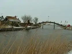 Canal through Wjelsryp | |
 Flag  Coat of arms | |
.svg.png.webp) Location in Friesland | |
| Coordinates: 53°7′N 5°35′E | |
| Country | Netherlands |
| Province | Friesland |
| Established | 1 January 1984 |
| Government | |
| • Body | Municipal council |
| • Mayor | Johanneke Liemburg (PvdA) |
| Area | |
| • Total | 132.64 km2 (51.21 sq mi) |
| • Land | 130.75 km2 (50.48 sq mi) |
| • Water | 1.89 km2 (0.73 sq mi) |
| Elevation | 1 m (3 ft) |
| Time zone | UTC+1 (CET) |
| • Summer (DST) | UTC+2 (CEST) |
| Postcode | Parts of 8000 and 9000 range |
| Area code | 0515, 0517, 058 |
| Website | www |
Population centers
Baaium, Baard, Bears, Boazum, Britswert, Easterlittens, Easterwierrum, Hidaard, Hilaard, Hinnaard, Húns, Iens, Itens, Jellum, Jorwert, Kûbaard, Leons, Lytsewierrum, Mantgum, Reahûs, Rien, Spannum, Waaksens, Weidum, Winsum, Wiuwert, Wjelsryp, Wommels.
Topography
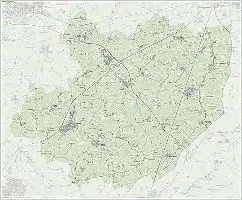
Dutch topographic map of the municipality of Littenseradiel, June 2015
References
- "Samenstelling en taken van college b en w" [Members and tasks of the board of mayor and aldermen] (in Dutch). Gemeente Littenseradiel. Archived from the original on 23 September 2013. Retrieved 21 September 2013.
- "Kerncijfers wijken en buurten 2020" [Key figures for neighbourhoods 2020]. StatLine (in Dutch). CBS. 24 July 2020. Retrieved 19 September 2020.
- "Postcodetool for 8731BN". Actueel Hoogtebestand Nederland (in Dutch). Het Waterschapshuis. Archived from the original on 21 September 2013. Retrieved 21 September 2013.
External links
 Media related to Littenseradiel at Wikimedia Commons
- Official website
Neighbouring municipalities at time of dissolution | ||||||||||
|---|---|---|---|---|---|---|---|---|---|---|
| ||||||||||