Little Cholame Creek
Little Cholame Creek is a perennial stream in southeastern Monterey County, California, United States.[2] The headwaters rise from an unnamed peak 2 miles (3 kilometres) southwest of Reason Mountain, in the southern part of the Diablo Range. From there, the creek flows southeast along Parkfield-Coalinga Road, before reaching confluence with Cholame Creek.
| Little Cholame Creek | |
|---|---|
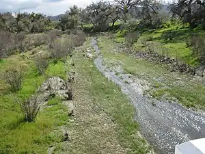 Little Cholame Creek at crossing over San Andreas Fault | |
 Location of the mouth of Little Cholame Creek in California | |
| Location | |
| Country | United States |
| State | California |
| Region | Monterey County |
| City | Parkfield, California |
| Physical characteristics | |
| Source | On the southern flank of an unnamed peak in the southern part of the Diablo Range |
| • coordinates | 35°59′13″N 120°31′09″W[1] |
| • elevation | 2,690 ft (820 m) |
| Mouth | Parkfield, California |
• coordinates | 35°54′32″N 120°31′09″W[1] |
• elevation | 1,560 ft (480 m)[1] |
| Length | 8 mi (13 km) |
| Basin features | |
| Tributaries | |
| • left | Reason Mountain, Pine Canyon Creek, Joaquin Canyon Creek |
| • right | Middle Mountain Ridge |
History
"Cholame" is a Yokut Native American word meaning "the beautiful one". The creek runs through the northern part of Cholame Valley, along Parkfield-Coalinga Road, and on through the small town of Parkfield before crossing the San Andreas Fault and merging with Cholame Creek.
See also
References
- "Little Cholame Creek". Geographic Names Information System. United States Geological Survey.
- Upper Salinas Las Tablas Resource Conservation District. "Cholame Creek Watershed" (PDF). Retrieved 2017-08-10.
External links
This article is issued from Wikipedia. The text is licensed under Creative Commons - Attribution - Sharealike. Additional terms may apply for the media files.