Lookout Point Dam
Lookout Point Dam is an earth-type dam on the Middle Fork Willamette River in the U.S. state of Oregon. It is located in Lane County. Its reservoir is called Lookout Point Lake. The dam's primary purpose is flood control, with secondary purposes of power generation, recreation, and irrigation.[1][2]
| Lookout Point Dam | |
|---|---|
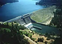 An aerial view of Lookout Point Dam | |
| Location | Lane County, Oregon, USA |
| Coordinates | 43°54′53″N 122°45′9″W |
| Opening date | 1953[1] |
| Operator(s) | Cenwp[1] |
| Dam and spillways | |
| Impounds | Middle Fork Willamette River |
| Height | 276 feet (84 m)[1] |
| Length | 3,175 feet (968 m)[1] |
| Reservoir | |
| Creates | Lookout Point Lake |
| Total capacity | 477,700 acre feet (0.589 km3)[1] |
| Catchment area | 991 square miles (2,570 km2)[1] |
| Surface area | 4,360 acres (1,760 ha)[1] |
See also
- List of dams in the Columbia River watershed
- List of lakes in Oregon
References
- Lookout Point Dam Archived 2012-02-17 at the Wayback Machine, NPDP Dam Directory
- Lookout Point Dam, US Army Corps of Engineers
This article is issued from Wikipedia. The text is licensed under Creative Commons - Attribution - Sharealike. Additional terms may apply for the media files.