Lount Township, Ontario
Lount is a geographic township in the Unorganized Centre Part of Parry Sound District in Central Ontario, Canada.[1][2][3] The communities of Bummer's Roost, Rye and Wattenwyle are located in the township. It originally was settled by the building of the Rosseau and Nipssing Road which cuts diagonally through the township.[2] Lount is part of the Almaguin Highlands region.
Lount | |
|---|---|
Geographic township | |
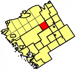 Location of Lount Township in Parry Sound District | |
 Lount Location of Lount Township in Ontario | |
| Coordinates: 45°49′59″N 79°38′56″W | |
| Country | Canada |
| Province | Ontario |
| Municipality | Parry Sound, Unorganized, Centre |
| Time zone | UTC-5 (Eastern Time Zone) |
| • Summer (DST) | UTC-4 (Eastern Time Zone) |
| Postal code FSA | P0A |
| Area code(s) | 705, 249 |
Etymology
This township in Parry Sound District was named in 1874 for William Lount (1840-1903), Liberal member for Simcoe North in the Legislative Assembly of Ontario, 1867–71, and for Toronto Centre in the House of Commons, 1896–7. He was subsequently appointed a judge in the High Court of Ontario. William Lount was a nephew of Samuel Lount, who led a party of reformers in the Rebellion of 1837 and was put to death the following year.[4]
See also
References
- "Lount". Geographical Names Data Base. Natural Resources Canada. Retrieved 2011-11-11.
- "Lount" (PDF). Geology Ontario - Historic Claim Maps. Ontario Ministry of Northern Development, Mines and Forestry. Archived from the original (PDF) on 2012-04-26. Retrieved 2011-11-11.
- "Ontario Map #4". Restructured municipalities. Ontario Ministry of Municipal Affairs and Housing. 2008. Retrieved 2011-11-11.
- Rayburn, Alan (1997). Place Names of Ontario. Toronto: University of Toronto Press. p. 199. ISBN 0-8020-7207-0.