Lovango Cay, U.S. Virgin Islands
Lovango Cay is a private island of the district of Saint John, in the United States Virgin Islands.
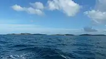
At 118 acres in area, with a highest point of which is 255 feet, Lovango (also known at various times as "Loango" and "Awango") lies one mile northwest of Saint John.[1]
The island has been sparsely inhabited since at least 1728. The peak recorded population was 49 people in 1917, at which point there was briefly a school.[2]
The island hosts an eco-responsible housing development called Loving Cay Estates.[3] The island is self-sufficient and hosts its own solar array, wind turbine, and reverse osmosis desalinization facility. New island developments include a pool and beach club.[4]
Accessible only by boat, the north side of the cay features a small bay. With Congo Cay to the north, the water here tends to stay calm and offers very good snorkeling. Among other things, nurse sharks are often found resting here during the day.
The south side of the island is popular snorkeling spot for charter boats from St. John and St. Thomas.
References
- Dick, Kenneth (1980). "Historical Account of the Lovango or Loango Islands" (PDF). History of the Virgin Islands Archaeology (10): 3–16.
- "Lovango Cay Historical Timeline, March 2008". St. John Historical Society. Retrieved 2020-12-20.
- http://www.privateislandsonline.com/islands/lovango-cay
- "Officials, Lovango Resort execs tout new facilities". Virgin Islands Daily News. 2020-12-19. Retrieved 2020-12-20.
Charlotte Amalie (capital) | |
| Topics |
|
| Government | |
| Cities | |
| Islands | |
| Parks | |