Lumut, Brunei
Lumut, also known as Kampong Lumut (Malay: Kampung Lumut), is a settlement area in Belait District, Brunei. It is the common name given to a group of village subdivisions and residential communities in the subdistrict of Liang.
Lumut
Kampong Lumut | |
|---|---|
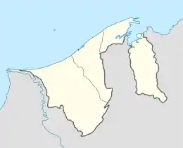
 Location in Brunei | |
| Coordinates: 4°39′01″N 114°26′09″E | |
| Country | Brunei |
| District | Belait |
| Subdistrict | Liang |
History
Archaeological evidence found in Lumut suggests that human activity had existed in the area as early as the fourteenth century; Chinese and Siamese potteries dateable to the time corresponding to the Ming Dynasty (1368-1644) had been unearthed in the vicinity of the Lumut River.[1][2] However, the characteristics of the evidence suggests that the site was for burial rather than residential purpose.[1][2]
Administration
The area which constitutes Lumut officially comprises several village subdivisions, the third- and lowest-level administrative division of Brunei. The villages in Lumut are subdivisions of Liang (Malay: Mukim Liang), a subdistrict of Belait. Each village may also correspond to a postcode area. These subdivisions in Lumut as designated by the Survey Department include:[3][4]
- Kampong Lumut
- Kampong Lumut Tersusun
- Kampong Sungai Bakong
- Kampong Sungai Kuru
- Kampong Sungai Tali
- Kampong Sungai Taring
- Perkhemahan Lumut
- Perumahan Negara Lumut Kawasan 1
- Perumahan Negara Lumut Kawasan 2
- Skim Tanah Kurnia Rakyat Jati Lumut
However, the Belait District Office, which de facto administers the communities in the district, governs the population in Lumut as two village communities, namely Kampong Lumut I and II, whereby each has its own village head (Malay: ketua kampung).[5]
Education
The School of Science and Engineering campus of Brunei Polytechnic is located in Lumut, which offers post-secondary, vocational courses mainly in engineering field, taking advantage of the proximity to the oil and gas industries in the district.
There is one secondary school in Lumut: Pengiran Anak Puteri Hajah Rashidah Sa’adatul Bolkiah Secondary School provides five years of secondary education leading up to 'O' Level qualification.
Primary education is available in Lumut which is provided in two primary schools, namely Lumut Primary School (Malay: Sekolah Rendah Lumut) and Sungai Tali Primary School (Malay: Sekolah Rendah Sungai Tali).[6]
There are also three primary religious schools in Lumut, namely Lumut Religious School, Sungai Tali Religious School and Sungai Taring Religious School.[7] They provide primary religious education, which is compulsory for Muslim children in the country.
Economy
Economy in Lumut is primarily based on the petroleum industry. It is the location of the Brunei LNG plant, a 130-hectare (320-acre) liquified natural gas plant with annual production capacity of 6.7 million tonnes.[8]
Lumut also has a small retail economy. There are a few commercial buildings and several shops, mainly grocery stores and restaurants, for the consumption of the residents.
Infrastructure
Road
Lumut is mainly served by Jalan Seria–Kuala Belait, a two-lane road which traverses the area.[3] Lumut Bypass is a highway which bypasses Lumut at its southern fringe; access between the two roads are possible through a short section of Jalan Tutong–Belait in the east and Jalan Malawaring in the middle, which passes through the public housing area.[3] There is also a third access but it is not open to public as it traverses Lumut Camp, a military area.
Public housing
Lumut is one of the locations for the Rancangan Perumahan Negara (National Housing Plan), a government housing scheme.
Miscellaneous
Zainab Mosque serves the need of the Muslim residents for Islamic congregational prayers and activities, in particular the Jumu'ah or Friday prayers. The mosque was inaugurated on 22 May 1998 by Sultan Hassanal Bolkiah, the Sultan of Brunei.[9] It can accommodate 2,000 worshippers at one time.[9]
Lumut Post Office is the sole post office in the area.[10]
Places of interest
Lumut is a coastal settlement and Lumut Beach stretches along the coastline where the area meets the South China Sea. A section of the beach has been made a recreation park for the public.[11]
Liang Lumut Recreation Club is a venue for recreational activities and events. It has a multipurpose hall as well as a small waterpark.
References
- Omar, Matussin (1981). Archaeological Excavations in Protohistoric Brunei. Muzium Brunei. pp. 66–67.
- "15th century artifacts found in Lumut". The Brunei Times. Archived from the original on 14 June 2012. Retrieved 29 December 2011.
- Brunei Darussalam street directory : quick & easy reference maps., Brunei. Juruukur Agung., Brunei Press Sdn. Bhd., Published & printed by Brunei Press Sdn. Bhd., Commercial Printing Services, 2014, ISBN 9789991732411, OCLC 932264901CS1 maint: others (link)
- "Belait District" (PDF). www.information.gov.bn. pp. 8–9. Retrieved 22 December 2017.
- "Direktori Penghulu, Ketua Kampung, dan Ketua Rumah Panjang - All contacts". www.belait.gov.bn. Retrieved 22 December 2017.
- "Ministry of Education, Brunei Darussalam". www.moe.gov.bn. Archived from the original on 14 December 2017. Retrieved 22 December 2017.
- "Laman Utama - Senarai Sekolah Ugama". www.kheu.gov.bn. Retrieved 22 December 2017.
- "The Plant | Brunei LNG Sendirian Berhad". www.bruneilng.com. Retrieved 22 December 2017.
- "SenaraiMasjid - Masjid Zainab". www.kheu.gov.bn. Retrieved 22 December 2017.
- "Brunei Postal Services - lumut". www.post.gov.bn. Retrieved 22 December 2017.
- "Department of Environment, Park and Recreation - Parks and Recreation Facilities". www.env.gov.bn. Retrieved 22 December 2017.