Lunag Ri
Lunag Ri is a mountain in the Rolwaling Himal mountain range of the Himalayas.
| Lunag Ri | |
|---|---|
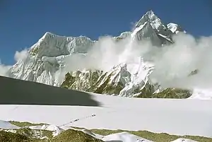
 View of Nangpa La and the Lunag Ri-massif, seen from the Cho Oyu base camp. The top of Lunag Ri is on the far right of the picture, half right in the background is the Lunag Ri IV, behind on the far left is the Jobo Rinjang. | |
| Highest point | |
| Elevation | 6,895 m (22,621 ft) |
| Prominence | 1,179 m (3,868 ft) |
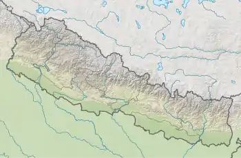
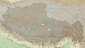
| Coordinates | 28°03′11″N 86°33′06″E |
| Geography | |
 Lunag Ri  Lunag Ri Lunag Ri (Tibet) | |
| Parent range | Rolwaling Himal |
| Climbing | |
| First ascent | October 25, 2018 by David Lama (solo) |
The 6,895 metres (22,621 ft) high Lunag Ri is located on the Himalayan main ridge on the border between Nepal and Tibet. Lunag Ri is 11.7 km (7.3 mi) west of Cho Oyu (8,188 m (26,864 ft)). The Jobo Rinjang (6,778 m (22,238 ft)) forms a southeastern secondary summit of Lunag Ri. On the southern flank of the Lunag Ri runs the Lunag glacier. In the east flows the Nangpa glacier. On the northern slope lies the feeding area of the Shalong glacier.
History
Lunag Ri was first climbed in October 25, 2018 by the Austrian alpinist and climber David Lama.[1] Lama ascended the mountain without any partner. Lama and the American climber Conrad Anker had failed to make the summit at two previous attempts in November 2015 and fall 2016. During the second attempt Anker had suffered a heart attack. A first solo attempt by Lama, which got him up to 6,700 metres (21,982 ft), the highest attempt to that date, had also been unsuccessful.[2][3][4]
References
- "Lunag Ri Solo-Erstbesteigung von David Lama" (in German). bergsteigen.com. 27 November 2018. Retrieved 20 July 2020.
- "Der Berg ist wie eine weisse Leinwand". nzz.ch.
- "Versuch am Lunag Ri". Bergsteigen.com.
- "David Lama gelingt Erstbesteigung des Lunag Ri". LaCrux.com.
External links
| Wikimedia Commons has media related to Lunag Ri. |
- Picture on summitpost.org
- explorersweb.com: Chad Kellogg and David Gottlieb return to Lunag Ri (6895m)
- Picture of the Lunag Ri massif at summitpost.org