Lyttelton Ridge
Lyttelton Ridge (66°22′S 63°7′W) is a dark, jagged ridge, 425 metres (1,400 ft) high, extending 4 nautical miles (7 km) in a northwest–southeast direction along the west side of Churchill Peninsula, on the east coast of Graham Land, Antarctic Peninsula. It was charted in 1947 by the Falkland Islands Dependencies Survey, who named it for Rt. Hon. Oliver Lyttelton, M.P., then British Minister of Production and member of the War Cabinet. It was photographed from the air during 1947 by the Ronne Antarctic Research Expedition under Finn Ronne.[1]
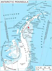
Location of Churchill Peninsula in Graham Land, Antarctic Peninsula.
References
- "Lyttelton Ridge". Geographic Names Information System. United States Geological Survey. Retrieved 2013-07-12.
![]() This article incorporates public domain material from the United States Geological Survey document: "Lyttelton Ridge". (content from the Geographic Names Information System)
This article incorporates public domain material from the United States Geological Survey document: "Lyttelton Ridge". (content from the Geographic Names Information System)
This article is issued from Wikipedia. The text is licensed under Creative Commons - Attribution - Sharealike. Additional terms may apply for the media files.